
 English
 Українська
 Français
 Ελληνικα
 Magyar
 Íslenska
 Italiano
 Latviešu
 Lietuvos
 Русский
 Српски
 Slovenčina
 Slovenščina
 Español
 Svenska
 Türkçe
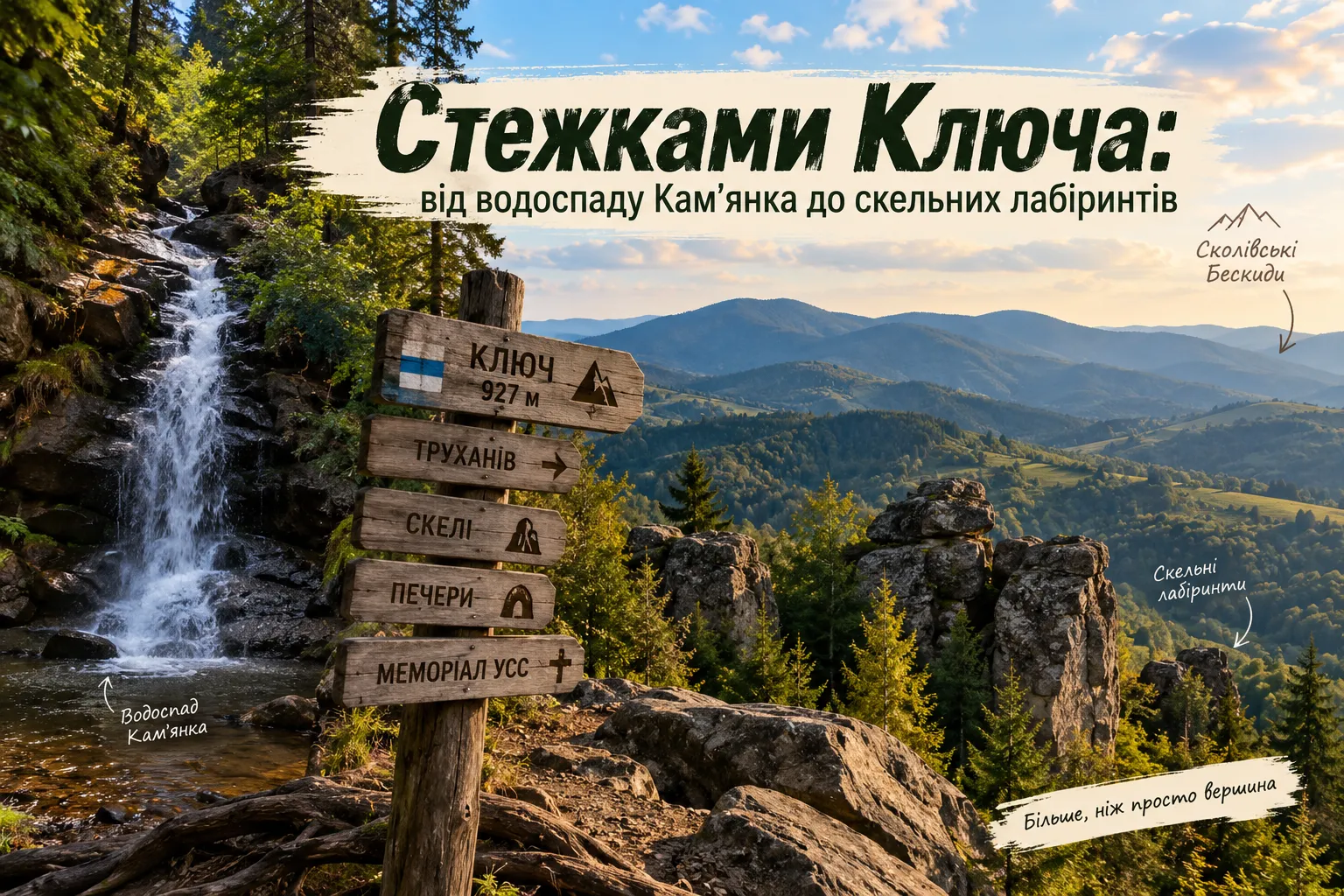
Mount Kliuch in the Skole Beskids is a good example of why, in the Carpathians, a route should not always be judged solely by the number next to the summit. The elevation here is about 930 metres, so against Parashka, Lopata, and other higher neighbours, Kliuch may seem rather modest. But once you begin the ascent, it quickly becomes clear that the main appeal of this place has nothing to do with altitude records.
On a single ridge, the history of the Ukrainian Sich Riflemen, sandstone cliffs, vertical caves, narrow gorges, and old beech forests come together. And if you plan your route from the Kam’ianka Valley side, you can add a waterfall, Zhuravlyne Lake, and several natural attractions, each of which could easily be a destination for a separate walk.
The Kliuch Ridge has a distinctly unusual character. Among the trees are chaotic accumulations of enormous sandstone boulders with equally unusual tourist names—«Easter Island,» «Stonehenge,» «Playroom,» «Arch,» and «Falcon.» Cracks, caves, and deep narrow gorges hide between them. These are sometimes called Carpathian canyons, although their origins are far more interesting than this simple name suggests.
Kliuch also has an entirely different side. On 28 October 1914, the mountain became the site of a battle between the Ukrainian Sich Riflemen and Russian troops. A mass grave and memorial to the fallen riflemen now stand not far from the summit, so an ordinary mountain hike here quietly becomes a journey through Ukrainian historical memory as well. At the same time, the summit is partly forested, so coming here solely for an expected 360-degree panorama would be a mistake. Kliuch leaves its strongest impression along the way: in open meadows, beside the cliffs, among the old forest, above the gorges, and in places where you suddenly realise that the next strange stone wall is not scenery but the result of millions of years of geological processes.
In this article, we will explore Kliuch in precisely this way: learn what happened here in 1914, find «Easter Island» among the Carpathian forest, see what makes the ridge’s caves and gorges so interesting, discover why one mountain has two «Dead Lakes,» and choose a route after which Kliuch will certainly no longer seem like merely a low summit on the map.
Mount Kliuch and the 1914 Battle of the Ukrainian Sich Riflemen
The Carpathian summit of Kliuch entered Ukrainian history long before tourists began coming here for its rock labyrinths and routes through the Skole Beskids. On 28 October 1914, during the first months of the First World War, its slopes became the site of a battle between the Ukrainian Sich Riflemen and Russian troops.
Today, a mass grave near the summit recalls these events, but during the hike itself it is easy to forget that just over a century ago this quiet mountain area looked completely different. Instead of hiking trails, there were military positions, trenches, and artillery fire, while control of the heights had very practical significance for the front.
Why Mount Kliuch Was Strategically Important
In autumn 1914, the Russian army advanced through Galicia towards the Carpathians. The 55th Infantry Division of the Austro-Hungarian Army, which included units of the Ukrainian Sich Riflemen, was at risk of encirclement. The command planned to stabilise the defence along the Beskid line, but a safe retreat and the retention of positions required regaining control of several important heights. Among them were Mount Komarnytska and Mount Kliuch.
To a tourist today, this is simply a forested ridge. To military command in 1914, a height meant the ability to observe the surrounding area, control approaches, and prevent the enemy from using an advantageous position against its own units. In the mountains, even a few hundred metres of terrain can sometimes decide far more than the map suggests.
The Battle for Mount Kliuch on 28 October 1914
The task of retaking Kliuch was assigned to a company of Ukrainian Sich Riflemen under the command of Volodymyr Srokovskyi. On 28 October, after artillery preparation, the riflemen began their advance on the Russian positions. The battle quickly turned into close combat. Some Russian troops began to retreat, while other units left their trenches and moved towards the riflemen with bayonets. The Ukrainian Sich Riflemen continued the attack, captured the enemy positions, and ultimately regained control of the strategic height.
Today, the Ukrainian Institute of National Memory explicitly defines the event of 28 October as the victory of the Ukrainian Sich Riflemen over the Russian army on Mount Kliuch. But this victory came at a heavy price: riflemen were killed and wounded.
Who Were the Ukrainian Sich Riflemen?
The Ukrainian Sich Riflemen Legion—the USR—was established in 1914 after the outbreak of the First World War. It was formed mainly from Ukrainian volunteers from Galicia and became the first organised Ukrainian military formation of the 20th century to openly operate under Ukrainian national symbols.
At the beginning of the war, the riflemen were often deployed in small units for reconnaissance, security, advance operations, and combat in difficult mountainous terrain. That is why the Carpathians became one of the first areas where the USR gained real combat experience.
The Mass Grave of the Sich Riflemen on Mount Kliuch
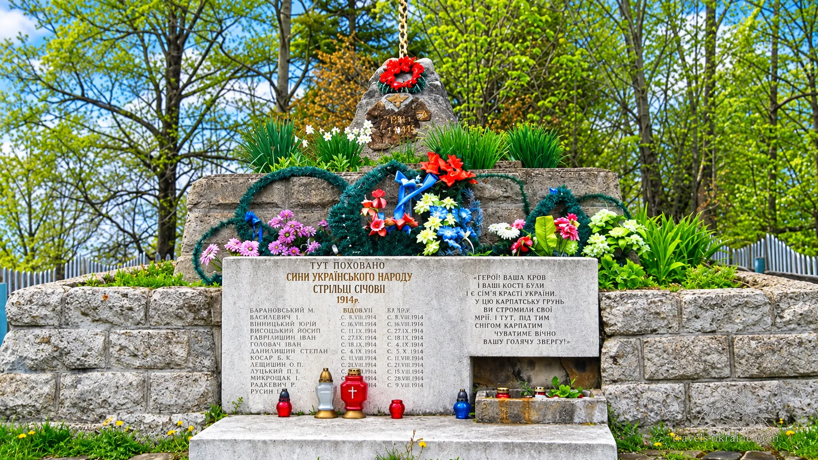
Not far from the summit stands the mass grave of the Ukrainian Sich Riflemen who died in the battles of 28 October 1914. A stone memorial with a cross has been erected over the burial site. The commemorative plaque bears the surnames, first names, and military ranks of 13 fallen riflemen. This is one of those details that suddenly changes how you perceive the route. Until then, history may seem like a collection of dates, military units, and old maps. Here, however, you are faced with the specific names of people for whom this trek along the mountain ridge was their last.
That is why it is worth pausing at the memorial for at least a few minutes. Not merely to photograph it or mark the point on your route, but to realise that the mountain tourists walk across today was once a real battlefield.
Kliuch as a Place of Historical Memory Today
The memory of the events of 1914 at Kliuch is not limited to the commemorative plaque. Memorial and patriotic ascents are organised to the mountain, during which participants honour the fallen Ukrainian Sich Riflemen. Such events have also taken place in the 21st century. In 2021, people climbed Kliuch to mark the 107th anniversary of the battle, while in 2023 the Lviv Regional Administration organised an ascent for Ukrainian defenders. The route combined historical memory with the ridge’s natural attractions, including the «Stonehenge» and «Easter Island» rock complexes.
And this captures the character of Mount Kliuch very precisely. Here, history does not stand apart from the tourist route. To reach the memorial, you must walk through the same forest, climb the same ridge, and see the same terrain over which a battle was fought more than a century ago. Kliuch reminds us that the Carpathians are not only beautiful summits. Sometimes the trail you walk peacefully today with a backpack passes through a place where Ukrainian history was written in anything but hiking boots.
The Rocks, Caves, and Gorges of the Kliuch Ridge
If the history of the Ukrainian Sich Riflemen gives Mount Kliuch a sense of human memory, its natural side looks as if someone deliberately gathered everything most interesting on one small ridge: enormous sandstone boulders, rock towers, arches, narrow gorges, deep cracks, and vertical caves. Many of these features are hidden right in the forest, so an ordinary hike occasionally begins to resemble a search for scenery from an adventure film.
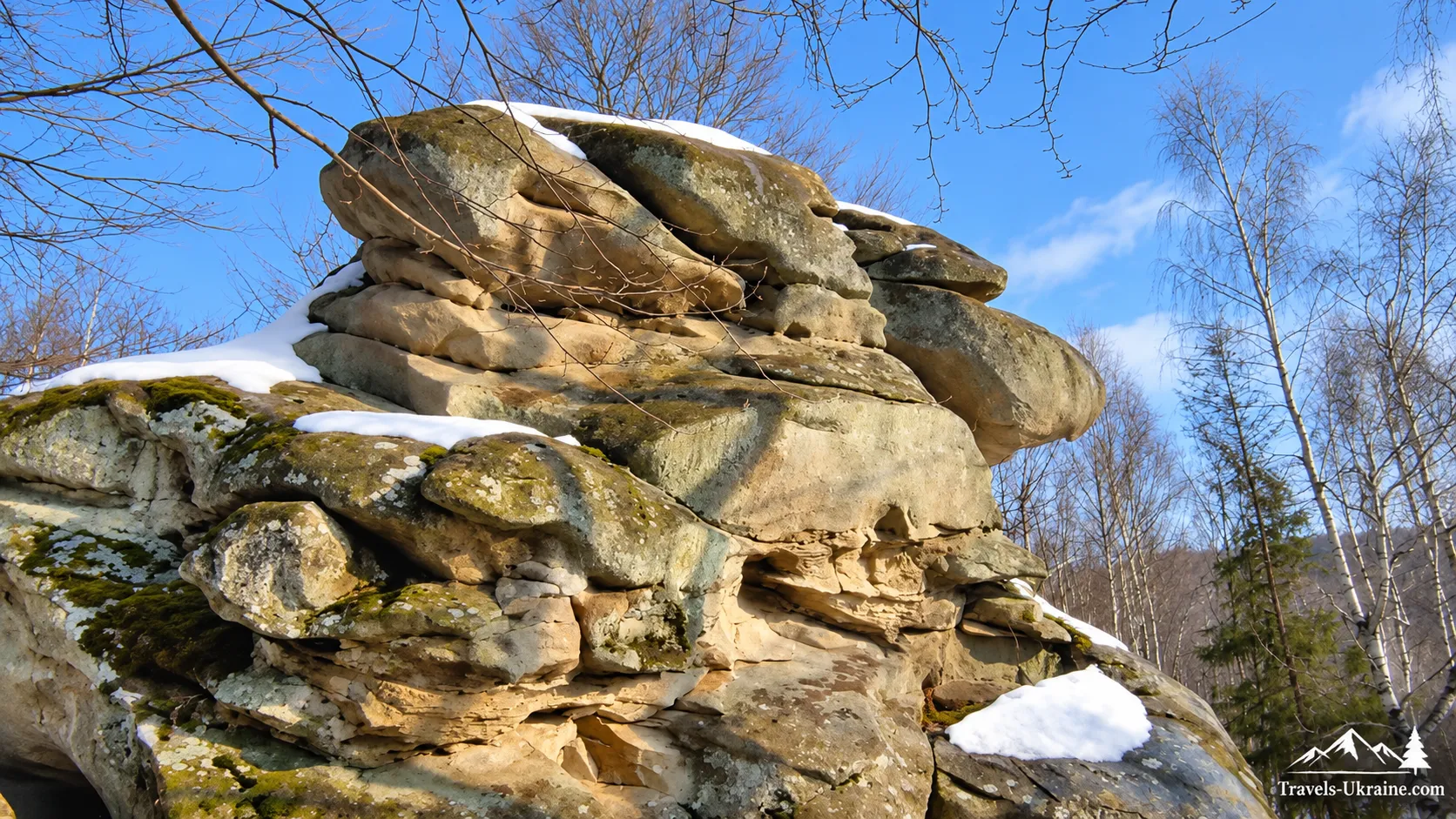
Geologists explain this diversity through the structure of the Kliuch Ridge. Massive sandstone layers emerge here and have been gradually worn down by weathering, water, tectonic cracks, and gravity. Individual blocks broke away from the main mass, shifted, and moved apart, creating narrow chasms, corridors, and cave cavities between them. This is why Kliuch interests more than just tourists. Modern geographical studies identify the Kliuch–Kamianka area as one of the promising geotourism regions of the Skole Beskids, where a large number of different geological and geomorphological features are concentrated in a relatively small area.
Stone Giants Among the Carpathian Forest
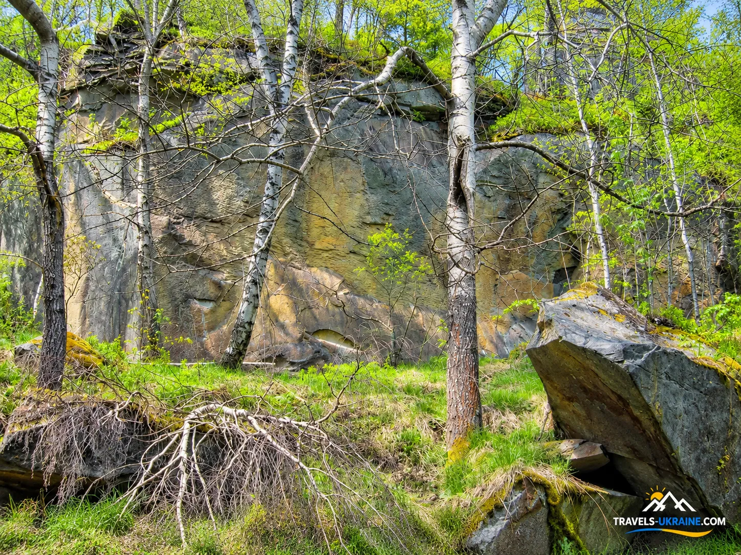
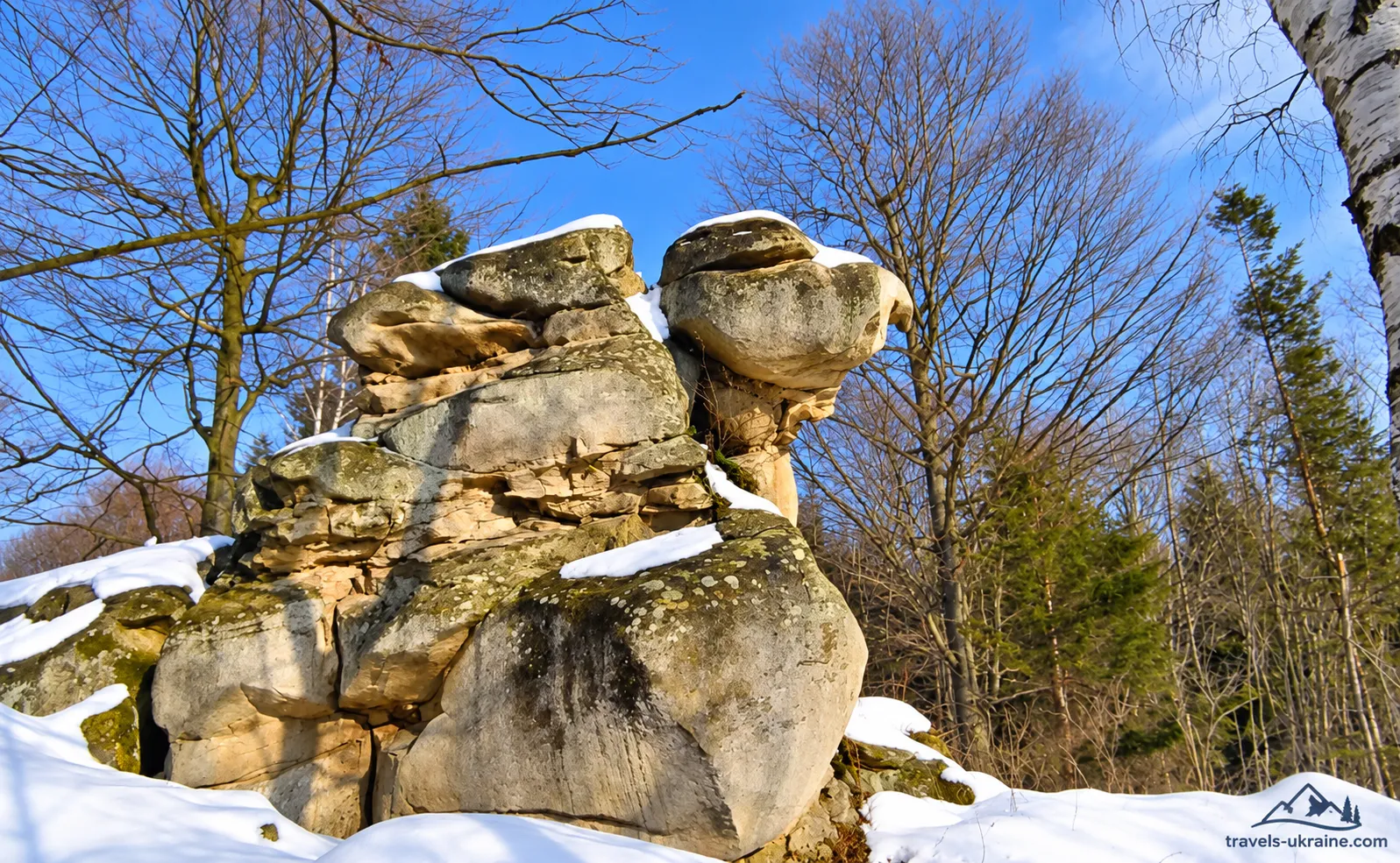
The best-known rock group on the ridge is «Easter Island», also often called «Easter Island» in English. The name has no connection to the actual island in the Pacific Ocean—it arose because of the unusual appearance of the large stone boulders, which resemble giant figures among the forest. Scientific descriptions characterise the site as a chaotic cluster of approximately ten large sandstone blocks. The tallest reach about eight metres. The rocks have rounded shapes, smoothed walls, numerous niches, and natural openings.
They look especially impressive among the trees: first one large grey boulder appears between the trunks, then a second, and a few dozen metres later you realise that you are standing in the middle of an entire stone complex. This group is now one of Kliuch’s most recognisable natural attractions. The Lviv regional authorities also include «Easter Island» among the region’s tourist magnets, and modern marked routes pass through it.
And Where Is «Stonehenge»?
The situation with the name «Stonehenge» is somewhat confusing. The site is sometimes described as a separate rock complex, while in geological works the word may be used as another unofficial name for the boulder formation of «Easter Island.» So there is certainly no need to search the forest for an exact copy of British Stonehenge. No prehistoric megaliths were installed here—what we see are natural sandstone outcrops and boulders formed by geological processes.
The name simply caught on among tourists because of the chaotic arrangement of the large stones in the forest. The Carpathians are particularly good at acquiring grand names: a few unusual boulders, and suddenly the Skole Beskids have their own Stonehenge.
«Playroom,» «Arch,» «Cobra,» and «Falcon»
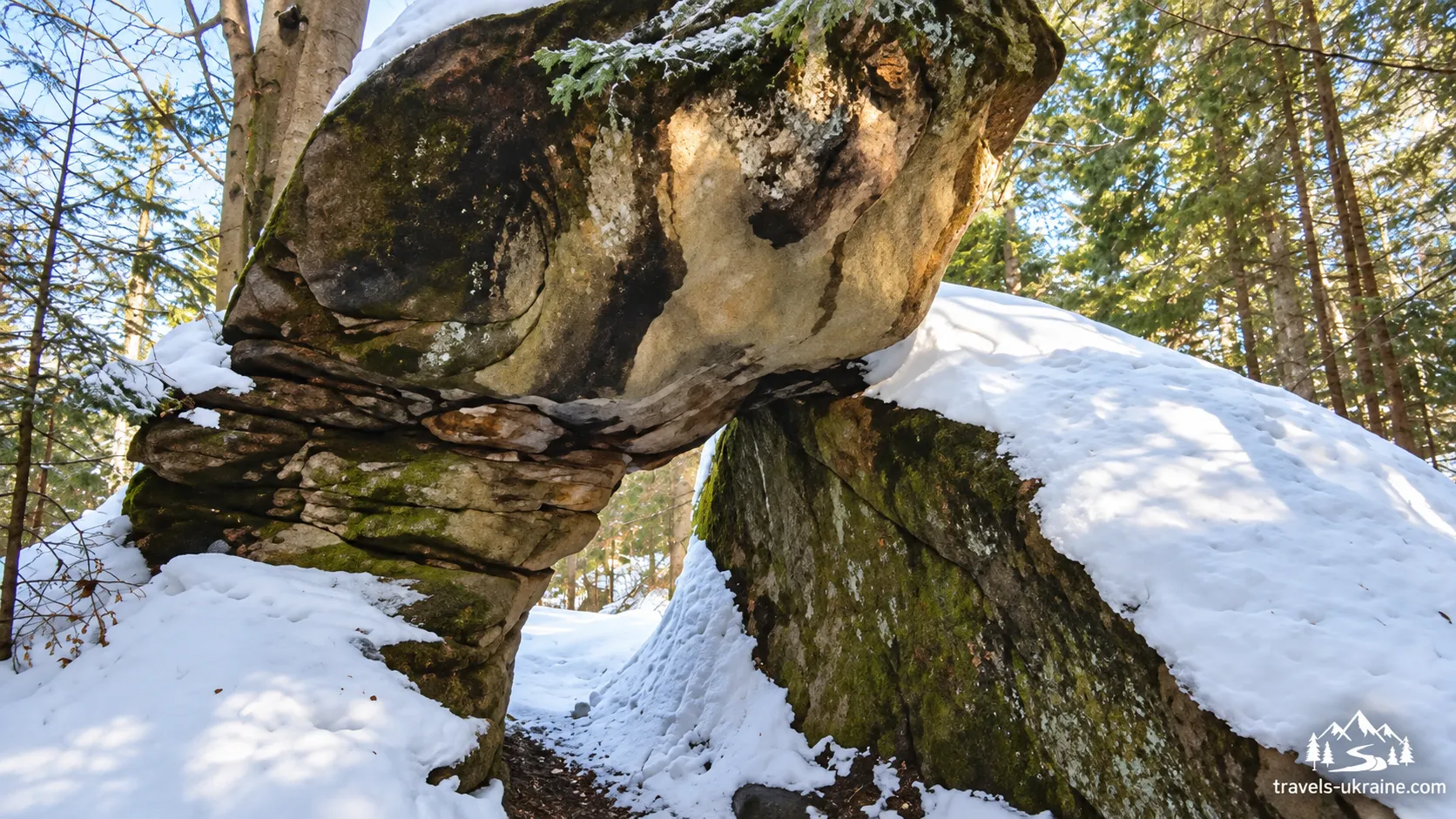
«Easter Island» is far from the only interesting rock group on the ridge. Further on, there are other sandstone formations given their own names by tourists and researchers. «Playroom» is a group of low, fragmented blocks with cracks, openings, and bizarre shapes. Nearby is the «Arch,» also called «Cobra»: a natural opening in the rock creates a distinctive passage through it.
Further on, you can see the «Falcon» rock and several tower-like outcrops. Some boulders are several metres high and look almost artificial, although they are all natural in origin. These are the places that make the Kliuch route interesting even without an open summit. At some point, you stop waiting for the next viewpoint and start looking at your feet and between the trees—because another fascinating rock may appear literally around the next bend.
Kliuch’s «Canyons,» Which Are Not Quite Canyons
The narrow stone gorges on the ridge are especially unusual. Tourist descriptions often call them «the canyons of Kliuch,» but from a geological standpoint, this name is not entirely accurate.
A classic canyon is carved over a long period by a flowing body of water. Here, the mechanism is different: massive sandstone layers cracked, while parts of the mountain mass gradually shifted under the force of gravity. This created tectonic-gravitational gorges with almost vertical walls and narrow floors.
And the dimensions of some of these formations are far from symbolic. One of the studied gorges in the western part of the ridge is only about 8 meters long and 3 meters deep, while another in the southeastern part stretches for approximately 100 meters and reaches up to 20 meters in depth. When you walk along its bottom between sheer sandstone walls, the tourist name «canyon» no longer seems so strange. It was simply not a river that created this corridor, but the slow movement of the mountain itself.
Key Vertical Caves
The same cracks that formed the gorges continue deeper into the massif in places, creating vertical caves. They are one of Key’s least-known yet most unusual natural features. Unlike Podillia’s famous gypsum caves, which water gradually carved out of the rock, Key’s caves are primarily of tectonic and gravitational origin. In essence, they are large cracks and cavities between sandstone blocks that shifted relative to one another.
So do not expect kilometers of smooth galleries inside. The characteristic features here are narrow passages, vertical shafts, sharp boulders, and complex transitions between stone blocks. Geologists note that Key’s vertical caves are among the largest known sandstone caves in Ukraine. At the same time, they remain insufficiently explored, and some cracks may continue to considerable depths.
Pilgrim, Three Bats, and Other Caves
Speleological descriptions of the ridge mention the names «Pilgrim,» «Three Bats,» «Seven Bats,» «Icy,» «Rainbow,» and «Passage Yard.» Lviv speleologists studied some of these caves as early as the late 20th century, and research groups returned to them in the 2010s–2020s.
The best-known among tourists is Pilgrim Cave, located near the route in the Key area. Another famous cave, «Three Bats,» has a significant vertical drop and a system of underground passages. However, the names and detailed characteristics of most caves come primarily from speleological studies and tourist reports rather than from the park’s official tourist catalogue.
A Geological Route That Is Easy to Walk Right Past
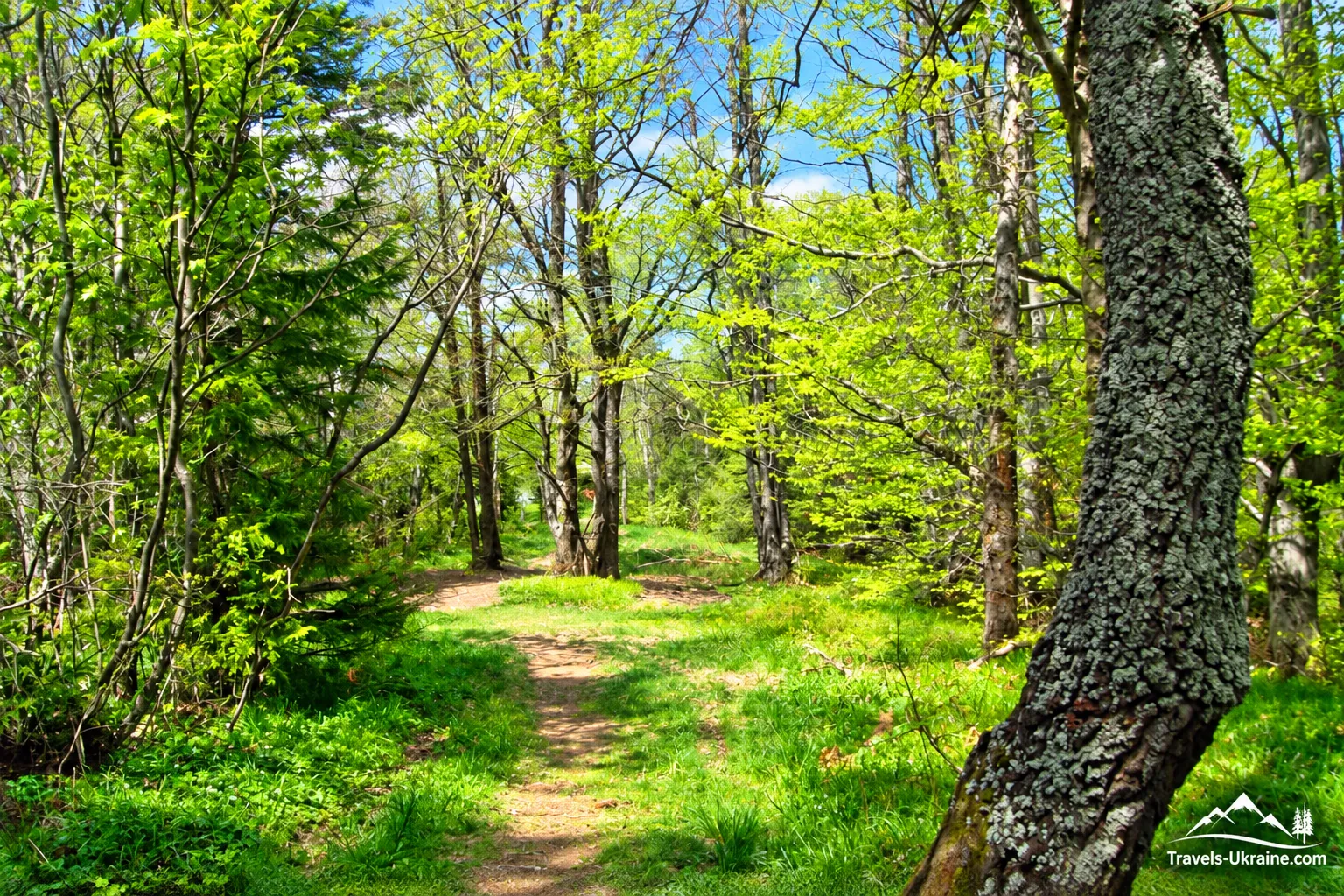
Interestingly, many of these features can go unnoticed if you simply follow the main road to the summit of Key. The cliffs and gorges lie in the forest, while the cave entrances sometimes look like ordinary narrow cracks between rocks. That is why the area is gradually gaining its own tourist routes. The marked Yurii Ruf Memory Trail, which begins near Kamianka Waterfall, passes through Zhuravlyne Lake, «Easter Island,» and the Key Ridge. A separate tourist trail to the cliffs of «Easter Island» is also being developed.
And it is precisely along this section that Key’s main feature becomes especially clear: the mountain is interesting not because of a single summit, but because of the entire labyrinth of natural features surrounding it. So if, during your hike, you suddenly realize that you have been studying some rocks for half an hour and have completely forgotten about the summit, that is perfectly normal. That is simply how the route on Key works.
The Route to Mount Key: How to Cross the Ridge
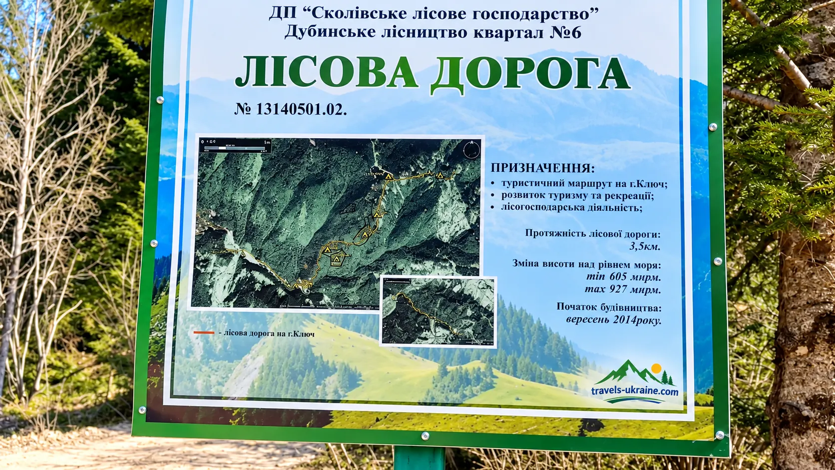
Mount Key is interesting because it is not tied to just one tourist itinerary. You can take the classic historical and educational route through Trukhaniv, cross the ridge, and finish the hike in Skole, or turn toward the Kamianka Valley after reaching the summit and add Zhuravlyne Lake and the waterfall to the route. So before setting out, decide what matters most to you: the mountain itself and the history of the Ukrainian Sich Riflemen, a full traverse of the ridge, or combining Key with the best-known natural sites of the Skole Beskids. This will determine the route’s length, elevation gain, travel time, and the most convenient starting point.
Official Route: Nyzhnie Syniovydne — Trukhaniv — Key — Skole
Skole Beskids National Nature Park has an official historical and educational route, “Nyzhnie Syniovydne — Trukhaniv — Mount Key — Skole,” with a total length of about 20 kilometers. The route can be completed in one day, but the park rates the one-day option as a route of moderate difficulty. A more relaxed two-day format is recommended for inexperienced hikers.
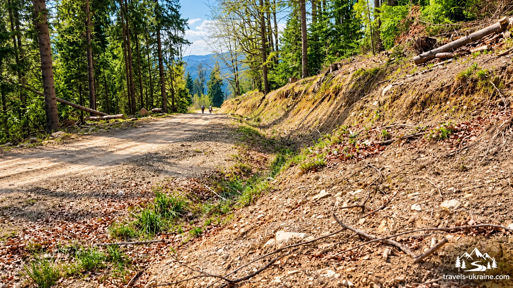
The route is convenient to start because Nyzhnie Syniovydne has a railway connection. From the station, the path runs through Tyshivnytsia toward Trukhaniv, gradually changing from village roads into a genuine mountain ascent. As far as Trukhaniv, the route runs mostly through the valley, but the most demanding part of the climb begins just beyond the village. From the village center, you need to take a dirt road toward the forest, where the trail rises sharply toward the Key Ridge.
The park’s official description explicitly calls this section the most difficult part of the route. The slope is steep, and after heavy rain the trails can effectively turn into small streams. So Key’s modest height of 900-something meters should not be misleading. The summit’s elevation alone does not show how difficult a particular ascent will be. Sometimes a mountain looks almost modest on the map, while half an hour later your legs are already demanding an explanation of who came up with this route.
Along the Key Ridge Toward Skole
From the summit area, the official route continues north along the Key Ridge. Part of this section has blue tourist markings, but the national park’s older description warns that in some places the trail may disappear among grass, fallen trees, and open clearings. So even on the official route, do not rely entirely on paint marks on the trees. An offline map or downloaded GPX track will provide useful backup, especially if you are hiking the route for the first time.
The ridge alternates between forested sections, clearings, and more open areas offering views of the surrounding Beskids. Toward the end, the trail begins a gradual descent into the Kamianka and Opir valleys, from where you can continue on to the town of Skole.
The Most Popular Route to Key via Kamianka Waterfall
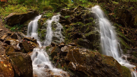
One of the most popular and, at the same time, most interesting ways to climb Mount Key begins near the village of Dubyna and the Kamianka River valley. Its main advantage is that the hike is not limited to reaching the summit: along the way, you can see Kamianka Waterfall, the mysterious Zhuravlyne Lake, the ridge’s rock formations, caves, and the memorial to the Ukrainian Sich Riflemen. In fact, this is already a ready-made historical and natural route through the Skole Beskids.
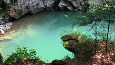
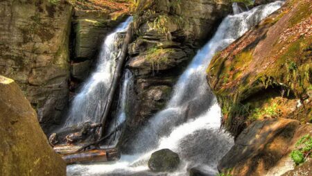
A convenient starting point is the turnoff to the village of Kamianka near Dubyna. The road crosses the railway and the Opir River, then gradually enters the Kamianka Valley. The waterfall can be reached on foot, by bicycle, or by car; it is approximately four kilometers away. For many tourists, the walk ends at the waterfall, but for the route to Key, this is only the beginning. A little farther up the road there is a spring and a turnoff to Zhuravlyne, or Dead, Lake. The lake lies in the forest not far from the main road, so it is easy to include it in the hike as a short detour.
After Zhuravlyne Lake, there are several ways to reach the ridge. Hikers with good navigation skills can continue along trails through the rock formations, particularly toward «Easter Island,» and from there gradually reach the main Key Ridge. This option is the most interesting in terms of natural features, but in places the trail becomes overgrown, passes through windthrow, and is not always easy to follow on the ground.
For less experienced hikers, it is safer to return to the main road along the Kamianka after visiting the lake. After approximately one kilometer, you need to reach the point where the Luzhky stream flows into the Kamianka River, leave the main road, and head uphill through the Luzhky Valley. The path then crosses several side streams and reaches the road connecting Kamianka with Trukhaniv. From here, the main ascent to the Key Ridge begins.
Once you reach the main ridge, a trail leads to the mass grave and memorial to the Ukrainian Sich Riflemen. This clearing is one of the route’s main points of interest. From there, you can continue along the ridge, look for rock formations and gorges, or plan a descent toward Trukhaniv or back to the Kamianka Valley.
Frequently Asked Questions About Mount Key and the Route Through the Skole Beskids
How high is Mount Key?
According to Skole Beskids National Nature Park, Mount Key stands at 929.7 meters above sea level. Tourist materials often round this figure to 927–930 meters. Key is not one of the highest peaks in the Beskids, but the difficulty of the hike is determined less by elevation than by the route’s length, the steepness of certain climbs, and the condition of the forest trails.
Which route to Mount Key is the most popular?
One of the most popular hiking options begins near Kamianka Waterfall. Along the way, you can visit Zhuravlyne Lake, reach the rock formations of the Key Ridge, pass the Ukrainian Sich Riflemen memorial area, and continue toward Trukhaniv or Skole. This option is particularly appealing because it combines a waterfall, a lake, cliffs, historic sites, and the ridge itself in a single hike.
Which official route passes through Mount Key?
The national nature park has a historical and educational route «Nyzhnie Syniovydne — Trukhaniv — Mount Key — Skole» that is approximately 20 km long. It can be completed in one day, but the park rates the one-day option as a moderately difficult route. A more relaxed two-day format is officially recommended for beginners.
Is it difficult to climb Mount Key?
Key is not a technically difficult mountaineering peak, but the full route can be quite strenuous. The most challenging section of the official route is considered to be the steep ascent from the Trukhaniv side. After rain, dirt trails become slippery, and some sections may turn into streams. The hike requires proper trekking shoes, water, and sufficient time.
What happened on Mount Key in 1914?
On October 28, 1914, a battle took place on Mount Key between the Ukrainian Sich Riflemen and Russian forces. A company under the command of Volodymyr Srokovskyi attacked the Russian positions and regained control of the strategic height. A mass grave and memorial to the fallen riflemen now stand near the summit.
Can you enter the caves of the Key Ridge independently?
You can see the entrances to some caves during the hike, but descending on your own without caving experience is not recommended. Some caves have vertical shafts, narrow passages, and unstable rock blocks, so exploring them requires specialized equipment and appropriate preparation. In winter, the caves may also serve as hibernation sites for rare bats, which should not be disturbed.
Why are there two «Dead Lakes» near Klyuch?
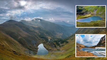
In this area, the name «Dead Lake» refers to two different bodies of water. The first is Zhuravlyne Lake near Kamyanka Waterfall. The second is Polianytske Lake on the other side of the Klyuch area. These are separate natural sites, so when planning a route, it is better to use their official names rather than only the local name «Dead Lake.»
Is there a panoramic view from the summit of Klyuch?
The summit of Klyuch is partly forested, so you should not expect an open 360° panorama from the geographical summit itself. Good views can be found on open sections of the ridge, in clearings, and near individual rock outcrops. That is why Klyuch’s main appeal is the entire route, not just the final ascent point.
Can you hike Mount Klyuch with children?
A hike with school-age children is possible if they are used to long walks and the route is chosen according to their fitness level. A full 18–20-kilometre trek may be too exhausting for younger children, so families should choose a shorter route from the Kamyanka side and not try to see all the rocks, caves, lakes, and the summit in a single day.
When is the best time to hike Mount Klyuch?
The most comfortable period is late spring, summer, and the first half of autumn. After prolonged rain, steep dirt trails become slippery and considerably more difficult to navigate. The ridge is especially beautiful in autumn because of its beech forests, but you should take the shorter daylight hours into account. Before setting out, check the forecast and download an offline map or GPX track.
Mount Klyuch — a route remembered not for its height
Mount Klyuch is a case where the elevation figure says almost nothing about the route’s true value. Less than a thousand metres above sea level, a partly forested summit, with none of the grand status of «one of the highest mountains in the Carpathians» — on the map, it all looks rather modest. But once you walk this route, the impression changes completely. First comes the sound of Kamyanka Waterfall, then dark Zhuravlyne Lake hidden in the forest, followed by enormous sandstone boulders, gorges, caves, and stone labyrinths. And closer to the summit, nature suddenly gives way to history — the memorial to the Ukrainian Sich Riflemen and the events of 1914.
It is this changing sequence of impressions that makes Klyuch special. There is no single main attraction after which you can say, «That’s it, we’ve seen everything — let’s head back.» Each successive section of the route reveals something new: water, forest, rocks, geology, history, and the silence of an old ridge. Perhaps that is why Klyuch is best understood not as an isolated summit, but as a large historical and natural route through the Skolivshchyna region. The summit is just one point along the way — and far from always the most interesting.
If you are looking for a place in the Carpathians where you can see a little more in one day than just another mountain with a summit sign, Klyuch certainly deserves your attention. You can begin your hike by a waterfall, lose yourself gazing among the boulders, pause at the memorial, and only towards evening realize that all day you barely thought about how many metres remained to the summit. And that is probably the finest compliment for Mount Klyuch: people come here for the summit, but remember something entirely different.

No Comment
You can post first response comment.