
 English
 Українська
 Русский

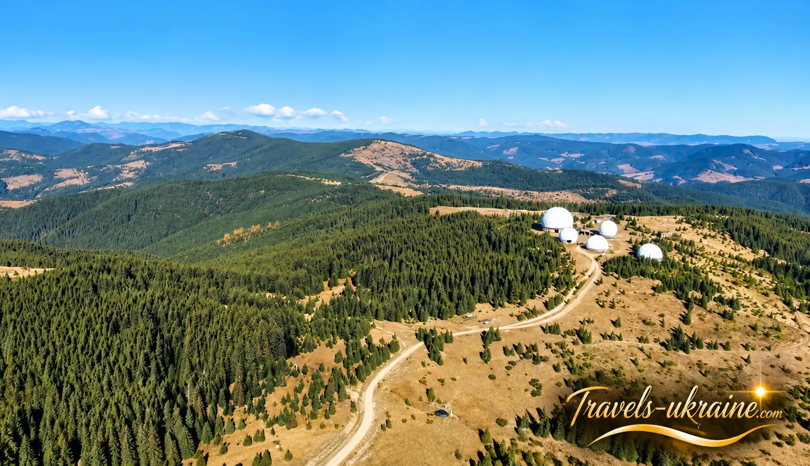
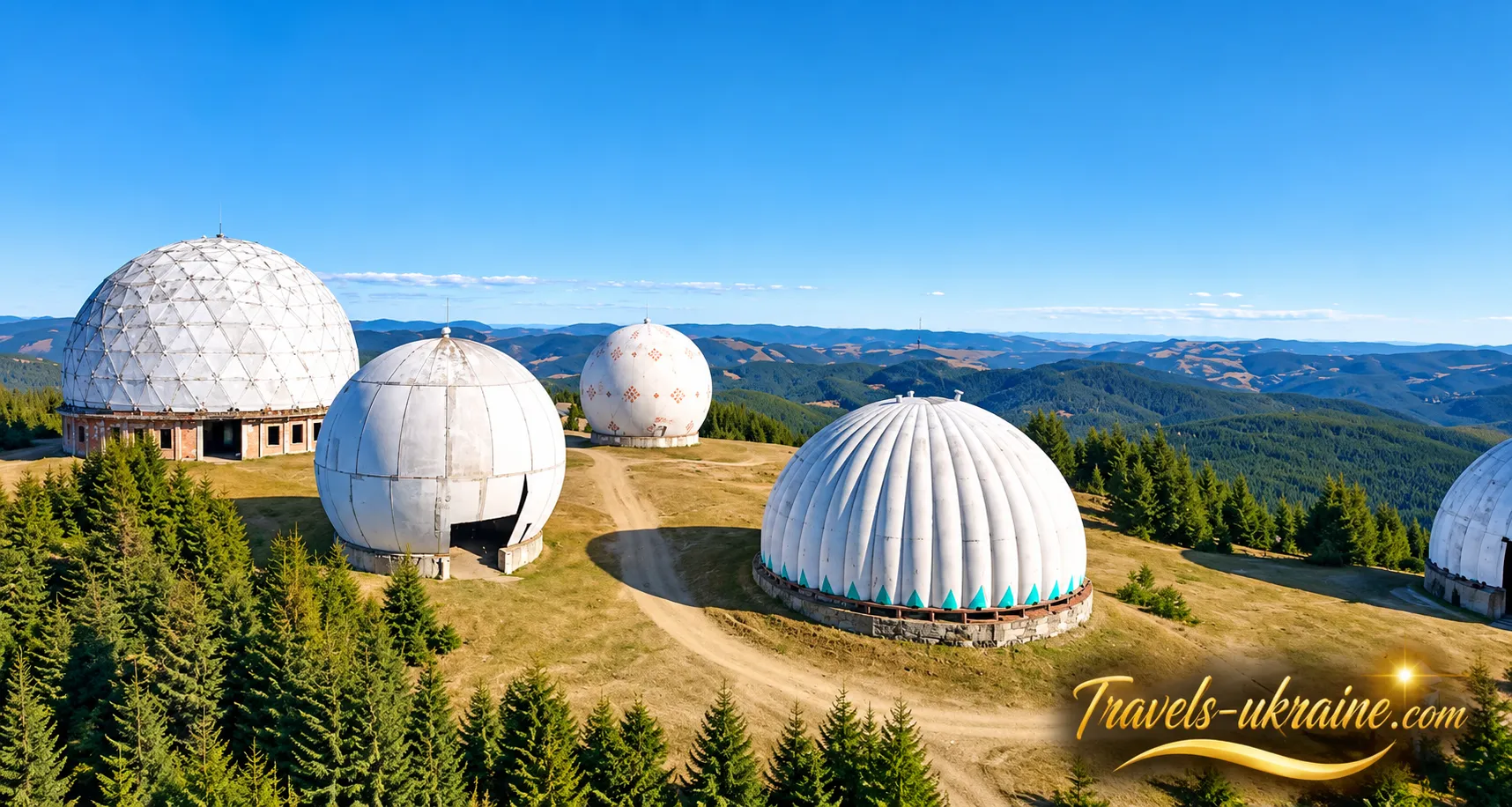
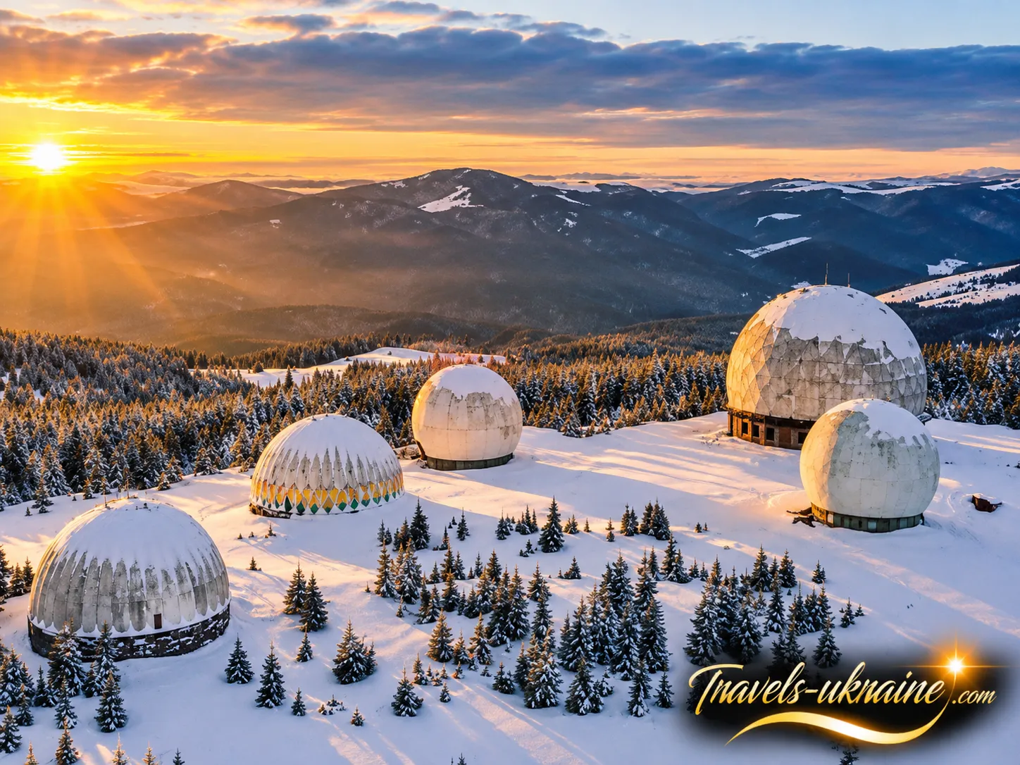
High in the Bukovinian Carpathians, among alpine meadows, strong winds and almost uninhabited mountain landscapes, stand structures you would hardly expect to find at an altitude of more than 1,500 metres. Five enormous white domes rise above the summit of Mount Tomnatyk, resembling either a futuristic space base or a high-altitude observatory when viewed from a distance. In reality, these are the remains of a very different era — the former Pamir Radar Station.
Mount Tomnatyk is located near the Ukrainian-Romanian border. Today, visitors come here for unusual photographs and panoramic views of the Carpathian Mountains, but just a few decades ago, tourists would hardly have been allowed to wander freely among these structures. Pamir was a military installation belonging to the air defence system, established during the Cold War to monitor the surrounding airspace.
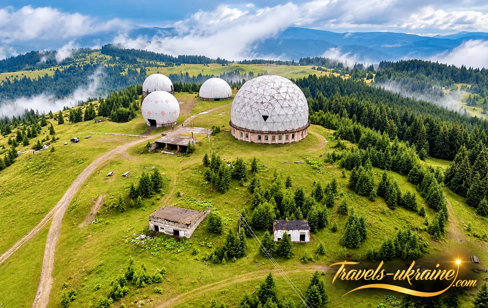
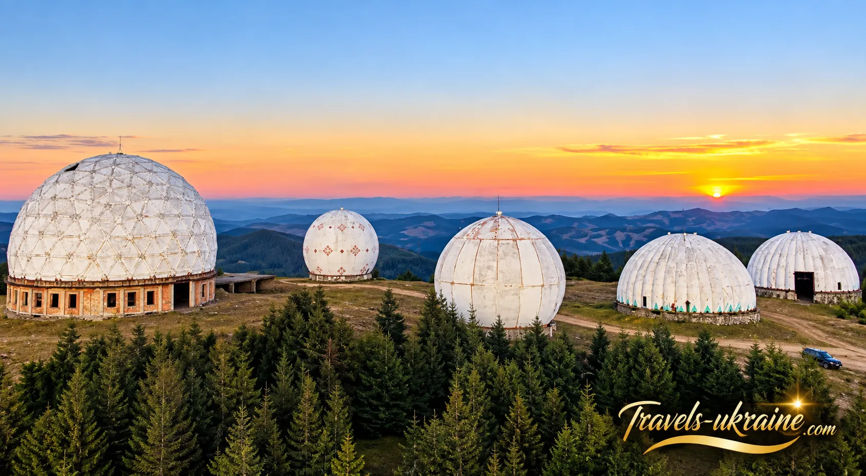
The domes themselves are the most striking feature. Their white spherical shells were not radars in their own right — they were protective enclosures designed to shield sophisticated radar equipment from snow, rain and powerful mountain winds. Inside one of the largest shelters, visitors can still see the remains of a P-14 Lena radar antenna, while nearby stand old barracks, military garages and other remnants of the former military base. Yet the greatest mystery of the Carpathian Pamir goes beyond its technology. It is difficult to imagine what life was like for the military personnel stationed on this remote mountain summit, where winter brings heavy snow, dense fog and strong winds. Even more intriguing is why Mount Tomnatyk was chosen for the radar station, how much airspace it could monitor and why, after decades of secrecy, all this equipment was simply left behind in the mountains.
After the military base was closed, the Pamir Radar Station began a new chapter in its history. What was once hidden from outsiders gradually became one of Bukovina's most recognisable tourist attractions. One of the domes was decorated with traditional Ukrainian patterns, music videos were filmed among the white spheres, and the mountain summit began appearing increasingly often in travellers' photographs. However, describing the Carpathian Pamir as merely an "abandoned military base" would be an oversimplification. The surrounding landscape is dominated by the Yalovychory Mountains, with Mount Yarovytsia rising nearby, while the exposed summit offers views of mountain ridges on both sides of the Ukrainian-Romanian border. Here, the history of the Cold War literally stands amid the wild natural beauty of the Carpathian Mountains.
In the following sections, we will explore what the Carpathian Pamir is, how the secret radar station on Mount Tomnatyk operated, why its famous white domes were built, what remains of the former military installation today, and how a once-restricted site became a tourist landmark of the Bukovinian Carpathians.
Carpathian Pamir: Where Is It Located and What Makes It Special?
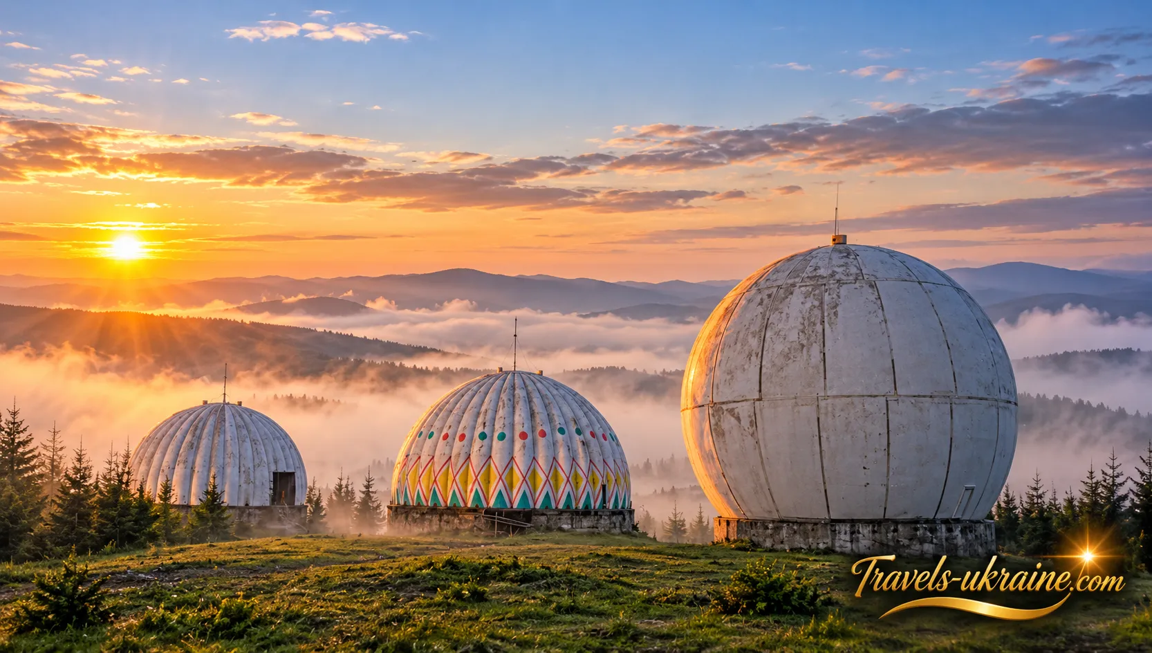
The Carpathian Pamir is located on the summit of Mount Tomnatyk in the Yalovychory Mountains, one of the most remote parts of the Bukovinian Carpathians. Administratively, the mountain lies in Vyzhnytsia District of Chernivtsi Oblast, along the Tomnatykul Ridge, near the village of Sarata and Semenchuk Pass. The summit reaches an elevation of 1,565.3 metres above sea level. It is here, among the high-altitude mountain meadows, that the famous white domes of the former Soviet Pamir radar station have survived.
On the map, this part of the Carpathians appears considerably less developed than the popular tourist areas around Bukovel, Yaremche or Verkhovyna. There are no large resorts, densely built-up areas or conventional paved roads leading directly to the summit. Instead, the landscape is dominated by mountain ridges, forests, alpine meadows and the valleys of the Sarata and White Cheremosh rivers. The Ukrainian-Romanian state border also runs nearby.
Mount Tomnatyk — A High-Altitude Peak in the Yalovychory Mountains
The summit of Mount Tomnatyk is largely open, with a treeless upper section, while its lower slopes gradually descend into mountain forests. This provides sweeping panoramic views of the surrounding ridges and peaks, including mountains on the Romanian side of the border.
To the north of Tomnatyk rises Mount Yarovytsia, at 1,586.9 metres — the highest peak in both the Yalovychory Mountains and Chernivtsi Oblast. Together, Yarovytsia and Tomnatyk form one of Bukovina's most distinctive high-altitude mountain areas, where the natural landscapes remain far less developed than in many of the more popular parts of the Carpathians.
Several ecological and hiking trails belonging to Cheremoskyi National Nature Park pass through this area. One route leads through Semenchuk Pass directly to Tomnatyk, while others connect the summit with Yarovytsia and the surrounding high-altitude landscapes. As a result, the mountain is now more than just the site of a former military radar station — it is also an established destination along the hiking routes of the Bukovinian Carpathians.
What Is Pamir, and Where Did the Name Come From?
The name Pamir did not originally refer to the mountain itself. It was the code name of the military radar station located on Mount Tomnatyk. Over time, the name became so closely associated with the area that tourists now frequently use Pamir to describe the entire summit with its white domes. This is how the popular tourist name Carpathian Pamir originated. It does not mean that Mount Tomnatyk has any geographical connection to the Pamir mountain range in Central Asia. In this case, the name refers specifically to the former military installation, whose designation gradually became a recognisable tourist landmark.
Information about the site may also refer to it by simpler names, such as Pamir Base, the Domes of Tomnatyk or simply Mount Tomnatyk. All these names essentially refer to the same place — the summit where the remains of a former air defence installation still stand, including five enormous white domes. These structures contrast so dramatically with the surrounding mountain landscape that they can be spotted from neighbouring ridges. It is these distinctive spherical structures that have made Mount Tomnatyk one of the most recognisable landmarks of the Bukovinian Carpathians.
Carpathian Pamir Today — More Than an Abandoned Military Base
If the white domes stood in an industrial area or on the outskirts of a large city, they would probably create a completely different impression. What makes the Carpathian Pamir unique is precisely this contrast: the remains of sophisticated military technology stand in the middle of a high-altitude natural landscape. On one side are radar installations, concrete, metal and structures dating back to the Cold War. On the other are alpine meadows, mountain ridges, the valleys of the White Cheremosh and Sarata rivers, and the distant peaks of the Romanian Carpathians. This remarkable contrast has transformed Mount Tomnatyk into a destination that attracts mountain enthusiasts, photographers, industrial heritage enthusiasts and travellers interested in the lesser-known history of the 20th century.
However, its remote location also has practical implications: the Carpathian Pamir is not an ordinary roadside tourist attraction. Visiting the site requires preparation, and its proximity to the international border means that travellers must take current border-area access regulations into account before setting off. We will return to this important issue in the practical section of the article. For now, the key point is that Tomnatyk is a real high-altitude summit in the Bukovinian Carpathians, while Pamir is a genuine former military radar base whose remains still stand more than 1,500 metres above sea level. To understand why such a remote mountain became home to a sophisticated complex of enormous radars and white domes, we need to travel back to the Cold War.
Pamir Radar Station: History of the Secret Military Installation and What Remains Today
Today, the white domes on Mount Tomnatyk look almost like a science-fiction setting amid the Carpathian Mountains. Yet just a few decades ago, their purpose was entirely practical and military. Pamir was part of the Soviet air defence system, designed to detect airborne targets in time and transmit information about their direction and distance. During the Cold War, stations like this formed an essential part of an extensive airspace surveillance network.
Most historical and local heritage sources indicate that the station on Mount Tomnatyk operated from the 1960s until the mid-1990s. A separate page published by Cheremoskyi National Nature Park mentions a broader period of 1950–1995, meaning that popular sources do not entirely agree on the exact year the complex was established. It is more reliable to say that Pamir was already an operational military installation by the 1960s and remained in service until 1995.
Why Was the Radar Station Built on Mount Tomnatyk?
Its location at an altitude of 1,565.3 metres was no coincidence. A radar station requires the widest possible field of observation with minimal natural obstructions, and the exposed summit of Mount Tomnatyk offered considerably better conditions than a mountain valley. Its proximity to the Soviet Union's western border with Romania also gave the location additional strategic importance. During the Cold War, airspace was continuously monitored, and information collected by high-altitude radar posts formed part of the broader air defence system.
Some historical accounts claim that Pamir monitored airspace stretching from the Turkish coast to the Baltic Sea. However, interpreting this as the detection range of a single radar would be incorrect. More likely, it refers to the area of responsibility of a wider network of radar stations, of which the installation on Mount Tomnatyk was one component.
How Did the Pamir Radar Station Work?
The station maintained round-the-clock operational duty. Its radar equipment transmitted radio waves, received signals reflected from airborne objects and enabled operators to determine the position of detected targets. This information was then forwarded to the air defence command system, where decisions were made about tracking the identified objects.
According to Cheremoskyi National Nature Park, several types of radar equipment were used on Mount Tomnatyk. The best-known surviving example is the P-14 Lena, a large VHF early-warning radar designed for long-range detection of airborne targets and the determination of their range and azimuth.
For its time, the P-14 was a sophisticated technical system. Its large antenna had to function in extremely challenging weather conditions, precisely the kind for which Mount Tomnatyk is known. Powerful winds, freezing temperatures, heavy snowfall, ice accumulation and sudden changes in the weather are far from unusual here.
Why Were the Enormous White Domes Necessary?
The harsh mountain climate explains the existence of the Carpathian Pamir's most recognisable feature — its radio-transparent radomes. A large radar antenna needed to rotate freely while remaining protected from snow, ice and strong winds. An ordinary roof would not have been suitable because it would interfere with the radar equipment's operation. Instead, the antennas were housed inside spherical enclosures made from materials that allowed radio waves to pass through. Cheremoskyi National Nature Park identifies one such shelter as type RPU-63U6E. According to reliable sources, the enclosure was designed to withstand wind speeds of up to 30 m/s and substantial snow loads of up to 250 kg per square metre.
This is why it is important to distinguish between two things: the white dome is not the radar itself. Its purpose was simply to protect the antenna housed inside. After the station ceased operations, most of the equipment was dismantled, while the spherical shelters remained on the summit and gradually became its most recognisable symbol.
More Than Radars: What Was the Military Base Like?
Pamir consisted of much more than five domes. Keeping a remote high-altitude radar station operational required an entire military infrastructure. The summit and its immediate surroundings accommodated barracks, technical facilities, garages, utility buildings and engineering installations. Military personnel were responsible not only for maintaining the radars but also for living on an isolated mountain. Transporting personnel, food, fuel, spare parts and everything required for everyday life involved travelling along a difficult mountain road. During winter, these logistical challenges became particularly demanding.
Accounts from former military personnel, recorded by local historians, help us imagine the station as a small, largely self-sufficient mountain garrison. Soldiers maintained round-the-clock duty, repaired equipment, kept living quarters operational and ensured that the radar systems continued functioning regardless of the weather outside the domes.
When Was the Pamir Radar Station Closed?
Following the collapse of the Soviet Union, the strategic defence system of which Mount Tomnatyk had been a part underwent major changes. The need to maintain such a complex and expensive high-altitude installation gradually diminished, and its technical equipment began to be taken out of service. 5 November 1995 is considered the date when the Pamir military base officially ceased to exist. This date is cited by Ukrinform, the Faculty of Geography at the University of Lviv and accounts from former military personnel.
After the military personnel departed, some of the equipment was dismantled. Over the years, the buildings deteriorated, metal structures were removed, and certain parts of the complex were taken apart for scrap metal. In 2018, Ukrinform even reported the dismantling of some remaining military infrastructure, raising concerns about the possible loss of this unique tourist landmark.
From a Secret Military Installation to a Tourist Attraction
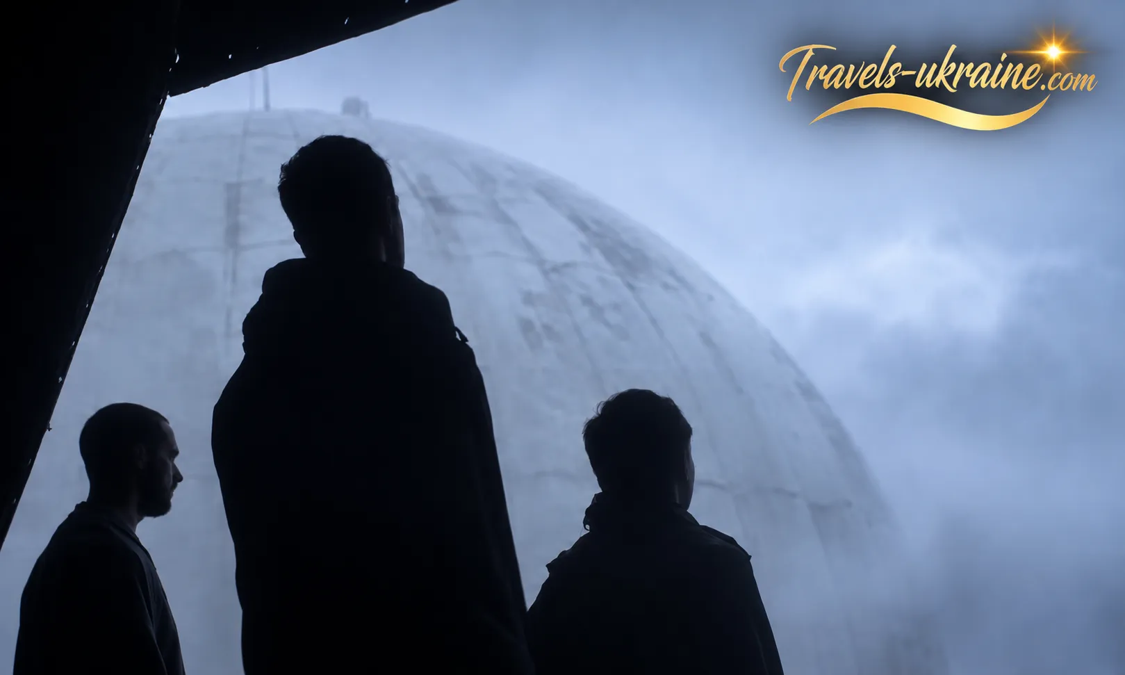
After the base ceased operations, Mount Tomnatyk gradually lost its military significance. Some of the radar equipment was dismantled, military personnel left the installation, and the buildings and technical structures began to deteriorate under the effects of time and harsh mountain weather. Yet the very features that had once made the station restricted and inaccessible eventually transformed it into one of Bukovina's most unusual tourist attractions.
The enormous white domes remained standing among the alpine meadows, even though their military purpose had disappeared. Over the years, travellers, photographers and enthusiasts of lesser-known destinations began exploring the site. Today, Cheremoskyi National Nature Park explicitly describes Mount Tomnatyk as a tourist magnet and notes that hiking routes through the Bukovinian Carpathians pass through the area of the former radar station.
Pamir's transformation into a tourist attraction took place largely without a conventional museum restoration. No exhibition featuring reconstructed radar operators' rooms or newly built pavilions was created. Instead, the main attraction remained the high-altitude military complex itself, which travellers gradually discovered through off-road jeep tours and hiking routes across the mountains.
Over time, Mount Tomnatyk began appearing on tourist itineraries, while cultural and community events were organised on the grounds of the former military base. In 2018, the site hosted an ethnic festival called "Love Bukovina, Because It's Worth It", and one of the domes was even used as a venue for a conference dedicated to rural development.
Today, Cheremoskyi National Nature Park is also developing tourist infrastructure around the summit. A viewing tower with a rest area has been built nearby, offering views of Pamir's white domes and the Romanian Carpathians. In this way, the former military site is gradually becoming integrated into the region's modern tourist routes.
The Ukrainian Easter Egg Dome on Mount Tomnatyk
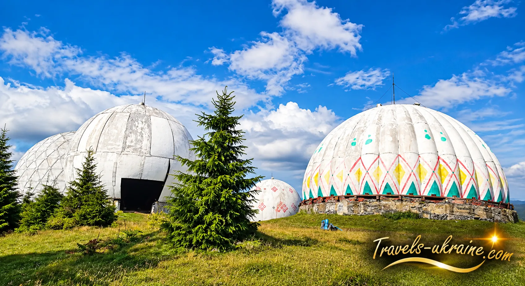
One of the most remarkable chapters in Pamir's new history began in 2017. As part of the cultural project "A Sea of Opportunities on Mount Tomnatyk", artists began decorating one of the radar domes with traditional Ukrainian Easter egg patterns, known as pysanka designs. The idea carried a powerful symbolic meaning: a structure originally built for military purposes was transformed into a large-scale work of art. The white technical dome became an enormous canvas covered with traditional Ukrainian motifs. During subsequent events, the decorative work continued, and the image of a giant Easter egg standing among the mountains became another recognisable feature of Mount Tomnatyk.
This contrast is particularly symbolic: a structure that once concealed a Cold War radar antenna was decorated with patterns associated not with military technology, but with traditional Ukrainian culture.
Jamala and "1944": A Music Video Filmed at Carpathian Pamir
Even before the appearance of the pysanka dome, Carpathian Pamir had already gained an important place in Ukrainian cultural history. In 2016, the official music video for Jamala's song "1944" was filmed on Mount Tomnatyk. With this song, the singer won the Eurovision Song Contest that same year. The abandoned Pamir military base served as the main filming location. According to Jamala's official channel, filming in the Bukovinian Carpathians lasted three days. The video was directed and choreographed by Anatolii Sachivko, with cinematography by Mykyta Kuzmenko.
Mount Tomnatyk proved to be a particularly fitting location for the song's atmosphere. In the video, dramatic mountain landscapes, mist, vast open spaces and the monumental remains of the Soviet military complex create a powerful sense of isolation and emotional intensity. The domes are no longer perceived merely as technical structures, but become an integral part of the video's visual storytelling.
For Pamir itself, appearing in such a well-known music project marked another step in its transformation from a formerly classified military installation into a place recognised far beyond Bukovina. Today, Cheremoskyi National Nature Park also mentions the filming of "1944" in its descriptions of local tourist routes.
Why the White Domes Became a Symbol of the Bukovinian Carpathians
The Carpathian Mountains are home to countless beautiful peaks, waterfalls and alpine meadows, but Mount Tomnatyk possesses something found almost nowhere else in Ukraine. Its landscape is unmistakable: five enormous white spheres on an exposed mountain summit create an image that remains memorable even after seeing just one photograph. However, the tourist appeal of Carpathian Pamir extends far beyond the photogenic appearance of its domes. They are tangible reminders of relatively recent history — a time when this remote part of the Carpathians formed part of an extensive military surveillance system and access was strictly prohibited to outsiders.
Today, the situation is entirely different. Tourists hike to Mount Tomnatyk, guided excursions and off-road jeep tours to Pamir are organised, recreational routes are being developed in the surrounding area, and the former military base has become one of the most distinctive tourist landmarks of Chernivtsi Oblast.
It is precisely this transformation that makes Pamir in the Carpathians so special. Within just a few decades, Mount Tomnatyk has changed from a restricted area hidden from public view into a destination that travellers now actively search for on maps. And although the original military equipment is gradually disappearing, the five white domes continue to tell the story of a bygone era preserved among the alpine meadows of the Carpathian Mountains.
Nature of the Carpathian Pamir
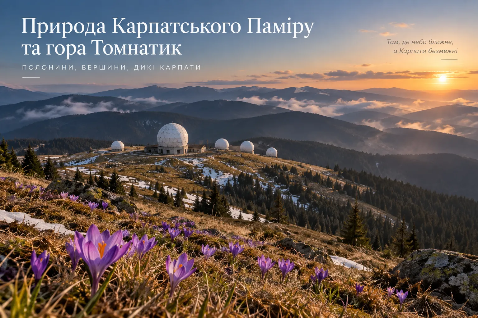
The white domes dominate photographs of the Carpathian Pamir so strongly that the surrounding natural scenery sometimes fades into the background. In reality, Mount Tomnatyk is located in one of Bukovina's least developed high-altitude regions, surrounded by the Yalovychory Mountains, alpine meadows, spruce forests and deep mountain river valleys. Even if the former radar station had never existed here, a journey into this remote part of the Carpathians would still be well worth taking.
Mount Tomnatyk forms part of the Yarovytsia–Tomnatyk mountain ridge. Its upper slopes are characterised by open subalpine meadows, meaning that the domes are not hidden among trees but stand in the middle of a vast mountain landscape, resembling giant mushrooms after the rain. This openness creates the famous panoramic views in which the Cold War structures appear almost small against the seemingly endless mountain ridges.
Much of the area near the summit is covered by subalpine meadows, locally known as polonynas. During the warmer months, the harsh winter landscape gives way to lush greenery, mountain grasses and seasonal wildflowers. For generations, local Hutsul communities have used these high-altitude pastures for summer grazing of sheep, cattle and horses. As a result, the natural landscape of Mount Tomnatyk is also an important part of the traditional rural culture of the Bukovinian Carpathians.
Cheremoskyi National Nature Park particularly highlights spring on Mount Tomnatyk. While patches of snow may still remain in shaded areas, the sunlit slopes become covered with Heuffel's crocuses (Crocus heuffelianus), also known as Carpathian crocuses. Their violet-blue flowers emerging among last year's grass and melting snow create a completely different image of Pamir from the familiar winter photographs of its white domes.
The flowering season depends on altitude, slope orientation and the weather conditions of each spring, so the timing varies from year to year. According to the national park, the different conditions across the mountain slopes make it possible to observe crocuses around Mount Tomnatyk over a relatively extended period in spring. If you are particularly interested in spectacular displays of these spring flowers, consider visiting the Valley of Crocuses in Kolochava, another picturesque seasonal destination where crocuses create magnificent carpets of purple blossoms.
How to Get to the Carpathian Pamir and What You Need to Know About Access
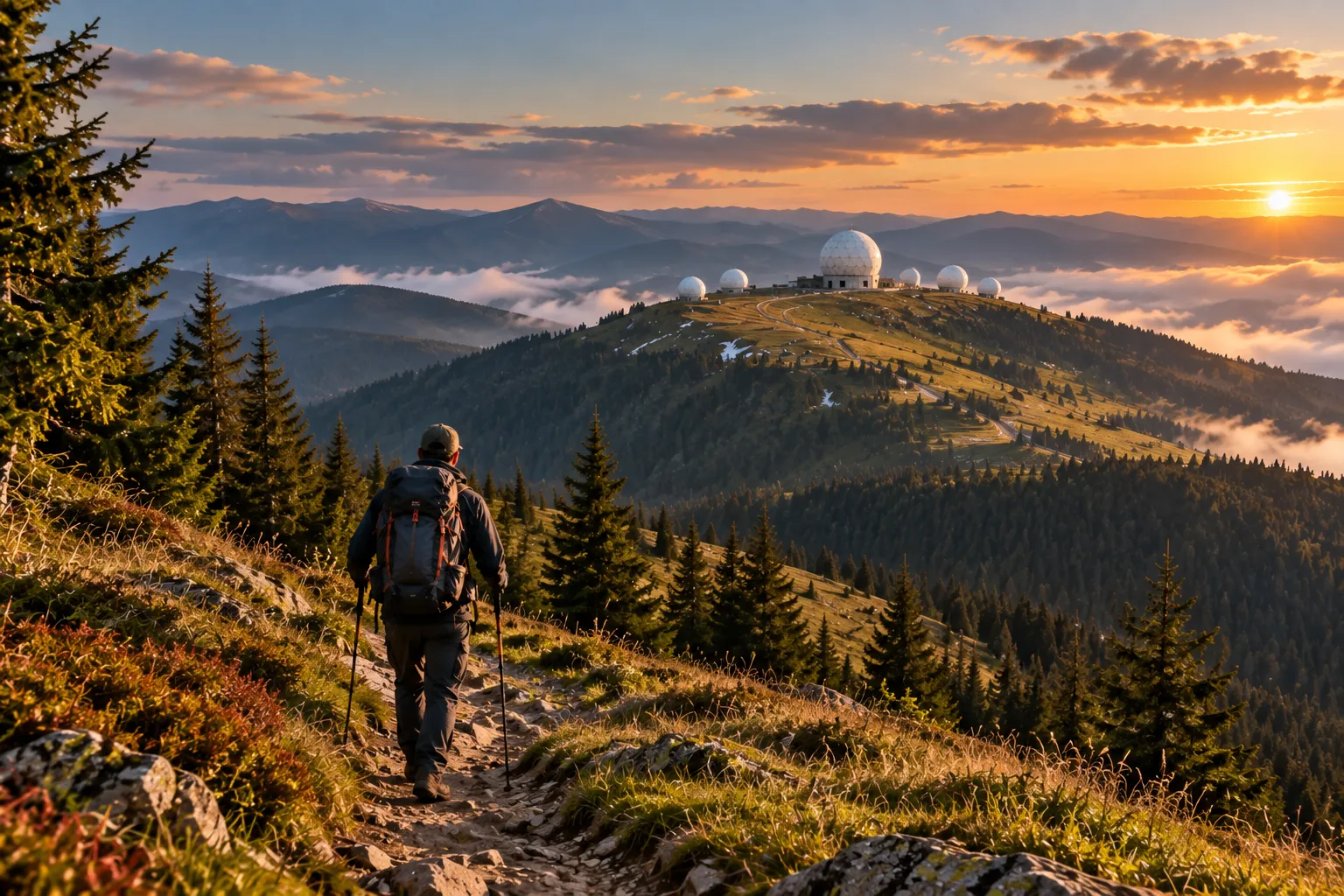
Visiting the Carpathian Pamir on Mount Tomnatyk is quite different from travelling to an ordinary tourist attraction. There is no paved road leading to the white domes, no major resort or regular public transport nearby, and the summit itself lies in a remote high-altitude border region of Bukovina. As a result, reaching the site requires advance planning, even in warm and dry weather.
One of the main traditional access points to Mount Tomnatyk is the village of Shepit. Cheremoskyi National Nature Park describes a route from Chernivtsi through Putyla, Ploska, Seliatyn and Shepit, after which the mountain section of the journey towards Tomnatyk begins. According to the park, the distance from Shepit to the mountain is approximately 18 km.
The Route via Shepit and Semenchuk Pass
The best-known tourist route leads from Shepit to Semenchuk Pass and then continues towards Mount Tomnatyk. This is the route followed by the official ecological hiking trail of Cheremoskyi National Nature Park, known as "Trails of the Windy Ridges". The full route is 34.5 km long, and the park recommends allowing approximately two days to complete it.
Along the way, hikers can discover the Suchavskyi Huk Waterfall, high-altitude alpine meadows and panoramic views of the Ukrainian and Romanian Carpathians. From Semenchuk Pass, the trail continues directly towards Mount Tomnatyk, where the Pamir site is located. This means that a visit to Pamir can be planned as part of a genuine mountain hiking adventure rather than simply a short trip to see the domes. For travellers who want to explore the Yalovychory Mountains more extensively, the park's official routes also connect Tomnatyk with Yarovytsia, Verkhnii Yalovets, Sarata and other natural attractions.
Can You Drive to the Pamir Radar Station?
The mountain road towards Mount Tomnatyk has traditionally been used by off-road vehicles and other high-clearance, all-terrain transport. Tour operators have offered routes through Shepit, where groups transferred from ordinary vehicles to jeeps, GAZ-66 trucks or other vehicles designed to handle the challenging terrain of the Carpathian Mountains.
Travelling in a standard passenger car is not advisable. Beyond Shepit, the route becomes an unpaved mountain road with rocks, deep ruts, steep sections and water crossings. Its condition depends heavily on rainfall: after prolonged rain, even a route that was passable the previous day can become significantly more difficult. The existence of a road does not automatically mean that tourists are permitted to drive along it at any time. Due to border-area restrictions, it is essential to confirm whether the specific route is open to visitors on your intended travel date.
Hiking to the Carpathian Pamir
For hikers, Mount Tomnatyk forms part of several official trails within Cheremoskyi National Nature Park. One of the most interesting options is the previously mentioned "Trails of the Windy Ridges", which passes through Semenchuk Pass and Tomnatyk before continuing towards Verkhnii Yalovets. Another longer route, "Rising Above the Horizon", covers approximately 43 km. It passes through Verkhnii Yalovets, Yarovytsia and Tomnatyk and is designed to take roughly two days to complete. This type of journey is particularly suitable for experienced hikers who want to explore not only Pamir but also the wider natural landscapes of the Yalovychory Mountains.
Regardless of the chosen route, hiking in the high mountains requires appropriate equipment, including sturdy footwear, a waterproof jacket, warm layers, drinking water, a fully charged phone and offline maps. Even in summer, temperatures and weather conditions at elevations above 1,500 metres can change rapidly.
Border Zone Restrictions: The Most Important Thing to Check Before Visiting
Mount Tomnatyk is located close to the Ukrainian-Romanian state border. For this reason, access regulations cannot be considered permanent: they depend on the current border security regime, martial law and decisions made by the relevant authorities. The situation in 2026 is particularly important. During the summer, a representative of Cheremoskyi National Nature Park told Suspilne that a significant part of the park lies within the border zone and that, at the time, the permits required to organise tourist excursions to Pamir were not being issued. As a result, the number of visitors to Mount Tomnatyk had decreased considerably.
At the same time, in September 2026, the Chernivtsi Regional Military Administration reported an organised ascent of Mount Tomnatyk as part of the "Mandrotherapy" project. This demonstrates that certain approved and organised visits may be possible, but it does not mean that the area is automatically open to all independent tourists. Before travelling, it is therefore essential to verify the current access regulations directly with the Ukrainian Border Guard Service and Cheremoskyi National Nature Park. Do not rely solely on travel blogs or hiking guides published several years ago that recommend simply arriving in Shepit, obtaining a permit on the spot and continuing towards the summit. Access rules may have changed significantly since those guides were written.
What to See Near the Carpathian Pamir
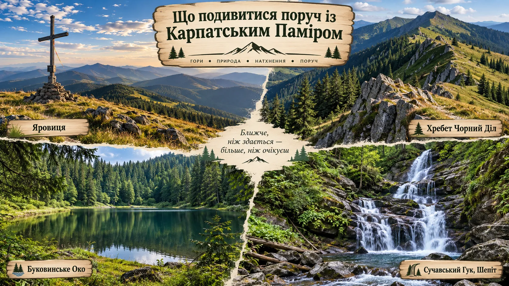
Pamir is located so far from major tourist centres that it would be a shame to travel all this way just to take a few photographs beside the white domes. The Yalovychory Mountains and the territory of Cheremoskyi National Nature Park are home to numerous natural and historical attractions that can be included in a longer itinerary. Some lie directly along the approaches to Mount Tomnatyk, while others can conveniently be visited on the way through Shepit or the neighbouring mountain valleys.
If your journey to the Carpathian Pamir begins through the village of Shepit, make sure to stop at Suchavskyi Huk Waterfall. Located almost in the village itself, on the Suchava River, it is one of the best-known natural attractions in this part of Bukovina. The waterfall consists of several cascades with a combined height of approximately 5–6 metres. It becomes particularly powerful after heavy rainfall and during the spring snowmelt. The name "Huk" perfectly reflects its character: in the local dialect, the word is associated with the loud roar of rushing water.
Suchavskyi Huk is particularly convenient to visit because it does not require a separate, challenging hike. It fits naturally into the journey towards Mount Tomnatyk via Shepit and can serve as the first stop before the high-altitude section of your mountain adventure.
Mount Yarovytsia — The Highest Peak in the Bukovinian Carpathians
To the north of Mount Tomnatyk rises Mount Yarovytsia, reaching 1,586.9 metres — the highest peak in both Chernivtsi Oblast and the Bukovinian Carpathians. Tomnatyk and Yarovytsia are located so close to each other that they are frequently combined into a single extended mountain hiking route. Yarovytsia also has an open, largely treeless summit. From the top, visitors can enjoy sweeping views of the Sarata and White Cheremosh valleys, the Yalovychory Mountains and neighbouring ridges. A metal cross and a memorial marker commemorating the Bukovinian Assembly of 1918 stand at the summit.
Mount Yarovytsia also offers excellent views of Tomnatyk itself, with its distinctive white domes clearly visible among the green alpine meadows. For hikers with sufficient time and physical fitness, combining these two peaks provides a much more complete experience of this remote part of the Carpathian Mountains.
Chornyi Dil Ridge
Another important natural area nearby is the Chornyi Dil Ridge. Stretching for approximately six kilometres, it lies within Cheremoskyi National Nature Park. Although slightly lower than the Yarovytsia–Tomnatyk ridge, Chornyi Dil features a more varied and, in places, considerably more rugged landscape.
While Mount Tomnatyk is characterised mainly by gentle, rounded contours, the Chornyi Dil area features steep slopes, exposed rock formations and karst landscapes. From its open sections, visitors can admire the Yalovychory Mountains, the Chornohora mountain range, spruce forests and green alpine meadows. Rare plant species grow in the high-altitude grasslands, some of which are protected. For this reason, hikers should stay on established trails and avoid picking unfamiliar wildflowers simply for photographs or bouquets.
Bukovinian Eye — A Mountain Lake Hidden Among the Forests
One of the region's most fascinating natural attractions is Hirske Oko Lake, also known as the Bukovinian Eye or Carpathian Eye. It is located approximately one kilometre from the village of Nyzhnii Yalovets, at the foot of Mount Tvorylets, at an elevation of around 1,128 metres. The lake was formed by a landslide. It measures approximately 100 metres in length and 70 metres in width, with a water surface area approaching one hectare. The water remains cold even in summer and, according to the national park, usually does not warm above 12–14°C.
Hirske Oko Lake offers a completely different atmosphere from Mount Tomnatyk. Instead of open alpine meadows and former military structures, visitors discover a peaceful body of water surrounded by Carpathian forest. This contrast makes the two destinations particularly rewarding to combine in a single journey.
Frequently Asked Questions About the Carpathian Pamir
Where Is the Carpathian Pamir Located?
The Carpathian Pamir is located on Mount Tomnatyk in the Yalovychory Mountains of Chernivtsi Oblast, within Cheremoskyi National Nature Park, near the Ukrainian-Romanian border. Mount Tomnatyk reaches an elevation of 1,565.3 metres above sea level.
What Was the Pamir Radar Station on Mount Tomnatyk?
The Pamir Radar Station was a former Soviet military radar installation belonging to the air defence system. It operated on Mount Tomnatyk during the Cold War and was used to monitor airspace and detect airborne targets.
Why Were the Large White Domes Built on Mount Tomnatyk?
The white spheres were radio-transparent protective radomes, not radars themselves. Large radar antennas were housed inside them. The enclosures protected the equipment from strong mountain winds, snow, rain and ice accumulation while allowing radar signals to pass through.
What Radar Equipment Remains at Pamir?
Elements of the large P-14 Lena radar antenna have survived inside the largest dome. This VHF radar system was used for long-range detection of airborne targets. Remnants of barracks, garages and other engineering structures can also be found around the former military base.
When Was the Pamir Military Base Closed?
The military installation ceased operations in the mid-1990s. Several historical sources identify 5 November 1995 as the date when the Pamir base officially closed. Afterwards, some of the equipment was dismantled, while the remaining structures gradually began to deteriorate.
Why Is One of the Carpathian Pamir Domes Decorated Like a Ukrainian Easter Egg?
In 2017, as part of a cultural project, artists began decorating one of the former radar domes with traditional Ukrainian patterns. In this way, a military technical structure was transformed into a symbolic work of art — a giant Ukrainian Easter egg, known as a pysanka, standing high in the mountains.
Was Jamala's "1944" Music Video Really Filmed at Carpathian Pamir?
Yes. In 2016, the former Pamir military base on Mount Tomnatyk served as the main filming location for the official music video for Jamala's song "1944". Filming in the Bukovinian Carpathians lasted three days.
How Can You Get to the Carpathian Pamir?
One of the traditional routes leads through the village of Shepit and Semenchuk Pass towards Mount Tomnatyk. The mountain route from Shepit to the summit area is approximately 18 km long. Visitors can travel on foot or use suitable off-road vehicles where permitted by current regulations and road conditions.
Do You Need a Permit to Visit the Carpathian Pamir?
Mount Tomnatyk is located in a border area near Romania, so access regulations may change. During martial law, additional restrictions apply to certain routes. Before travelling, visitors must check the latest requirements with the State Border Guard Service of Ukraine and Cheremoskyi National Nature Park rather than relying on outdated travel guides.
What Can You See Near the Carpathian Pamir?
Nearby attractions worth exploring include Mount Yarovytsia, the Chornyi Dil Ridge, Bukovinian Eye Lake, Suchavskyi Huk Waterfall, the village of Sarata, Semenchuk Pass and the White Cheremosh river valleys. Most of these destinations are best visited as part of a separate excursion or a multi-day hiking itinerary.
Carpathian Pamir — Where the Cold War Left Its Mark on the Mountains
The Carpathian Pamir can hardly be described as an ordinary tourist attraction. There is no restored museum, no exhibition halls and no artificially created scenery. Among the alpine meadows of the Yalovychory Mountains still stand the original radio-transparent domes, remnants of antennas, barracks and technical structures of the former Pamir Radar Station — tangible traces of an era when this remote summit formed part of an extensive air defence network. It is the combination of two completely different worlds that makes Mount Tomnatyk so extraordinary. On one side are military equipment, radar installations and the history of the Cold War. On the other are open Carpathian ridges, alpine meadows, drifting mist, spring crocuses and panoramic views stretching far towards Romania. The white domes appear almost out of place in such a landscape, yet over the decades they have become one of its most recognisable features.
The story of Pamir did not end when the military base closed. The former secret installation gradually transformed into a tourist and cultural landmark: one of its domes was decorated with traditional Ukrainian Easter egg patterns, and in 2016 the official music video for Jamala's song "1944" was filmed here. What was once intended to remain hidden from public view has become one of the most recognisable images of the Bukovinian Carpathians. Perhaps it is precisely this remoteness that has allowed Mount Tomnatyk to preserve its distinctive atmosphere. Here, the boundary between past and present can still be felt: old military structures slowly deteriorate, grass gradually reclaims the concrete platforms, and all around them, just as decades ago, the same mountains and winds remain.

No Comment
You can post first response comment.