
 English
 Українська
 Български
 Hrvatski
 Čeština
 Dansk
Dansk Nederlands
 Eesti
Eesti Suomi
Suomi Français
 Deutsch
 Ελληνικα
 Magyar
 Íslenska
 Italiano
 Latviešu
 Lietuvos
 Polski
 Português
 Română
 Русский
 Српски
 Slovenčina
 Slovenščina
 Español
 Svenska
 Türkçe
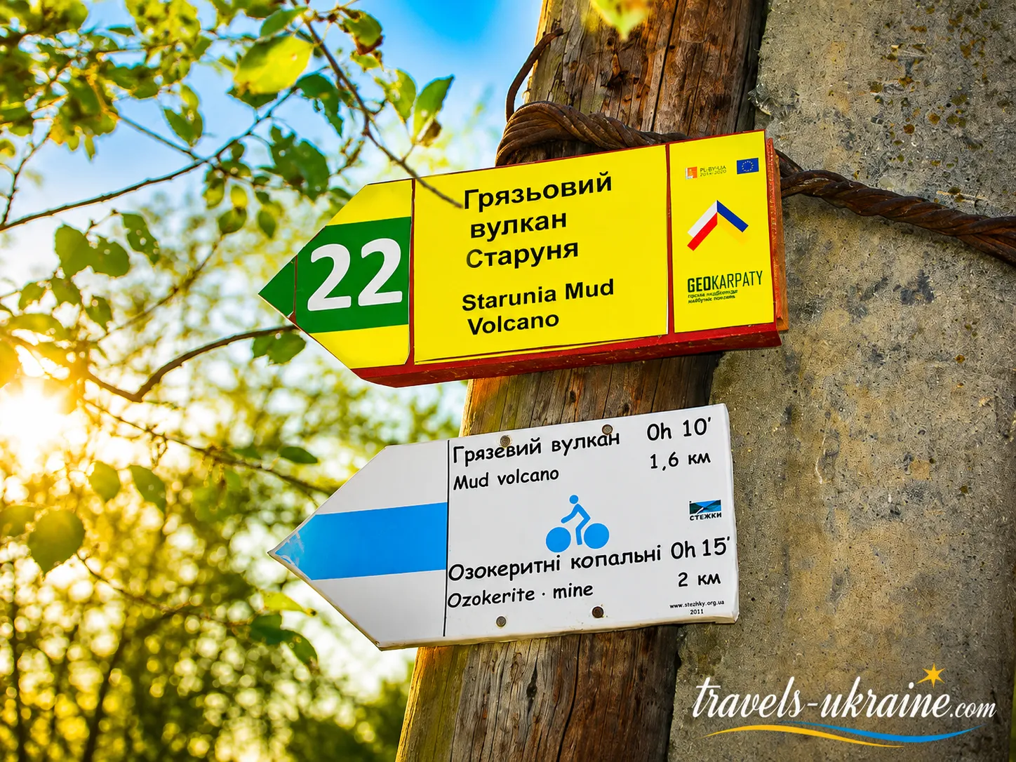
Starunia Mud Volcano is one of those places where the familiar idea of the Carpathians changes literally within a few minutes. There are no snow-covered peaks, glowing lava, or towering volcanic cone here. Instead, the earth quietly bubbles, small craters release gas, water, and clayey material, and traces of oil occasionally appear on the surface. Amid the green Precarpathian region, such a landscape looks so unusual that it is initially hard to believe: all this is happening not somewhere in Iceland or the Caucasus, but in Ivano-Frankivsk Oblast.
The volcano is located near the eponymous village of Starunia and belongs to a distinctive type of geological formation—the mud volcano. Unlike magmatic volcanoes, it is not lava that breaks through to the surface here, but a mixture of gases, mineralized water, clay slurry, and substances associated with the local oil-and-ozokerite deposits. That is why the Starunia mud volcano is better understood not as a miniature copy of a classic volcano, but as a kind of natural «window» into geological processes taking place underground.
What makes Starunia especially valuable is its exceptional character for this region. It is the only known active mud volcano in the Carpathian region, whose activity became noticeable in 1977 after a powerful earthquake in Romania’s Vrancea Mountains. Since then, the surface here has continued to change: some Starunia microcraters become active, others fall silent, while gases, water, and mud emerge through small openings. This variability is precisely what makes the site feel alive—its appearance is not that of a natural exhibit frozen forever in time.
Today, this geological natural monument primarily appeals to travelers seeking a genuine natural anomaly rather than a landscaped tourist attraction. Here, it is worth watching your step, listening to the quiet bubbling of the small craters, noting the color of the soil, and understanding that what lies before you is the visible result of processes usually hidden at considerable depth.
In this journey, we will explore how the mud volcano in Starunia formed, what triggered its activation, which craters can be seen today, where the oil and ozokerite came from, and what mammoths and woolly rhinoceroses have to do with this place. We will also find out where Starunia is located, how to get to the volcano, what to see nearby, and what you need to know before visiting one of the most unusual natural sites in Ivano-Frankivsk Oblast.
Starunia’s History: From Ozokerite Mines to a Mud Volcano
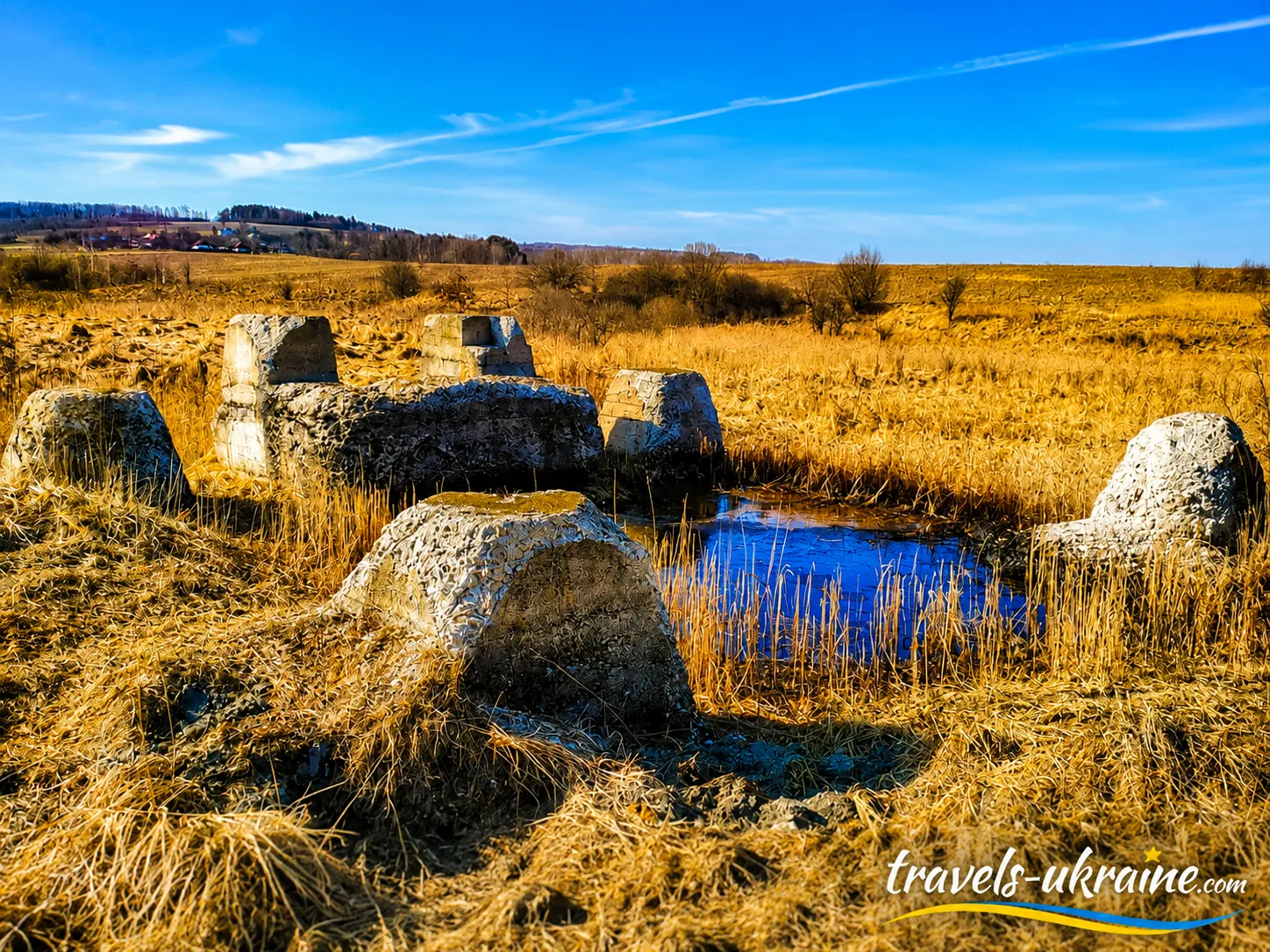
The history that made Starunia famous far beyond Ivano-Frankivsk Oblast began long before the mud volcano itself appeared. At the end of the 19th century, this part of the Precarpathian region attracted attention primarily because of its ozokerite deposits—a natural mineral wax found alongside oil-bearing rocks. Mining began near the village, with shafts being built and workers penetrating layers of rock that had remained hidden from humans for millennia.
It was industrial activity that unexpectedly opened an entirely different chapter in the Carpathians’ past. Underground, workers discovered not only ozokerite but also remarkably well-preserved remains of Ice Age animals. Thanks to rocks rich in salts and bitumens, organic remains could survive here in conditions that significantly slowed their decay. Thus, an ordinary mine turned Starunia into one of Ukraine’s best-known paleontological sites.
Starunia’s Paleontological Discoveries in 1907–1929
On October 5, 1907, during work in an ozokerite mine, workers came across mammoth remains in Starunia at a depth of approximately 12.5 meters. A woolly rhinoceros was soon discovered at a greater depth. The finds were so well preserved that they attracted the attention of scientists and made the small Precarpathian village known in European scholarly circles.
The value of these discoveries lay not only in the bones themselves. Soft tissues, skin, and other parts of the animals’ bodies were preserved in Starunia’s deposits—materials that under normal conditions almost never survive for tens of thousands of years. The natural mixture of salts, petroleum products, and ozokerite effectively acted as a preservative. That is why the search query «where was a mammoth found in Ukraine» is directly associated with Starunia, one of the country’s most important sites for such discoveries.
Scientific interest in the area did not disappear after the 1907 discovery. In 1929, during specially organized research, three more woolly rhinoceroses were found here. Thus, Starunia is associated with the discovery of a mammoth and a total of four woolly rhinoceroses. Some of these unique remains are now held in museum collections in Lviv and Kraków.
For today’s traveler, this history is important because it also explains the unusual nature of the local geology. Starunia’s paleontological discoveries, ozokerite deposits, oil, saline underground waters, and the later emergence of the mud volcano are not a random collection of separate phenomena, but different aspects of the area’s complex geological structure.
Oil, Wells, and Changes in Starunia’s Underground Environment
Interest in the subsurface did not end after the decline of the ozokerite mines. During the first half of the 20th century, oil exploration was carried out in and around the village, and wells were drilled. Traces of this industrial history can still be seen today: old shafts, remnants of technical structures, and wells have become part of Starunia’s modern landscape.
Human economic activity may have affected the circulation of underground water and gases, but the volcano should not be explained solely by old mines or drilling. The emergence of such a phenomenon requires a combination of natural geological conditions: oil- and gas-bearing rocks, mineralized waters, plastic clays, fractures, and pressure in the subsurface. Therefore, explanations for the formation of the Starunia mud volcano consider both natural geological factors and the possible influence of decades of human activity.
The 1977 Earthquake and the Emergence of an Active Mud Volcano in Starunia
A new stage in the area’s history began in 1977. Following a powerful earthquake in Romania’s seismically active Vrancea zone, mud-volcanic activity suddenly intensified in Starunia. Craters formed on the surface, releasing gases, mineralized water, and clayey material. This is the point from which the modern history of the active mud volcano in the Carpathians is generally dated. Interestingly, no enormous volcanic cone formed here, as the word «volcano» might suggest. Activity became distributed among small openings and microcraters. Their intensity can vary: some remain active, others temporarily fall silent, while water, gas, clay slurry, and oil components continue to appear at the surface.
Starunia Geological Natural Monument Since 1984
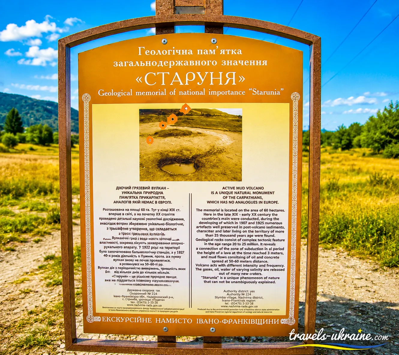
The area’s uniqueness received official recognition in 1984, when Starunia was granted the status of a geological natural monument of national importance. The protected area covers approximately 60 hectares and combines several important elements of natural and scientific heritage: mud-volcanic manifestations, oil-and-ozokerite deposits, paleontological discoveries, and traces of ancient human activity.
It is this layered history that makes the mud volcano in the Precarpathian region far more fascinating than it may initially seem. Its history did not begin in 1977, or even with the first 19th-century mines. Beneath your feet lies a chronicle spanning tens of thousands of years—from mammoths and woolly rhinoceroses to ozokerite mines, oil wells, and geological processes that continue to this day.
Natural Features of the Starunia Mud Volcano
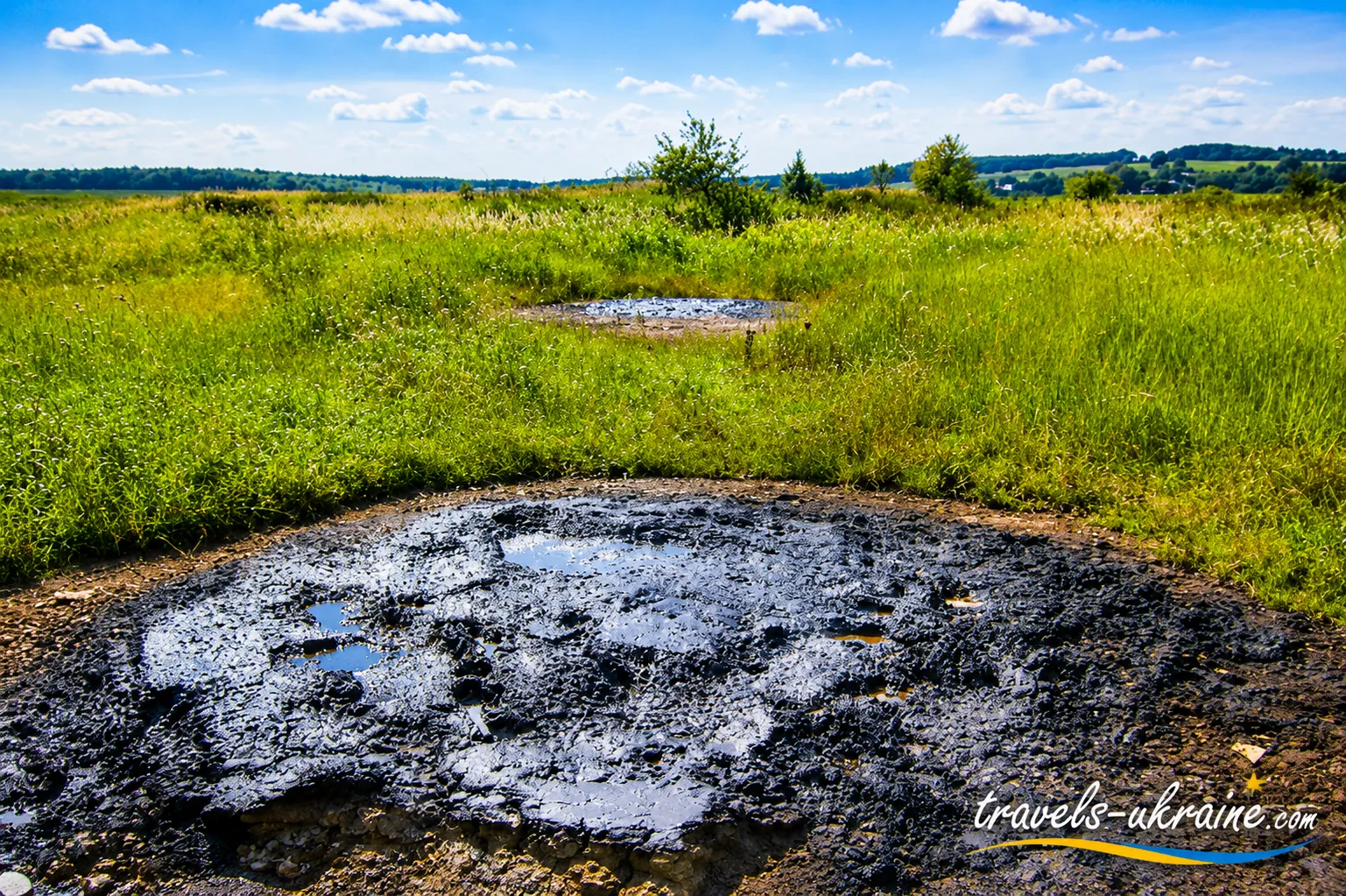
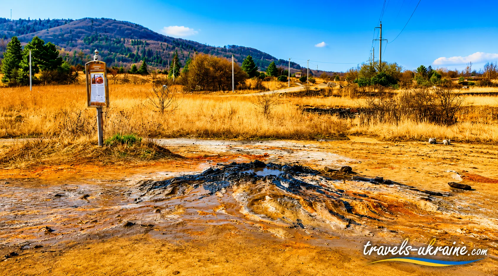
The mud volcano in Starunia bears little resemblance to a classic volcano with lava flows. Its main feature is a collection of small mud craters and openings in the ground through which gases, mineralized water, clay slurry, brine, and sometimes oil components slowly reach the surface. This is why the natural site impresses not through its scale, but through the unusual behavior of the earth itself.
From a distance, the area may look like an ordinary marshland. But come closer and you will notice small depressions, patches of exposed soil, salt deposits, and places where the surface occasionally bubbles. Through these manifestations, the active mud volcano in the Carpathians seems to «breathe,» releasing substances that rise from deeper geological layers.
Unlike magmatic volcanoes, Starunia has no single enormous vent. Volcanic activity is distributed among several small centers. According to current observations, the site has approximately a dozen active microcraters and about twelve more that are inactive. Their condition is not constant: some openings may become more active, while others may almost completely fall silent.
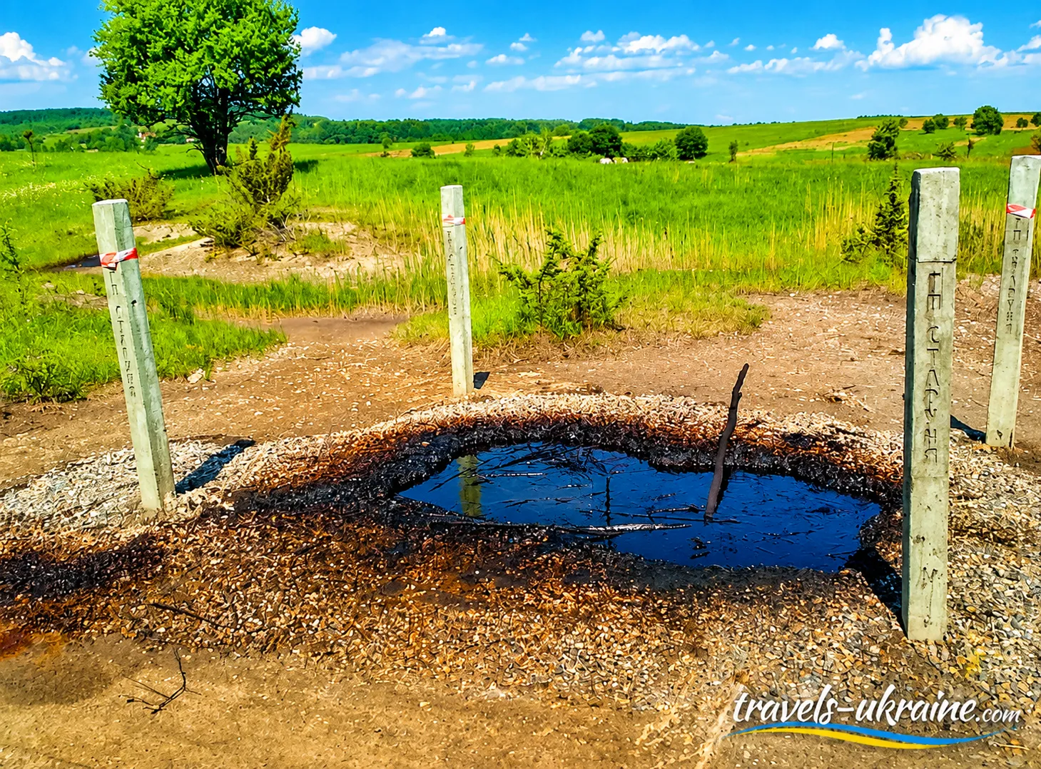
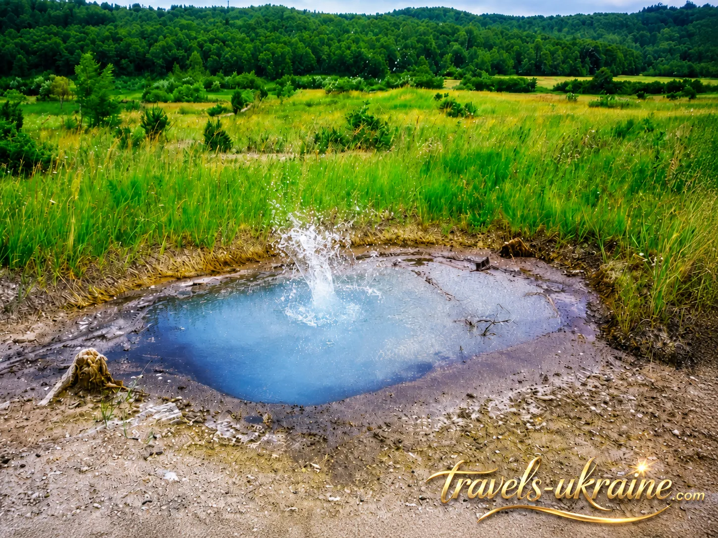
The most active points resemble small mud bowls or depressions in the ground. Inside, you may see water and clayey material, with gas bubbles appearing on the surface. Sometimes they emerge only rarely; at other times, the surface moves almost continuously. This unpredictability makes the Starunia volcano especially interesting to observe: there is no exhibition mechanism that starts on schedule—everything depends on natural processes underground.
The main mud manifestation should not be imagined as a large crater that you have to climb up a slope to reach. It is a relatively low formation, and the active areas themselves are quite compact. That is why tourists sometimes walk past without immediately realizing that they are looking at a genuine active mud volcano.
Brine and Mineralized Waters of Starunia
One of the area’s characteristic features is Starunia brine—natural water with a very high concentration of dissolved mineral salts. It reaches the surface together with other underground fluids and may leave pale salt crusts behind after evaporation.
The high level of mineralization is clearly visible even without special equipment. Vegetation is much sparser near some active craters than in the surrounding area, and certain patches of soil appear almost lifeless. The reason is simple: excess salts create unfavorable conditions for most familiar plants. As a result, small patches of a distinctive «lunar» landscape form around the active outlets, sharply contrasting with the green hills of the Precarpathian region.
Gases, Oil, and Ozokerite in Starunia’s Mud Eruptions
Gases from the Starunia volcano rise to the surface through cracks and channels in the rocks. As they pass through water and clayey material, they form characteristic bubbles that make the craters seem alive. This quiet bubbling is often the first sign for a tourist that what lies ahead is not an ordinary puddle, but an active geological manifestation.
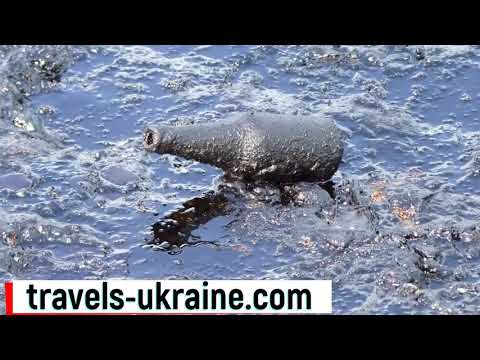
Another feature that distinguishes the mud volcano in the Carpathians from many other natural sites is its direct connection with oil-bearing and ozokerite-bearing rocks. Along with water, gas, and clay, oil and ozokerite from the Starunia volcano, or their components, may reach the surface.
That is why the color of the liquid and mud is not always the same. Yellowish, gray, brown, and dark shades, an oily film, and unusual surface deposits can all be seen here. To a geologist, these are clues about the composition of the subsurface; to a tourist, they offer the chance to see, quite literally, substances usually hidden beneath hundreds of meters of rock.
The Clay-Bitumen Volcano and Minerals Hidden in the Mud
Because of the nature of its emissions, Starunia is sometimes described as a clay-bitumen volcano. This accurately reflects its outward features: plastic clay, mineralized water, and petroleum-derived substances occur here together. However, the primary scientific name of the site remains mud volcano.
The composition of its emissions is far more interesting than it may seem at first glance. Researchers have found various minerals in the clay mass, including pyrite, barite, gypsum, calcite, fluorite, and sulfur compounds, while the salt crusts contain minerals associated with high salt concentrations. In this way, the small craters bring a distinctive mineral «cross-section» of the local subsurface to the surface.
Why the mud volcano in the Carpathians is constantly changing
Starunia’s most fascinating natural feature is its variability. Mud volcanoes are dynamic geological systems: underground pressure, the movement of water and gases, the condition of fractures in the rocks, and seismic vibrations can all affect the intensity of the outlets. As a result, the same area may look different after some time.
New cracks may appear at the surface, the amount of water in the small craters may change, or gas emissions may intensify. That is why the Starunia geological natural monument is interesting not only as a tourist destination, but also as a natural laboratory where visitors can observe processes that usually take place far from human eyes.
And this is where Starunia’s main appeal lies. There is no enormous mountain or grand canyon before the traveler—instead, there is a small patch of land that constantly reminds us that the Carpathians live not only on the surface. Beneath the green hills, water and gases move, minerals, oil, and salts interact, and some of this hidden world emerges through tiny craters.
Volcanoes of Ukraine: when our land truly breathed fire
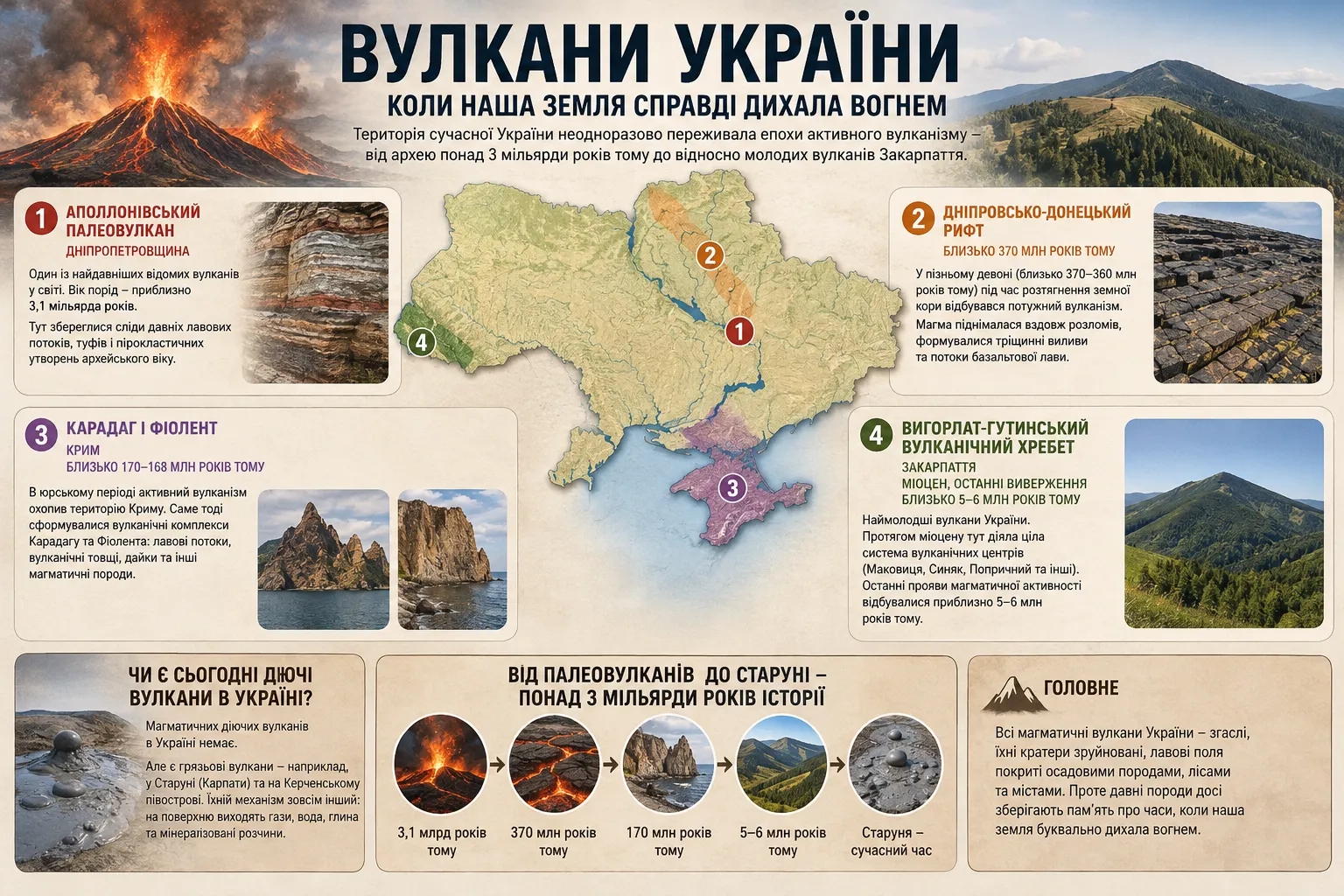
When the Starunia mud volcano is called a volcano, it is easy to assume that it is almost Ukraine’s only connection with volcanic phenomena. In reality, the geological history of our territory is far more dramatic. In different eras, genuine magmatic volcanoes were active here, basaltic lava flowed, volcanic ash and tuffs accumulated, and magma broke through to the surface along deep fractures in the Earth’s crust.
This is not a matter of thousands or even millions of years of human history. The oldest traces of volcanism in present-day Ukraine are more than three billion years old. Over this incredibly long period, continents and oceans changed, mountain systems formed and disappeared, and the territory where Ukrainian cities, fields, and forests lie today repeatedly found itself in areas of active magmatic processes.
Therefore, the question «Did Ukraine have true volcanoes?» has a clear answer: yes. The volcanic history of present-day Ukraine spans nearly the entire geological timescale—from the Archean to the relatively young Neogene volcanism of Transcarpathia.
The Apollonian paleovolcano—one of Ukraine’s oldest volcanic complexes
One of the most striking testimonies to ancient volcanism is the Apollonian paleovolcano in Dnipropetrovsk Oblast. Today, there is no volcanic cone, crater, or lava lake here—billions of years of erosion and geological transformation have virtually erased the original relief. However, traces of volcanic activity have survived in the ancient rocks: altered lava sequences, tuffs, pyroclastic material, and other volcanogenic formations.
Some of these rocks are approximately 3.1 billion years old. For comparison, dinosaurs appeared only about 230 million years ago. This means that almost three billion years of geological history lie between the activity of the Apollonian paleovolcano and the first dinosaurs.
In those distant times, Earth looked completely different. Modern continents, the Carpathians, the Black Sea, and the ecosystems familiar to us did not exist. Some Archean volcanism occurred underwater, as evidenced by the characteristic structures of ancient lavas. It is therefore more accurate to imagine not a huge cone rising above present-day Dnipropetrovsk Oblast, but a complex system of ancient volcanic centers, lava flows, and submarine eruptions.
The Ukrainian Shield preserves traces of volcanoes more than three billion years old
The Apollonian paleovolcano is associated with a much larger geological structure—the Ukrainian Shield. It is one of the oldest parts of the crust of Eastern Europe, where Archean and Proterozoic rocks reach the surface. The Ukrainian Shield itself cannot be called the remnant of one enormous volcano. It formed through many complex geological processes. However, ancient volcanogenic complexes have survived within it, showing that more than three billion years ago, individual areas of present-day Ukraine experienced intense magmatism.
It is in these rocks that geologists today literally read the oldest pages of the history of our part of the planet. Ancient lavas have long since transformed into metamorphic rocks, and volcanic mountains were destroyed by erosion, but their geochemical and structural «imprint» remains.
The Dnipro-Donets Rift: volcanism about 370 million years ago
The next major stage of volcanism in Ukraine was associated with the formation of the Dnipro-Donets Depression. Approximately 370–360 million years ago, during the Late Devonian, the Earth’s crust in this area began to stretch and fracture. This created a large rift—a zone of deep faults through which magma could rise from the interior. Volcanic activity here often did not resemble the modern high cones we typically imagine. Fissure eruptions played a major role: magma emerged along extensive faults and spread in flows of basaltic lava.
Individual volcanic structures also formed in some places, but the main feature was large-scale magmatism associated with the stretching of the Earth’s crust. Later, the rift filled with an enormous thickness of sedimentary rocks, and most of the volcanic structures ended up deep underground.
Karadag and Fiolent—the traces of Ukraine’s Jurassic volcanoes
Another notable stage occurred approximately 170 million years ago, during the Jurassic Period. Active magmatism affected part of the territory of present-day Crimea. The famous volcanic complexes of Karadag and the Fiolent area are associated with this activity.
Today, Karadag is one of the most vivid examples of ancient volcanism. Its complex relief, rocky outcrops, volcanic rocks, lava formations, and ancient magmatic structures are remnants of processes that took place here during the Middle Jurassic. Lava sequences, dikes, and other rocks associated with Jurassic magmatism have also survived in the Fiolent area.
What looks today like picturesque cliffs above the sea was once part of an active geological environment. Millions of years of erosion destroyed the original volcanic structures but exposed their internal architecture—a kind of natural cross-section of an ancient volcano.
The Vihorlat-Hutin Range—the youngest extinct volcanoes in Ukraine
The youngest major chapter of magmatic volcanism in present-day Ukraine is associated with Transcarpathia. The Vihorlat-Hutin volcanic range stretches across this area as part of the great volcanic arc of the Carpathian region. Throughout the Miocene, an entire system of volcanic centers was active here. These included the areas of the modern Makovitsa, Syniak, Antalivska Polyana, Poprichnyi massifs and other volcanic structures of Transcarpathia. Eruptions formed lava flows, tuffs, volcanic domes, and substantial layers of volcanogenic rocks.
This volcanism is far younger than the Apollonian paleovolcano or the Jurassic volcanoes of Crimea. The final manifestations of magmatic activity in this part of the Carpathians occurred approximately 5–6 million years ago. By geological standards, this is relatively recent. Today, these extinct volcanoes of Transcarpathia are covered by forests, villages, vineyards, and tourist trails. People may not even realize that the foundations of former volcanic structures lie hidden beneath the picturesque green slopes.
Are there active magmatic volcanoes in Ukraine today?
Today, there are no known active magmatic volcanoes in Ukraine. Karadag, the ancient volcanic complexes of the Ukrainian Shield, and the volcanoes of Transcarpathia went extinct long ago, while erosion over millions and billions of years has significantly altered their original appearance. However, this does not mean that all volcanic phenomena belong only to the distant past. Ukraine has mud volcanoes, particularly on the Kerch Peninsula, and the Starunia mud volcano remains an active geological site in the Carpathian region.
It is important not to confuse these two phenomena. A magmatic volcano receives material from deep magmatic systems and may erupt lava, ash, and pyroclastic rocks. A mud volcano works differently: gases, water, clay, and other underground fluids rise to the surface under pressure. Therefore, Starunia is not a young continuation of the ancient volcanoes of Transcarpathia—it is a separate geological system with a different formation mechanism.
From paleovolcanoes to Starunia—more than three billion years of geological history
When the entire picture is viewed together, it becomes clear how diverse the geological history of present-day Ukraine has been. Approximately 3.1 billion years ago, volcanic centers were active in the Middle Dnipro region. Around 370 million years ago, powerful magmatism accompanied the formation of the Dnipro-Donets Rift. Approximately 170 million years ago, volcanic activity formed the complexes of Karadag and other areas of Crimea, while the volcanoes of Transcarpathia were still active several million years ago.
Today, all these magmatic systems are extinct. Their craters have been destroyed, lava fields transformed by geological processes, and forests grow and settlements stand where volcanoes once existed. Yet the ancient rocks still preserve the memory of times when parts of our land were literally shaped by fire.
Against this backdrop, the Starunia volcano becomes even more interesting. It does not erupt magma and does not belong to that ancient volcanic history, but it allows us to see another expression of activity in Earth’s interior today. A tiny bubble of gas in a mud crater may seem modest beside imagined flows of ancient lava, but it reminds us of the same thing: the planet beneath our feet has never been completely still.
Starunia Mud Volcano: a quick guide for tourists
A trip to the Starunia mud volcano does not require a full day or extensive tourist preparation. This is a compact natural attraction that can easily be included in a tourist route through the Precarpathian region, together with other interesting places in Ivano-Frankivsk Oblast or Ukraine. At the same time, do not expect a developed tourist complex with ticket offices, paved paths, and extensive service infrastructure—the main value of Starunia lies precisely in its natural character.
- Type of site: a geological natural monument of national significance and an active mud volcano.
- Location: the village of Starunia, Bohorodchany Hromada, Ivano-Frankivsk Raion, Ivano-Frankivsk Oblast.
- Physical difficulty: easy in dry weather; after rain, moving across unpaved areas may be considerably less comfortable.
- Budget: low—the main expenses are related to travel, fuel, or public transportation.
- Best way to visit: a road trip or part of a one-day route through the interesting places of the Precarpathian region.
How much time is needed to visit the Starunia volcano?
The Starunia volcano itself does not cover a large area, so about half an hour may be enough for a quick introduction to the site. However, there is no need to rush here. If you take a close look at the active microcraters, search for salt deposits, examine the brine and oil seepages, take photographs, and walk around the surrounding area, it is better to allow a little more time.
If you add the flaming well, sites connected with the history of ozokerite extraction, or other tourist attractions near Starunia to your itinerary, the trip can easily become a full part of a day-long journey through the Ivano-Frankivsk region.
What to See in Starunia and What to Do Near the Mud Volcano
The volcano in Starunia is not the kind of tourist attraction where you need to hurry past a dozen sites and tick each one off a list. The most interesting things begin when travelers slow down and look carefully at the ground. Small craters, gas bubbles, salt deposits, dark oil traces, and almost vegetation-free areas create a landscape that differs sharply from the green Carpathians.
That is why the answer to the question of what to see in Starunia is not limited to a single central crater. Within a relatively compact area, you can see several different manifestations of geological activity, an old oil well, traces of the industrial past, and a site of considerable paleontological and archaeological importance.
The main reason to travel to Starunia is, of course, the mud volcano. Do not expect a huge crater or a tall volcanic mountain: the activity here is spread among small microcraters and mud seepages. Some of them may look like small depressions in the ground filled with grayish or brown liquid, with bubbles appearing on the surface from time to time.
Stop beside an active area for a few minutes. If you simply walk past quickly, you may not notice any movement at all. Gas emerges unevenly: one bubble bursts almost silently, then the surface settles for a while before beginning to move somewhere else. It is in these small details that the character of the active volcano in the Ivano-Frankivsk region reveals itself.
See the «Nadiya» Flaming Well in Starunia
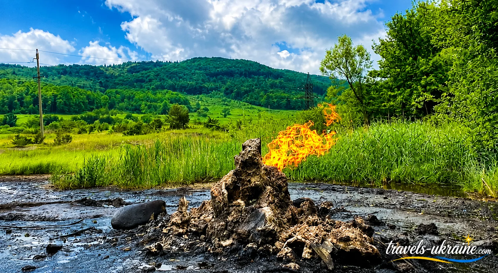
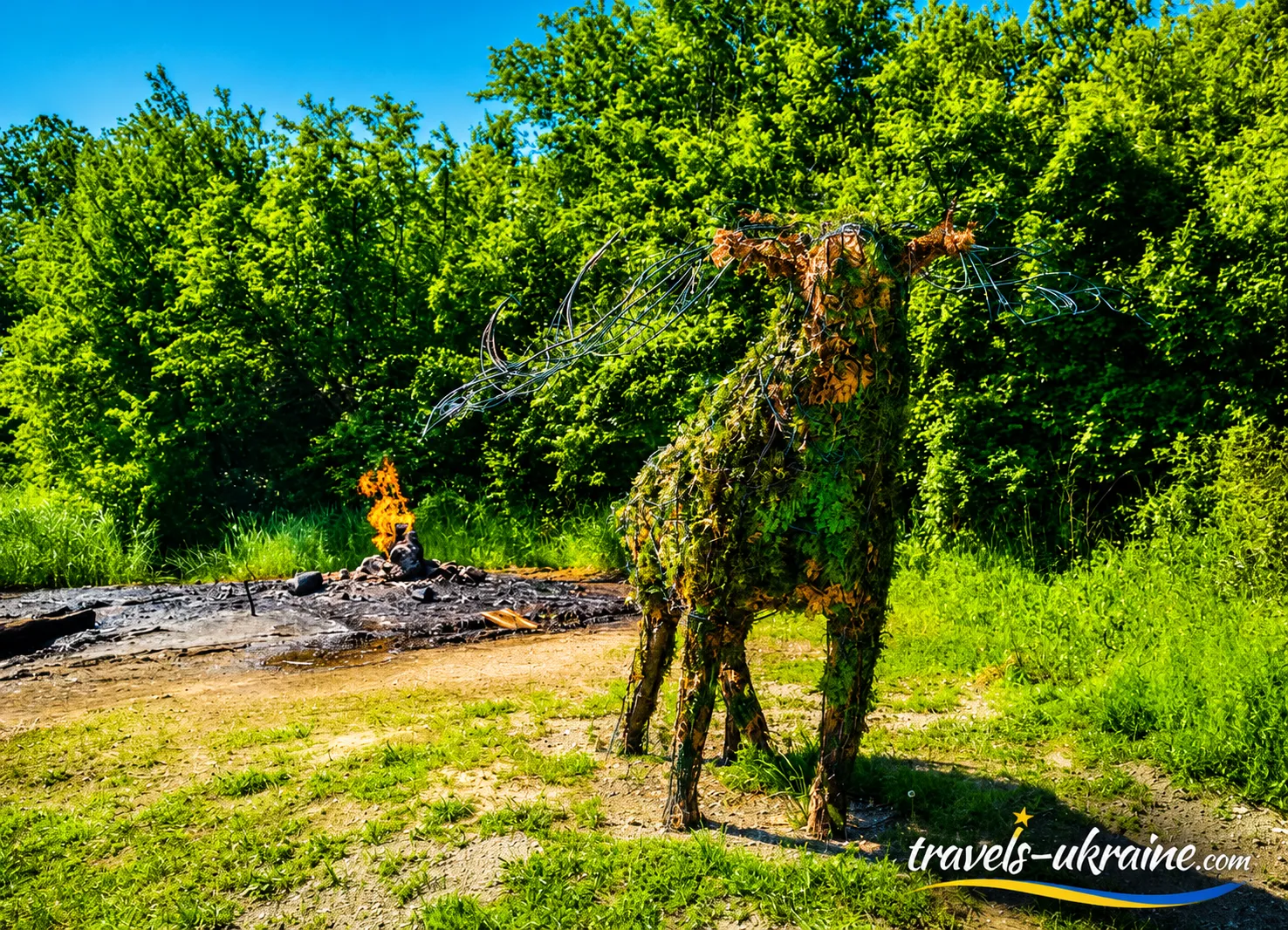
One of the most striking sites near the volcano is the old oil and gas well «Nadiya». Its history is connected with the industrial development of the oil fields of the Carpathian foothills. When operations ended, the well was not properly sealed, so natural gas and a small amount of oil still reach the surface through it. To prevent the gas from accumulating, local residents periodically set it alight, creating a distinctive flame above the well.
Starunia’s flaming well often makes an even stronger first impression on travelers than the small mud craters. The flame burning in the middle of the open foothill landscape looks unusual, but it is important to understand its origin correctly: this is not fire from a volcano’s vent or a «burning crater,» but natural gas emerging from an old drilling well.
For photographs, Starunia’s burning well is one of the most expressive sights on the route: a living flame against a backdrop of hills and open sky creates an image unlike the familiar landscapes of the Carpathians. At the same time, this is an active natural-gas seepage, not a tourist installation. Do not approach the flame too closely, touch the equipment, ignite the gas yourself, or attempt to interfere with the well in any way.
It is precisely the combination of mud craters and the «Nadiya» flaming well that makes Starunia such an unusual tourist attraction. Within a small area, you can immediately see several different manifestations of what lies beneath the Carpathian foothills: gas breaks through the surface and burns, oil appears above ground, and mud microcraters quietly bubble nearby. This is a case where geology can be not only read about in a textbook but literally seen in front of you.
Walk Around the Starunia Geological Landmark
Starunia is of interest not only to paleontologists. The area contains the multilayered archaeological site «Starunia I», where research has uncovered numerous stone artifacts and traces of ancient human habitation. This is another layer of the site’s history that is easy to miss if you view Starunia solely as a «place with a volcano.» So do not limit your visit to taking a photograph beside one active crater. The protected area of the Starunia geological landmark is much larger than the volcano itself, and a leisurely walk offers a better understanding of the character of this landscape.
Pay attention to changes in soil color, marshy areas, old industrial traces, and vegetation-free patches. Some features that initially look like nothing more than an uneven wasteland are directly connected with the geological structure of the area and former ozokerite and oil industries. This format is particularly suitable for those interested in geology, natural sciences, or unusual places in Ukraine. Here, curiosity arises not from the scale of the site but from realizing how many different processes are concealed beneath a small patch of land.
Visit the Ice Age Park in Starunia
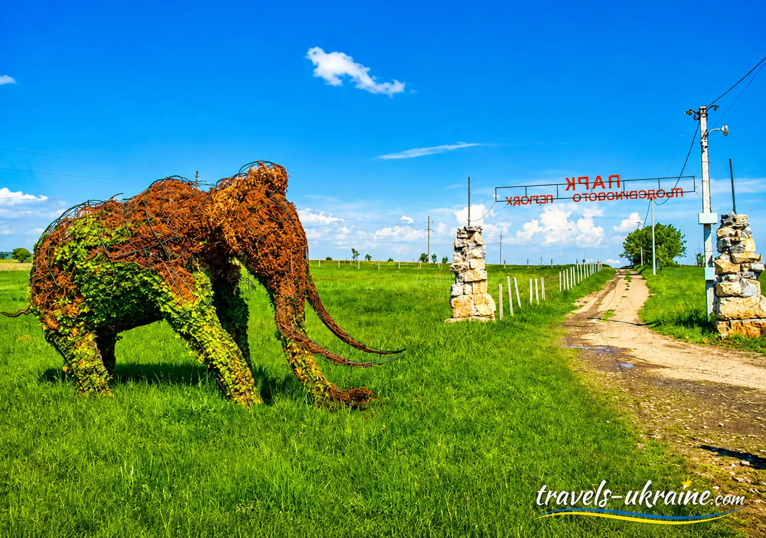
In 2019, practical work began in Starunia on the concept of an Ice Age Park, and themed figures of a mammoth, a woolly rhinoceros, and other representatives of ancient fauna were installed. At the same time, the large-scale scientific and tourist complex envisioned in the original concept has still not been fully implemented.
The creation of such a park here is by no means accidental. Exceptionally well-preserved remains of mammoths and woolly rhinoceroses were discovered in Starunia. The prehistoric animal figures therefore have a real historical basis and recall the time when large representatives of the Ice Age fauna roamed the territory of today’s Carpathian foothills. For tourists, the Ice Age Park can be a good addition to a walk near the mud volcano. It is especially appealing to families with children: the large prehistoric animal figures help visitors visualize the inhabitants of the Carpathian region tens of thousands of years ago, while the story of their discovery transforms an ordinary photo zone into a small open-air lesson in natural history.
In fact, several different historical eras are represented within a relatively small area. The mammoth figures recall the Ice Age, the old mines the period of intensive ozokerite extraction, the oil wells the industrial development of the Carpathian foothills, and the active microcraters demonstrate geological processes that continue today. That is why the idea of creating a scientific and recreational complex around Starunia has been discussed for many years. With further development of routes, information boards, viewing areas, and tourist infrastructure, this area has the potential to become one of the most interesting centers of geological, paleontological, and educational tourism in the Ivano-Frankivsk region.
What to See Near Starunia: Interesting Tourist Attractions in the Carpathians
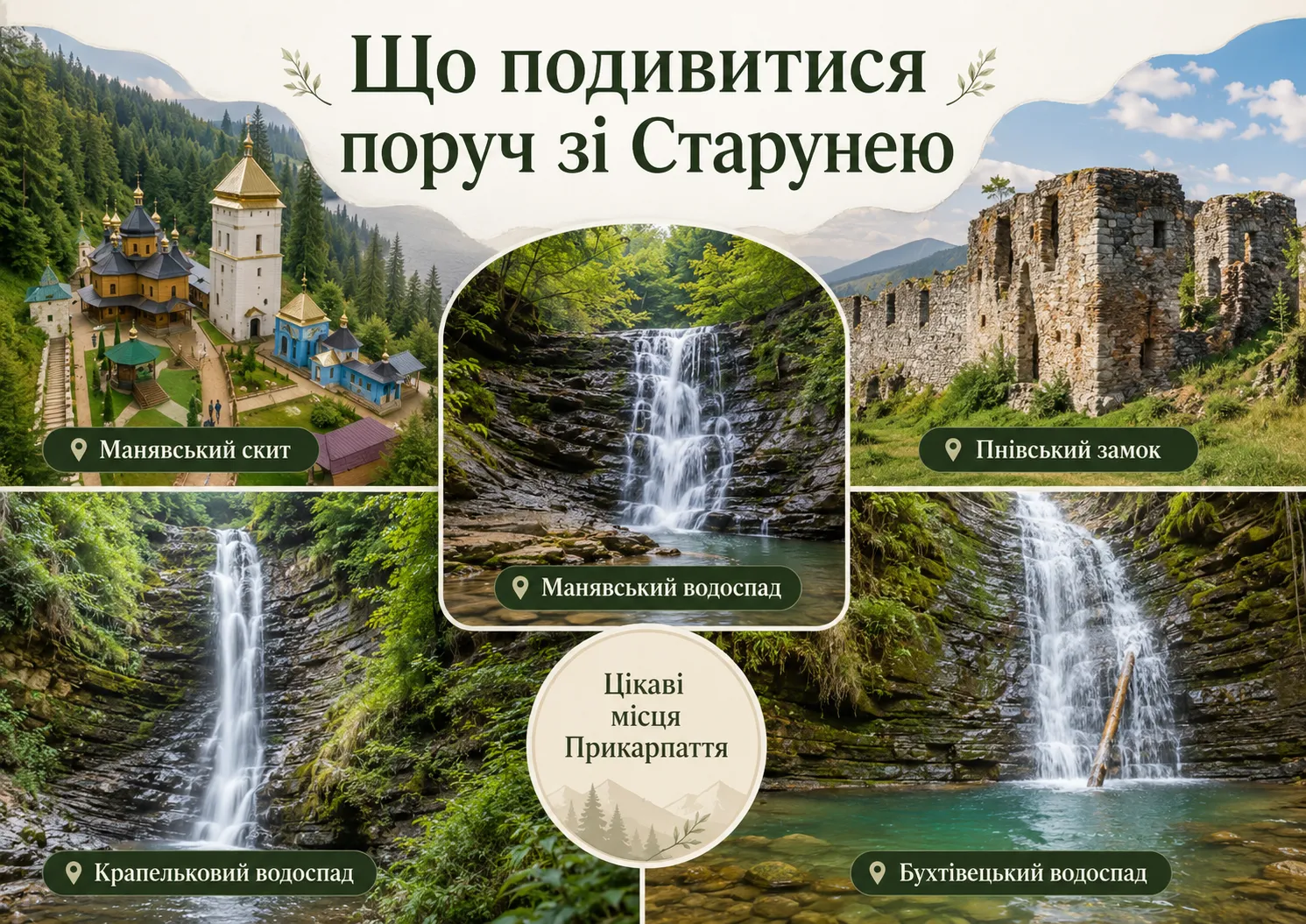
A trip to the volcano in Starunia does not have to end after visiting the craters and flaming well. This part of the Ivano-Frankivsk region is convenient because one driving route can combine places with entirely different character: a geological landmark, an ancient monastery, mountain waterfalls, and the ruins of a medieval fortress. So if you are planning a day-long journey through the Carpathian foothills, it is better not to try to see everything at once. After Starunia, choose one direction: head to Manyava for nature and history, or continue toward Nadvirna and the Carpathian waterfalls. This way, the trip will remain full but will not turn into a nonstop race between points on the map.
Manyava Skete — an Ancient Monastery Near Starunia
One of the best-known places in this part of the Carpathian foothills is Manyava Skete, whose history dates back to the beginning of the 17th century. The monastery complex is located among Carpathian forests and surrounded by stone walls with defensive towers, so from the outside it partly resembles a mountain fortress.
At one time, the skete was an important spiritual and cultural center of Galicia. It had a library, crafts and icon painting flourished there, and the monastery is linked to the history of the famous Bohorodchany iconostasis, created by masters under the direction of Yov Kondzelevych. Even for travelers not planning a pilgrimage, Manyava Skete is interesting for its architecture, mountain setting, and completely different atmosphere after Starunia’s geological landscape. In a single day, you can see how diverse this region can be: from bubbling ground and oil seepages to a quiet monastery courtyard in the forest.
Manyava Waterfall — a Natural Continuation of the Starunia Route
If, after visiting the volcano in Starunia, you want more Carpathian nature, Manyava Waterfall is one of the best ways to continue the journey. It is located in the upper reaches of the Manyavka River, among fir and beech forests and a rocky canyon. The water drops from a height of approximately 18 meters, forming a small natural pool at the foot. The waterfall is particularly powerful in spring and after prolonged rain. During drier periods, the flow is calmer, but it is easier to walk along the trails and examine the canyon’s layered rocks. The journey to the waterfall is already an experience in itself: many travelers cover the final stretch on foot along a forest road.
Manyava Skete and the waterfall combine well. If you have enough time, it is best to treat them as a single destination: first explore the monastery, then move from the historical part of the route into nature.
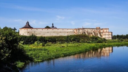
Pniv Castle — the Ruins of an Old Fortress Near Nadvirna
History enthusiasts should continue the route to Pniv Castle near Nadvirna. It was once one of the region’s most powerful defensive structures. The fortress had an irregular pentagonal shape, massive walls, and defensive towers, and it was entered via a bridge over a moat. The castle has not survived intact, but the remnants of its walls and towers still convey the scale of the old fortification. There are no restored palace halls or museum displays behind every door here—the main impression comes from the ruins themselves, the stone, and the mountain scenery around them.
This contrast works particularly well on a route combined with Starunia. In the morning, you can explore a natural geological landmark of the Ivano-Frankivsk region, and a few hours later walk among the remains of defensive architecture from past centuries.
Krapelkovyi and Bukhtivetskyi Waterfalls — Another Route into the Carpathians
If nature is the main purpose of your trip, you can continue to the Bukhtivets River valley. Two waterfalls are located close to each other here—Krapelkovyi Waterfall and Bukhtivetskyi Waterfall.
Krapelkovyi is about 10 meters high and takes its name from the distinctive character of its flow: the water does not always fall as a continuous wall but breaks into countless thin streams and droplets. The waterfall is hidden among flysch rocks, moss, and dense greenery, creating an intimate atmosphere that is much calmer than that of larger tourist waterfalls.
Approximately 50 meters away is the Bukhtivetskyi Waterfall, about 8 meters high. Its character is completely different: a more powerful stream falls between steep layers of Carpathian flysch, then continues through a narrow canyon-like valley. The proximity of the two waterfalls makes this destination especially convenient. During one walk, you can see two different types of Carpathian waterfall and, if time allows, continue exploring the valley, where several smaller waterfalls can also be found.
Which Route Near the Starunia Mud Volcano Should You Choose?
The best route depends on what interests you most. For a first trip, it is not worth trying to combine all the locations in one day. Distances in the Carpathians are often deceptive: a few dozen kilometers on mountain and local roads can take considerably longer than it seems when planning.
- History and a relaxed walk: Starunia → Manyava Skete.
- Nature: Starunia → Manyava Skete → Manyava Waterfall.
- Geology and fortifications: Starunia → Pniv Castle → Nadvirna.
- Maximum number of natural attractions: Starunia → Bukhtivets Waterfall → Krapelkovyi Waterfall.
The ability to combine such diverse places is precisely what makes Starunia in Ivano-Frankivsk Oblast a good starting point for discovering the less obvious Precarpathian region. Here, a tourist trip does not end at the crater: simply continue along the road, and around the next bend you may find monastery walls, an old fortress, a mountain canyon, or the roar of a waterfall in the forest.
Rules for Visiting the Starunia Mud Volcano and Tourist Etiquette
The mud volcano in Ivano-Frankivsk Oblast may look like an ordinary field with small pools and mud craters, but it is part of a protected natural area. Its value lies precisely in preserving natural geological processes, so when visiting, it is important to behave in a way that leaves the site in the same condition after your walk.
There is no need to follow complicated tourist formalities here. The main rule is simple: observe, take photographs, and do not interfere with natural processes. Do not test the crater’s depth with a stick or dig at its edges to intensify the bubbling; do not touch oil, brine, or mud with your bare hands; do not leave children unsupervised near the craters and the borehole; and do not interfere with Starunia’s processes—the activity beneath your feet is fascinating precisely because it occurs without human involvement.
Do Not Enter Starunia’s Mud Craters
Even if an individual crater of the Starunia mud volcano looks like a shallow puddle, you should not step into it. Beneath the thin liquid surface there may be soft, unstable ground, and the actual depth and density of the mud cannot be reliably determined visually. Personal safety is important here, but so is preserving the geological formation itself. Footprints, widening the crater’s edges, or stirring the mud alter the natural appearance of this active area. For a photograph, it is enough to keep a safe distance and choose a different angle.
Do Not Collect Mud, Brine, Oil, or Ozokerite as Souvenirs
The desire to take home some unusual mud or a piece of rock is understandable, but the Starunia natural monument is not a place for collecting natural «souvenirs.» Removing material from active areas can damage the surface and gradually alter the site’s condition. You should also avoid using local mud, brine, or oil seepages for homemade cosmetic or therapeutic treatments. A substance’s natural origin does not in itself mean that it is safe for the skin or has proven medicinal properties.
Do Not Damage Information Boards or Tourist Signs
Information boards, route markers, and signs have been installed throughout Starunia to help visitors find the mud volcano, ozokerite mines, and other attractions. Do not leave inscriptions, stickers, or personal markings on them. For a little-known tourist site, such navigation aids are especially important: the next traveler may be relying precisely on the sign that someone decided to use as a place for an autograph.
The best tourist etiquette near an active mud volcano can be summed up in one sentence: after your visit, there should be no sign that you were here. Do not leave litter, destroy craters, take natural materials, or create new roads by car. Starunia is interesting precisely because of its authenticity. Here, the earth bubbles without pumps, gas emerges without stage effects, and natural processes shape the landscape. The less people interfere with this system, the more likely it is that future generations of travelers will see it in the same condition.
Frequently Asked Questions About the Starunia Mud Volcano
What is the Starunia mud volcano?
The Starunia mud volcano is an active geological formation in the Precarpathian region, where gases, mineralized water, clay slurry, brine, and petroleum components reach the surface through small craters and fissures. It is not a magmatic volcano: there is no lava or large volcanic vent here. Starunia is a geological natural monument of national importance and a unique example of modern mud-volcanic activity in the Carpathians.
Is the Starunia volcano active?
Yes. The Starunia mud volcano remains active: its area contains microcraters through which gas, water, and mud emerge. The intensity of individual manifestations may vary, so different craters may not bubble with equal intensity on the day of your visit. This variability is one of the defining features of this natural geological system.
Where is the Starunia mud volcano located?
The volcano in Starunia is located near the village of Starunia in the Bohorodchany hromada of Ivano-Frankivsk Raion, Ivano-Frankivsk Oblast. The approximate coordinates of the tourist site are: 48.688524, 24.487669. The village can be reached by car, but the condition of the final local and unpaved sections of the route should be assessed in light of the weather.
When did the mud volcano in Starunia appear?
Modern activity of the mud volcano in Starunia became evident in 1977 after a powerful earthquake in Romania’s Vrancea seismically active zone. Following the event, active mud craters appeared on the surface, releasing liquid, gas, and clayey material. At the same time, the geological conditions for this phenomenon had existed much earlier and were connected with oil-and-ozokerite deposits, groundwater, gases, and the complex structure of the local rocks.
What can you see near the Starunia volcano?
Visitors can see Starunia’s active microcraters, gas bubbles in the mud, brine, salt deposits, oil seepages, and areas of unusually colored soil. Another point of interest is the old «Nadiia» borehole, from which oil and natural gas continue to emerge and above which a gas flame can be seen. Starunia’s Ice Age fauna is also commemorated by the themed Ice Age Park.
Did they really find a mammoth and woolly rhinoceroses in Starunia?
Yes. In 1907, well-preserved remains of a mammoth and a woolly rhinoceros were discovered during the development of an ozokerite mine in Starunia. In 1929, further research uncovered the remains of three more woolly rhinoceroses. In total, Starunia is associated with one mammoth and four woolly rhinoceroses. Special conditions in deposits rich in salts, bitumen, and ozokerite contributed to the exceptional preservation of these Ice Age animal remains.
Can the Starunia volcano predict earthquakes?
To say that the Starunia volcano can predict earthquakes with certainty would be an exaggeration. Scientists are interested in the seismic sensitivity of this geological system and in changes in the release of gases and underground fluids under crustal stress. Starunia is a promising area for geophysical monitoring, but today it cannot be considered a natural instrument capable of accurately determining the time, location, and magnitude of a future earthquake.
Can you visit the Starunia mud volcano with children?
Yes, Starunia can be an interesting family destination, especially for children fascinated by nature, volcanoes, and mammoths. At the same time, the area is not a fully developed park with protective barriers around every geological feature. Children must be supervised at all times near the mud craters and the «Nadiia» borehole; do not allow them to touch oil, mud, or brine or approach the open flame.
How much time is needed to visit the Starunia volcano?
For a relaxed tour of the Starunia mud volcano, allow approximately 45–90 minutes. This is enough time to examine the active microcraters, brine, oil and salt seepages, and take photographs. If you also plan to visit the «Nadiia» borehole, the Ice Age Park, and the surrounding area, it is better to set aside several hours to explore Starunia.
Sources and Further Information
This material was prepared using academic publications, official resources, and current journalistic materials. They provide further information about Starunia’s geology, paleontological discoveries, the area’s conservation status, and Ukraine’s volcanic past.
Scientific and Reference Sources on the Starunia Mud Volcano
-
Taras Shevchenko National University of Kyiv — “Environmental Monitoring System for Protected Natural Areas in the ‘Natural Monument’ Category.”
A research paper on the Starunia geological natural monument, the discovery of mammoth and rhinoceros remains, the emergence of the mud volcano after the 1977 earthquake, and its conservation status.
-
Taras Shevchenko National University of Kyiv — «Project for Establishing an Ice Age Park in the Village of Starunia in the Precarpathian Region.»
Material on Starunia’s paleontological significance, mammoth fauna, the gas flame at the «Nadiia» borehole, and the creation of the Ice Age Park.
-
Verkhovna Rada of Ukraine — Law of Ukraine «On the Nature Reserve Fund of Ukraine.»
The legislative basis for protecting natural monuments and restricting activities that may damage, degrade, or alter their natural condition.
Scientific Sources on Ancient Volcanoes of Ukraine
-
V. Manyuk, V. Sukach — «Precambrian Paleovolcanoes of the Middle Dnieper Megablock of the Ukrainian Shield.»
A study of the Apollonivka paleovolcano and other ancient volcanic formations of the Ukrainian Shield. The age of the metavolcanics is estimated at approximately 3.168–3.080 billion years.
-
«Magmatism and the geodynamics of rifting of the Pripyat-Dnieper-Donets rift, East European Platform» — Tectonophysics.
A scientific study of Late Devonian magmatism and rifting in the Dnieper-Donets system.
-
«Removing a mask of alteration: Geochemistry and age of the Karadag volcanic sequence in SE Crimea» — Lithos.
A modern geochronological and geochemical study of the volcanic rocks of Karadag. The age of one of the main magmatic series was determined to be approximately 172.8 ± 4.5 million years.
-
Geological Journal of the National Academy of Sciences of Ukraine — «The Vyhorlat-Hutyn Volcanic Ridge of the Transcarpathian Inner Depression (A Contemporary Perspective).»
A scholarly work on the structure, volcanic complexes, and stages of Neogene volcanism in Transcarpathia.
Some natural processes and the condition of the tourist infrastructure may change. Before traveling to Starunia, check the latest local notices, road conditions, and weather forecast.
Is Starunia Mud Volcano Worth Visiting?
Starunia, as an active mud volcano in Ukraine, is unlikely to impress with its scale in the way a Carpathian peak or a powerful waterfall might. Its value lies elsewhere. In a small area, you can see processes that are usually hidden deep underground: gas, brine, clay, and oil-component seeps, active microcraters, and traces of a complex geological history.
What makes Starunia especially fascinating is that the modern volcano in the Carpathians is only one layer of this story. Mammoths and woolly rhinoceroses were found underground here, while ozokerite and oil deposits were once developed nearby. The old Nadiia well still evokes the area’s industrial past. As a result, an ordinary-looking walk becomes an introduction to geology, paleontology, and the history of resource extraction in this mountainous region all at once.
This volcano will most appeal to curious travelers who enjoy unusual natural sites and are willing not merely to take a few photographs but to look closely at the details. It is fascinating to watch gas bubbles emerge in a tiny crater, examine salt deposits, notice dark oil stains, and compare the almost vegetation-free active areas with the green meadows around them. For families with children, the trip can also become a small natural-science expedition. A story about the mammoth in Starunia, woolly rhinoceroses, and the oil well is far more engaging when connected to a real place that can be seen with one’s own eyes.
Yet perhaps Starunia’s strongest impression comes after you begin to understand the scale of time hidden beneath an ordinary field. Tens of thousands of years ago, large Ice Age animals lived here; later, people dug mines and drilled wells; today, the earth continues to release gas, water, and mud through tiny craters. That is why the mud volcano in the Precarpathian region is worth visiting—not because of grand tourist staging, but because of its authenticity. Starunia lets you see, quite literally, that the history of Earth did not end millions of years ago: some geological processes are still unfolding right now, quietly bubbling amid the green Carpathian hills.


No Comment
You can post first response comment.