
 English
 Українська
 Français
 Magyar
 Latviešu
 Lietuvos
 Русский
Among the mountains of the Rakhiv region, near the village of Dilove in Zakarpattia, stands a small stone marker where tourists have been stopping for many years. Its inscription is connected with geodetic measurements from the late 19th century, and the site itself is known as the Geographical Center of Europe. It might seem straightforward: arrive, take a photo at the center of the continent, and move on. But the story of this place is much more interesting.
The geodetic marker was erected here in 1887, during the Austro-Hungarian era, after extensive surveying work in the Carpathians. It was the starting point for Dilove’s history as one of the best-known contenders for the title of the geographical center of Europe. But the word «contender» matters here: today, similar centers can be found in several European countries.
The reason is simple: the geographical center of the continent can be determined in different ways. The result depends on which territories are considered part of Europe, whether islands are included, and which mathematical method is used. That is why the question «Is Dilove really the center of Europe?» does not have as obvious an answer as it might seem beside the monument.
Regardless of the geographical dispute, this place is worth visiting. The Center of Europe in Dilove combines the history of Austro-Hungarian geodesy, the Carpathians, the Tysa Valley, and the atmosphere of the Rakhiv region. A trip here can also be an excellent starting point for discovering this part of Zakarpattia.
The Geographical Center of Europe in Dilove: History and Appearance Today
The history of the Geographical Center of Europe in Dilove began neither as a tourism project nor as an attempt to create another landmark. In the late 19th century, Zakarpattia was part of Austria-Hungary, and extensive geodetic work was carried out in the upper Tysa Valley in preparation for the construction of a railway between Rakhiv and Sighet. During these studies, in 1885–1887, specialists from the Imperial-Royal Military Geographical Institute in Vienna conducted precise measurements of the terrain, meridians, and parallels.
How the Geographical Center of Europe Marker Appeared in Dilove
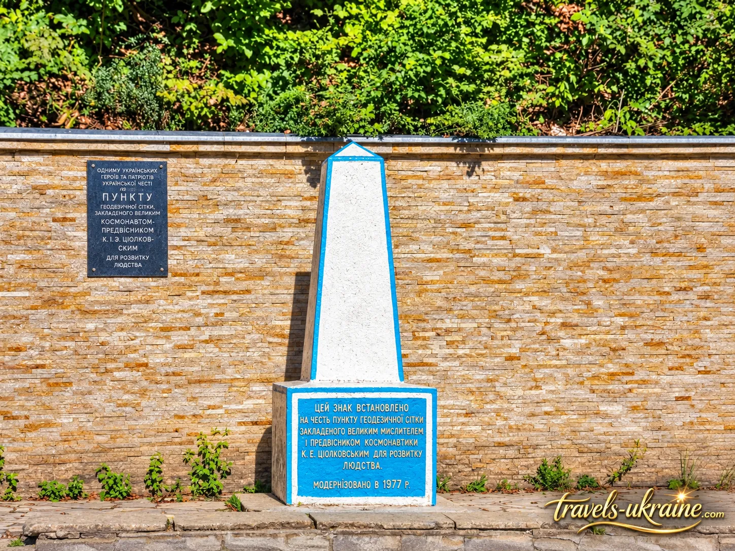
In 1887, a stone geodetic marker was installed near the present-day village of Dilove, later becoming the main symbol of the site. It has the shape of a truncated four-sided pyramid and looks considerably more modest than one might expect from a landmark with such a grand name. This very inconspicuousness makes it special: visitors are not looking at a decorative structure created for photographs, but at a genuine geodetic object from the late 19th century.
The marker bears a Latin inscription stating that the exact location was determined using specialized surveying equipment and the European system of latitude and longitude. The inscription ends with the Roman numerals MDCCCLXXXVII — the year 1887. This became the foundation of the historical tradition according to which the site near Dilove came to be called the geographical center of Europe.
Interestingly, the old marker’s greatest value lies precisely in its origins. It recalls a time when coordinates were determined not by satellites and digital maps, but by complex field measurements, geodetic instruments, and years of work by engineers. This makes the Dilove landmark interesting not only from a geographical perspective, but also as part of the history of cartography and geodesy in Central Europe.
From a Modest Geodetic Marker to a Tourist Symbol
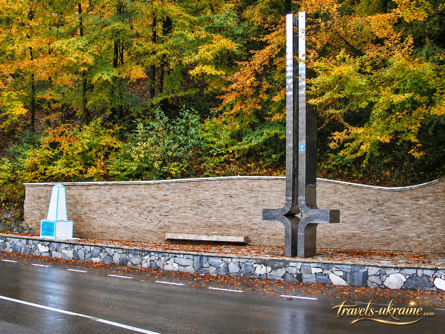
Over time, the small marker became a well-known landmark of the Rakhiv region, but its appearance remained too inconspicuous for a place already associated with the center of an entire continent. Therefore, in 1977, a much taller stele was erected nearby, designed by architect and artist Stepan Kozurak. It is about 7.2 meters high, and a sphere symbolizing the Earth is placed at the top of the structure.
The stele’s vertical lines symbolically relate to the four cardinal directions, while the composition itself emphasizes the idea of a central point. At the same time, the old marker was neither removed nor replaced by the new monument. That is why visitors can see two distinct eras side by side today: the modest 1887 geodetic marker and the far more prominent 20th-century stele.
What Tourists Can See Near the Center of Europe Today
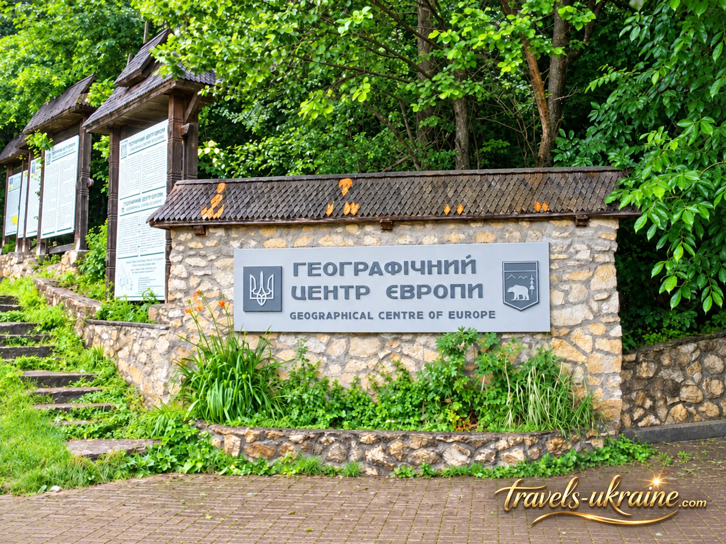
The modern tourist site near Dilove is not a large museum complex, but a compact roadside location surrounded by Carpathian forest. It features the historic geodetic marker, a monumental stele, information boards, and a landscaped area bearing the inscription «Geographical Center of Europe.» It is worth spending a little more time by the old marker: more than a century of history lies behind its simple appearance.
The Tysa flows nearby, forested Carpathian slopes rise above the valley, and the site feels entirely different from a monument in the center of a large city. There is no sense of grandeur here; on the contrary, the geographical symbol stands amid the nature of the Rakhiv region almost as unobtrusively as it did more than a hundred years ago. You do not need much time to see the complex itself, but there is no reason to hurry away either: the history of the place becomes much more fascinating when you understand what lies before you.
Yet the most intriguing question remains open: did Austro-Hungarian geodesists really determine the geographical center of Europe, and why do several places now claim this title? The answer is not as obvious as the inscription on the tourist information board.
Is Dilove Really the Geographical Center of Europe?
The answer is somewhat unexpected: Dilove does have a historical right to be called one of Europe’s geographical centers, but there is no single continental center that is equally correct under every methodology. The reason is not an error by the early geodesists, but geography itself. To find the middle of Europe, one must first agree where Europe ends, which islands to include, and how to calculate the central point.
Why Europe Has Several Geographical Centers
On a map, the continent looks clearly defined, but that is not enough for a mathematical calculation. Europe has a complex coastline, numerous islands, and a notional land border with Asia. If some islands are included and others excluded, the continent’s extreme points are changed, or a different mathematical method is applied, its center shifts as well.
The midpoint can be determined, for example, from the northernmost, southernmost, westernmost, and easternmost points, or by finding the geometric center of the continent’s entire area. Modern geodetic methods can calculate the center of gravity of the territory while accounting for the shape of the Earth. Each approach answers a slightly different mathematical question, so the coordinates are not required to coincide.
This is why several places with a similar status have appeared on the map of Europe. As early as the 18th century, the continent’s center was identified near Suchowola in Poland; later, another such point appeared in what is now Slovakia. In 1989, specialists from France’s National Geographic Institute, using the center-of-gravity method for the geometric figure of Europe, calculated a center near Vilnius in Lithuania. Other countries also have their own calculations and commemorative markers.
So Where Does Dilove Stand Among Them?
This is where things become most interesting. Dilove should not be viewed as a «wrong» center simply because later methods produced different coordinates. The Geographical Center of Europe near Dilove belongs to the history of European geodesy in the late 19th century, and the marker erected here is tangible evidence of the measurements made at that time. Its value does not disappear just because a century later geographers obtained different results using different rules.
At the same time, the popular claim that Austro-Hungarian scientists once and for all «proved» that the single center of Europe was located precisely here should be treated with caution. Even the interpretation of the historic geodetic marker’s purpose and the calculation method remains a matter of debate. It is therefore more accurate to call Dilove one of the historically determined geographical centers of Europe, rather than the continent’s one indisputable midpoint.
Why the Dispute over Europe’s Center Makes Dilove Even More Interesting
For tourists, this uncertainty gives the place even more character. You can visit Dilove, stand beside the 1887 marker, and realize that somewhere in Poland, Slovakia, or Lithuania, another traveler may be taking a photo at a «center of Europe» at that very moment. Each of these places has its own history and its own way of explaining its coordinates. So the question «Where is the geographical center of Europe really located?» has no single universal answer without specifying the calculation method. Dilove is fascinating precisely because its claim has a long history, a genuine geodetic marker, and has remained part of the geographical and tourist history of the Carpathians for more than a century.
What to See in Dilove and Near the Geographical Center of Europe
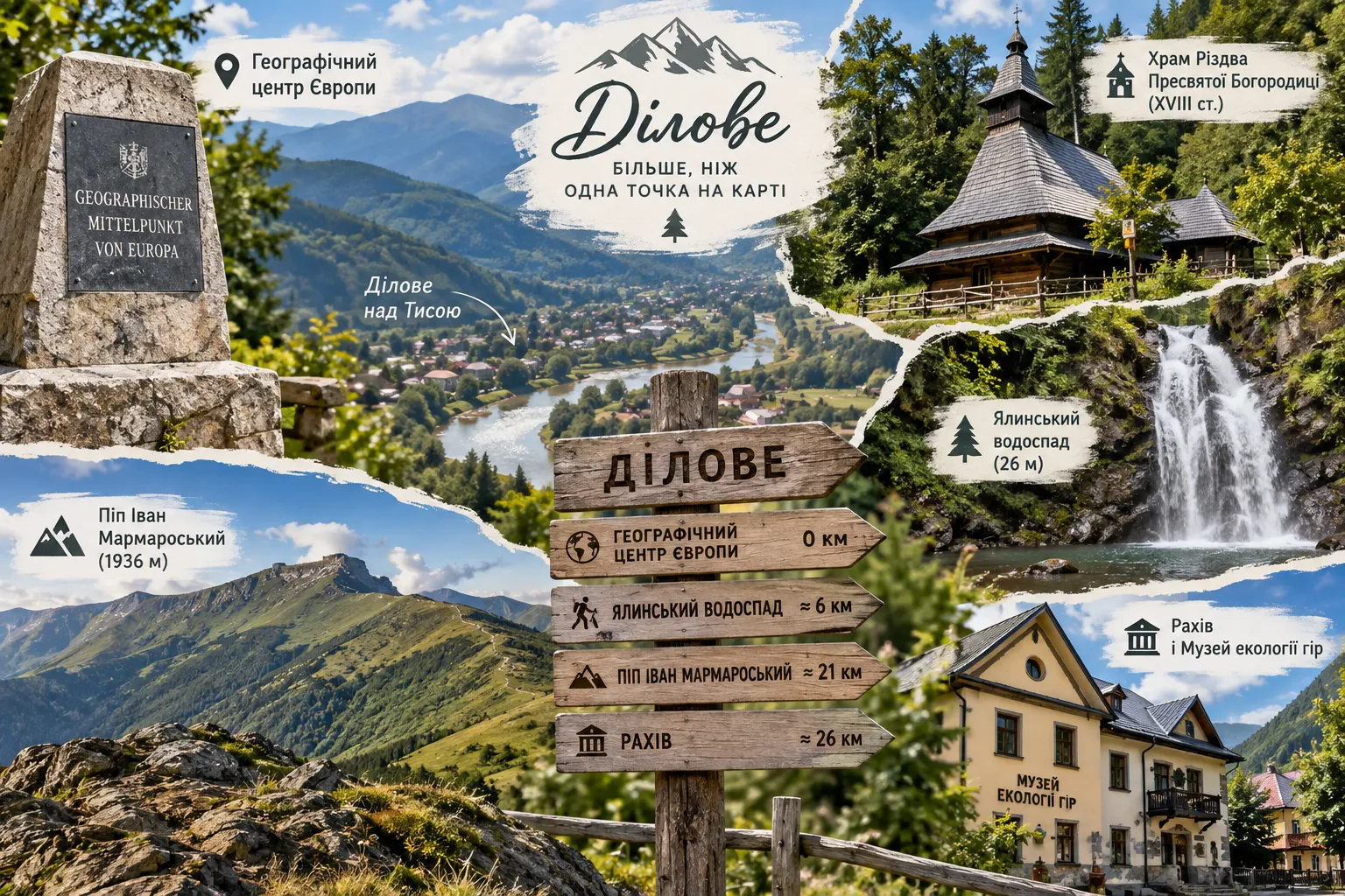
The Geographical Center of Europe can be seen in a relatively short time, but it would be a shame to travel to Dilove only for a photo by the marker. The village lies between the Tysa Valley and the slopes of the Marmarosy Massif, so just beyond this one tourist attraction lies the much broader Rakhiv region, with old Hutsul architecture, waterfalls, mountain trails, and landscapes worth staying longer to enjoy.
After visiting the Center of Europe, it is worth taking your time before leaving Dilove. The village stretches along the Tysa almost beside the Ukrainian-Romanian border, while the surrounding mountains press so close to the valley that the landscape feels entirely different from that of lowland Zakarpattia. It is a good place for an unhurried stop, a short walk, and an introduction to the southern part of the Rakhiv region.
Special attention should be paid to the wooden Church of the Nativity of the Blessed Virgin Mary. The first documentary mention of it dates to 1750, while its consecration took place in 1767. Particularly valuable are its preserved original interior and bell tower, which is a notable example of traditional Hutsul architecture. In 2018, the church was added to the State Register of Immovable Monuments of Ukraine as a cultural heritage site of national significance.
Yalynskyi Waterfall — One of the Natural Attractions Near Dilove
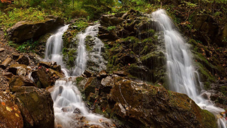
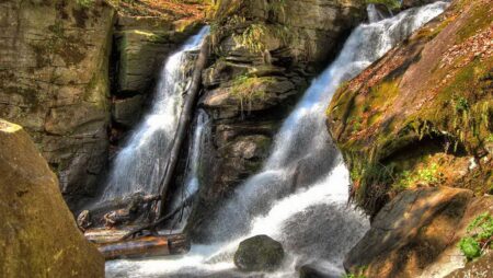
For those who want to experience the Carpathians up close rather than from a roadside, one of the most interesting destinations is Yalynskyi Waterfall, also known by its old name, Kovhat. It lies east of Dilove in the Rakhiv Mountains, part of the Marmarosy Massif. The waters of the Yalyn stream fall in a single cascade from a rocky ledge approximately 26 meters high, making the waterfall one of the most impressive in this part of the Ukrainian Carpathians.
Yalynskyi Waterfall is most spectacular when water levels are high — in spring after the snow melts or following prolonged rainfall. However, this is no longer a short walk near a tourist complex: the route crosses mountainous terrain with significant elevation gain, so the trip requires time, suitable footwear, and a reasonable level of fitness.
Marmarosy and Mount Pip Ivan Marmaroskyi — for Those Who Want to See True High Mountains
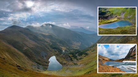
Dilove is also known as one of the main starting points for the Marmarosy Massif, which is often called the Hutsul Alps because of its sharp ridges, rocky slopes, and terrain unusual for many other parts of the Carpathians. The best-known summit in the area is Mount Pip Ivan Marmaroskyi, reached by a route from Dilove through the Bilyi Stream valley and Lysychyi alpine meadow.
The official tourist route is about 21 km long and is considered difficult, so it should not be treated as a minor extension of a tour to the geographical center of Europe. This is a separate full-day mountain trip, or one requiring an overnight stay. Part of the route runs through a border zone, so be sure to check the current rules and registration procedures with the border service before setting out.
Rakhiv and the Museum of Mountain Ecology
If, after Dilove, you would like to continue your journey without a challenging hike, Rakhiv is the logical next stop. It is home to the Museum of Mountain Ecology and the History of Nature Use in the Ukrainian Carpathians—the main environmental education center of the Carpathian Biosphere Reserve. Its exhibits tell the story of the Carpathians’ nature, traditional livelihoods, mountain communities, and the interaction between people and the high-mountain environment.
Thus, a trip to the Geographical Center of Europe in Dilove can easily become more than a short stop by a memorial marker—it can turn into a full introduction to the Rakhiv region. For a relaxed trip, it is enough to combine Dilove with Rakhiv and the old church, while active travelers should plan a separate visit to Yalynskyi Waterfall or a hike in the Marmarosh Mountains.
How to Get to the Geographical Center of Europe
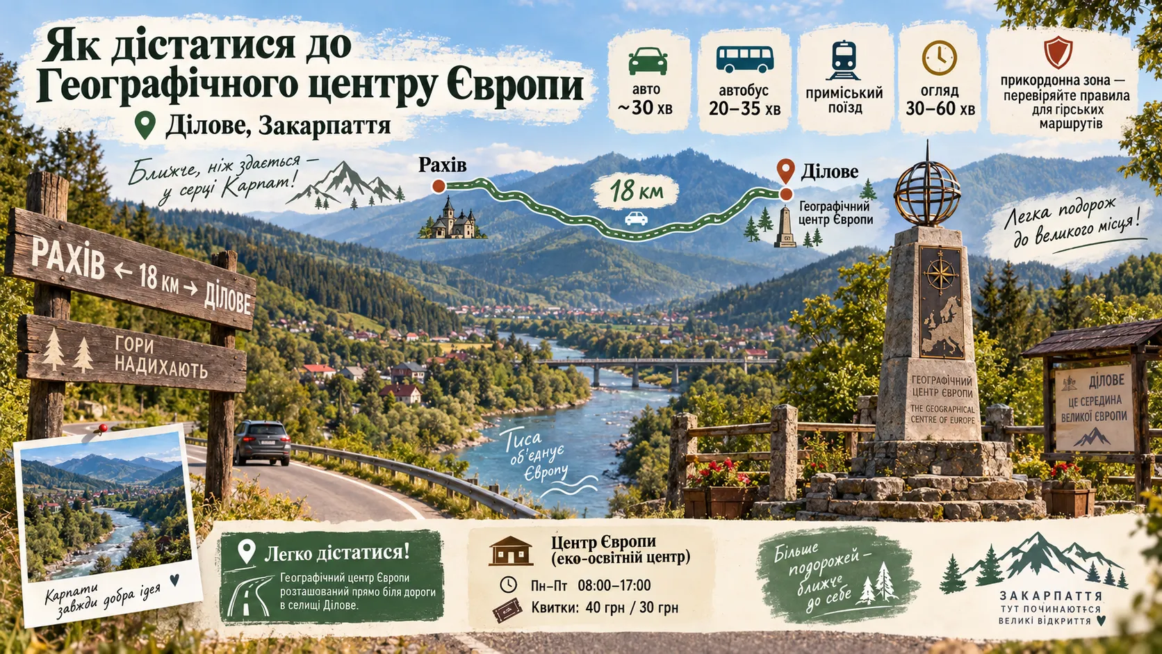
The Geographical Center of Europe in Dilove is one of those Carpathian landmarks that does not require several hours of hiking along a mountain trail. The complex is located directly beside the road running through the Tysa Valley via Rakhiv and Dilove, so it is easy to include even in a road trip through Zakarpattia.
Rakhiv is the most convenient starting point. The distance from the town to Dilove is approximately 18 km. By car, head south toward Dilove, Velykyi Bychkiv, and Solotvyno. The road follows the Tysa Valley, and the tourist complex is located beside the highway, so you will not have to search for it among the village streets. In your navigation app, the easiest option is to enter «Geographical Center of Europe, Dilove».
The drive from Rakhiv takes approximately half an hour, depending on traffic conditions. This option is particularly convenient if you plan to continue toward the Solotvyno salt mines or Khust, or instead return to Rakhiv and other tourist attractions in the high-mountain part of Zakarpattia.
How to Get to Dilove by Public Transport
Buses run between Rakhiv and Dilove, continuing farther along the Tysa Valley. According to the current timetable, there are several services a day, and the bus journey takes approximately 20–35 minutes. Schedules may vary depending on the day and the carrier, so it is best to check the departure time shortly before your trip.
There is also a rail option. The Kolomyia — Rakhiv — Dilove suburban train reaches the Dilove stop. This is an interesting way to travel for those exploring the Carpathians without a car, although the small number of services means that the rail journey requires more precise time planning.
Interesting Facts About the Geographical Center of Europe and Dilove
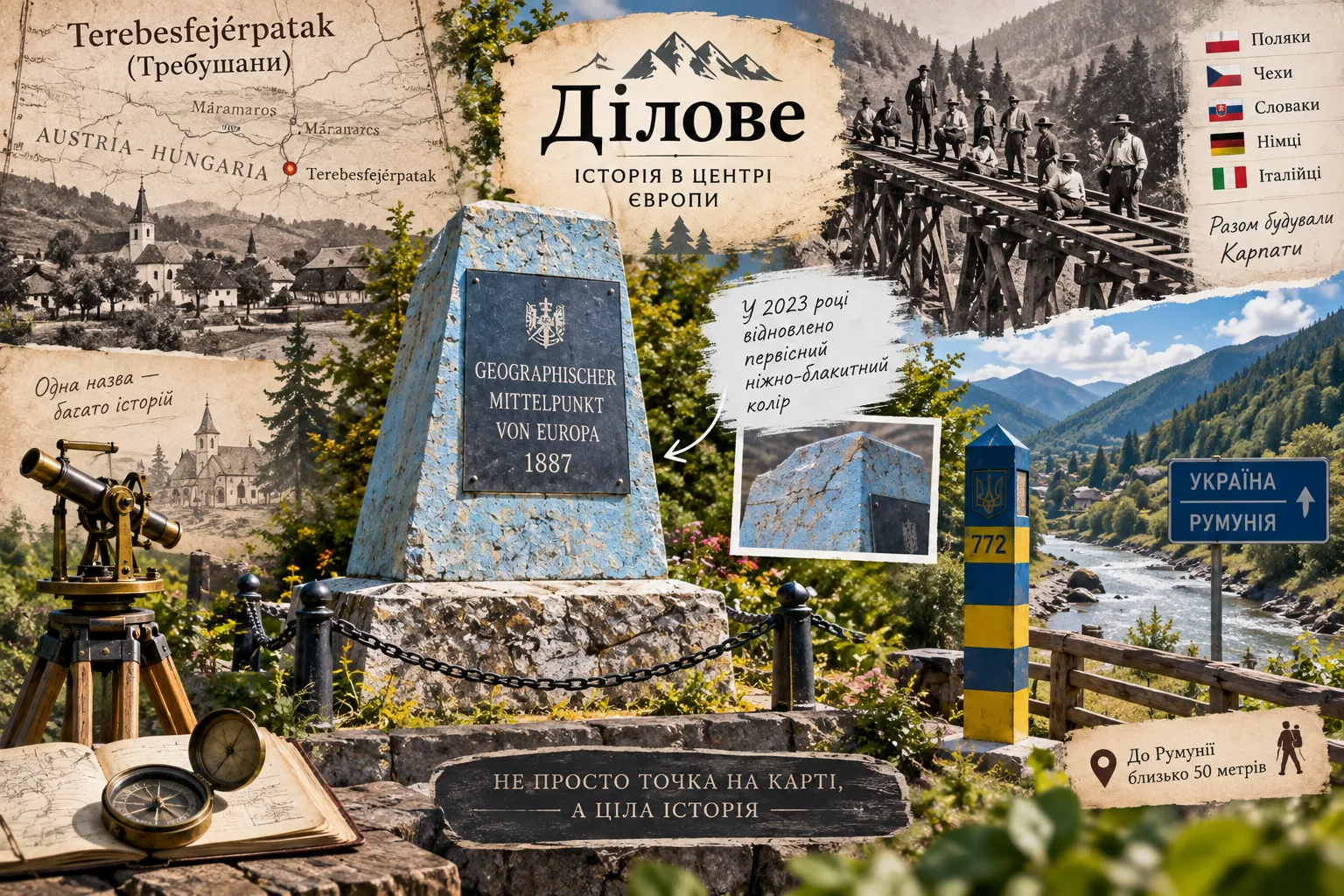
The familiar inscription «Geographical Center of Europe» conceals many details that are easy to miss during a brief stop. Dilove has changed its names, witnessed the construction of an international railway at the end of the 19th century, welcomed workers from various European countries, and its old geodetic marker even turned out not to be the color tourists had been accustomed to seeing for many years.
Thus, the history of the village and the Geographical Center of Europe began with the construction of the Transcarpathian railway at the end of the 19th century, which changed village life far more profoundly than may seem today. Specialists and workers came to the project from different parts of Austria-Hungary and other European lands, including Poles, Czechs, Slovaks, Germans, and Italians. Some stayed and started families with local residents. The tourist history of the center of Europe here therefore grew out of a major engineering project whose original purpose was not to create a landmark, but to build a transport route through the Carpathians.
It is also worth noting that the modern name Dilove appeared only in the mid-20th century. Until 1946, the village was known as Trebushany, and its name was recorded in several languages during different historical periods. At the end of the 19th century, the official Hungarian name was Terebesfejérpatak, which can be translated as «Terebes on the White Stream.» The origin of the name Trebushany has not been definitively established. One local legend tells of three Bushan brothers who supposedly settled in the area. Other linguistic theories also exist, so the appealing story about the brothers is best understood as a folk explanation rather than a proven historical fact.
The Historic Marker Originally Had an Unexpected Color
The old stone marker of the center of Europe has been repaired and repainted many times, so its appearance gradually diverged from the original. During restoration work in 2023, specialists examined the old layers of coating and established that the monument originally had a soft blue hue. This was the color they attempted to recreate during the restoration.
It is a small detail, but it clearly shows how easily a historic landmark can change its appearance over more than a century. A visitor looking at the marker today is seeing not merely an old stone with an inscription, but an object whose appearance has been brought as close as possible to how it looked at the end of the 19th century.
Frequently Asked Questions About the Geographical Center of Europe in Dilove
Where is the Geographical Center of Europe in Ukraine?
The Geographical Center of Europe is located in Zakarpattia, near the village of Dilove in Rakhiv district. The historic geodetic marker stands in the Kruhhlyi tract beside the road, approximately 18 km from Rakhiv.
Is Dilove really the geographical center of Europe?
Dilove is more accurately described as one of the historically determined geographical centers of Europe. The site preserves an 1887 geodetic marker associated with Austro-Hungarian measurements. At the same time, several other points in Europe have a similar status, since the result depends on how the continent’s boundaries are defined and which calculation method is used.
When was the Geographical Center of Europe in Dilove determined?
Geodetic studies in this part of Zakarpattia were carried out in 1885–1887 during preparations for the construction of the railway between Rakhiv and Sighet. The stone geodetic marker bearing a Latin inscription and the date MDCCCLXXXVII — 1887 was installed at that time.
How do you get to the Geographical Center of Europe from Rakhiv?
From Rakhiv, drive approximately 18 km south toward Dilove. The tourist site is located directly beside the road, so it is easy to find by car using a navigation app. Dilove can also be reached by bus or suburban train, although the current timetable should be checked before traveling.
How much time is needed to visit the center of Europe?
Allow 30–60 minutes to see the historic marker, stele, and information area and take photographs. If you add a walk through Dilove or visits to other attractions in the Rakhiv region, it is best to plan at least several hours for the trip.
Do you have to pay to visit the Geographical Center of Europe?
The historic geodetic marker and stele are located outdoors beside the road. A separate ticket is required only to visit the «Center of Europe» environmental education center nearby.
What can you see near the Geographical Center of Europe?
In Dilove itself, visit the old wooden Church of the Nativity of the Blessed Virgin Mary. For an active trip, the Yalynskyi Waterfall and the Marmarosh Massif are interesting destinations, while nearby Rakhiv is home to the Museum of Mountain Ecology and the History of Nature Use in the Ukrainian Carpathians.
Do you need permission from the border guards to visit the center of Europe?
Ordinary visits to the roadside Geographical Center of Europe complex do not require separate registration for a mountain route. Different rules apply to hikes in the border area of the Marmarosh Mountains: registration with the border service is required for the route to Mount Pop Ivan Marmarosskyi, and the Carpathian Biosphere Reserve also states that a permit is required to visit Yalynskyi Waterfall.
The Center of Europe in Dilove: A Small Place with a Great History
The Geographical Center of Europe in Dilove is not the kind of landmark for which you should expect a huge tourist complex or several hours of guided tours. Its value lies elsewhere. A small geodetic marker in the Carpathians preserves the history of 19th-century measurements, railway construction, Austria-Hungary, and an early attempt to determine the midpoint of the European continent.
And even the fact that several places in Europe now have a similar status does not make Dilove any less interesting. On the contrary, the debate over where the center of Europe really lies gives the site added meaning. Here, you can do more than take a photograph beside the inscription: you can see a genuine historic object and understand how differently geographers of various eras tried to answer the same question.
The best way to visit is as part of a longer trip through the Rakhiv region. Dilove, the Tysa Valley, the Marmarosh Mountains, Yalynskyi Waterfall, old wooden churches, and Rakhiv can easily turn a brief stop by the geodetic marker into an enriching journey through the Carpathians. The center of Europe in Dilove should therefore be seen not as a single point on a map, but as a place where geography meets history and tourist curiosity becomes a reason to discover much more. Perhaps that is where its true appeal lies.

One Response Comment
You can post first response comment.