
 English
 Українська
 Български
 Hrvatski
 Čeština
 Dansk
Dansk Nederlands
 Eesti
Eesti Suomi
Suomi Français
 Deutsch
 Ελληνικα
 Magyar
 Íslenska
 Italiano
 Latviešu
 Lietuvos
 Polski
 Português
 Română
 Русский
 Српски
 Slovenčina
 Slovenščina
 Español
 Svenska
 Türkçe
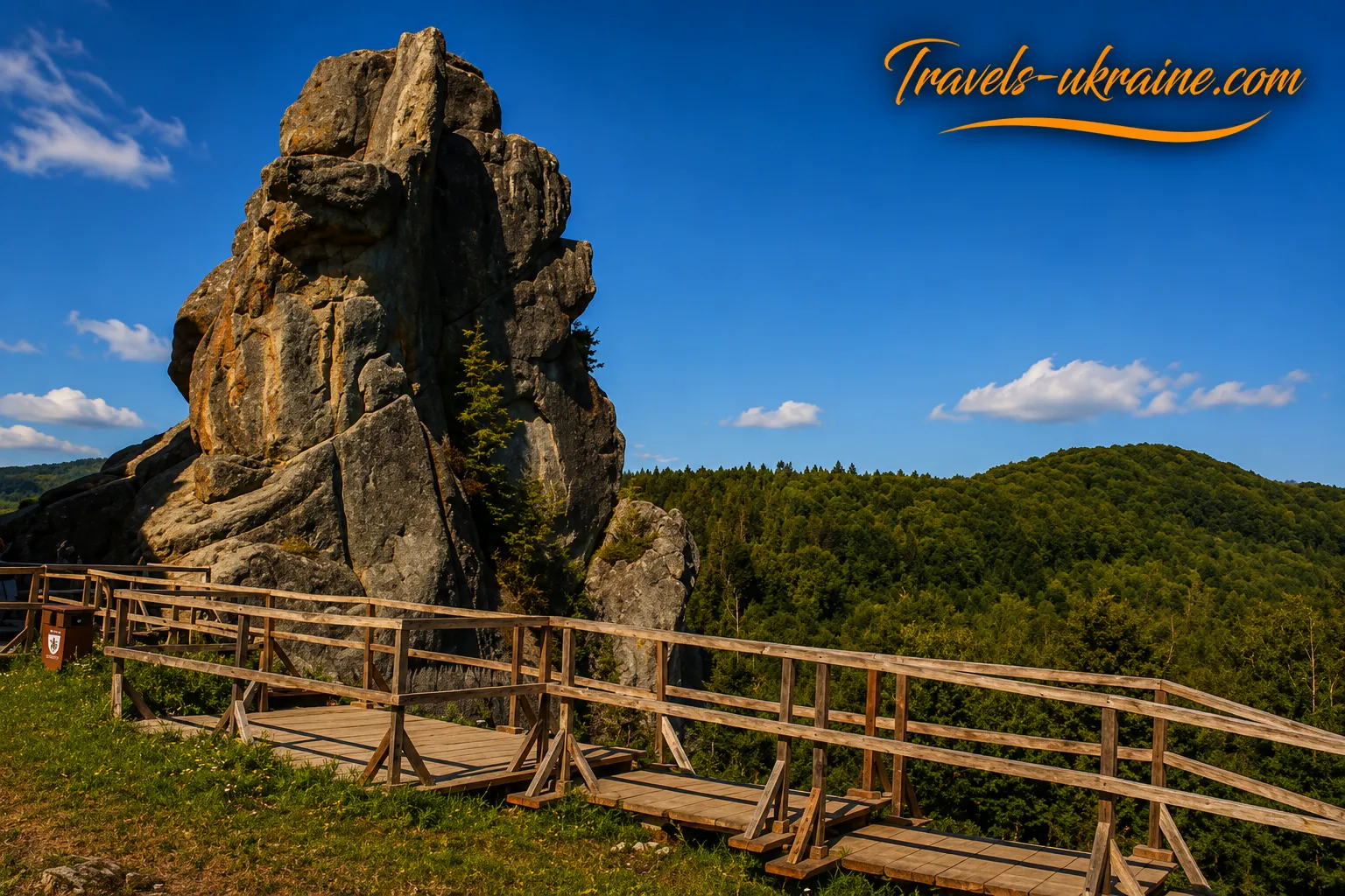
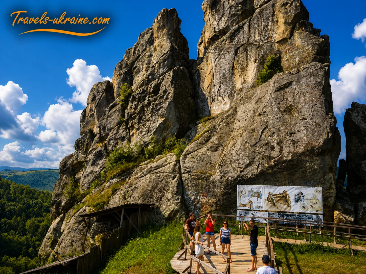
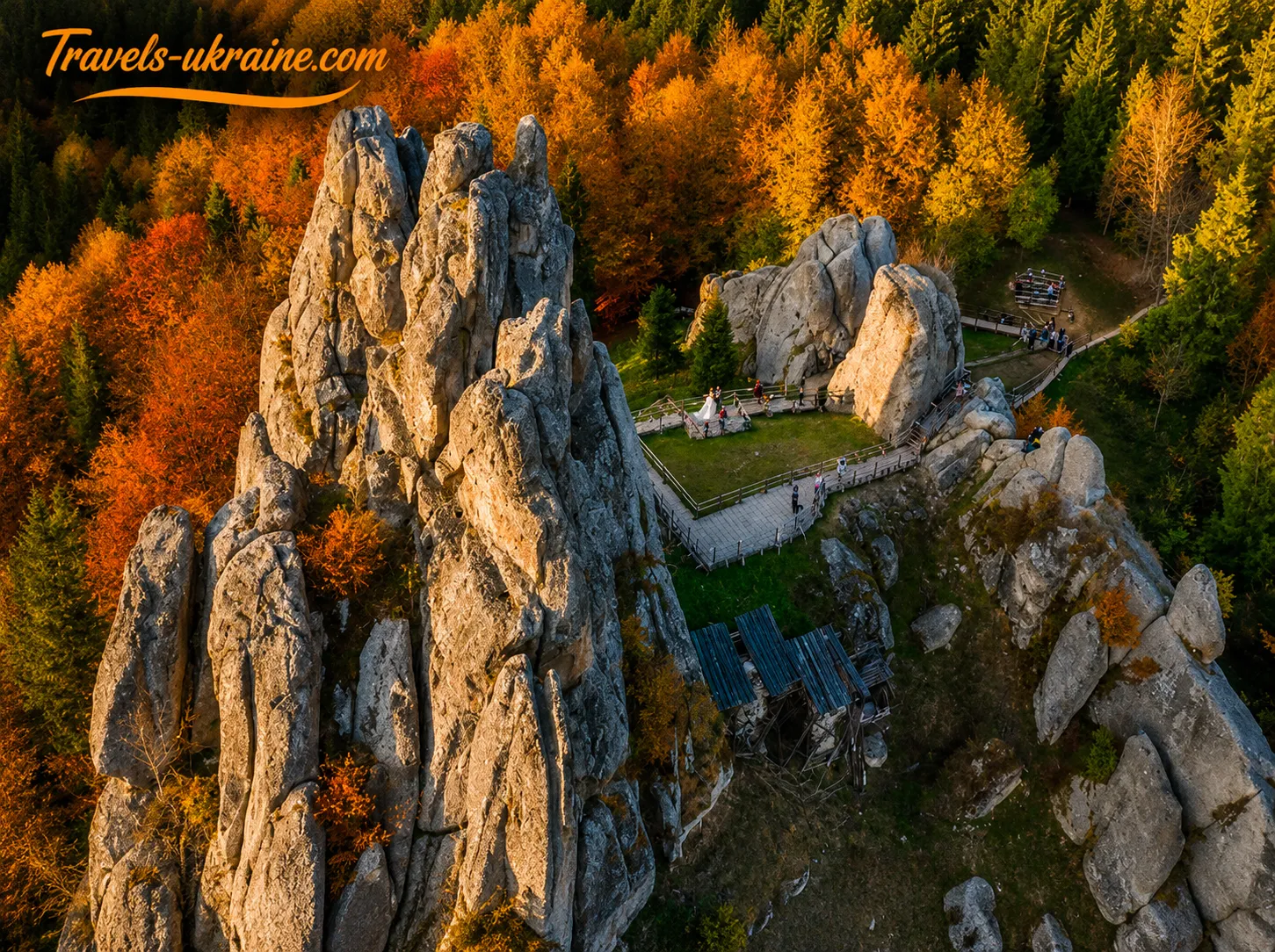
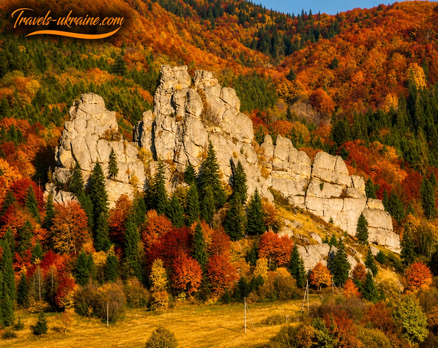
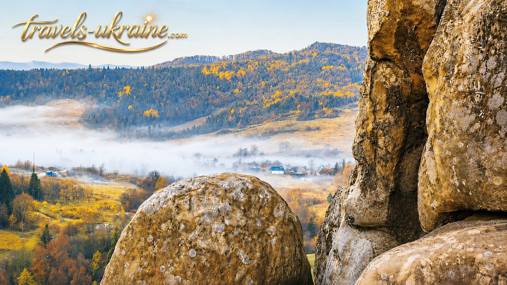
Amid the Carpathian forests near the village of Urych rise massive sandstone rocks, crowned nearly a thousand years ago by an unusual wooden stronghold. Today, there are no stone walls, defensive towers, or restored princely chambers here, yet the rock formations are no less impressive than well-preserved medieval castles. Its history is recorded directly on the stone—in the grooves, holes, steps, and traces of structures that once supported multilevel wooden fortifications.
Tustan and the Urych Rocks are a rare example of a place where the natural landscape became part of a complex defensive system. Medieval builders used the shape of the rocks as ready-made walls and supports, constructing wooden galleries, passageways, living quarters, towers, and fortifications between the stone formations. Thus, the cliff fortress of Tustan arose above the Carpathian valley, controlling an important trade route through the mountain passes and protecting the surrounding area.
Tustan, the Urych Rocks, and Urych: What Is the Difference?
These names are often used interchangeably, although they have different meanings. The Urych Rocks are a natural complex of sandstone outcrops that formed the basis for the fortifications. Tustan was a medieval fortress town, a defensive, administrative, and customs center that existed among and beside the rocks. Urych is the modern Carpathian village near which the landmark is located, while the State Historical and Cultural Reserve «Tustan» is the institution that researches, protects, and presents this historic area to visitors.
The location’s popularity is explained not only by its scenic landscapes and unusual history. In 2025, the Tustan Reserve welcomed approximately 190,000 tourists, for whom more than 6,000 excursions were conducted. Over the course of the year, 60 cultural and educational events were also organized here. These figures show that Tustan has long been not only a renowned landmark of the Lviv region, but also one of the important tourist centers of the Ukrainian Carpathians.
The village of Urych has also received international recognition. In 2024, it was included in the list of the world’s best tourism villages by UN Tourism. This recognition drew attention not only to the fortress but also to the local community’s work to preserve cultural heritage, the natural environment, and the traditional Carpathian landscape.
A journey to Tustan offers a chance to see the Carpathians from a different perspective. Here, every rock ledge was once part of a defensive system, while cliff grooves and holes help visitors imagine structures that disappeared long ago. This place does not reveal its secrets at first glance. To understand the landmark, it is not enough simply to climb to the viewing platform and take a few photographs. It is worth looking more closely at the stone, imagining wooden walls between the rocks, and mentally returning to the time when merchant caravans traveled through the Carpathian passes and guards from the medieval fortress kept watch over the valley.
History of Tustan Fortress: From a Princely Stronghold to a Customs Post in the Carpathians
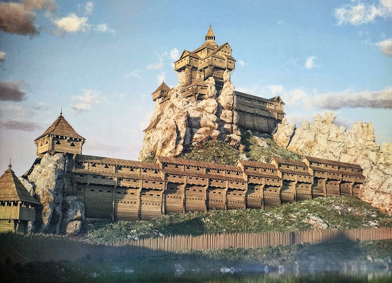
The history of Tustan began long before the rocks near the village of Urych became a popular tourist destination. In the Middle Ages, this was a fortified defensive and administrative center built along one of the routes leading from the Principality of Galicia to the Carpathian passes. The rocks’ natural position made it possible to control the valley, observe the movement of people and goods, and spot danger in advance.
The Kyivan Rus fortress of Tustan was not an ordinary castle with continuous stone walls. Its foundation was a massif of sandstone rocks, between which builders installed wooden walls, towers, galleries, and living quarters. The stone served as a natural fortification, while the wooden structures complemented the terrain wherever passages or vulnerable areas remained. This gradually formed a complex defensive system adapted to the conditions of the lower Carpathian highlands.
The fortress’s exact founding date has not yet been established. Popular descriptions often call Tustan a fortification dating from the IX–XVI centuries, but scholars assess the earliest period of its existence more cautiously. Archaeological materials allow researchers to speak with confidence about life and construction at the complex in the XII–XVI centuries, while the dating of certain early traces to the IX–XI centuries remains disputed.
This uncertainty does not diminish the landmark’s importance. On the contrary, it shows how complex the history is of a place where wooden structures have almost completely disappeared, leaving archaeological finds and thousands of grooves and notches on the rock surfaces as the main evidence of the past. Researchers use these traces to determine the locations of walls, ceilings, galleries, passageways, and buildings.
Tustan Fortress on the Trade Route Through the Carpathians
Tustan’s location was strategic. Roads ran through the Carpathian valleys and passes, connecting the Galician lands with Transcarpathia and, farther on, with Central Europe. Merchants, envoys, military detachments, and local residents traveled these routes. The salt trade was particularly important: salt was extracted in the area around Drohobych and transported to various regions.
The fortress in Urych may have performed several functions at once: guarding the road, controlling passage through the mountainous terrain, providing temporary protection, and maintaining administrative order. In a later period, a customs post operated here, where officials inspected goods and collected payments from those using the trade route. Tustan was therefore not an isolated military structure but part of the economic and communications system of the medieval Carpathians.
The Defensive Significance of the Carpathian Cliff Fortress
Choosing a rocky massif for the construction gave the defenders an important advantage. Steep stone walls made a direct assault difficult, while approaches to the fortification could be controlled from above. Gaps between the rocks were closed with wooden structures, so the interior could be reached only through protected entrances and passageways.
The fortified area on the central Kamian rock group had several defensive lines. The fortress developed gradually: old structures were rebuilt, fortifications were expanded, and the buildings were adapted to new needs. In later periods, stone was used alongside wood, so Tustan should not be imagined as an unchanging structure built according to a single plan. It was a living complex whose architecture evolved along with political and military circumstances.
The First Written References to Tustan
The earliest known written references to Tustan date from the middle of the XIV century. The Kraków Cathedral Chronicle lists it among the fortifications rebuilt during the reign of the Polish King Casimir III. The Polish chronicler Jan Długosz also named Tustan among the towns and fortresses captured by Casimir in 1340.
These records do not mean that the fortress originated in the XIV century. By that time, it already existed and had sufficient political and defensive importance to be mentioned in medieval chronicles. Documents from the late XIV century refer to the Tustan district, a territorial unit whose center was a fortification or settlement associated with it.
The history of Tustan can be divided conditionally into several main stages:
- the princely period — the formation of cliff-based defensive structures and control of routes through the Carpathians;
- the XIV–XV centuries — the reconstruction of the fortifications and Tustan’s incorporation into a new administrative system;
- the XVI century — the operation of the customs post and the gradual loss of its former military importance;
- the XVII century — the decline of the fortress and the end of its function as an important fortified center.
Why the Tustan Cliff Fortress Declined
Tustan’s decline was not the result of a single sudden catastrophe. The fortress gradually lost its importance because of changing trade routes, the development of new methods of warfare, and the spread of firearms. Wooden fortifications on the rocks were well suited to the conditions of the early and high Middle Ages, but over time they could no longer adequately withstand new artillery.
The transport network also changed. If the road controlled by the fortress became less important, maintaining a complex fortification no longer made economic sense. As its defensive role diminished, so did the importance of the customs post, while administrative functions shifted to other settlements. In the XVII century, Tustan finally fell into decline, and its wooden buildings gradually disappeared through the effects of time, moisture, fires, and natural erosion.
What remains of the former stronghold are the rocks, fragments of stone structures, a well, archaeological artifacts, and numerous grooves cut into the rock. For a long time, these were seen as mysterious traces of unknown structures, until systematic research of the landmark began in the XX century.
How the Kyivan Rus Fortress of Tustan Was Studied
A new stage in the study of Tustan began in 1971. After his first survey of the Urych Rocks, Mykhailo Rozhko organized a small expedition with students of architecture from the Lviv Agricultural Institute. The researchers examined caves, upper platforms, grooves, and notches, photographed traces of the ancient buildings, and carried out geodetic surveys of the rocky complex. In the following years, Rozhko systematized the collected materials and used them to determine the locations of the wooden walls, galleries, ceilings, and towers of the medieval stronghold.
Further architectural and archaeological work made it possible to identify several construction periods at Tustan and trace how its buildings changed. The most important result was a scientifically grounded spatial reconstruction of the fortifications. The dimensions and positions of the structures were determined from grooves in the rock, traces where wooden elements had been attached, archaeological finds, and remnants of individual structures. This enabled researchers to recreate the fortress’s overall appearance without arbitrary assumptions.
In 1994, the Tustan monument complex was granted the status of a state historical and cultural reserve. This created conditions for the systematic protection of the rocky landmark, the continuation of scholarly research, and the presentation of the fortress’s history to visitors. Today, the Tustan Reserve combines archaeological, historical, and natural heritage with modern visualization tools. These help tourists see, behind the preserved rocks, the outlines of the complex multilevel structure that once stood there—the medieval cliff fortress near the village of Urych.
From Scholarly Reconstruction to a 3D Model of Tustan Fortress
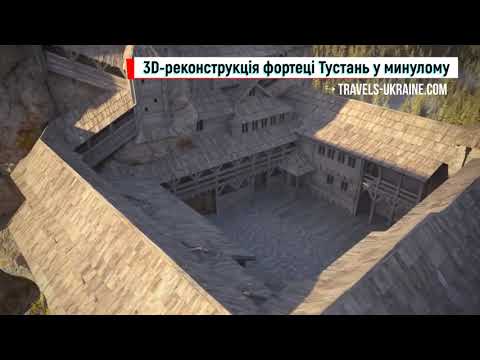
Mykhailo Rozhko’s graphic reconstructions became the foundation for a new stage in presenting Tustan: the digital recreation of the lost fortress. The results of many years of architectural and archaeological research were transferred into three-dimensional space, combining a model of the wooden buildings with the precise terrain of the Kamian rock group and the surrounding area.
The first complete 3D model of Tustan Fortress was presented in Lviv on 25 April 2014 as part of the «Virtual Tustan» project. It showed five construction periods of the fortification and made it possible to trace how its dimensions, height, and internal structure changed over time. The digital reconstruction included not only wooden walls, towers, and passageways but also defensive ramparts, ditches, a body of water, the ancient trade route, and the surrounding landscape.
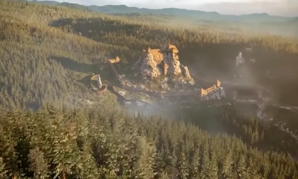
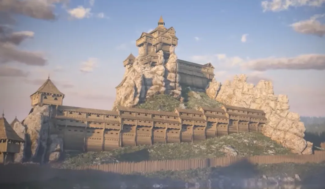
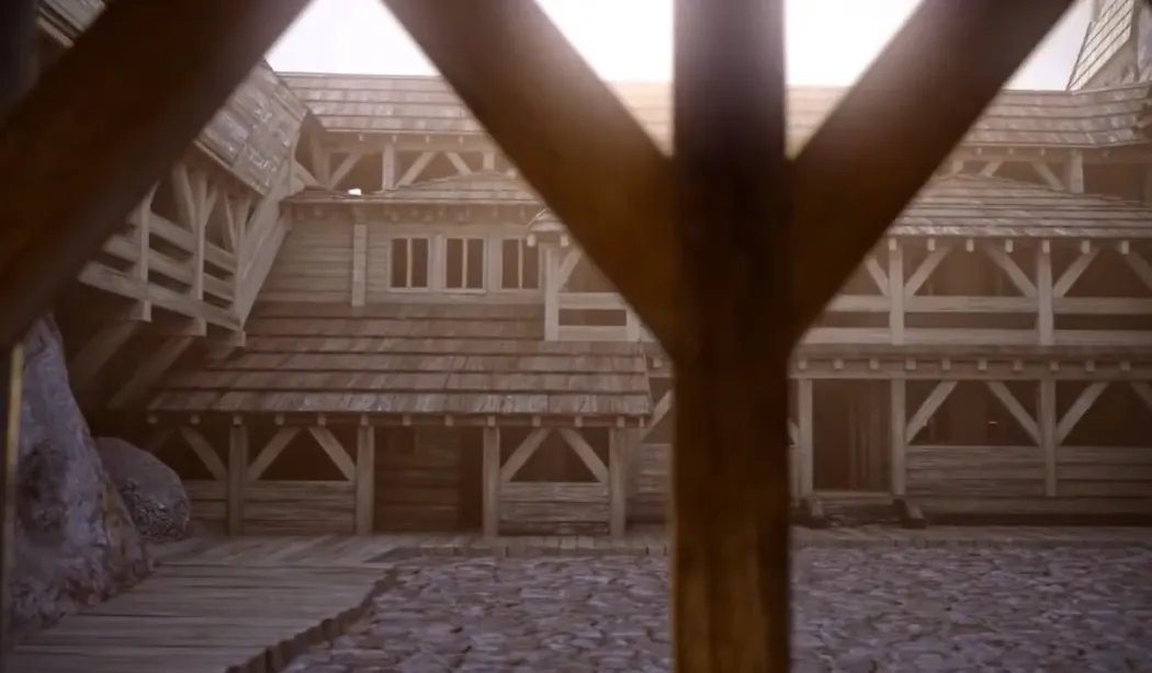
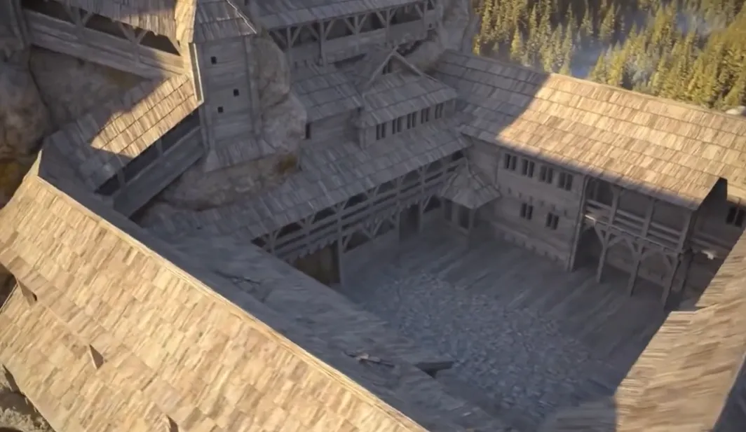
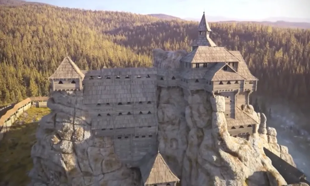
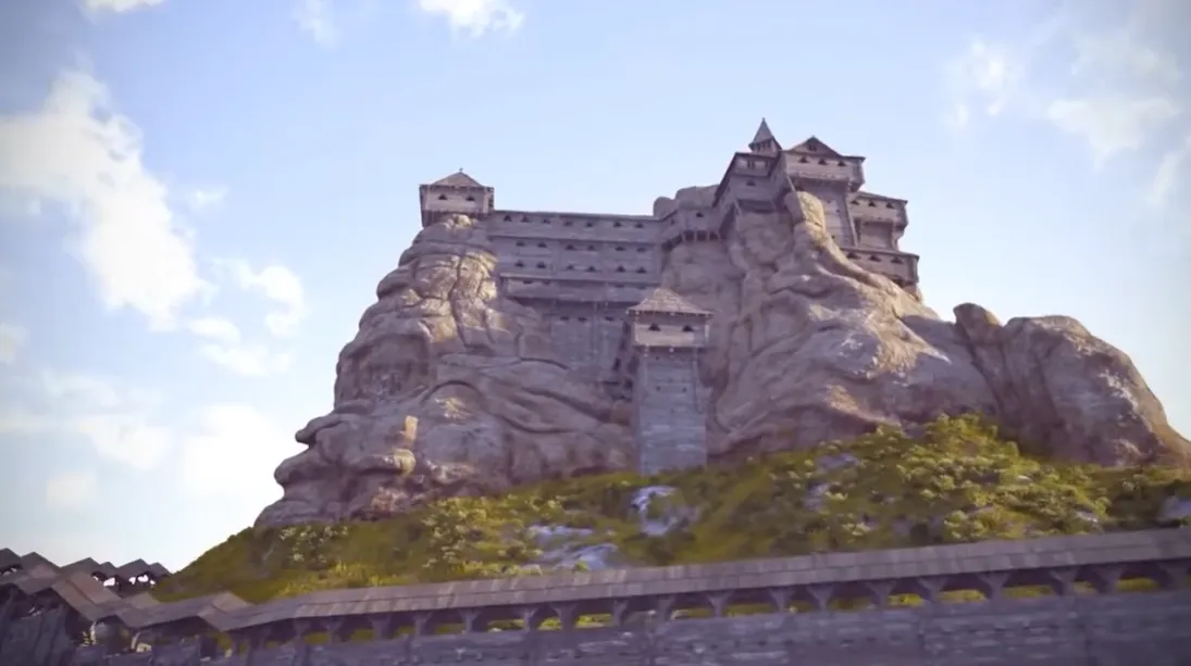
The project was led by architect Vasyl Rozhko, who continued his father’s scholarly work. Maksym Yasinskyi carried out the architectural analysis and development modeling, Vasyl Dmytruk created the digital model of the cliffs and surrounding area, and Oleh Rybchynskyi served as the fortress architecture consultant. The authors’ work was based on drawings, archaeological materials, and graphic reconstructions accumulated over decades of research into the monument.
The digital model was created not merely as a visual illustration for tourists. It became a tool for analyzing the spatial structure of the complex, planning protective and conservation work, and explaining how the wooden architecture interacted with the natural terrain. Thanks to the three-dimensional reconstruction, individual elements that appeared abstract in a conventional drawing became an intelligible, cohesive system.
The materials developed were later used in virtual and augmented reality projects. Today, such technologies make it possible to see the fortress directly among the cliffs where it once towered and to better appreciate its true scale. This is especially important for Tustan, since almost nothing remains of the above-ground wooden structures, while simply viewing the cliffs does not convey the complexity of the multilayered defensive complex.
Natural Features of the Urytski Cliffs
The Urytski Cliffs consist mainly of thick-bedded sandstones of the Yamna Formation, which formed at the end of the Paleocene, approximately 55–60 million years ago. During that period, a deep-water Outer Carpathian Basin existed where the future Carpathians would arise, connected with the Carpathian branch of the ancient Tethys Ocean. Sandy and coarse-grained material flowed into its deep-water portion from the slopes of the continental margin. Powerful submarine gravity flows carried it along the basin floor. Over time, the accumulated sediments compacted, cemented, and transformed into durable sandstone.
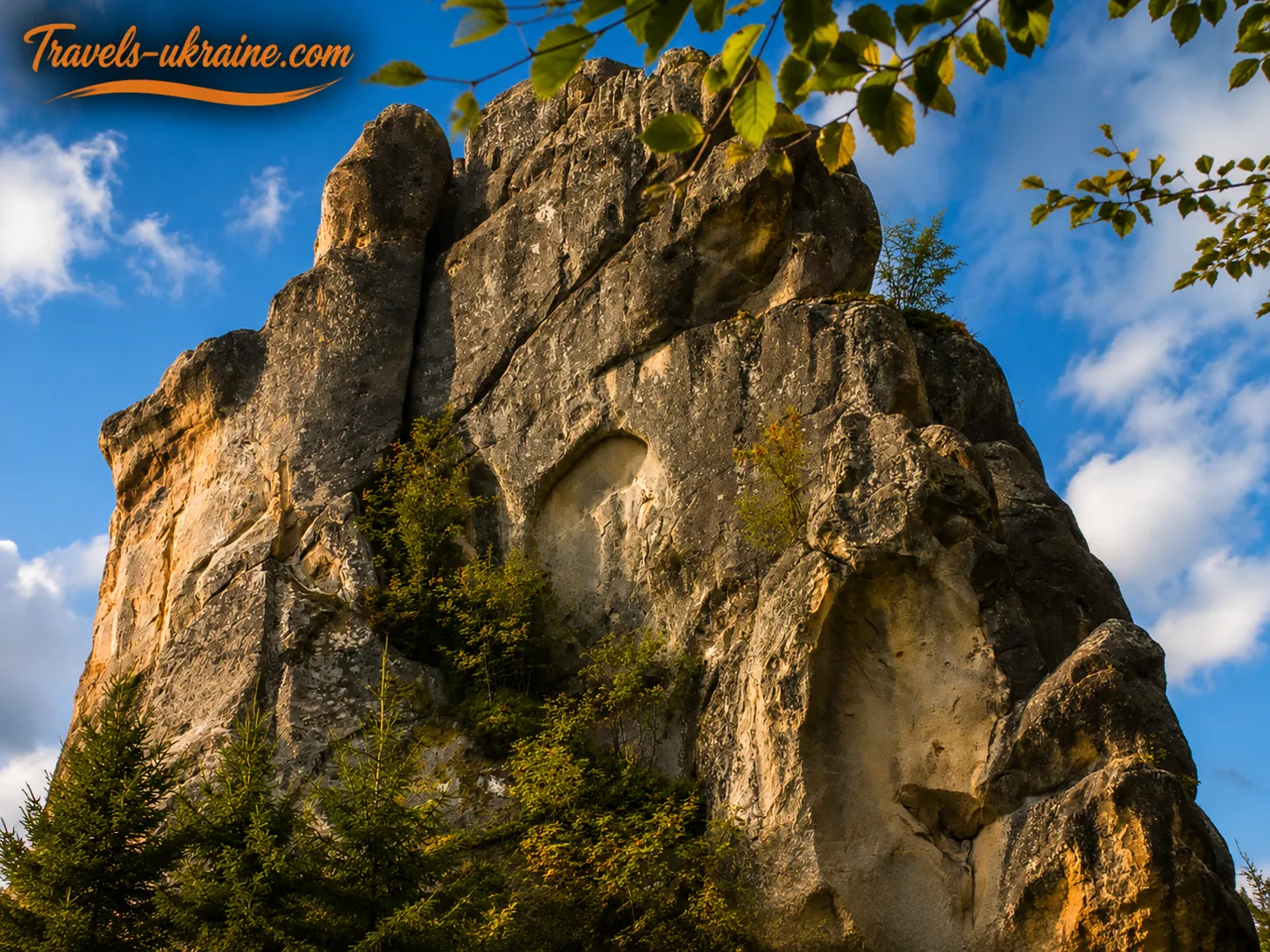
During the formation of the Carpathians, these strata were folded, faulted, and uplifted together with other rocks of the Outer Carpathians. Some layers assumed a steep, in places almost vertical, position. After reaching the surface, the sandstone began to break down under the effects of water, frost, wind, temperature fluctuations, and gravity. More heavily fractured and less stable sections gradually eroded, while stronger masses survived as isolated rock formations. This created sheer walls, individual blocks, narrow passages, and natural terraces, later used by the medieval builders of Tustan Fortress.
Main Rock Groups of the Urytski Complex
The Urytski Cliffs consist of several separate groups of sandstone outcrops that differ in size, shape, and position in the terrain. The best known are Kamin, Ostryi Kamin, Mala Skelia, and Zholob, also called Oril. The complex also includes Hulka, Khrest, and another unnamed rock.
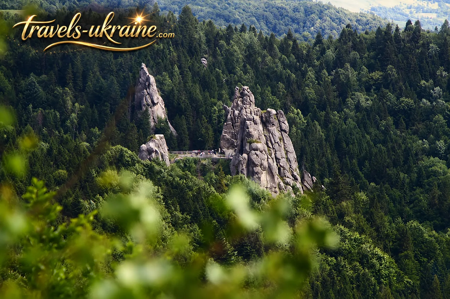
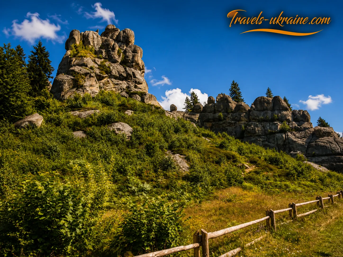
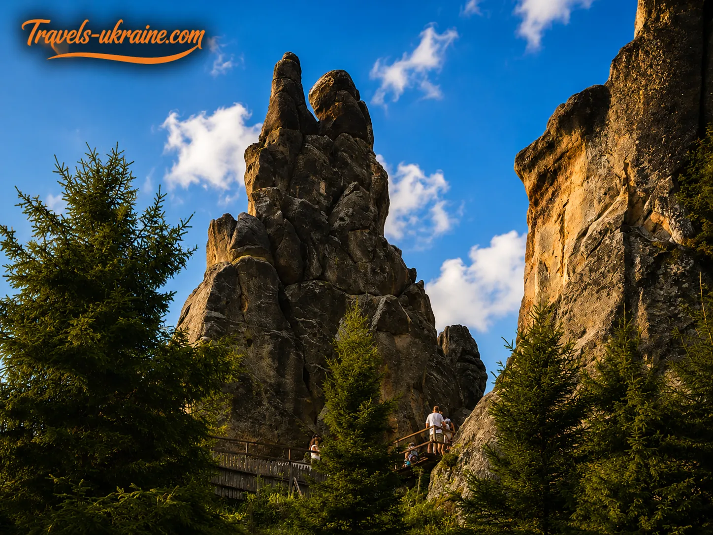
The largest and most distinctive is the Kamin rock group. Its sheer walls, natural terraces, narrow passages, and upper platforms define the present-day appearance of Tustan’s central area. Ostryi Kamin and Mala Skelia are smaller and located separately, while Zholob and the other outcrops complete the monument’s natural ensemble.
Together, these rock formations create a complex landscape of stone walls, ravines, ledges, and viewing platforms. It was precisely the character of this terrain that the medieval builders later used when constructing Tustan’s defensive complex.
Tustan Fortress Architecture: How Wooden Fortifications Were Combined with the Cliffs
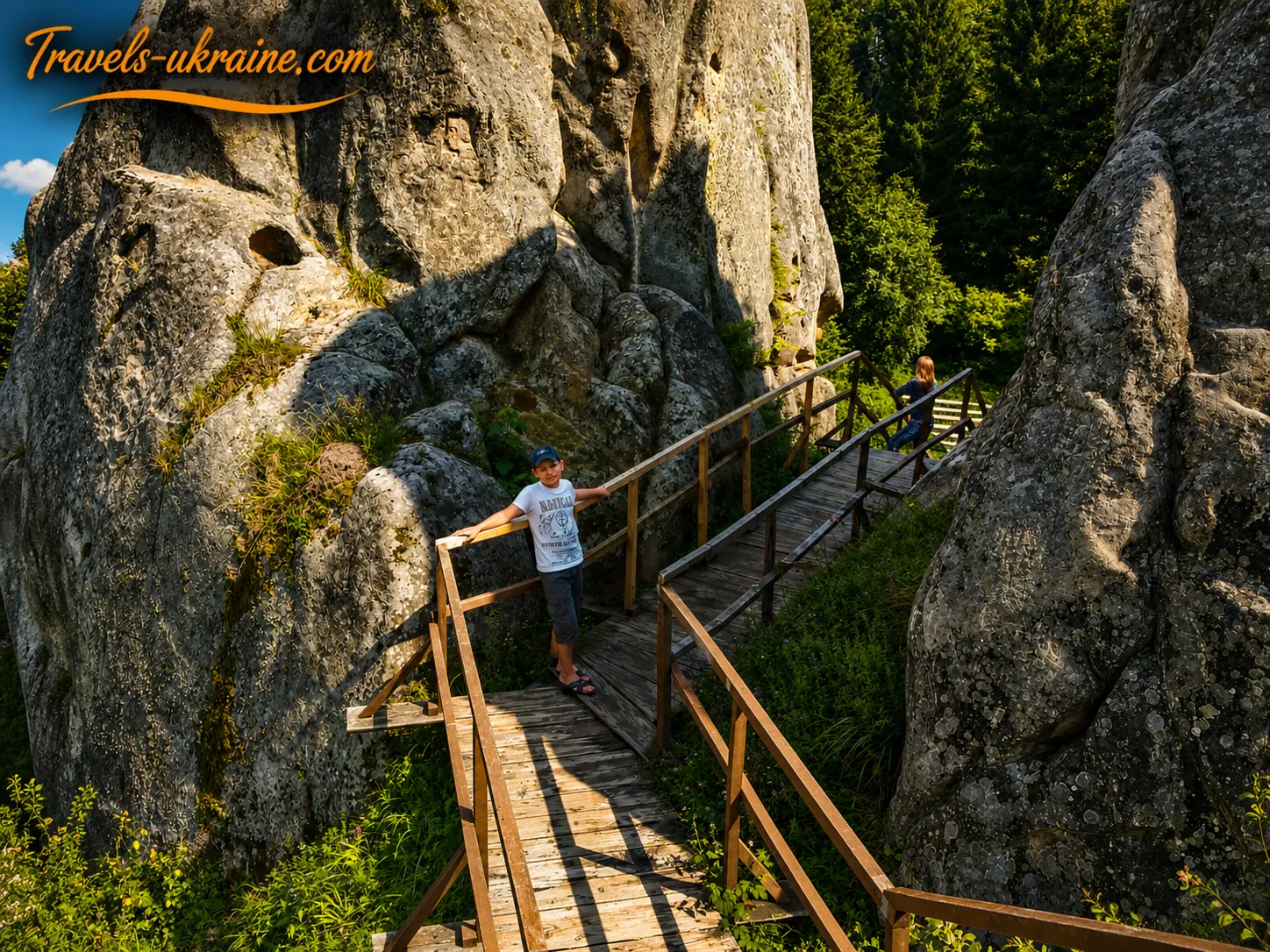
Tustan’s architecture was unusual even by medieval standards. The fortress was not built separately from the natural terrain or enclosed by a continuous stone wall, as were many European castles. Its wooden structures were adapted so closely to the shape of the Urytski Cliffs that the rock effectively became part of the building itself. Rock ledges served as natural walls and supports, while the spaces between them were filled with wooden fortifications, walkways, and rooms.
As a result, the cliffs became home not to a single watchtower but to a complex, multilevel defensive and residential complex. The wooden structures rose along vertical rock surfaces, spanned passages between the cliffs, and used the elevation of the terrain to monitor the valley. The fortress was rebuilt repeatedly, but its central architectural principle remained unchanged: the natural shape of the cliffs was not destroyed but transformed into the foundation of the fortification.
How the Urytski Cliffs Became Tustan Fortress’s Natural Walls
The medieval builders exploited the advantages of the Kamin rock group, around which the main structures were concentrated. Tall sandstone outcrops formed vertical walls, narrow passages, and hard-to-reach ledges. They made access to the fortification difficult and, in some areas, effectively replaced artificial defensive walls.
Where open gaps remained between the stone masses, wooden walls made of logs and beams were installed. Roofs, galleries, stairs, towers, and interior rooms were attached to them. In this way, separate rock ledges were united into a single defensive system, and the fortress itself appeared to grow literally out of the stone.
The natural terrain not only saved building materials but also determined the method of defense. Steep cliffs directed attackers toward a limited number of accessible passages that could be controlled from above. At the same time, from the upper levels the garrison monitored the valley, roads, and the approach of people or merchant caravans.
Grooves, Cuttings, and Holes: How Wooden Structures Were Attached to the Stone
The most valuable evidence of Tustan’s architecture has been preserved directly on the sandstone surface. It consists of thousands of artificially created grooves, cuttings, holes, ledges, steps, and leveled platforms. To an unprepared visitor, they may look like random irregularities, but their shape, depth, and placement corresponded to specific construction tasks.
Grooves generally took the form of elongated recesses into which logs or beams fitted. They helped press wooden elements tightly against the Tustan rock and prevented the structure from shifting. The direction of the grooves makes it possible to trace where individual walls and floors ran.
Cuttings were made where the end of a beam had to rest on the stone or be securely joined to it. Part of the sandstone was specially worked to create a support platform of the required shape. As a result, the wooden element did not merely touch an uneven surface but fitted into a recess prepared for it.
Holes may have been used to install the ends of beams, posts, fasteners, and other structural elements. From their height and relative position, researchers determine the levels of floors, the directions of walls, and how different parts of the structures were connected.
In some areas, the traces intersect or overlap. This indicates that the fortress was rebuilt repeatedly: old structures were dismantled, while new ones were installed higher, lower, or at a different angle. Thus, the rock surface preserved not one unchanging plan but several successive stages in Tustan’s development.
Overall, approximately four thousand traces of wooden construction have been recorded on the cliffs. A single groove reveals almost nothing about the fortress, but thousands of interconnected marks form a kind of architectural drawing that makes it possible to trace wall lines, floor levels, gallery positions, and the approximate height of the structures.
Tustan’s Multilevel Structures: Walls, Towers, Galleries, and Walkways
Scientific reconstructions present Tustan as a vertical complex in which wooden structures rose along the cliffs across several levels. Above-ground defensive walls may have reached approximately 13–15 meters, while the height of the continuous residential structures was about 17.5 meters. Together with the natural height of the cliffs, this created a powerful vertical structure visible from a great distance.
Gaps between the rock ledges were spanned by wooden walls. Defensive galleries—protected walkways from which the garrison watched the approaches and defended the most vulnerable areas—may have run above them. Towers strengthened control over entrances, roads, and the area in front of the outer fortifications.
Different levels were connected by wooden stairs, walkways, and galleries. Some steps and ledges were cut directly into the rock. This enabled the fortress’s inhabitants to move between separate parts of the stone massif without having to descend to the foot each time.
The interior structures had to support not only defense but also the garrison’s daily life. Based on archaeological materials and the nature of the structures, researchers believe that the complex included residential, хозяйственные, and service rooms, as well as spaces for storing supplies, preparing food, and carrying out craftwork. However, it is impossible to establish the exact purpose of every room, so detailed plans of the interior remain scientifically grounded reconstructions.
In the later stages of its existence, Tustan was no longer exclusively wooden. Archaeological finds indicate the use of stone elements, so the final periods in the complex’s development are described as wooden-and-stone. This shows that the fortress architecture was constantly changing and adapting to new needs and methods of defense.
Entrances and Defensive Lines of Tustan Fortress
Tustan’s impregnability depended not only on the height of the Urytski Cliffs. Access to the central area was controlled by a system of successive fortifications that included natural obstacles, earthworks, wooden walls, gates, and narrow passages between the rock masses.
Researchers identify three defensive lines protecting the main fortified area. If attackers managed to overcome the outer obstacle, they found themselves facing the next line. Narrow passages prevented large numbers of people from advancing simultaneously, while defenders could control movement below from higher galleries and platforms.
The fortress architecture did more than complement the natural terrain. It forced attackers to move along precisely those routes that were easiest for the garrison to control. This combination of cliffs, wooden fortifications, and a carefully designed system of entrances was one of Tustan’s principal defensive advantages.
The Well, Cisterns, and Water Supplies at Tustan Fortress
One of the most difficult tasks for any hilltop fortification was securing a water supply. During a siege, defenders could not freely descend to the stream, so they established their own water-supply system inside the fortress.
A well has survived on the complex’s grounds, with researchers estimating its depth at approximately 35 meters. In addition, two cisterns were carved into the stone to collect water. Rainwater from roofs and wooden platforms may have flowed into them. Such reservoirs provided the garrison with an additional supply in the event that outside water sources were cut off for an extended period.
The well and cisterns show that Tustan was designed not as a temporary watch post but as a fortified complex capable of existing autonomously for some time. It had to accommodate people, store provisions, and sustain daily life, not merely support observation.
How Travelers and Researchers Saw the Urytski Cliffs
None of the known travelers of the modern era could see Tustan with its wooden towers, walls, and galleries. By the time the first detailed descriptions appeared, the structures had long since disappeared, leaving only cliffs, artificial recesses, steps, grottoes, and numerous traces of structural fastenings amid the forest. Consequently, early authors were less concerned with describing the fortress’s actual appearance than with trying to understand the origin of the unusual marks in the stone.
One of the first people to describe the Urych Rocks in detail was Ivan Vahylevych in his essay «Berdy in Urych,» published in 1843. His text combined observations of nature, descriptions of the rock formations, and local legends. In particular, he recorded a legend about a giant who supposedly ordered evil spirits to forge a stone palace in the rocks.
Such a legend cannot serve as a historical source about the fortress’s architecture, but it clearly shows how local residents explained the origin of the grottoes, stairs, and worked stone surfaces at a time when the site’s actual purpose had already been forgotten.
In the summer of 1884, Ivan Franko visited Urych together with participants in a Ukrainian-Ruthenian student journey. He conveyed the man-made traces he saw among the rocks in the following lines:
«And in Urych, stone, with chambers forged within,
Gates and cellars, too;
Whether a giants’ or robbers’ house,
No one knows at all.»
These words convey the impression of someone who had seen complex structures cut into the rock but did not yet have a scientific explanation for their origin. At the same time, Franko viewed earlier interpretations critically, noting that researchers often first developed their own theory and then paid attention only to those elements of the site that confirmed it. He believed that the Urych Rocks could be understood only through detailed archaeological study.
At the beginning of the 20th century, research gradually shifted from romantic descriptions to scientific documentation. In 1900, archaeologist Volodymyr Demetrykevych surveyed the Urych Rocks, photographed the artificial grottoes, and recorded remains associated with an ancient castle. His photographs are important not because they show a wooden fortress, but because they document the condition of the site before modern visitor infrastructure and large-scale archaeological work.
By 1938, archaeologist Yaroslav Pasternak was already characterizing Tustan as a rare monument of the princely era—the remains of a rock castle. Even then, however, researchers still lacked a complete spatial model of the settlement and could not confidently explain how the thousands of individual slots, holes, and cut platforms were interconnected.
Why Tustan’s architecture could be reconstructed in such detail
Wooden fortresses rarely leave behind enough material for a three-dimensional reconstruction. Archaeologists usually find traces of foundations, postholes, charred wood, and individual objects. Such finds can reveal a building’s general layout, but determining its height and the appearance of its upper levels is much more difficult.
Tustan was an exception because a significant part of its wooden structures stood against vertical cliffs. After the walls and roofing collapsed, the stone preserved the points where they had been attached. Horizontal rows of slots help determine the levels of the beams, vertical systems of cuttings indicate the directions of the walls, and angled traces may point to roof elements or structural reinforcements.
The decisive stage of the research began in 1971, when systematic architectural and archaeological surveys were first recorded on paper. Instead of imagining the fortress solely from legends or the general appearance of the rocks, researchers began documenting the position, shape, and dimensions of every slot, cutting, and opening.
A single trace revealed almost nothing about the architecture, but thousands of measurements plotted on precise plans gradually formed the lines of beams, floors, walls, and passageways. If several openings were located at the same level, they might indicate the position of a beam. Vertical rows of fastenings helped determine the boundaries of the floors, while angled traces suggested a possible roof structure or structural reinforcement.
The results of archaeological excavations were added to the rock surveys. Fragments of beams, boards, shingles, wooden wedges, post structures, ceramics, metal and leather items, glass, and other objects were found on the territory of Tustan. They helped date individual stages in the complex’s existence and better understand medieval construction technologies.
However, modern images of Tustan should not be viewed as an exact photograph of the past. The positions of many beams, walls, and structural levels are supported by physical evidence, but the form of some roofs, the exterior appearance of the façades, the purpose of certain rooms, and decorative details remain the result of scholarly reconstruction.
It is precisely the combination of cliffs, thousands of traces cut into the rock, archaeological materials, and preserved fragments of wooden structures that makes Tustan unique. It has been possible to reconstruct not only the fortification’s ground-level plan but also its vertical structure. The stone preserved a distinctive imprint of long-vanished architecture—and thanks to this, we can now imagine towers, walls, and multi-level galleries of a medieval fortress rising above the Carpathian valley.
Key historical and scholarly sources: Ivan Vahylevych, “Berdy in Urych”; materials from the 1884 Ukrainian-Ruthenian student journey and Ivan Franko’s poem “Bubnyshche”; studies by Volodymyr Demetrykevych, Yaroslav Pasternak, and Mykhailo Rozhko; archaeological materials from the Tustan State Historical and Cultural Reserve.
Photo and Video Gallery


Tustan and the Urych Rocks: A Brief Guide for Tourists
A trip to Tustan combines a walk through a natural area, an introduction to medieval history, and visits to museum exhibitions. This is not a difficult mountain hike, but the main route follows uneven paths, wooden stairs, and sections with a noticeable incline. Comfortable footwear is therefore recommended, and it is best not to plan a rushed visit.
- Location type: historical and cultural reserve, archaeological site, natural rock complex, and open-air museum space.
- Recommended visit duration: approximately 3–4 hours to see the main route, the Tustan Museum, and the «House in Hlubokyi» Local History Center.
- Short visit: about 1.5–2 hours if limited to a walk around the rocks, a climb to the viewing platforms, and an examination of the fortress remains.
- Route difficulty: easy to moderate for someone with average physical fitness; after rain, the rocks, stairs, and unpaved sections may be slippery.
- Accessibility: the lower part of the complex and the museum sites are more accessible than the upper platforms. The climb to the citadel leads over stairs and uneven ground.
- Suitable for: families with children, couples, history enthusiasts, photographers, and travelers looking for an easy route in the Carpathians.
How much does it cost to visit the Tustan Reserve?
Ticket prices may change, so before your trip, check the current prices on the reserve’s official website or through an online ticketing service.
One ticket provides access to the reserve grounds, the Tustan Museum, and the «House in Hlubokyi» Local History Center. For a typical independent trip, the main expenses are therefore admission, transportation, food, and personal costs. Guided tours can be booked separately, which is especially useful for those who want to learn to distinguish the slots cut into the rock and better understand the structure of the lost fortress.
How much time should you plan for Tustan?
For a first introduction to the site, it is best to set aside at least half a day. In 3–4 hours, you can comfortably follow the marked route around the Kamin rock group, climb to the citadel, see the well, visit the museum, and walk through the village of Urych. If you add a guided tour, lunch, photography, and time to relax at the viewing platforms, the visit can easily extend to 5–6 hours.
Families with young children, older travelers, and people unaccustomed to climbs should allow extra time. There is no need to move quickly along the route: Tustan’s greatest value reveals itself through careful observation of the rocks, traces of the wooden structures, and the panorama of the Carpathian valley.
Important: prices, seasonal opening hours, and tour arrangements may change. Before your trip, check the current information on the reserve’s official website.
Interesting Facts and Legends of Tustan: What the Urych Rocks Conceal
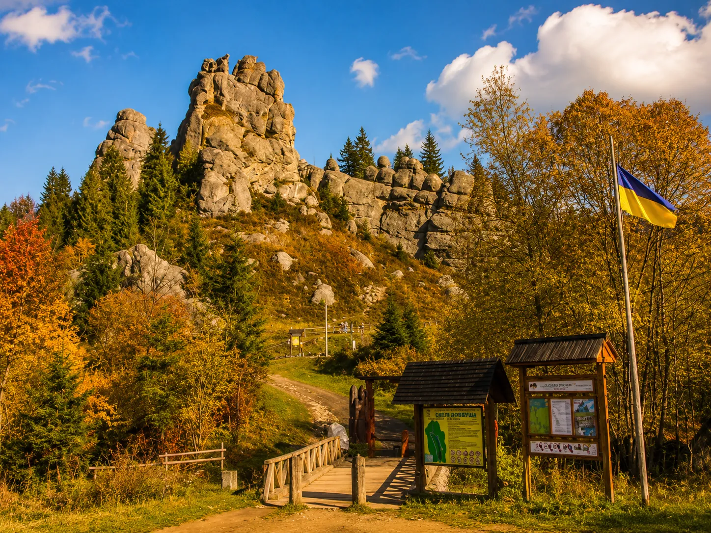
Tustan is surrounded by legends no less than any ancient Carpathian fortress. The unusual shape of the rocks, caves, marks carved into the stone, and near-total disappearance of the wooden structures have left room for the imagination of many generations. Some stories arose as attempts to explain the fortress’s name; others are connected with springs, hidden treasures, or mysterious images on the stone.
However, it is important to distinguish Tustan’s legends from the findings of archaeological and linguistic research. A folk tradition may preserve a memory of a place’s ancient function, but it does not always reproduce historical events literally. It is precisely the combination of fact and folklore that makes the Urych Rocks especially fascinating: here, visitors can see traces of a medieval fortress while also hearing stories passed down by local residents for centuries.
What does the name «Tustan» mean?
The best-known folk explanation connects the fortress’s name with the words «stand here». According to the legend, guards used this phrase to stop merchants traveling along the Carpathian trade route. Travelers had to show their goods, pay a toll, and only then continue on their way. This version fits well with Tustan’s role as a customs and control point, so it was easy to remember and became part of the local tradition.
Interestingly, this interpretation is not a modern tourist invention. The Polish historian Stanisław Sarnicki recorded the folk etymology connected with the phrase «to stand here» as early as 1585. Linguists, however, consider another version more likely: the name may have come from the ancient personal name Tustan. It is interpreted as meaning «strong,» «sturdy,» «brave,» or «determined.»
Rock Art and Mysterious Signs of Tustan
In addition to construction slots and cuttings, the Urych Rocks preserve rock images from different periods. Researchers have described crosses, axes, geometric signs, depictions of animals and a horseman, and other figures among them. Some of these images were discovered during archaeological surveys; others had been known to local residents and travelers much earlier.
The first written reports about the unusual images and natural forms of the Urych Rocks appeared as early as the 19th century. Ivan Vahylevych, one of the members of the «Ruthenian Triad,» wrote about them in particular. In the decades that followed, researchers continued to record new drawings, inscriptions, and symbols dating from various historical periods.
These signs must be interpreted cautiously. Not every depression in the stone is a petroglyph created by humans: some forms may have arisen naturally through the weathering of sandstone. Moreover, even unquestionably man-made images cannot always be dated precisely. Ancient symbols, signs, crosses, coats of arms, and much later inscriptions from the 19th–20th centuries coexist on the rocks.
For this reason, claims about a «secret sanctuary,» an «ancient observatory,» or an unequivocally ritual meaning for all the symbols remain conjectural. The scholarly value of the rock images lies primarily in the fact that they testify to the long-standing presence of people near the cliffs and to the different ways this place was perceived over the centuries.
Archaeological Finds That Tell the Story of Life at Tustan Fortress
The most interesting facts about Tustan concern more than defense alone. Archaeological finds show that everyday life existed behind the wooden walls: people prepared food, repaired structures, stored supplies, and used vessels, weapons, tools, and personal belongings.
During excavations, fragments of wooden structures, shingles, laths, wedges, and dowels used to join individual building elements were found. The damp environment in some depressions helped preserve organic materials that usually almost completely disappear at medieval sites.
Notable finds include a wooden vessel, an encolpion cross, weapons components, metal objects, fragments of glass, leather, pottery, and stove tiles. An encolpion cross was a small hinged reliquary worn on the chest and possibly used to store a fragment of a sacred relic. Such objects help researchers understand not only the fortress’s military organization but also the spiritual and everyday life of its inhabitants.
Even ordinary pottery fragments, nails, and building elements are important. Their find locations can reveal the functions of particular areas, the approximate time when structures were rebuilt, and the nature of Tustan’s connections with other regions. Some of the finds are now displayed at the Tustan Museum in the village of Urych.
The Legend of the Living and Dead Water Near Tustan
One local tale is connected with two springs near the hillfort. According to the legend, one has «dead» water, supposedly capable of healing wounds and restoring the body, while the other has «living» water that can return a person’s strength and youth. The image of living and dead water is well known in Ukrainian folklore, so over time it became part of Urych’s oral tradition.
Local tales also connect the springs with Ivan Franko: it is said that the writer came here and washed his eyes with the water. There is no reliable documentary evidence of this particular treatment, so the story should be regarded as a local legend rather than an established fact from Franko’s biography.
What Studies Revealed About Water from a Spring in Urych
Scientists studied water from one of Urych’s popular springs. According to a published hydrochemical analysis, it is fresh water of the magnesium-calcium bicarbonate type and has low mineralization—approximately 0.28 g/dm³. At the time the samples were collected, the water met the standards for the sanitary and chemical indicators tested.
At the same time, these results do not confirm that the water can rejuvenate, treat diseases, or heal wounds. Moreover, the analysis describes the condition of the spring only at the time of the study: the chemical and microbiological composition of natural water can change under the influence of precipitation, seasonality, and the condition of the surrounding area. Therefore, the springs near Tustan are better understood as part of Urych’s natural and folkloric heritage, not as a proven medicinal remedy.
Where the Facts of Tustan’s History End and Legends Begin
Tustan’s true history needs no exaggeration. Archaeological materials confirm the existence of a complex rock fortress, a customs post, multilevel wooden buildings, and a settlement at its foot. Grooves carved into the rock, remains of walls, a well, cisterns, and household objects are tangible evidence of the past.
Legends have a different value. They show how people explained the unusual rocks, ancient symbols, springs, and the fortress’s very name after the wooden structures had disappeared. Tales should therefore not be dismissed but presented appropriately—as part of Urych’s cultural memory, complementing rather than replacing scholarly knowledge about Tustan.
The «Tu Stan!» Festival and Cultural Events Near the Tustan Rocks
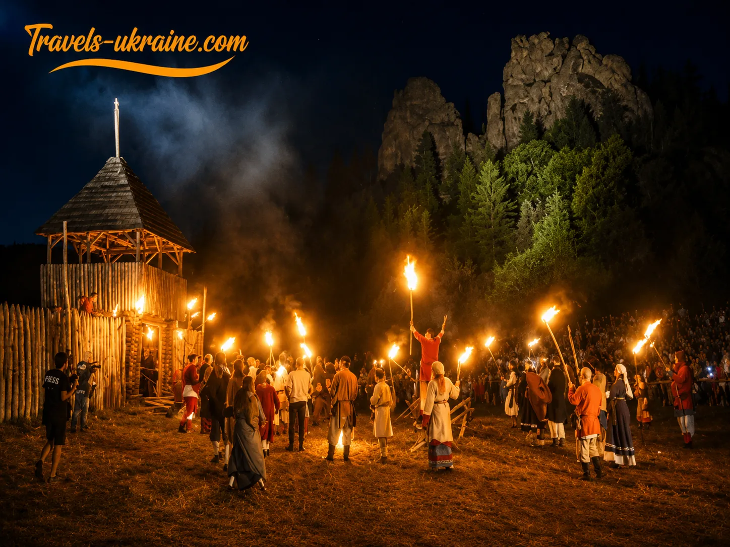
For most of the year, Tustan remains a peaceful historical destination amid the Carpathian forests. In summer, however, the area near the Urych Rocks becomes a living-history venue where visitors can see medieval crafts, military exercises, everyday scenes, and reconstructions of past events. The reserve’s best-known event is the «Tu Stan!» Festival of Ukrainian Medieval Culture.
What makes it distinctive is that history here is not confined to museum display cases or theatrical sets. Reenactors recreate clothing, weapons, craft tools, and household items based on archaeological materials, written sources, and studies of medieval culture. As a result, visitors can not only hear about Tustan Fortress but also see what everyday life, warfare, and crafts might have looked like several centuries ago.
The festival began in 2006. It was created to promote the Ukrainian Middle Ages and draw attention to the unique rock fortress in Urych. Over time, the event brought together historians, museum professionals, reenactors, traditional craftspeople, musicians, and volunteers from various regions of Ukraine.
The name «Tu Stan!» simultaneously refers to the folk explanation of the fortress’s name and sounds like an invitation to stop by the rocks and take a closer look at the past. Over the years, the event has become one of Ukraine’s best-known historical reenactment festivals and an important part of the cultural life of Urych village.
The organizers aim to present not an abstract «European Middle Ages», but the history of Ukrainian lands within the broader context of contemporary Europe. Participants recreate elements of warfare, clothing, music, crafts, and daily life from different periods, explaining the sources on which their reconstructions are based.
What You Can See at the Festival Near the Urych Rocks
The program changes every year, but its foundation usually remains historical reenactment. Camps, craft workshops, market stalls, and areas for demonstrations are set up at the foot of the rocks. Visitors can watch duels, military exercises, and a reenactment of an assault on the fortress.
The everyday-life component is no less important. Craftspeople demonstrate working with wood, clay, metal, leather, and fabric, explain the features of historical clothing, and show how objects were made without modern equipment. Some activities allow guests to try traditional crafts, medieval dances, or other historical practices.
In different years, the festival program has included:
- knightly duels, military demonstrations, and a reenactment of an assault on the fortification;
- workshops in pottery, blacksmithing, weaving, woodworking, and other crafts;
- tours of the reserve and explanations of the fortress’s architecture;
- lectures, historical discussions, and demonstrations of archaeological reconstructions;
- performances by musicians, theatrical productions, and introductions to ancient instruments;
- a fair featuring craftspeople’s products and Ukrainian cuisine.
Separate activities related to history, crafts, and games are usually arranged for children. However, because of the large crowds, loud performances, and uneven terrain, parents should keep a close eye on young children, especially near paths and approaches to the rocks.
How Events at Tustan Changed After 2022
After Russia’s full-scale invasion of Ukraine began, the usual festival format was temporarily changed. Instead of a large entertainment festival, the reserve held historical reenactment and living-history camps. The program focused on education, research into the past, crafts, historical experiments, and interaction with reenactors.
In 2025, such a camp took place from August 1–3. Participants demonstrated warfare and crafts and held lectures, duels, assaults, and historical experiments. This approach preserved the tradition of gatherings near the rocks while shifting the main focus away from mass entertainment and toward a meaningful introduction to Ukrainian history.
In 2026, the organizers announced the return of the festival format. The event, titled «Tu Stan. The Hero’s Path», is scheduled for July 31–August 2. The program is to include historical reconstructions of the High and Late Middle Ages, knightly combat, craft workshops, literary meetings, discussions, and theatrical and musical performances.
How to Plan a Trip to the «Tu Stan!» Festival
Festival days differ considerably from an ordinary visit to the reserve. During this period, many more tourists come to Urych, increasing pressure on roads, parking areas, restaurants, and accommodation. Those planning to stay for several days should book a guesthouse in Urych, Skhidnytsia, or nearby settlements in advance.
A festival ticket may differ in price and conditions from a regular admission ticket to the reserve. Before traveling, check the program, admission price, tent-camping rules, parking availability, and possible changes related to the security situation separately.
For a more relaxed visit to the rocks and museum exhibitions, it is better to arrive before the main program begins or stay for an extra day. During the busiest events, it is harder to examine the grooves in the rocks carefully, follow the route without rushing, and experience the quiet of the Carpathian landscape. The festival, by contrast, offers a different experience—it lets visitors see Tustan not only as an archaeological site, but as a space where history once again fills with voices, movement, and living traditions.
Important: The event’s name, dates, program, and visitor rules may change. Before traveling, check the latest announcements from the reserve and the festival’s official pages.
The Urych Rocks on Screen: From «Zahar Berkut» to Music Videos
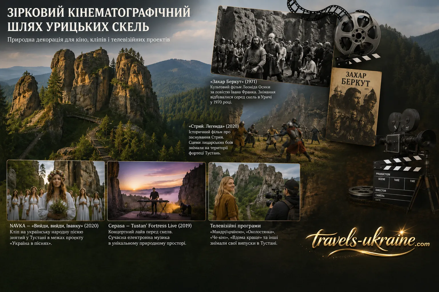
Steep stone walls, narrow passages, natural terraces, and dense Carpathian forests have made the Tustan Rocks appealing not only to tourists and researchers. Over the years, this landscape has served as a natural setting for feature films, music videos, concert videos, and television programs. The rocky complex easily changes its character on screen: in historical films, it resembles an impregnable medieval stronghold, while in contemporary music productions it creates an atmosphere of space, strength, and connection with the past.
Tustan’s screen history is especially interesting because filmmakers have rarely needed artificial sets. The massive sandstone outcrops already create a striking stage, while traces of the ancient settlement add historical authenticity. As a result, the rocks near Urych village have become a recognizable location where the natural landscape and cultural heritage work together.
The Urych Rocks in the 1971 Film «Zahar Berkut»
The best-known chapter in Urych’s cinematic history is the filming of the feature film «Zahar Berkut», directed by Leonid Osyka. The film was produced at the O. Dovzhenko Kyiv Film Studio from a screenplay by Dmytro Pavlychko and based on Ivan Franko’s novella of the same name. Released in 1971, it became one of the notable works of Ukrainian poetic cinema.
The rocks were one of the film’s on-location sites. Their sheer walls, passages, and forested slopes suited the depiction of the Carpathians in the XIII century, where the story of a community’s struggle against a Mongol army unfolds. Archival photographs from the set preserve images of actors, mass-scene participants, and residents of Urych village who happened to be near the film crew.
Today, these photographs have a dual value. They tell not only the story of the creation of a renowned film but also show what the Urych Rocks and the village itself looked like more than half a century ago. By comparing the old photographs with present-day views, visitors can recognize the stone walls and passages that became the film’s natural backdrop.
At the same time, it would be incorrect to claim that all of «Zahar Berkut» was filmed in Urych. Tustan was one of several on-location sites used for the large-scale production. Nevertheless, the film’s connection with the Urych Rocks has left a significant mark on local memory and become an important part of the village’s cultural history.
«Stryi. Legend»: The Return of Knightly Cinema to Tustan
Almost half a century later, a medieval atmosphere returned to the rocks during the production of the historical film «Stryi. Legend». Filming began on July 30, 2020, with the grounds of Tustan Fortress serving as the first location. It was here that the film crew worked on scenes of knightly battles.
The film is set in the mid-14th century and is linked to the legendary history of Stryi’s founding. The idea was conceived by Yurii Komarnytskyi, and the director was Oleksandr Korol. In addition to Tustan, the film was shot in Lviv, Nah uyevychi, and other locations across the Lviv region.
The Urych Rocks provided an especially fitting backdrop for the knightly scenes. The natural stone walls created the feeling of a genuine medieval fortification, while the open space at the foot of the rocks allowed the crew to work with battle participants, historical costumes, and props. In this case, Tustan once again appeared on screen not merely as a picturesque landscape, but as a fully fledged part of the historical setting.
Music Videos and Concert Films Among the Rocks of Tustan
The Urych Rocks attract more than just historical filmmakers. In 2020, singer NAVKA released a video for the Ukrainian folk spring song «Vyidi, vyidi, Ivanku», filmed at Tustan as part of the «Ukraine in Songs» project. The stone walls, wooden walkways, and Carpathian landscape formed a natural backdrop for a contemporary interpretation of the folk song.
The combination of a folk melody with an ancient fortress was no coincidence. Tustan on screen highlights the connection between contemporary Ukrainian culture and its historical roots. The video became both a musical work and a visual story about one of the Lviv region’s most distinctive tourist landmarks.
Ukrainian electronic musician Cepasa presented a different format. A concert video, «Tustan’ Fortress Live», was recorded among the rocks for the EVE8 music channel. The recording was later released as a separate concert album featuring ten tracks. Unlike a narrative music video, this production turned Tustan into an intimate open-air stage where contemporary electronic music interacted with natural acoustics and the monumental rocky landscape.
Tustan on Television Programs
Tustan’s screen presence is not limited to feature films and music productions. Episodes of Ukrainian television programs have also been filmed on the reserve’s grounds. These include «LeMarshrutka» with Lesia Nikitiuk, «The Bachelorette,» «Che-kin,» and the travel project «Home Is Better».
The formats of these programs varied, ranging from entertaining travel shows and a romantic series to travel features about Ukraine. In each case, however, the Urych Rocks served as a recognizable visual location capable of immediately conveying the atmosphere of the Carpathians. Television filming helped introduce Tustan to a broad audience and strengthened interest in it as a travel destination.
What to See and Do at Tustan and Around the Urych Rocks
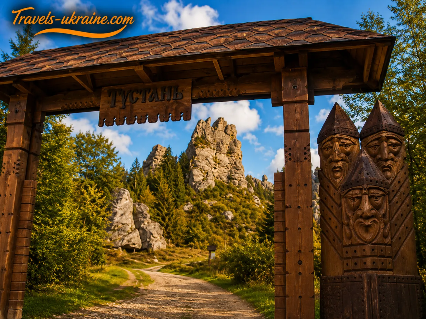
Tustan should be viewed not as a single observation point, but as an entire tourist area. The main program includes a route around the Kamin rock group, a climb to the inner bailey, an examination of traces of medieval construction, a visit to the Tustan Museum, and an introduction to the history of Urych village at the «Khata u Hlubokim» Local History Center.
For a first visit, it is best to take your time. Some details on the rocks do not immediately attract attention, yet they are precisely what help reveal the fortress’s true scale. A narrow groove in the stone may have held a wooden beam, a natural terrace may have served as the foundation for a room, and an ordinary-looking passage may have formed part of the internal connection between levels of the fortification.
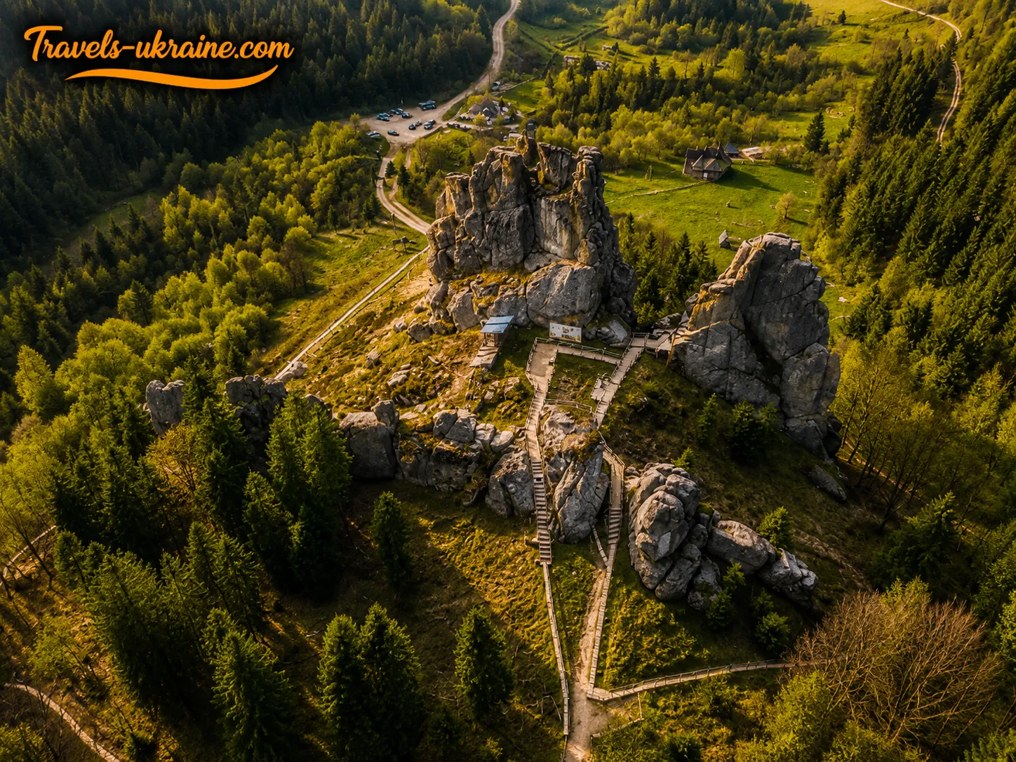
Exploration of the landmark begins at the Kamin rock group, the central part of the former fortress. The marked route runs around the massif and leads to areas where the natural walls, terraces, caves, passages, and traces of wooden structures are most clearly visible.
During the walk, do not just look at the rocks’ overall shape; examine their surface closely as well. Thousands of grooves, cuttings, and holes have survived here, allowing researchers to reconstruct the positions of walls, ceilings, galleries, and towers. Without explanation, some of these traces may look like random indentations, so a guided tour of the Urych Rocks or a route description prepared in advance can greatly deepen the experience.
The trail passes through sections with wooden stairs, boardwalks, and naturally rocky surfaces. The tourist route is not a difficult mountain hike, but it does require care, especially after rain, when sandstone, tree roots, and wooden structures can be slippery.
Climb to the Inner Bailey of Tustan Fortress
One of the main points along the route is the inner bailey—the best-protected inner part of the medieval fortification built on the rocky massif. Today, fitted stairs and walkways lead there, allowing visitors to climb between the rocks and see the fortress from a different perspective.
The upper platforms offer a view of the Urych valley, the surrounding forests, and the Skole Beskids ranges. From here, it is easiest to understand why this site was chosen for construction. The defenders could watch the approaches to the fortress, traffic on the road, and the area at the foot of the rocks.
The upper part of the complex also helps visitors imagine Tustan’s vertical structure. The fortification developed across several natural levels, while wooden buildings filled the gaps between the rocks and rose above the terraces. The modern ascent does not fully replicate the medieval system of passages, but it clearly shows how complex the terrain was and how the buildings were adapted to it.
Visit the Tustan Museum in Urych Village
After exploring the rocks, be sure to visit the Tustan Museum. In the open-air area, visitors mainly see the natural massif and traces of the lost buildings, while the museum helps complete the picture with objects once used by the fortress’s inhabitants.
The exhibition features original artifacts and copies of archaeological finds discovered during research. These include fragments of pottery, building elements, metal objects, parts of weapons, jewelry, and everyday items. A 14th-century signet ring bearing an image of a bird is particularly noteworthy.
Multimedia materials, models, and reconstructions explain what the fortress looked like, how large an area it occupied, and how it changed during different construction periods. One of the halls recreates the room of a 13th-century voivode, while reconstructed 16th-century Gothic tiles help visitors imagine the interior design of Tustan’s later period.
The museum is best visited after exploring the rocks. The drawings, archaeological objects, and digital images can then easily be compared with the grooves, passages, and platforms already seen along the route.
See Tustan Fortress in Augmented Reality
Because the wooden buildings have not survived, it is difficult to imagine the fortress’s height and volume from the rocks’ present-day appearance alone. The Tustan AR mobile app helps by superimposing a three-dimensional model of the fortification onto the real rocky massif.
Viewing the digital reconstruction directly beside the Kamin rock, visitors can see how wooden towers, galleries, ceilings, and defensive structures were arranged between the natural walls. This format does not replace a guided tour, but it clearly explains the scale of the construction and shows how the architecture was connected to the terrain.
The app was created using scholarly reconstructions, a digital model of the fortress, and a photogrammetric reproduction of the rocks. It can be used not only on the reserve’s grounds, as some of the materials are also available for remote viewing. It is best to install the app before the trip, since mobile coverage in mountainous areas can be unstable.
Visit the «Khata u Hlubokim» Local History Center
Tustan cannot be fully understood without getting to know Urych village. Its traditional buildings include wooden Boiko houses, farm structures, and old wells. One of the authentic homes was restored and converted into the «Khata u Hlubokim» Local History Center.
The exhibition is no longer about the medieval fortress, but about the people who lived near the rocks in much later times. To create it, museum workers collected old photographs, household objects, and oral memories from Urych residents. As a result, the village’s history emerges not as a list of dates, but through family possessions, personal accounts, and the everyday experience of the local community.
Here, visitors can see ethnographic materials and learn about traditional daily life, crafts, community life, and the events of the 20th century. The center also hosts themed meetings and folk-craft workshops, although their schedule should be confirmed before visiting.
What to See Near Tustan: Interesting Places Around Urych Village
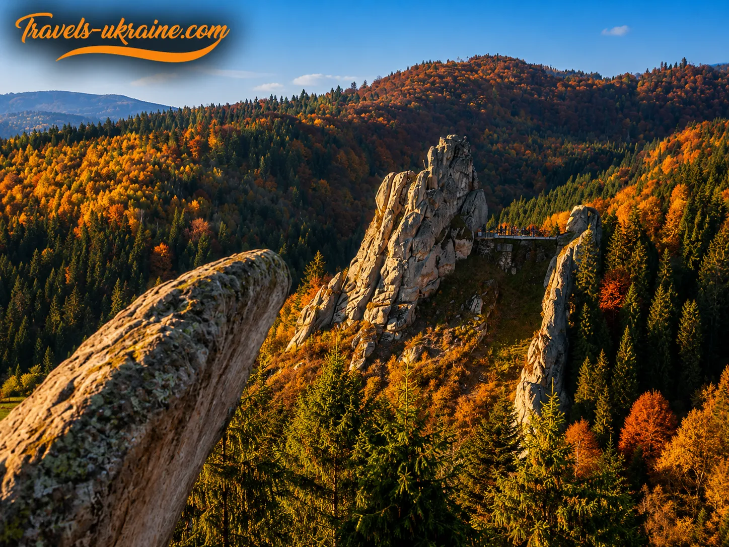
A trip to Tustan can easily become an engaging travel itinerary through the Lviv region. Near Urych village are the natural attractions of Skole Beskids National Nature Park, waterfalls, mountain lakes, and hiking trails of varying difficulty. At the same time, do not try to fit everything into one day: the Tustan rock complex deserves at least several hours of unhurried exploration.
The best option depends on the type of trip. Families with children may enjoy combining Tustan with Kamianka Waterfall. Those who prefer active recreation should set aside time for a route to Mount Parashka or Hurkalo Waterfall. Visitors planning to stay in the region for several days may find it convenient to use Urych and Skole as their bases.
Kamianka Waterfall in the Skole Beskids
One of the region’s most popular natural attractions is Kamianka Waterfall, located within the «Skole Beskids» nature park. Here, the river crosses a band of hard Yamna sandstone, causing its channel to narrow sharply and form a drop of around six meters.
A developed tourist route through the Kamianka River valley leads to the waterfall. An information and environmental station, a parking area, short-rest spots, and an observation platform operate nearby. The waterfall is at its fullest in spring, after prolonged rain, and during periods of active snowmelt.
Combining Tustan and Kamianka works well for a one-day road trip. After prolonged rainfall, however, it is worth checking the condition of the roads and hiking trails in advance, as unpaved and rocky sections may be slippery.
Zhuravlyne Lake, Also Known as the Dead Lake
Approximately half a kilometer from Kamianka Waterfall lies Zhuravlyne Lake, also known by its popular name, the Dead Lake. This small body of water is surrounded by a sphagnum bog where cranberry, cottongrass, sedge, and round-leaved sundew grow.
The name «Dead Lake» may give the false impression that there is no life in the water. In fact, national park staff report that small crustaceans, dragonfly larvae, and newts can be found here. The site’s true uniqueness lies in its wetland ecosystem and thick layer of sphagnum moss.
Stepping onto the surface of the peat bog is strictly prohibited. A quagmire lies beneath the vegetation, so visitors should remain on the designated trail. Zhuravlyne Lake should be visited not as a place for swimming or picnicking, but as a fragile protected natural site that requires especially careful treatment.
Mount Parashka for a Separate Day in the Carpathians
Those who want to take a full mountain route after exploring Tustan Fortress should consider Mount Parashka. It is one of the best-known peaks of the Skole Beskids, with several marked trails approaching it from Skole, Korostiv, and the surrounding villages.
The official «Skole — Parashka» route is about 10 kilometers long and takes approximately 4–5 hours. The national park classifies it as difficult. The trail passes through forest, emerges onto open sections of the ridge, and involves a sustained elevation gain.
Combining the ascent of Parashka with a detailed visit to Tustan in one day is not advisable. Both locations require time and physical energy, so it is better to leave the mountain hike for the following day. Before setting out, check the weather forecast, trail conditions, and length of daylight, and let someone know your planned route.
Hurкalo Waterfall near the Village of Korchyn
Another option for an active walk is Hurкalo Waterfall on the Velyka Richka River near the village of Korchyn. The official tourist trail from the upper part of the village to the waterfall follows the river valley and a forest road. The distance to the site is about five kilometers each way.
Hurкalo is particularly impressive after rainfall, when the river becomes fuller. During dry periods, the flow may be much gentler. The road to the waterfall is less developed than the route near Kamianka, so you should wear comfortable footwear, bring enough drinking water, and allow sufficient time for the return journey.
After heavy rain, crossings and forest roads may become difficult. Before setting out, it is advisable to check the latest notices from the Skole Beskids National Nature Park and avoid taking shortcuts through unmarked areas.
How to Plan a One- or Multi-Day Route near Tustan
For a short trip, the most convenient option is to choose one additional location nearby. This keeps the itinerary full without turning it into a series of constant drives between points.
- Relaxed one-day route: Tustan — a walk through the village of Urych.
- Nature-focused one-day route: Tustan — Kamianka Waterfall — Zhuravlyne Lake.
- Two-day route: day one — Tustan; day two — Kamianka, Zhuravlyne Lake, and Skole.
- Active two-day route: day one — the Tustan Rocks; day two — Mount Parashka or Hurкalo Waterfall.
When planning several locations, consider not only the distance on the map but also the quality of mountain roads, the weather, the duration of hikes, and the opening hours of tourist attractions. In the Carpathians, a short drive in terms of distance can sometimes take longer than expected, so it is advisable to allow at least an extra one or two hours in the itinerary.
The greatest value of traveling around Tustan is the variety of experiences. In one or two days, you can see a medieval rock fortress, walk through a mountain river valley, visit a waterfall, see a peat lake, and relax in nature. The key is not to rush and to choose a route suited to the weather, your fitness level, and the composition of your group.
Rules for Visiting Tustan and the Urych Rocks

The Tustan Rocks are an archaeological site, a natural rock complex, and part of the village of Urych. Following a few simple rules helps preserve the traces of the medieval fortress, the sandstone rocks, and the surrounding nature. Remember that grooves, steps, and recesses remain on the rock surfaces, enabling researchers to reconstruct the structure of the ancient fortress. Do not leave inscriptions, chip away at the stone, damage the recesses, or use them as handholds when climbing.
Use the marked trails, stairs, walkways, and viewing platforms. Do not climb over fences or take shortcuts across the slopes. Restricted areas may be dangerous or require special protection. A photograph is not worth stepping beyond a barrier, climbing onto unstable rocks, or blocking narrow passages for other visitors.
Do not pick plants, break branches, disturb animals, or create excessive noise. Take all rubbish, including food scraps, with you or dispose of it in a designated bin. Fires may be lit only in specially equipped areas. In dry weather, even a small fire or an unextinguished cigarette butt can cause a forest fire.
Urych is a residential village, not merely a tourist attraction. Do not enter private yards without permission, photograph people at close range without their consent, or leave cars by gates or on private driveways. The main principle of visiting Tustan is simple: after your trip, the rocks, nature, and reserve grounds should remain as you found them.
Safety on the Urych Rocks: What Tourists Need to Know
The route through the Urych Rocks does not require special mountaineering skills, but it crosses uneven rocky sections, stairs, and walkways near cliffs. Wet rocks, slippery steps, rushing, and attempts to leave the developed route pose the greatest risks. Accordingly, closed-toe footwear with non-slip soles is best for the walk. Sandals, heeled shoes, or smooth-soled city sneakers are less safe, especially after rain.
Check the weather forecast before your trip. During a downpour, fog, wet snow, or icy conditions, stone surfaces and wooden walkways become slippery. If a storm begins, do not remain on exposed upper platforms and follow the instructions of reserve staff.
At viewing areas, keep a safe distance from cliffs, do not climb over fences, and do not step onto ledges for a photograph. Sandstone can crumble, and the surface near an edge is not always stable. Do not keep looking at your phone or filming while walking. For photography, it is better to stop in a safe place first and only then take out your camera.
Children must be kept in sight at all times on the stairs and upper platforms. It is best to hold a small child by the hand and not allow them to run among visitors, approach the edge, or descend steep sections alone. A stroller is suitable here only for the lower part of the tourist area. It is inconvenient for climbing the rocks because of the stairs, uneven surfaces, and considerable changes in elevation.
When to Postpone the Ascent
You should skip the upper section of the route during a heavy downpour, thunderstorm, dense fog, icy conditions, or strong winds. You should also not continue climbing the Urych rock massif if you feel dizzy, weak, or extremely tired.
People with balance disorders or musculoskeletal or cardiovascular conditions should assess their abilities in advance. You can also learn about Tustan’s history at the museum and through the three-dimensional reconstruction of the fortress.
Frequently Asked Questions about Tustan and the Urych Rocks
Where are Tustan and the Urych Rocks located?
Tustan Fortress and the Urych Rocks are located near the village of Urych in Stryi Raion, Lviv Oblast. You can reach the reserve by car, taxi, or local bus.
How do you get to Tustan Fortress?
The most convenient option is to drive through Pidhorodtsi to the village of Urych. A tourist area has been established near the entrance to the reserve. Some bus services also run to Urych, but their schedules should be checked before the trip, especially the departure time of the last return bus.
Do you need to buy a ticket to visit Tustan?
Yes, admission to the main grounds of the Tustan State Historical and Cultural Reserve is paid. Before your trip, check the current ticket prices, concessions, opening hours, and guided-tour arrangements on the reserve’s official website.
How much time is needed to see Tustan?
Allow approximately two hours for a short walk around the Urych Rocks. For a full experience of the site, including the viewing platforms, the Tustan Museum, and the «Khata u Hlubokim» Local History Center, it is better to plan half a day.
How difficult is the route to the Urych Rocks?
The main tourist route does not require mountaineering skills, but it includes climbs, stairs, wooden walkways, and uneven rocky sections. After rain or snow, or in icy conditions, surfaces become slippery, so closed-toe footwear with textured soles is required.
Is Tustan suitable for a trip with children?
Yes, Tustan is an interesting destination for a family trip, especially if you visit the museum or use the three-dimensional reconstruction of the fortress before your walk. Children must be supervised constantly on stairs, walkways, and upper platforms. A stroller is mainly convenient in the lower part of the tourist area.
Has the medieval Tustan Fortress survived?
The wooden structures of the fortress have not survived to the present day. Thousands of grooves, holes, steps, and recesses remain in the rocks, where wooden structures were once attached. Based on these traces, archaeological finds, and research results, scholars reconstructed the appearance of the multi-level rock fortress.
When is the best time to visit the Urych Rocks?
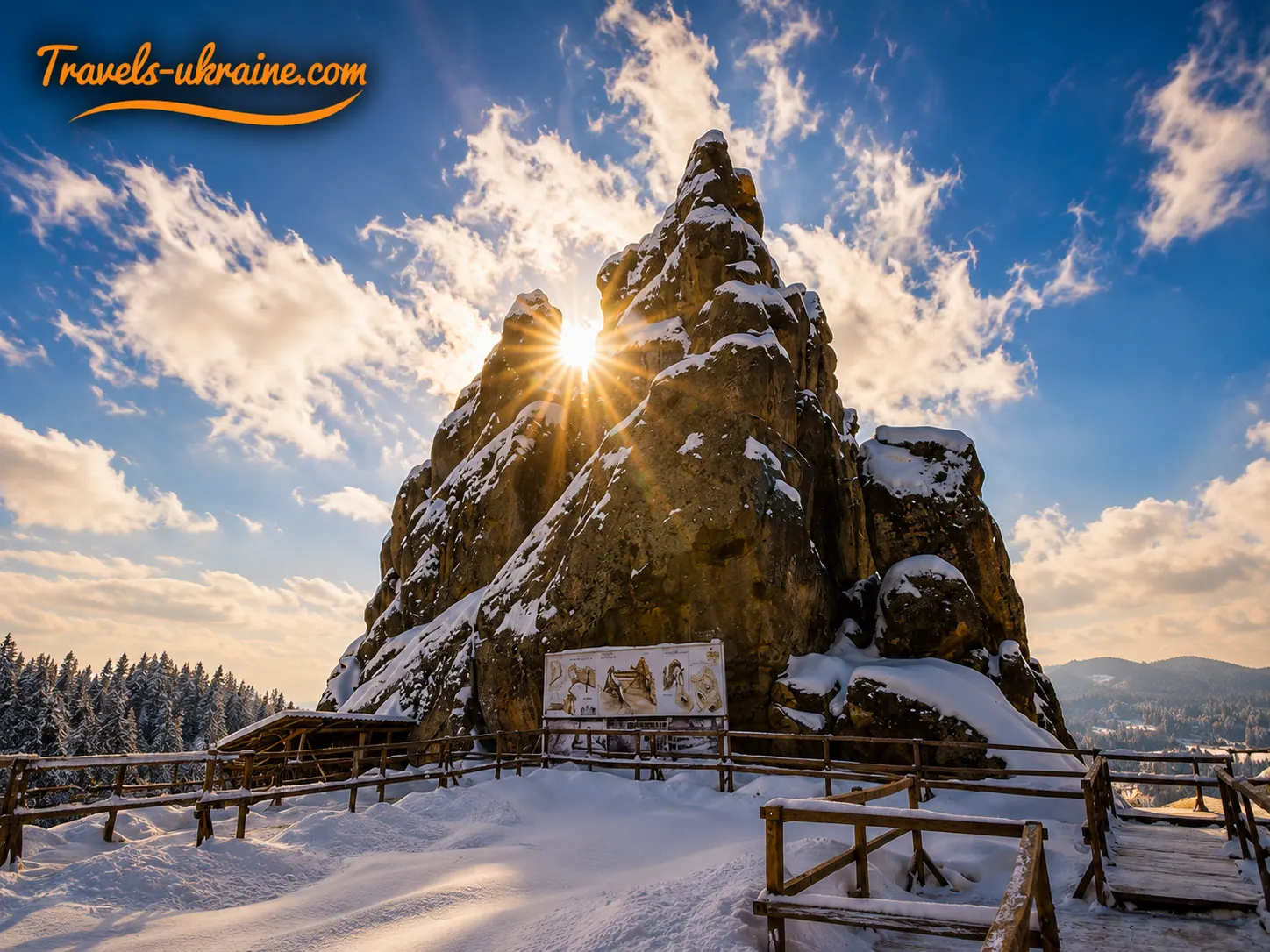
Tustan can be visited year-round. The most comfortable conditions for a walk are usually found in late spring, summer, and early autumn. For a quieter visit, choose a weekday and arrive in the morning. In winter and after precipitation, be prepared for potentially slippery stairs and rocks.
Are there places to eat, park, and rest near Tustan?
A tourist area near the entrance to the reserve includes food-service establishments, souvenir pavilions, and places for a short rest. Parking is available nearby. The opening hours of individual establishments may depend on the season, so it is best to bring water and a light snack with you.
What can you visit near Tustan?
You can combine a trip to Tustan with Kamianka Waterfall, Zhuravlyne Lake, Hurкalo Waterfall, the town of Skole, or a hike up Mount Parashka. For a one-day trip, it is best to choose just one additional location and leave longer mountain routes for a separate day.
Reference Information about Tustan
Tustan — where the Carpathians preserve memory
The Tustan rock landmark impresses not with preserved walls or towering towers, but with its astonishing ability to bring the past back to life through traces left in the stone. The wooden fortress disappeared long ago, yet thousands of socket holes, carved steps, the remains of a well, and archaeological finds still help us imagine the complex, multi-tiered structure that once rose above the Urych valley. All it takes is a closer look at the rocks—and they begin to tell their own story.
The Carpathian rocks bring together several eras and several different worlds at once. This is a natural complex shaped by ancient geological processes, the site of a medieval fortification, a customs and defense post, a subject of decades of scholarly research, and a recognizable location in Ukrainian cinema. Here, history does not merely coexist with nature—it is literally etched into the stone, in every passage, hollow, and outcrop.
A journey to Tustan unfolds differently for everyone. Some come for panoramic views of the Carpathians, some want to see the traces of the medieval fortress, walk through the museum galleries, or experience the atmosphere of a living-history festival. Yet almost everyone leaves Urych with a special feeling—as if, for a few hours, they had touched a time that has not disappeared here, but merely stood still among the rocks.
The best way to get to know Tustan is without rushing: first take in the fortress reconstruction, then walk around the rocks, climb to the viewing platforms, and pause above the valley for at least a few minutes. Listen to the wind, gaze across the Carpathian slopes, and try to imagine how vibrant life was here many centuries ago. It is in moments like these that you understand why the Urych Rocks remain one of the Carpathians’ most powerful and evocative places.
This unique rock complex is worth visiting for more than just the ancient fortress. People come here to see how nature, history, and human ingenuity created one of Ukraine’s most distinctive landmarks. Plan a trip to Tustan, follow the trails above Urych, and let these rocks tell you their story. After all, some places are not enough to read about or see in photographs—you have to experience them in person.



No Comment
You can post first response comment.