
 English
 Українська
 Български
 Hrvatski
 Čeština
 Dansk
Dansk Nederlands
 Eesti
Eesti Suomi
Suomi Français
 Deutsch
 Ελληνικα
 Magyar
 Íslenska
 Italiano
 Latviešu
 Lietuvos
 Polski
 Português
 Română
 Русский
 Српски
 Slovenčina
 Slovenščina
 Español
 Svenska
 Türkçe
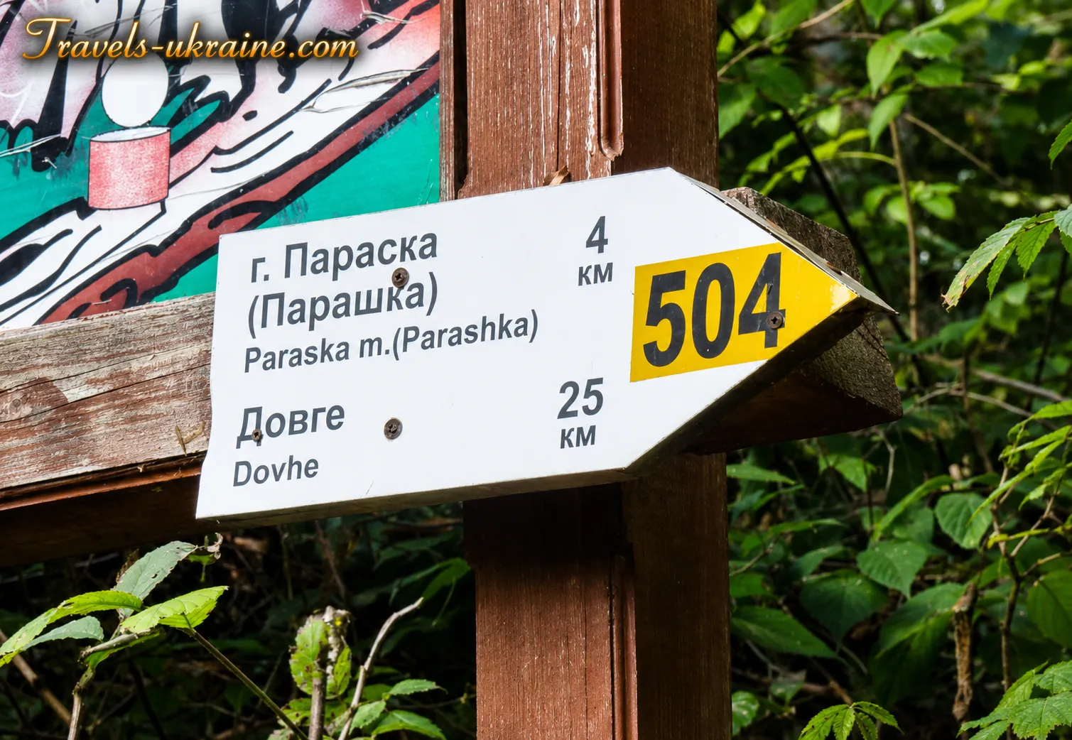
There are mountains whose names are explained by geography. Others are named after the shape of their summit, the colour of their slopes, or an ancient settlement near their foothills. But Parashka is different. Its name leads not only to the Carpathian mountain meadows and forest trails, but to one of the bloodiest episodes in the history of the princes — the year 1015, when, after the death of Volodymyr the Great, a struggle for the Kyiv throne broke out among his sons.
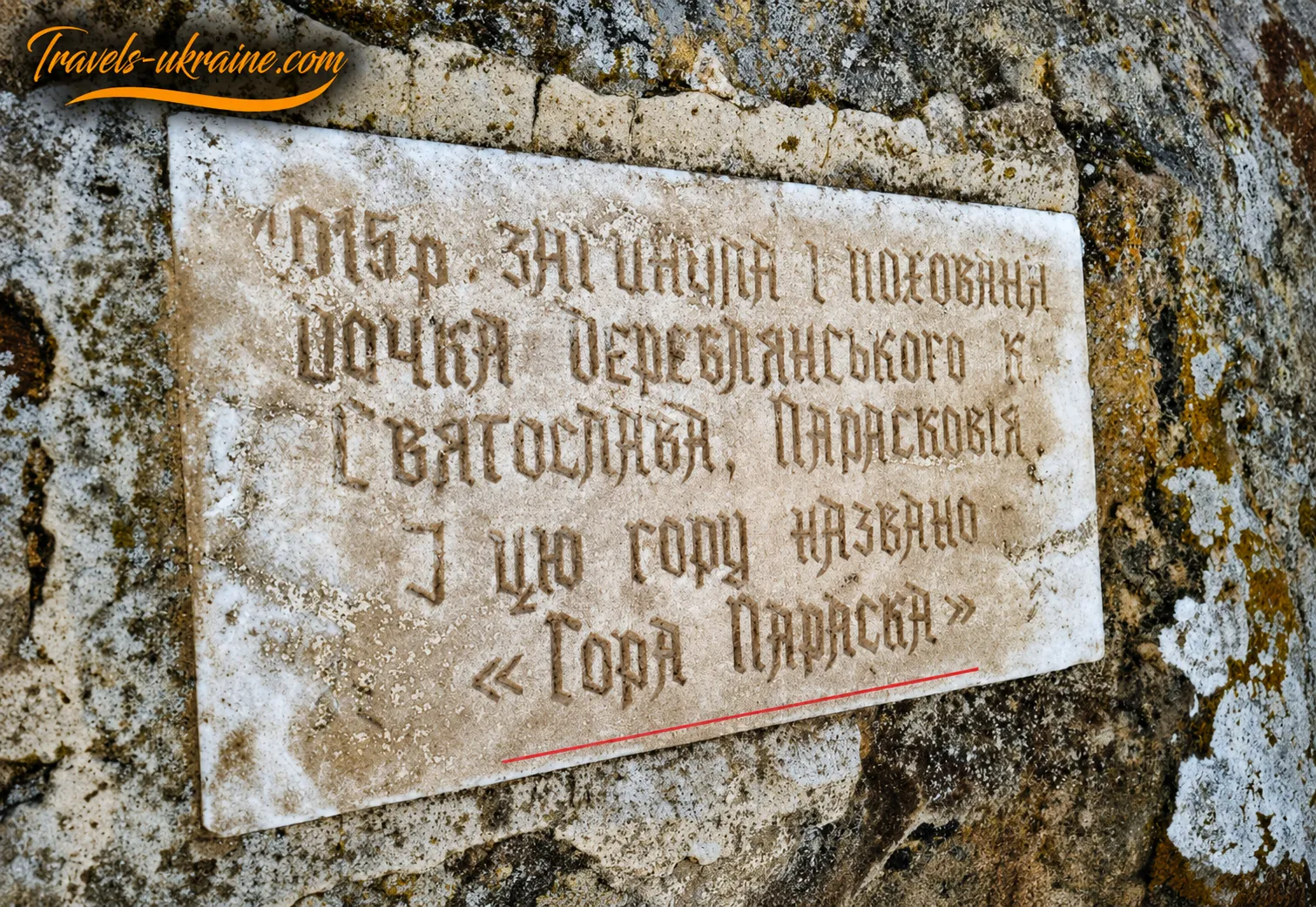
In the «Rus’ Chronicle,» according to the Hypatian manuscript, under the year 6523, corresponding to 1015, a brief and chilling message was recorded:«Sviatopolk the Accursed, the wicked one, killed Sviatoslav, sending assassins to Mount Uhorskaya when he was fleeing to Hungary.»
Only one sentence — with no description of the pursuit, no name of the pass, and no final words from the prince. The chronicler reports only the essential fact: Sviatoslav, the son of Volodymyr the Great, tried to escape to Hungary, but Sviatopolk’s men caught up with and killed him near Mount Uhorskaya. This is how the Carpathian borderlands and the route through the mountains toward Hungary may have been called in Old Rus’ sources.
Beyond this point begins territory that the chronicle no longer illuminates. It does not name the exact place of Sviatoslav’s death, mention modern-day Skole, or say anything about a girl named Paraska. Yet in folk memory, this silence gradually acquired a story of its own.
According to local legend, Sviatoslav’s daughter Paraska fled alongside him. Having witnessed her father’s death or fleeing from the same pursuit, she supposedly sought refuge on a mountain summit near Skole. But the pursuers reached there too. The girl was killed by the sword, while the previously nameless mountain preserved her name — Paraska, which later became Parashka in local pronunciation. This is how the origin of the name is explained by the Skole Beskids National Nature Park.
Was Paraska a real historical figure? Did her final journey truly lead along this ridge? There is no written evidence. The chronicle confirms that Prince Sviatoslav died while fleeing to Hungary, but the story of his daughter remains a legend. And yet legends rarely arise from nothing: they preserve not documents, but memory — sometimes altered over the centuries, yet stubbornly tied to a particular landscape.
Perhaps that is why Mount Parashka is perceived as more than simply the highest summit of the eponymous Parashka Ridge in the Skole Beskids. Its slopes seem to continue an ancient tale in which the Carpathian forest witnessed a princely escape, family betrayal, and a death that has survived for a thousand years in the mountain’s name.
Today, tourists climb Parashka for its panoramas, open ridge, and views stretching far beyond the Stryi Valley. But somewhere amid the sound of the beech forest, sharp gusts of wind, and the final metres to the summit, the journey unexpectedly changes. It is no longer merely a hike in the Carpathians — it becomes a path to a place where a single line of a chronicle meets a legend, and the history of Kyivan Rus’ still echoes among the mountains.
Geology and geomorphology of the Parashka Ridge
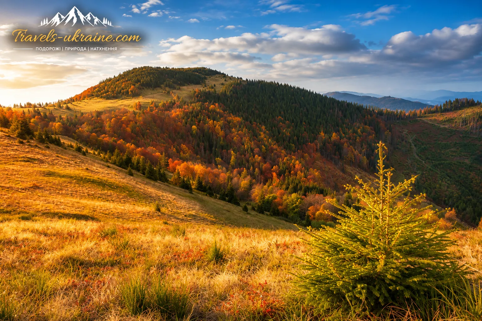
The panoramic ridge along which tourists climb Mount Parashka did not form by chance. Its present-day contours are the result of the complex geological history of the Ukrainian Carpathians, the prolonged uplift of rock formations, and their gradual breakdown by water, frost, and wind.
What travelers see today as steep slopes, elongated ridges, rocky areas, and deep valleys, geologists regard as part of the large folded system of the Outer Carpathians. Mount Parashka rises 1,268.5 meters above sea level, although some sources give its elevation as 1,271 meters, and is located approximately 8 kilometers northwest of the town of Skole in Lviv Oblast.
The Parashka slice: the rocky foundation of the ridge
Parashka Ridge belongs to the Carpathian Nappe Zone. In geology, the word «slice» refers to a large slab of rock that, during mountain formation, was crumpled, tilted, and thrust over adjacent strata. This is how the long, parallel ridges characteristic of the Beskids formed.
The ridge corresponds to a distinct morphostructure — the Parashka slice. Its foundation consists mainly of erosion-resistant sandstone formations of the Stryi Series. These hard layers withstand erosion better than softer argillaceous and clay deposits, so over time they remained as a high and prominent mountain range. Softer rocks eroded more quickly, while depressions, basins, and river valleys formed in their place.
This structure is typical of the Flysch Carpathians. Carpathian flysch consists of repeated alternations of sandstones, argillites, siltstones, and other sedimentary rocks that accumulated on the floor of an ancient marine basin. Later, these strata were uplifted, folded, and transformed into mountain ridges.
Why the slopes of Parashka have different degrees of steepness
One of the most distinctive features of Parashka Ridge is its asymmetrical transverse profile. This means that the opposite slopes differ in steepness and shape. The northeastern slopes, associated with outcrops of hard, resistant rocks, are generally steeper. The southwestern slopes follow the dip of the geological strata and are mostly more gently inclined.
A tourist can feel this asymmetry without specialised equipment. On one side, the ridge rises more sharply, and the trails pass through steeper forest slopes. On the other, the terrain gradually gives way to longer, gentler spurs. The geological structure explains why routes to Mount Parashka can differ significantly in difficulty even when they lead to the same summit.
The waters around Mount Parashka: rivers and the Gurkalo Waterfall
The nature around Parashka creates a distinctive mountain world in which water, forest, and rocky slopes merge into a single Carpathian landscape. Velyka Richka begins near the foot of the summit — a swift mountain stream that makes its way between forested slopes and rocky outcrops. Two important regional waterways flow nearby: the Opir River to the east and the Stryi River to the north. Their valleys shape the distinctive relief of the Skole Beskids and have long determined the natural rhythm of life in the surrounding settlements.
One of the best-known natural attractions of Velyka Richka is the Gurkalo Waterfall. Its water rushes noisily over a rocky ledge, filling the surrounding forest with coolness and a deep rumble from which the waterfall gets its name. Gurkalo is often included in tourist routes around Parashka, combining a climb to the summit with time spent beside mountain water.
How geology affects the hiking route
The geological structure of the ridge directly determines the character of the hike. Hard sandstones form stable ridges and panoramic areas near the summit, while softer rocks contribute to the formation of wet depressions, steep gullies, and valleys. This is why forest ascents, rocky sections, open ridge trails, and stretches with sharp elevation gain alternate along the route.
After heavy rain or snowmelt, erosion intensifies: water washes away soil, exposes rocks, and makes steep slopes slippery. Tourists should stay on the marked trail, wear footwear with reliable traction, and keep away from unstable scree slopes.
Thus, Parashka’s appeal is determined not only by the height of its summit or its views. Its character was shaped by ancient marine deposits, tectonic movements, resistant sandstones, and the ceaseless work of water. The ridge is a kind of geological chronicle in which every slope, crest, and rocky valley tells the story of the formation of the Carpathians over millions of years.
Vegetation and rare natural communities of the Parashka Ridge
Parashka attracts travellers with its open ridge and broad Carpathian panoramas, but its natural value is not limited to picturesque views. A complex mosaic of forests, secondary mountain meadows, bilberry patches, and mountain grasslands has developed on the slopes and near-summit sections of the ridge. Their appearance varies depending on elevation, slope aspect, moisture, wind strength, and the intensity of tourist pressure.
That is why a hike to Mount Parashka can be viewed as a journey through several natural complexes. Forested areas gradually give way to open meadows, while on the ridge, plant communities adapted to a cooler climate, strong winds, shallow soils, and a long snowy season appear.
From beech forests to open mountain meadows
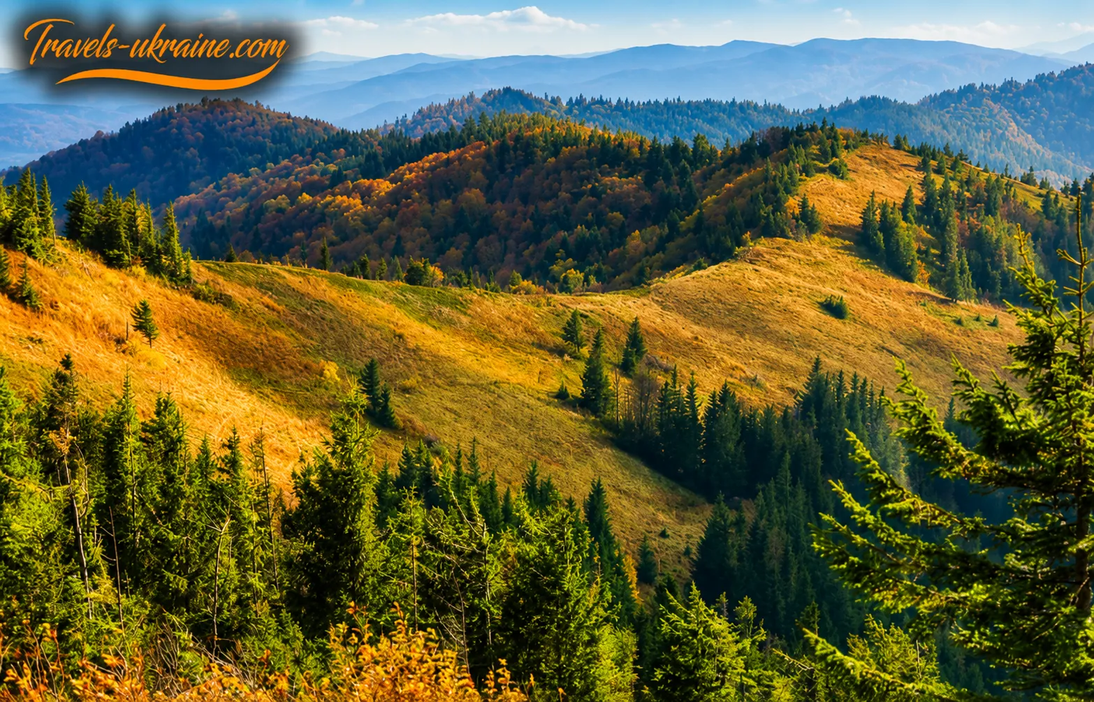
The mountain slopes are covered with dense coniferous forests dominated by spruce and fir. In places, dark-green conifer stands give way to lighter beech and birch areas. In spring and summer, the forest fills with the scent of damp bark, needles, and mountain grasses, while in autumn the beech slopes flare with golden and copper hues. The higher the trail climbs, the more often the forest opens up, revealing grassy slopes and distant Carpathian panoramas.
Parashka’s grass cover is notable for its considerable natural diversity. Alongside common mountain grasses, rare plants can be found here, many of them listed in the Red Book of Ukraine. They are especially vulnerable to trampling, picking, and careless treatment by tourists.
The open character of Parashka’s upper section does not mean that all of this territory is a natural high-altitude mountain meadow. A significant portion of the grasslands is secondary in origin and formed as a result of prolonged agricultural use, grazing, and mowing. Nevertheless, these areas have become habitats for many mountain grasses and an important component of the ridge’s landscape diversity.
Arnica mat-grass meadows and rare plant communities
The ridges and slopes immediately below the ridge crest of Parashka Ridge are of particular conservation value. According to ecological and landscape studies, they support arnica mat-grass meadows — mountain meadow communities combining mat-grass and mountain arnica. In some places, these are replaced by phytocoenoses that are very rare in the Ukrainian Carpathians and are dominated by mountain arnica.
Mountain arnica (Arnica montana) is one of the best-known medicinal plants of the Carpathians, but its natural populations are sensitive to picking, digging up, trampling, and changes in growing conditions. It is not only the individual plant that has value, but also the entire natural community of which it is a part.
The official description of the «Monastery — Parashka» route mentions mountain arnica, lesser butterfly-orchid, globe-shaped Traunsteinera, wood lily, and other rare species among the plants of the meadow areas. At the same time, the presence of a particular plant along the route does not mean that it grows evenly across the entire ridge: individual populations may occupy small and highly vulnerable areas.
Studies of rare non-forest communities in the Skole Beskids National Nature Park show that some valuable phytocoenoses occur in only one or several locations and occupy an area of just a few dozen square metres. That is why even a slight widening of the trail, mass picking of flowers, or regularly pitching tents can cause them significant damage.
When popularity becomes a threat to vegetation
The most vulnerable part of the route is the summit itself, where tourists converge from different directions, rest, take photographs, and often stray beyond the main trail. A field study whose findings were presented in N. M. Kepenіak’s 2015 dissertation, “Constructive and Geographical Substantiation of the Recreational Use of the Territory of Skole Beskids National Nature Park,” documented significant recreational pressure on the summit areas. The research found that only 5% of the grass cover remained in one of the surveyed areas, while trampled ground with exposed parent rock accounted for as much as 95% of the surface. The author classified the condition of this area as the fifth stage of recreational digression.
For comparison, the researchers selected the nearby Tymkiv Verkh peak, which has similar natural conditions but receives significantly fewer visitors. There, grass cover accounted for about 90%, while trampled areas occupied only 10% of the surveyed area. In the less disturbed territory, plant diversity was considerably higher, whereas on Mount Parashka, mountain arnica and long-leaved hawkweed were absent within the surveyed site, while large masterwort, mosquito orchid, and lesser butterfly orchid were in a suppressed state.
These figures reflect the condition of the specific surveyed sites during the fieldwork period and should not be regarded as a current measurement of the entire peak. Nevertheless, they clearly demonstrate how quickly mountain meadows respond to uncontrolled recreational pressure.
The Landscape and Recreational Value of Parashka
The Parashka Range belongs to the mid-mountain landscapes, with distinct parallel ridges, steep slopes, narrow river valleys, and significant changes in elevation. The combination of dense forests, an open ridge, and deep valleys creates the panoramic scenery that draws tourists to the summit.
From the open areas, visitors can see not only the surrounding peaks but also the valleys of the Stryi and Opir rivers, forested slopes, settlements, and distant mountain ranges. A scientific landscape description of the range mentions a multilayered view: bilberry bushes, gentians, and occasional Norway spruce dominate the foreground; hills covered with beech forests stretch beyond them; and, in good visibility, the lowland areas of the Precarpathian region can be seen on the horizon.
Scientists describe Parashka as one of the most attractive panoramic peaks in the Skolivshchyna region. It can be reached from various directions, including from Skole, Korostiv, Korchyn, and through the adjacent mountain valleys. This makes the peak an important hiking destination, but at the same time increases pressure on the meadows near the summit.
The Range’s Fauna: What Scientific Observations Confirm
The combination of forested slopes, open meadows, river valleys, and sparsely populated areas creates favorable conditions for a variety of animals. However, in a tourism article, it is important not to automatically attribute to Parashka every species known from Skole Beskids National Nature Park. The presence of a particular animal on the range can be stated reliably only when there is a specific documented observation.
One such confirmed observation is the recording of a western osprey (Pandion haliaetus) on Mount Parashka on April 10, 2017. Researchers recorded a single migrating individual. The osprey is a rare bird of prey associated primarily with bodies of water, so its appearance above the mountain range indicates that the Carpathians are used as part of a migration route.
This finding does not confirm osprey nesting on Parashka or its permanent presence on the range. It only shows that open mountain spaces may be important landmarks and transit corridors for migratory birds.
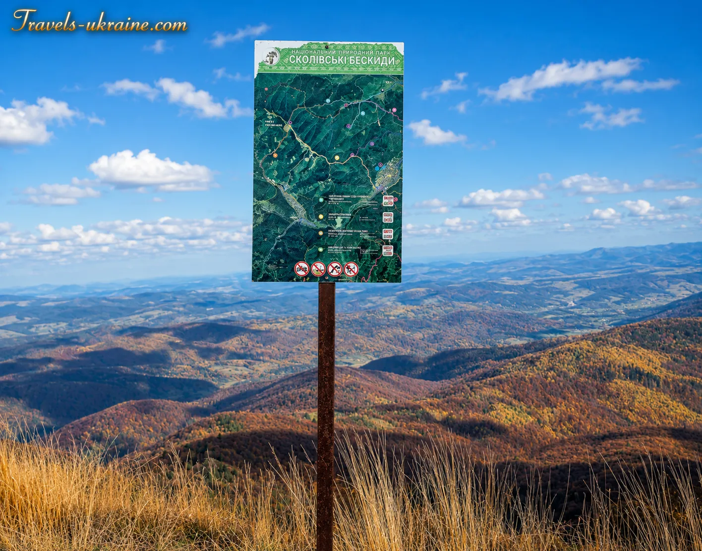
Mount Parashka — a Tourist Highlight of Skolivshchyna
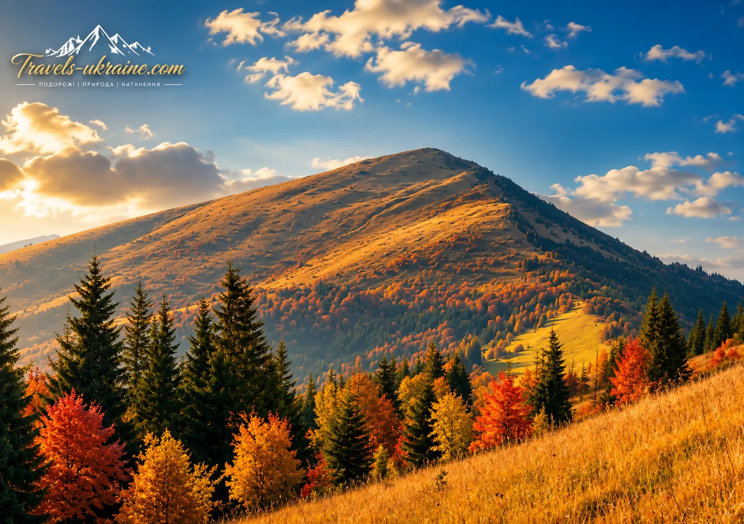
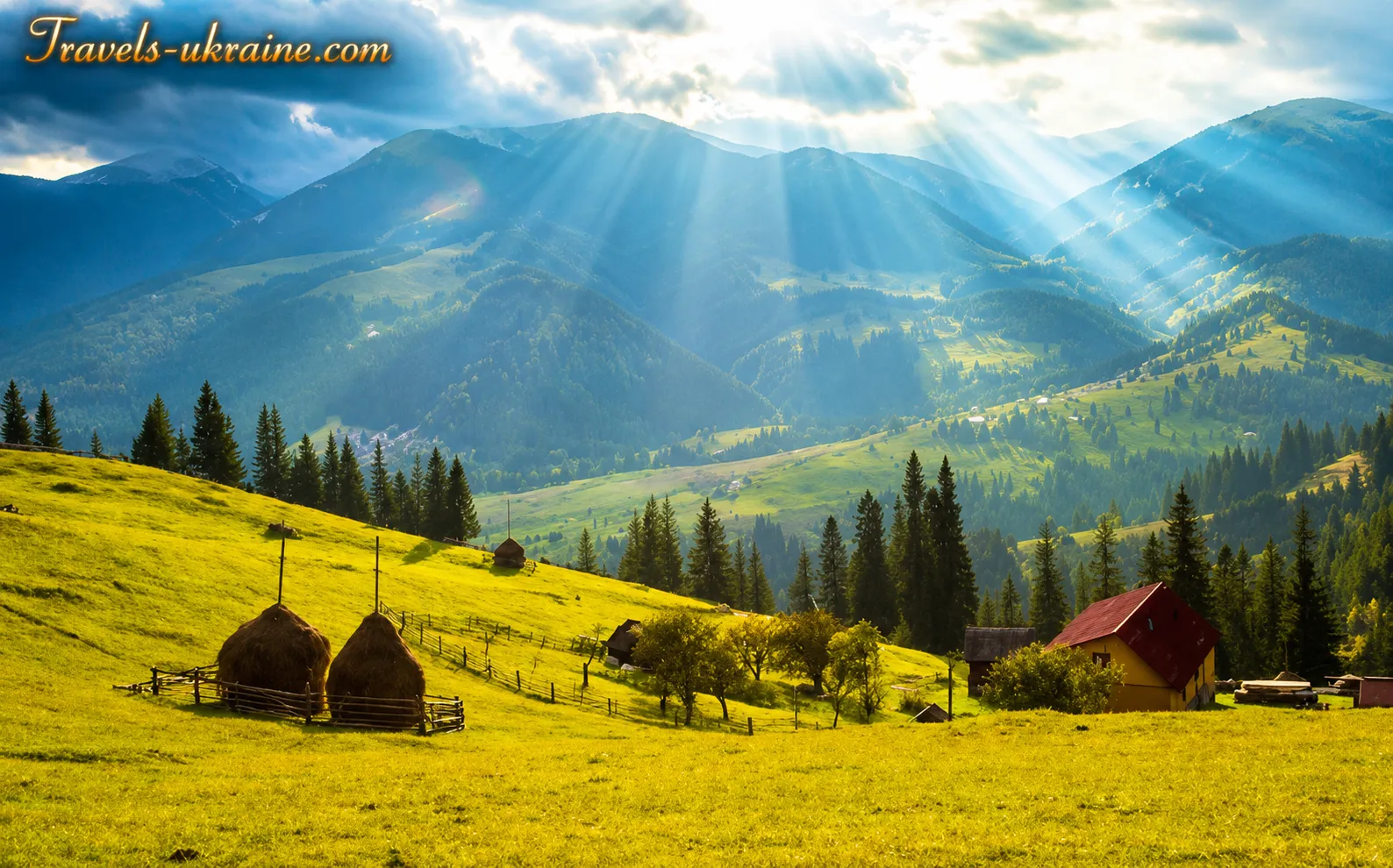
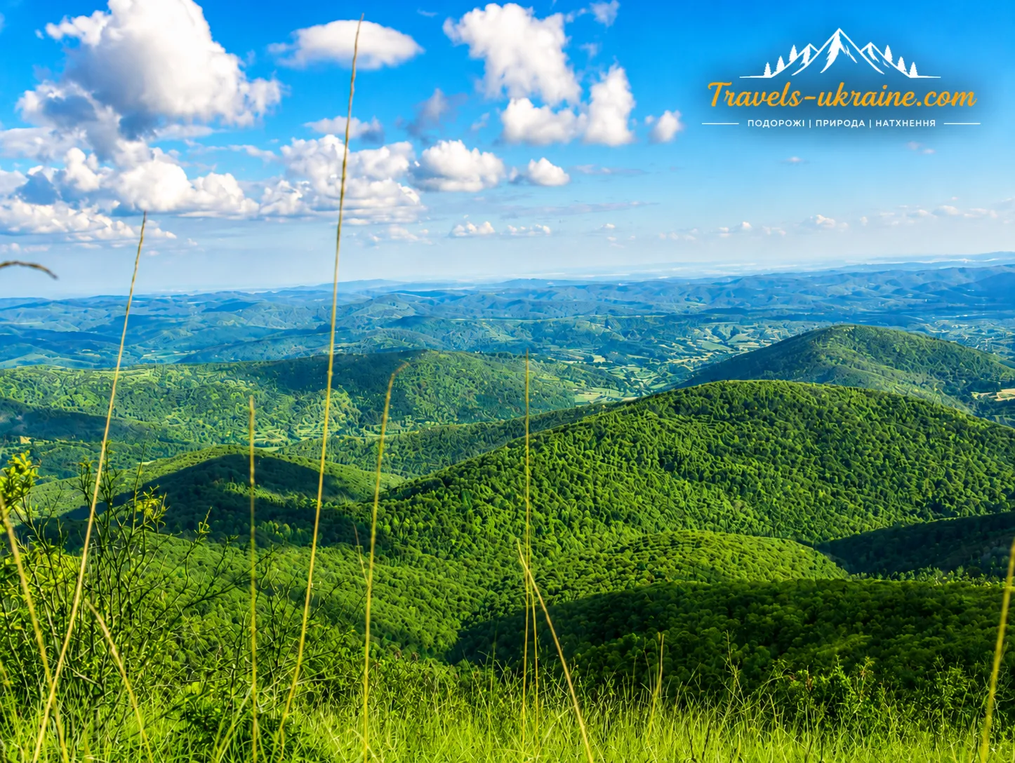
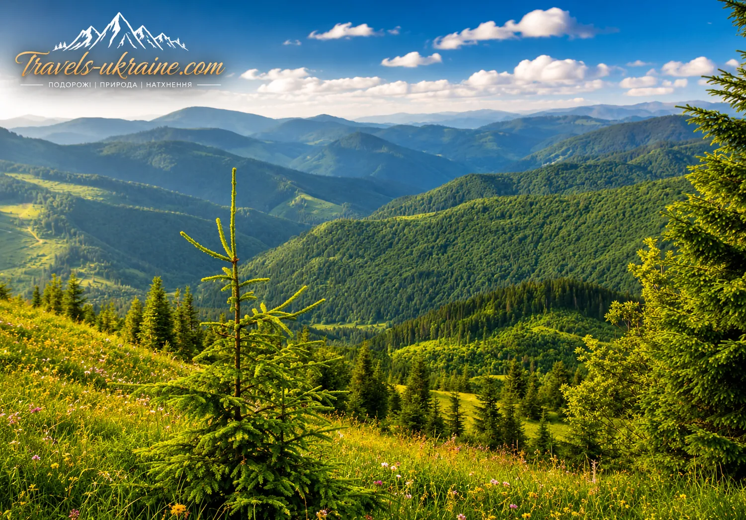
Mount Parashka near Skole attracts visitors for more than its elevation. Its main value lies in the journey itself. The natural landscapes change along the route: forested sections give way to open meadows, while mountain pastures, deep valleys, and forest-covered slopes appear before the hiker. In clear weather, the summit offers the best views of the Skole Beskids, where neighboring ranges gradually fade into the horizon.
Here, the vastness of the Carpathians is especially tangible: strong winds, open skies, changeable weather, and long mountain ranges concealing settlements and river valleys between them. The view does not appear at once—you have to climb to it under your own power, overcoming forest trails, prolonged ascents, and open sections of the ridge.
For Skolivshchyna, Parashka is more than just a popular hiking route. It is a natural symbol of the region, linked to princely history, local legends, and cultural memory. A hike to Parashka is ideal for those who want to experience the Carpathians not from a roadside viewing platform but by making their own way to the panorama. The route requires endurance and basic physical fitness, but no mountaineering equipment. This balance between accessibility and a genuine mountain challenge makes the peak one of the most attractive tourist destinations near Skole.
Why Mount Parashka Attracts Tourists to the Skole Beskids
Parashka’s summit appeals both to people just discovering mountain hiking and to more experienced tourists seeking a full-day weekend route. Beginners can use it to assess their endurance and learn to pace themselves, while experienced hikers can plan a longer ridge traverse or combine the ascent with visits to other natural sites in Skole Beskids National Nature Park.
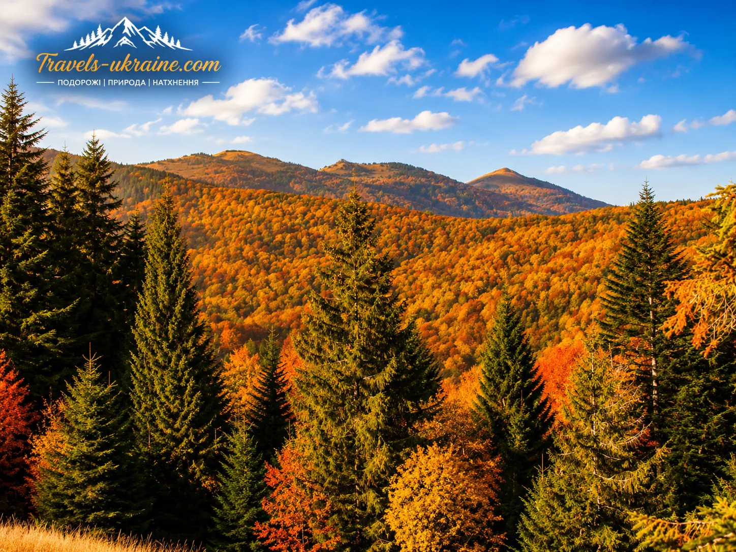
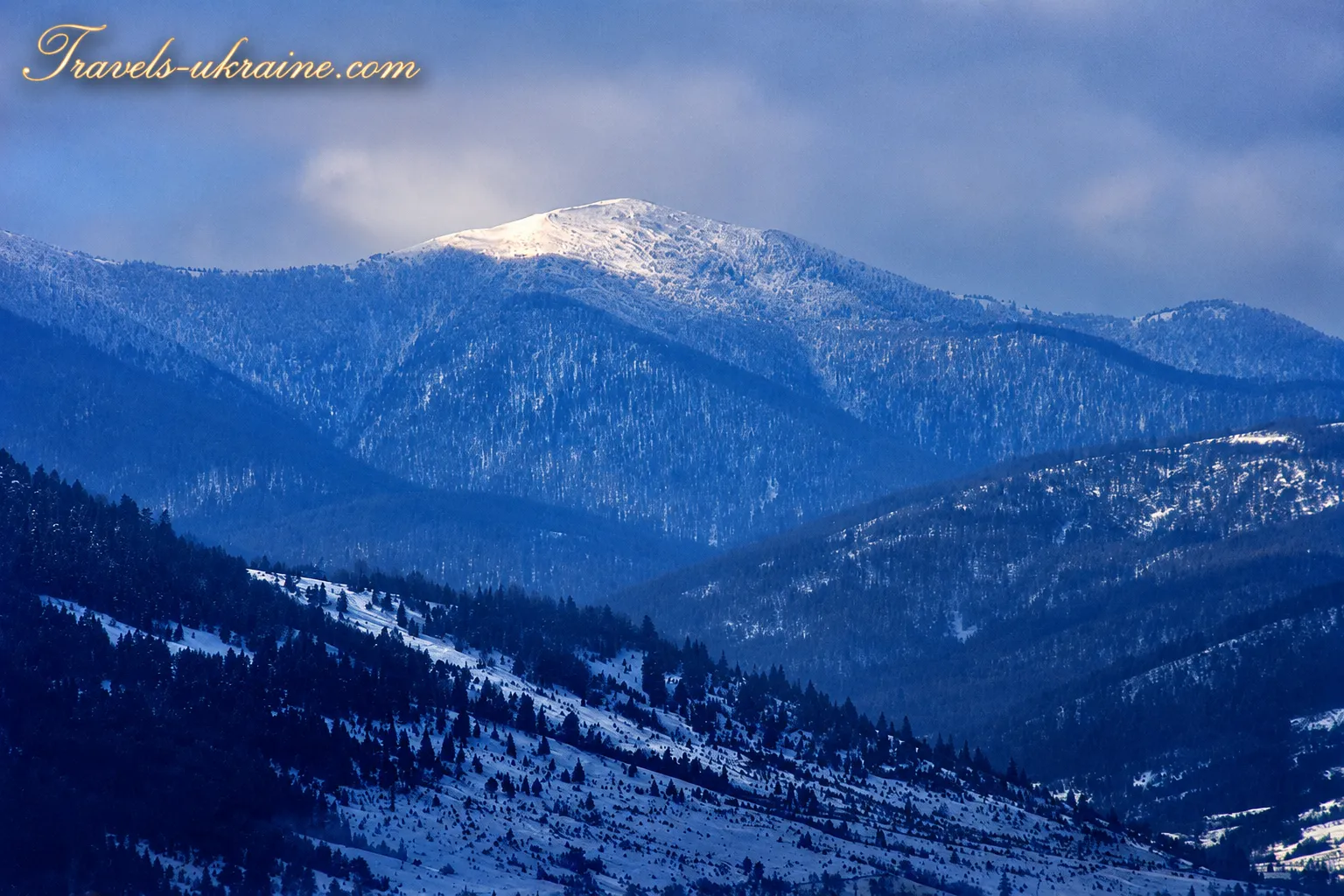
Parashka attracts visitors in every season, although each one changes the character of the hike. In spring, the slopes fill with water and fresh greenery; in summer, the route passes through dense, cool forests; and in autumn, it reveals a combination of golden beeches and dark conifer stands. In winter, the mountain requires much more serious preparation, as snow, ice, short daylight hours, and strong winds significantly increase the difficulty of the ascent.
That is why Mount Parashka remains more than a mark on the tourist map of Lviv region: it is a place where the journey to the summit becomes an essential part of the experience, and the panorama from the ridge a well-earned reward for every kilometer completed.
Mount Parashka Through Hikers’ Eyes: A Brief Tourist Guide
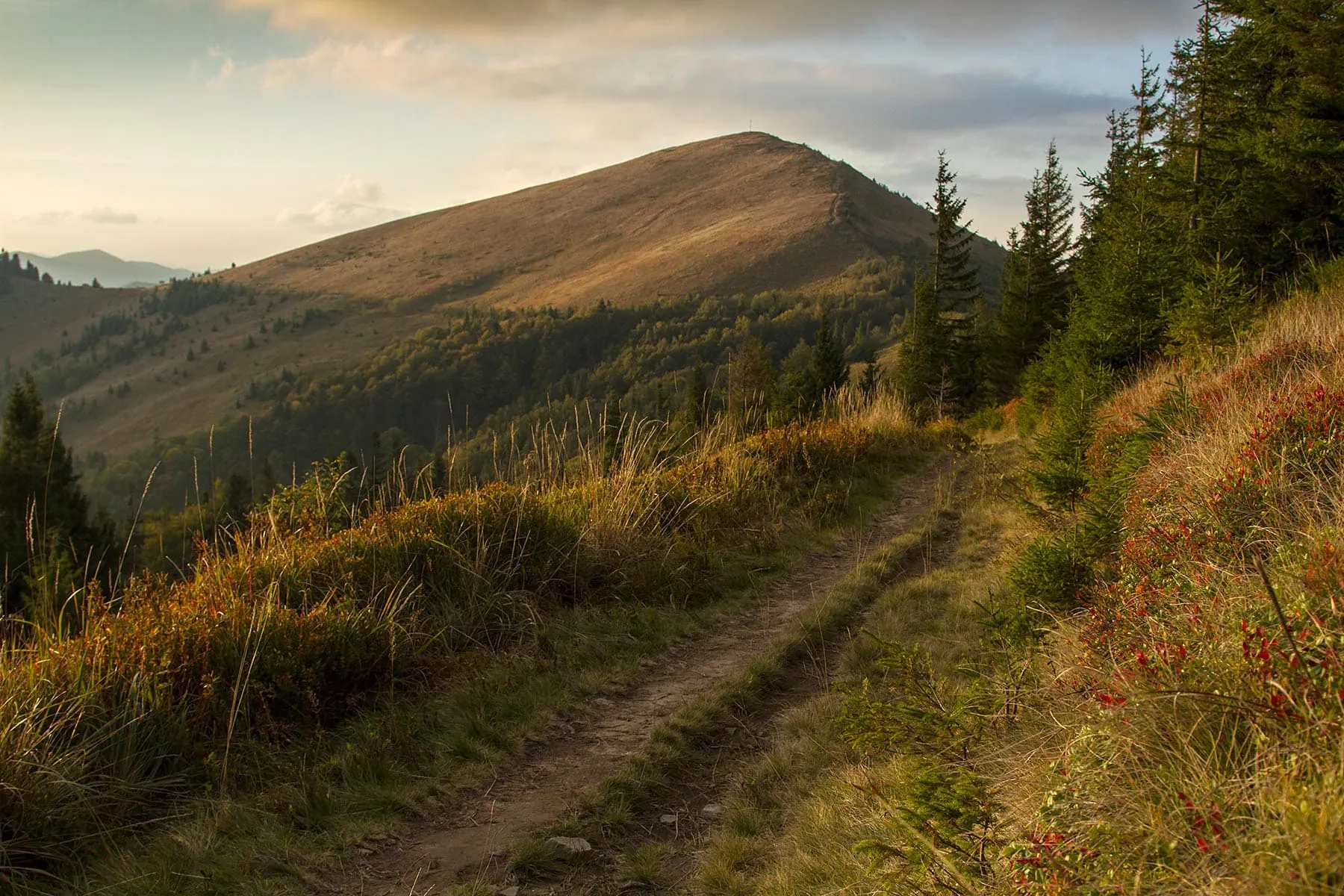
On a map, the route from Skole to Parashka may look like an ordinary one-day mountain hike: a clear direction, a marked trail, and a summit. Yet hikers’ memories show that the journey is far more varied than dry figures might suggest. It begins with a steep climb, disappears into the Carpathian forest for a long stretch, emerges onto an open ridge, and several more times makes you believe the summit is already just ahead.
Official tourist route No. 13, “Skole — Parashka,” is 10 kilometers long, takes approximately 4–5 hours to complete, and is classified as difficult by Skole Beskids National Nature Park. The start of the route is marked by an information sign at kilometer 655 of the Kyiv — Chop highway. Near the Dubravka recreation area, there is a rest area and parking lot where visitors can leave their cars before heading into the mountains.
What the Route Really Feels Like
Many hikers remember the first meters of the ascent as some of the steepest on the entire route. The trail gains elevation quickly and in places runs over rocky, eroded sections, making it clear from the outset that Parashka demands endurance, even though the route contains no technically difficult rock sections.
One hiker who completed route No. 13 in June 2025 spent about four and a half hours ascending, including breaks. She describes the beginning as steep and the entire route as moderately difficult, with several demanding climbs. Her complete hike, including the return to Skole, took approximately ten hours, so she recommends starting as early as possible and bringing trekking poles, which are especially helpful on the descent.
Another travel-report author notes that the ascent was quite manageable for a physically fit person, but it should not be described as unconditionally easy for everyone. For someone without experience in long walks or basic endurance, the route may prove considerably harder than expected.
Forest, Mountain Pastures, and «False» Summits
A substantial part of the route passes through forest. At first, hikers are accompanied by shaded slopes, damp air, tree roots, and the scent of leaves. During the warmer months, bilberry bushes grow beside the trail, while dense canopies conceal distant views for a long time. Only as elevation is gained does the forest gradually thin out, and the route emerges onto open meadows and ridge sections.
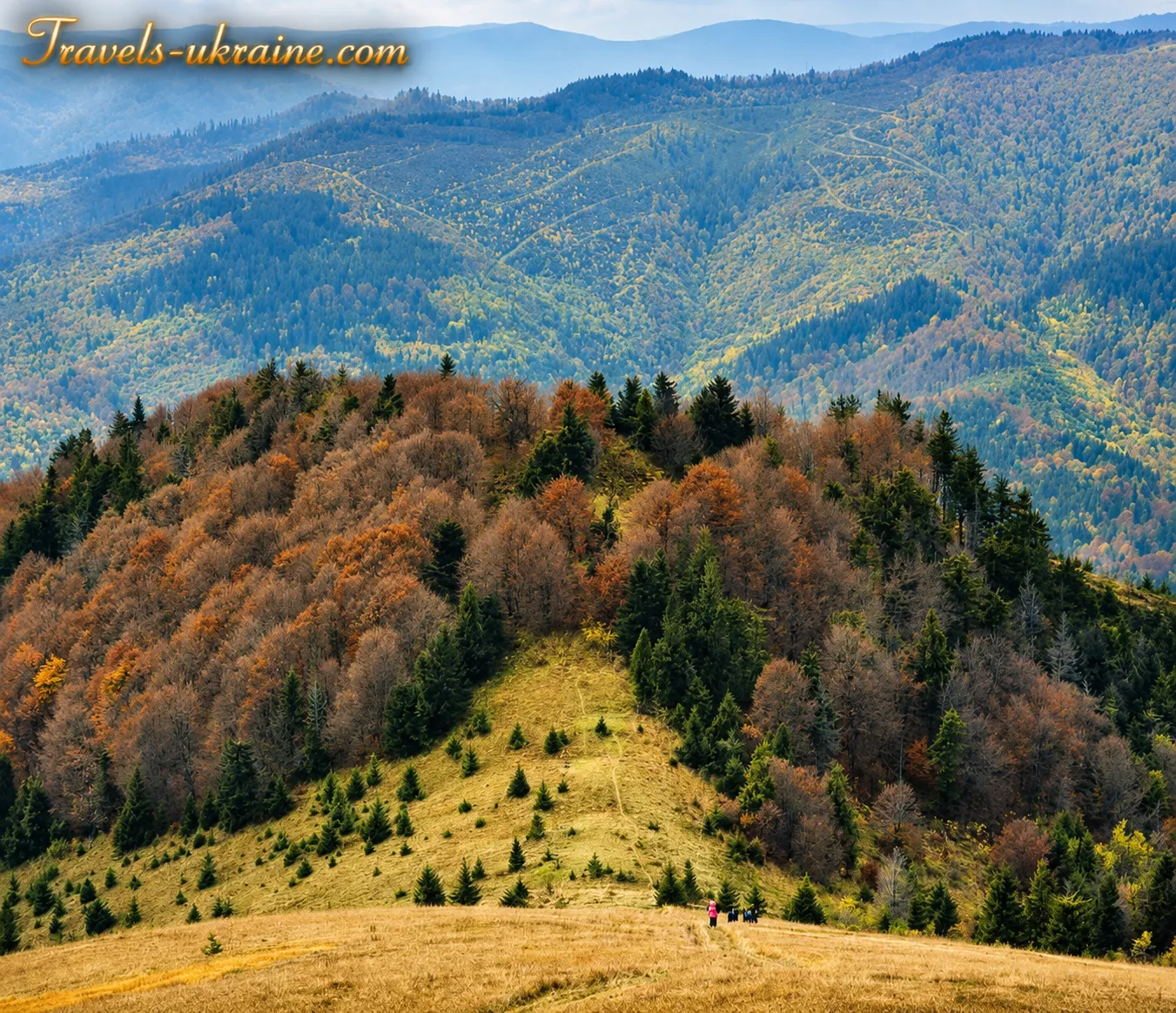
Hikers often describe this transition as the most striking moment of the journey. After a long stretch among the trees, neighboring mountains, mountain pastures, and deep valleys suddenly open up before them. Yet Parashka itself is not always visible. The ridge is undulating, so each successive rise may seem like the route’s endpoint. Only when a recognizable cross appears on a distant summit does it become clear how much farther there is to go.
Because of this route structure, the hike feels psychologically longer. The hiker ascends several times and loses some elevation, passes through Tymkiv Verkh, Zelena, and other rises of the range, before reaching the main summit. That is why Parashka is remembered not for one final climb but for a long journey in which the views unfold gradually.
Weather That Can Change the Entire Hike
The experience of Parashka depends largely on the weather. The open ridge offers almost no protection from strong winds, while clouds and fog can quickly obscure the panorama. One hiker recalls passing sections covered with fallen leaves, greenery, and snow during the ascent, then seeing clouds below on the ridge. However, while he was photographing the scenery, the cloud cover rose, and he reached the summit in dense fog. After resting for about half an hour, he had to begin descending because of the cold.
This experience clearly shows why conditions on the summit should not be judged solely by the weather in Skole. Even on a warm day, a windproof jacket, raincoat, and additional warm layer should be packed in the rucksack. In fog, distances look different, trail markings are harder to spot, and a wet clay trail becomes slippery on the descent.
Who Is a Hike to Parashka Suitable For?
Parashka does not require mountaineering equipment, ropes, or climbing skills. However, that does not mean the route is an easy walk. The park’s official classification describes it as difficult, and tourists’ first-hand accounts confirm the substantial physical exertion, prolonged elevation gain, and fatigue during the descent.
The route is suitable for active hikers with basic physical fitness who are prepared to spend most of the day on their feet. Beginners can also reach the summit in favorable weather, but they should allow extra time for rest, avoid overloading their backpacks, and set out only during daylight.
A hike with children, older people, or participants who have never previously undertaken mountain routes requires particularly careful planning. The group’s pace should be determined by its slowest member, and any decision to continue the ascent should take into account the weather, remaining energy, and time before sunset.
What to Bring
For a one-day ascent, you need hiking boots with reliable tread, sufficient drinking water, food, a raincoat, a warm outer layer, a hat, and a small first-aid kit. Trekking poles reduce strain on the knees and help maintain balance on wet and steep sections.
Your phone should contain an offline map or downloaded route track, and you should also bring a charged power bank. Even if you plan to return by evening, a flashlight is useful: delays caused by fatigue, fog, or searching for the correct turn can significantly change the time of the descent.
Hikers’ experiences differ: for some, the ascent becomes a pleasant one-day hike; for others, a serious test of endurance. Yet almost all accounts share one detail: emerging from the forest onto the open ridge and seeing the distant Carpathian panoramas becomes the main reward for the journey completed.
Parashka does not reveal its views immediately. It makes you walk uphill for a long time, misjudge the summit’s distance several times, feel the wind, and watch the clouds. That is why the cross at an elevation of 1268.5 meters is perceived not merely as a tourist attraction but as the true culmination of a journey reached through the hiker’s own efforts.
Conquering Mount Parashka: A Firsthand Hiking Experience
Our ascent of Mount Parashka began on the outskirts of Skole, near the bypass road and an OKKO filling station. Before setting off, we decided to fuel up with some hot dogs, left the car in the parking area, and unexpectedly lingered after a pleasant conversation with the talkative gas station attendant. He spoke so enthusiastically about his tourist region that the route ahead began to feel special even before we took our first steps.
Finding the start of the trail proved easy. The landmark is an information board about the ascent of Parashka, clearly visible from the road. Immediately behind it, a well-trodden path leads into the forest. That was where we headed.
At first, the route follows a forest road that climbs almost continuously. At the first fork, turn right. Another branch appears farther along, but it is already marked with trail signs. Here we turned left, following the white-and-yellow markings of route «5010.»
For me, the initial part of the climb was the most difficult. The road kept rising, with almost no gentle stretches where we could rest. Since we could hardly call ourselves experienced mountain hikers, we had to stop often, catch our breath, and recover our strength. It is difficult to remember how long this section took, but it was certainly the most physically demanding part of the hike.
Later, we switched from the white-and-yellow markings to the red route. The trail gradually became a little gentler, and walking was easier. However, we later learned that we could have continued along the yellow route, which other hikers said was much easier. That way, we would not have had to make the extra transition or exhaust ourselves so much on the climb. This practical detail is worth considering when planning your own trip.
Along the way, we passed several information boards, one of which describes the European beech. A truly enormous tree grows nearby, inviting you to stop for at least a few minutes. Overall, the hiking route to Parashka is well marked, so navigation is easy if you pay close attention to the signs. That is why the trail is suitable for an independent hike, although having an offline map on your phone is still a good idea.
Beyond the information boards, the forest gradually begins to thin out. More light filters through the trees, and a mountain ridge appears ahead. This is where the hike changes: instead of an enclosed forest space, a broad Carpathian panorama opens before you. Neighboring mountains, distant slopes, and Parashka itself—which is still ahead—come clearly into view.
During the warmer months, many bilberry bushes grow along the trail. The ripe berries became a small natural snack and a pleasant reward after the exhausting climb. Of course, they should be picked sparingly, without straying far from the marked trail or damaging the vegetation.
Eventually, following the marked route, we reached the summit. Near the finish, we were greeted by the cross on Mount Parashka, the Ukrainian flag, and a Carpathian panorama that is difficult to put fully into words. After the long road, countless breaks, and moments when our strength was running out, the view felt especially powerful. Mountain ranges stretched all the way to the horizon, while our fatigue gradually gave way to quiet joy at having climbed Parashka under our own power.
Interesting Facts About Mount Parashka in the Skole Beskids
Mount Parashka is well known to tourists in the Lviv region, yet its familiar summit profile conceals many interesting natural, historical, and route-related features. It is not only a popular destination for a one-day mountain hike but also the highest point in the Skole Beskids.
Parashka is also the highest point of the ridge of the same name. The ridge system includes several neighboring elevations, so during the hike, visitors see not one isolated mountain but a long, undulating line of Carpathian terrain. Crossing the open sections of the ridge forms the most distinctive part of the route.
Parashka Can Be Climbed From Several Directions
The best-known option remains the route to Parashka from Skole, but it is not the only one. Hiking trails to the summit approach from Korostiv, the Monastyr tract, Korchyn, Hurkalo Waterfall, and Krushelnytsia. They differ in length, difficulty, marking conditions, and terrain.
Thanks to the several approaches, hikers can plan not only a radial ascent and descent along the same trail but also a long-distance route across the Parashka ridge, ending in another settlement. This format is more interesting, but it requires carefully planned logistics and a verified navigation track.
The Cross on the Summit Has Become a Symbol of Parashka
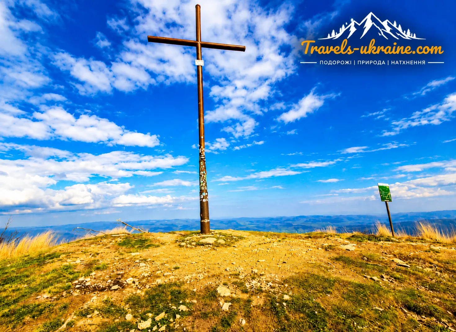
A metal cross stands on the summit and is clearly visible during the final stage of the ascent. For many hikers, seeing it above the slope means that the hardest part of the route is behind them. The cross has become one of Parashka’s most recognizable images and the central feature of most summit photographs.
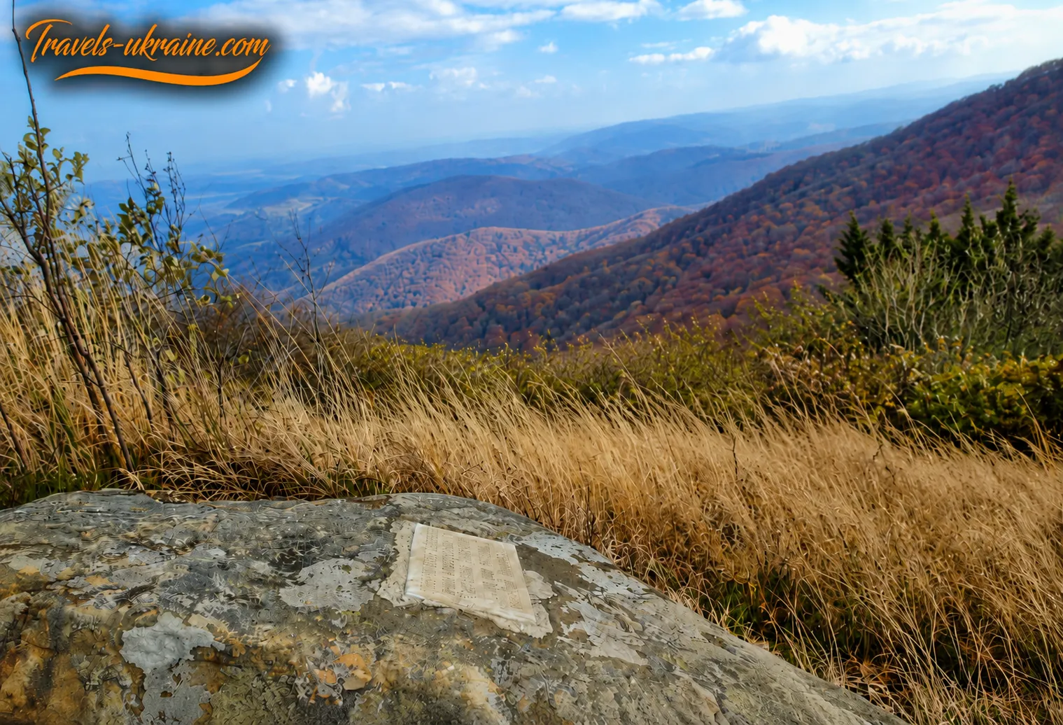
A memorial stone connected with the legend of Paraskoviia also stands on the mountain slope. In this way, the natural landscape merges with the region’s historical memory: the hiking route passes not only through a picturesque area but also through a place where ancient legends have taken material form.
Parashka Reveals the Carpathians Gradually
One of the hike’s most interesting features is that the summit remains hidden behind the forest and intermediate elevations for a long time. Panoramic views emerge gradually, so each successive section of the ridge changes how you perceive the route. At first, hikers see only the nearest slopes; closer to the summit, valleys, settlements, and distant mountain ranges come into view.
In clear weather, Parashka offers views across a significant part of the Skole Beskids, river valleys, and surrounding settlements. After rain, the air often becomes clearer, but the wet trail makes the ascent more difficult. In fog, the panorama almost completely disappears, and the exposed summit takes on a stark and mysterious appearance.
These facts help explain why Parashka remains one of the most popular mountains in the Lviv region. It combines accessible logistics, a full physical challenge, a distinctive Carpathian ridge, historical legends, and a panorama that hikers can enjoy only after several hours of determined climbing.
Events, Group Hikes, and Festivals Near Mount Parashka
Mount Parashka in Skole is not a festival venue in the usual sense. The open summit has no stage, permanent infrastructure, or regular entertainment program. Its event life takes a different form: organized group-themed ascents, educational hikes, patriotic trips, individual walking routes to Parashka, environmental initiatives, and activities focused on physical and emotional recovery are held here.
Such events are usually organized by Skole Beskids National Nature Park, tourism organizations, educational institutions, civic associations, or local authorities. The program, route, participation requirements, and group composition vary, so they should not be treated as guaranteed annual events. Before traveling, check the organizers’ current announcements.
Organized Ascents of Mount Parashka
One of the most common formats is a group hike to Parashka held to mark an important date, a tourism holiday, or an educational initiative. In different years, national park staff have organized ascents for Ukraine’s Independence Day and World Tourism Day. Participants followed the route with specialists, learning about the nature of the Skole Beskids, the region’s history, and responsible conduct in the mountains.
These trips are about more than sport. Climbing together creates a sense of support, teaches teamwork, and helps participants better understand the demands of a mountain route. For schoolchildren and youth organizations, such ascents are often combined with nature observations, talks about flora and fauna, and practical lessons in safe tourism.
«Travel Therapy» and Restorative Hikes to Parashka
Restorative trips for service members, veterans, and their family members have become a separate focus. As part of the «Travel Therapy» project, participants climbed Parashka along a route approximately 16 kilometers long. Tourism specialists, rescuers, and national park employees took part in organizing the hike.
On such trips, the mountain becomes more than a sporting objective. The quiet of the forest, physical exertion, mutual support, and sense of reaching the summit help participants shift their focus, regain inner balance, and spend time with people who have similar experiences. It is an example of how active recreation in the Skole Beskids can combine tourism with social support.
Festivals and Cultural Events in Skole and the Skole Beskids
A trip to Parashka can be combined with cultural and gastronomic events held in Skole and the surrounding villages. Their themes are often connected with Boyko heritage, traditional crafts, local cuisine, forest produce, and environmental education.
One example is the «Boyko Mushroom Pickers’ Gathering,» held in the Pavliv Potik tract under the patronage of Skole City Council. The program included mushroom competitions, a market featuring honey, Carpathian souvenirs, and local products, food tastings, and nature activities for children. The event demonstrates another side of recreation in the Skole area: discovering local traditions after an active mountain hike.
In addition to festivals, the park holds environmental lessons, themed workshops, nature observations, presentations of tourism projects, and events for International Mountain Day. Some activities take place at the park administration, the Skolivshchyna Museum of Local History, or designated recreational areas.
How to Find Out About Current Events Near Parashka
The event calendar may change depending on the season, weather conditions, the security situation, and the organizers’ decisions. Therefore, do not plan a trip around an old announcement or automatically assume that an event is held annually. Even if an event took place at the same time of year for several consecutive years, its occurrence requires separate confirmation.
- check the news from Skole Beskids National Nature Park;
- check official announcements from Skole City Council and tourism institutions in the Lviv region;
- confirm the registration requirements, difficulty level, and recommended equipment;
- find out whether a guide and rescue service escort are provided;
- check the weather forecast and any restrictions on visiting the park.
Can You Join an Organized Hike Independently?
Participation depends on the format of the specific event. Some ascents are open to everyone after prior registration, while others are organized for a specific group—schoolchildren, veterans, Plast members, or tourism club participants. If an announcement does not mention open registration, contact the organizers to ask whether you can join.
Even during a large group ascent, every participant should have their own supply of water, food, a rain jacket, a warm clothing layer, and suitable footwear. The presence of a guide does not remove personal responsibility for physical preparation and compliance with safety rules.
Events near Mount Parashka are interesting because they do not turn the Carpathians into a loud entertainment space. On the contrary, they help visitors gain a deeper understanding of the nature, culture, and people of the Skole area. A themed ascent or local festival can be a valuable addition to a trip, but the main event here remains the encounter with the mountains themselves.
What to See and Do on a Hike to Mount Parashka
Climbing Mount Parashka is not merely an ascent to the highest point of the Skole Beskids. Along the route, hikers observe changing natural landscapes, pass through shaded forests, emerge onto open mountain meadows, and gradually approach the panoramic ridge. To make the mountain journey more memorable, it is worth slowing down and paying attention to the interesting places along the trail.
One of the route’s main attractions is the gradual transition from an urban outskirts or rural valley to a true mountain environment. The lower sections run mainly along forest roads and trails, dominated by beech, fir, and spruce stands. Higher up, the trees become shorter, the forest thins out, and open slopes, grassy areas, and bilberry bushes appear before the summit.
The moment when the trail emerges from the forest onto the ridge is especially striking. This is where the broad Carpathian expanse first opens up, the line of the route ahead becomes visible, and nearby peaks no longer block the horizon. It is a good place for a short rest, photographs, and a weather check before the final ascent.
Enjoy the Panorama of the Skole Beskids
The main reward for the climb is the panorama from the summit of Parashka. In clear weather, you can see the valley of the Stryi River, surrounding ridges, forests, and settlements located between the mountains. Among them, you may recognize Verkhnie Syniovydne, Korchyn, Krushelnytsia, and, in the distance, Yamelnytsia, Urych, and the area of the rocky Tustan complex.
The clearest visibility often occurs after an atmospheric front has passed, when the air is free of haze. However, trails can become slippery after rain, so safety should not be neglected for the sake of distant views. In foggy weather, the panorama may disappear completely, and navigation on the open ridge becomes more difficult.
See the Cross and Memorial Stone
A metal cross stands on the summit and has become one of Parashka’s best-known symbols. Tourists usually rest beside it, take photographs, and identify the surrounding peaks. Because the area is exposed, strong winds are common, so even in warm weather you should not remain for long in damp clothing.
A memorial stone associated with the legend of Paraskoviia is located on the mountain slope. It recalls the local legend traditionally connected with the name of the summit. At the same time, the story should be regarded as part of folk memory rather than a documented account of events.
Take Landscape Photographs
Parashka is one of the best panoramic viewpoints in the Skole region. The summit itself is not the only interesting subject for photography: the ridge’s undulating line, forested slopes, river valleys, solitary trees, and the trail disappearing among tall grasses all offer compelling views. Striking shots can be taken while leaving the forest, on intermediate rises, and before the final ascent.
When taking photographs, do not step onto steep or unstable slopes merely for a dramatic angle. It is also advisable not to trample the vegetation around the cross and memorial stone. The best photographs can often be captured without leaving the main trail.
Combine the Ascent with a Visit to Hurkalo Waterfall
Hikers choosing the route from the village of Korchyn can combine the climb to Parashka with a visit to Hurkalo Waterfall. It is located on the Velyka River and consists of one cascade divided by a rocky outcrop into two streams. The waterfall is about five metres high.
Hurkalo has its greatest flow after prolonged rainfall and during floods, but river crossings, forest roads, and wet rocks can be dangerous at such times. The waterfall visit should be factored into the total hiking time in advance, since the route through Korchyn and Hurkalo is considered difficult and requires stamina.
Cross the Ridge
Parashka is interesting because trails approach it from several directions. After climbing from Skole, hikers can return by the same route or, with sufficient experience and careful logistics, descend toward Korostiv, Korchyn, or another settlement. This traverse makes it possible to see different parts of the ridge and avoid repeating the road already covered.
A point-to-point route is more difficult than an ordinary out-and-back hike. You need to download a navigation track in advance, check the trail markers, calculate the time available before darkness, and plan your return from the endpoint. In the mountains, you should not rely solely on mobile reception.
During the hike, it is important to allow enough time not only for the ascent but also for observation and rest. Parashka is remembered not for a single attraction but for a succession of impressions: the quiet of the forest, the emergence onto the open ridge, the strong wind, distant views, and the sense of space that appears at the summit.
Infrastructure near Mount Parashka
Tourist infrastructure near Mount Parashka is concentrated mainly in Skole and the surrounding villages. In the town, you can find accommodation, dining venues, shops, pharmacies, ATMs, and transport connections. By contrast, there are no services on the ridge or near the summit that you should expect to use during the hike. You must carry everything you need—water, food, warm clothing, a first-aid kit, and navigation equipment.
The town of Skole remains the most convenient base for the ascent. The best-known route to the summit of Parashka starts here, and after returning, hikers can reach accommodation, a shop, or a place to eat without a long transfer. For routes from Korostiv, Korchyn, or the Monastyr tract, transport to the starting point and the return journey after the descent must be planned separately.
How to Get to Skole
Skole has rail and road connections with other cities in Lviv and Zakarpattia regions. You can reach the town by train, commuter train, bus, or private car. Public transport schedules change, so they should be checked immediately before your trip.
The railway station is a convenient starting point for tourists arriving without a car. An information board at the station displays materials about routes and tourist sites in Skole Beskids National Nature Park. However, you should download a map or navigation track in advance, since the board alone is not enough for mountain navigation.
Getting to Other Trailheads
In addition to the classic route from Skole, Parashka can be climbed from Korostiv, Korchyn, and the Monastyr tract. Public transport to small settlements may run less frequently than to the regional tourist centre, and stops are not always located directly beside the trailhead.
For these routes, it is more convenient to arrange local transport in advance, use a taxi, or travel by private car. Planning logistics is especially important for a point-to-point traverse, when the ascent begins in one settlement and the descent ends in another.
Do not leave your car on a forest road, in front of a barrier, near a bridge, or anywhere it could obstruct local residents, park staff, or rescue services. Whether supervised parking is available near a particular trailhead should be confirmed separately.
Where to Stay Overnight
Skole and the surrounding settlements offer various accommodation options: hotels, private guesthouses, apartments, tourist bases, and cottages. Skole is best suited to travellers without their own transport, as it is easier to reach the station, shops, and the main trailhead from there.
Staying in Korostiv or Korchyn may be more convenient for those choosing to climb from that side of the ridge. Before booking, however, check the distance from the accommodation to the trailhead, whether an early departure is possible, whether meals are available, and how you will return after the hike.
Accommodation should be booked in advance for popular summer weekends and the autumn tourism season. This is especially important for large groups, families with children, and tourists who need somewhere to dry their gear after rain.
Camping and Tent Overnight Stays
Overnight stays in tents within the national nature park are permitted only in authorized or specially designated areas. Pitching a tent directly on the summit of Parashka is inadvisable because of strong winds, the lack of natural shelter, the vulnerability of the vegetation, and heavy tourist use.
Before planning a multi-day traverse, clarify the park regulations, possible camping areas, and the procedure for paying recreational fees. Do not assume that every clearing is automatically suitable for camping or making a fire.
Trail Markers, Signposts, and Navigation
Official tourist trails lead to Parashka and are marked with route numbers and coloured blazes. Signposts have been installed at some junctions, while recreational areas have information boards with maps and route descriptions.
However, the condition of the markings may vary from one section to another. Vegetation sometimes hides the signs, rainfall damages them, or forestry work makes them less visible. At junctions, do not rely solely on traces left by other hikers.
The official routes to Parashka are considered difficult and run along natural forest trails, uneven roads, and open slopes. They are not suitable for wheelchair users or prams, or for people who find prolonged ascents difficult.
The national park has more accessible recreational sites and routes, but the ascent of Parashka should not be confused with them. Travellers with mobility impairments or families with young children should choose developed walking areas near Skole instead.
Skole’s infrastructure makes it convenient to prepare for a hike, but once in the mountains, hikers remain responsible for their own supplies, navigation, and safety. That is why preparation should be completed in town, without postponing the purchase of water, route checks, or the search for transport until reaching the trailhead.
Safety When Climbing Mount Parashka
A hike to Mount Parashka does not require mountaineering equipment, but it should not be treated as an ordinary walk. A sustained elevation gain, forest roads, slippery slopes, an exposed ridge, strong winds, and sudden weather changes can create serious difficulties even for a physically fit hiker. Before setting out, therefore, assess not only the distance but also the participants’ fitness, the weather forecast, the length of daylight, and whether it will be possible to return safely to the starting or endpoint.
Check the Weather Forecast Before the Hike
Weather in the Skole Beskids can change much faster than in the valley. A sunny morning in Skole does not guarantee clear weather on the open ridge. Dense fog, strong winds, rain, a sharp drop in temperature, or thunderstorms may develop higher up. Check the forecast the evening before and again in the morning before setting out. Pay particular attention to the likelihood of thunderstorms, heavy precipitation, wind gusts, fog, and a sharp temperature drop.
If the forecast is unfavorable, it is better to postpone the hike. Abandoning the ascent because of bad weather is the right decision, not a failure. The summit will still be there, while the risk of injury on a wet trail or exposed ridge may be unjustifiably high.
Do Not Set Out for Parashka Alone
It is safest to follow the route in a small group. In the event of an injury, a deterioration in someone’s condition, or getting lost, participants can help one another and provide rescuers with more accurate information. The group should move together without becoming spread out over a significant distance. The pace should be set by the slowest participant, not the strongest. Do not leave anyone behind or allow individual hikers to change direction on their own.
Before setting out, agree on who will navigate using the map and who will carry the first-aid kit, a spare charger, and emergency service contact details. In a large group, it is advisable to appoint a leader and someone who will walk at the back.
Register the route with mountain rescuers
Before a long or challenging hike, it is advisable to register the route with a mountain search-and-rescue unit. During registration, provide the group’s composition, direction of travel, planned route points, and estimated completion time. Official services recommended by the State Emergency Service can also be used to register the route and send an emergency signal. Apps and online forms do not replace preparation, but they can help rescuers determine the group’s route and coordinates more quickly.
Mobile coverage along the route may be unreliable. In forested valleys, on remote slopes, and in bad weather, the signal may sometimes disappear. Therefore, download the map and navigation track to your phone in advance. Make sure the map opens without network access. Charge your phone, close unnecessary apps, and take a power bank with a cable. Ideally, the offline map should be installed on at least two phones in the group.
A paper map and compass are also useful, especially on long treks. An electronic device may run out of power, get wet, or stop working in the cold.
Take care on wet and steep sections
After rain, soil, roots, and rocks become slippery. Descending in these conditions is often more difficult than climbing, as a tired person has a harder time maintaining balance. On steep sections, slow down, increase the distance between participants, and avoid walking directly one behind another. A rock or branch dislodged by the hiker above may injure someone below.
Do not take shortcuts straight across the slope. Such sections may be steeper than they appear from above, while grass often conceals holes, wet rocks, and unstable ground.
What to do in fog
In dense fog, distances to landmarks are easily misjudged, and a trail on an open ridge may become almost invisible. The group should stay together, slow down, and check the direction of travel on the map after every major turn. Do not follow the tracks of unknown hikers or descend into a valley at random. If the route cannot be determined with confidence, it is safer to stop in a sheltered place, assess your coordinates, and make a decision together.
If visibility deteriorates, it is better to abandon the attempt to reach the summit and return by the route you know while the group still clearly remembers the landmarks it has passed.
What to do if a thunderstorm is approaching
An exposed summit and ridge are dangerous places during a thunderstorm. If you hear thunder or notice dark clouds approaching quickly, stop climbing and descend to a lower elevation without waiting for heavy rain. Do not wait out a storm near a metal cross, at the highest point of a slope, under a lone tall tree, or near water. Do not hold an umbrella over your head or remain tightly grouped together.
If there is no safe shelter, participants should spread out, set aside metal objects, and take the lowest position possible. Do not lie down on the ground. After the storm has passed, return to the exposed ridge only when the danger is truly over.
What to do if you get lost
The main rule is not to panic or continue moving at random. Stop, gather the group, and try to identify the last point where you knew exactly where you were.
- check your coordinates on the offline map;
- assess your phone’s remaining battery and the amount of daylight left;
- recall the last noticeable landmark or trail junction;
- do not split up to search for the trail;
- return to a known point only if the route to it is safe and clear;
- if in doubt, contact the emergency services and follow the operator’s instructions.
When speaking with rescuers, provide the route name, number of people, participants’ condition, the time and location of the last known position, approximate coordinates, phone battery level, and visible features around you.
What to do in the event of an injury
If a participant is injured, first stop the group and assess the hazards around you. Do not move the person unless absolutely necessary, especially after a fall from a height or if a serious injury is suspected. Protect the casualty from rain, wind, and hypothermia, provide any available first aid, and call the emergency services. One participant should maintain communication, while another should keep track of the coordinates and monitor the person’s condition.
Do not leave the injured person alone. Set out on foot for help only if there is no way to contact rescuers and the direction of travel and safe route are known with certainty.
A safe hike to Mount Parashka begins not at the first trail marker but at home—with checking the forecast, choosing a route, preparing equipment, and honestly assessing your own abilities. The summit is the goal of the trip, but the most important outcome should be the safe return of the entire group.
Frequently asked questions about Mount Parashka and the ascent route
How high is Mount Parashka and where is it located?
Mount Parashka is 1,268 meters above sea level. It is located in Lviv Oblast, near the town of Skole, within Skole Beskids National Nature Park. Parashka is the highest peak of the Skole Beskids and of the mountain ridge of the same name.
What is the most popular route to Mount Parashka?
The most popular option is the route to Parashka from Skole, designated as Tourist Trail No. 13. It is a convenient choice for travelers arriving by train or bus, since the ascent begins in a town with good transport connections. The summit can also be reached via routes from Korostiv, the Monastyr tract, and Korchyn via Gurkalo Waterfall.
How long does the hike to Parashka from Skole take?
Official Tourist Trail No. 13 from Skole is approximately 10 kilometers long, and the estimated hiking time is 4–5 hours. For a full hike including rest breaks, photography, and the return journey, plan to spend most of the day and set out in the morning.
Is climbing Mount Parashka difficult for a beginner?
The routes to Parashka are officially classified as difficult. They contain no mountaineering sections, but hikers should expect a prolonged ascent, uneven forest roads, slippery roots, and an exposed, windy ridge. A beginner can complete the ascent with good physical fitness, favorable weather, and the support of more experienced hikers.
When is the best time to climb Parashka?
For a first ascent, the best time is from late spring to mid-autumn, on a day with dry, stable weather. In summer, take the heat and possible thunderstorms into account; in autumn, the days are shorter. A winter hike to Parashka requires experience, appropriate equipment, and the ability to travel on snow-covered mountain trails.
What should you take on a hike to Mount Parashka?
Your backpack should contain drinking water, food, a rain jacket, a warm clothing layer, a first-aid kit, a headlamp, a charged phone, a power bank, and an offline route map. Comfortable hiking shoes with lugged soles are essential. Hiking poles make descents easier and reduce strain on the knees.
Is there drinking water on the route to Parashka?
Springs and streams may be found along some sections, but their flow depends on the season and the amount of rainfall. Do not rely on them as a guaranteed source of drinking water. Bring your main supply with you, and drink water from natural sources only after filtering or disinfecting it.
Can you climb Parashka with children?
The hike may be suitable for older children and teenagers who are used to long walks and already have experience on easy mountain routes. For young children, the ascent is usually too long and exhausting. The group’s pace, number of stops, and return time should be determined according to the abilities of the youngest participant.
Does mobile service work on Mount Parashka?
In Skole and on some exposed sections, the signal may be adequate, but in forests, valleys, and on slopes, coverage may weaken or disappear completely. Before the hike, download an offline map, save the navigation track, and tell your loved ones the planned route and estimated return time.
What should you do if the weather deteriorates during the ascent?
If a thunderstorm, dense fog, strong wind, or a sudden drop in temperature is approaching, abandon the attempt to reach the exposed summit and return by the route you know. Do not wait out a storm near a metal cross, at the highest point of the ridge, or under a lone tree. In the event of an injury, disorientation, or a threat to life, call 112.
Why you should conquer Mount Parashka
Mount Parashka is not merely the highest peak of the Skole Beskids or just another mark on a hiking map. It is a journey that first lures you in with the coolness of the forest, then tests your resolve with long uphill climbs, and finally rewards you with a view so magnificent that even the most talkative hikers fall silent for a few minutes. Every step here has its own mood: branches crackle underfoot, sunlight breaks through the trees, the trail stubbornly winds upward, and your backpack suddenly begins to feel heavier than all of life’s worries combined.
Parashka does not reveal its views all at once. It seems to size up each hiker: will they turn back after the first steep climb, start arguing with their boots, the weather, and their own idea of waking up at dawn? But the moment you emerge from the forest onto the open ridge, fatigue gives way. Waves of green mountains unfold ahead, valleys and villages disappear below, and the wind ruffles your clothes with such enthusiasm that it seems to be checking whether you prepared properly. In the Carpathians, they put it simply: if you cannot hold on to your cap, it means it has already set off for the summit ahead of you.
The strongest impressions are born not only beside the summit cross. They linger in the smell of wet earth, in the silence of the old forest, and in brief rest stops when water tastes better than any drink in a restaurant. You remember the moment when the summit finally comes within reach and realize that all the steep climbs, slippery roots, and thoughts like «Who talked me into coming here?» were part of the journey—without them, the view would not have held quite the same value.
Mount Parashka is truly worth conquering at least once. It offers not only a panorama from above, but also the rare feeling of joy honestly earned. Here, you understand that the summit does not begin at the cross, but down below—with the decision to set out, push through fatigue, and not stop too soon. And true victory lies not only in reaching the top, taking a photo, and proudly saying, «I did it,» but also in returning safely, bringing home good memories, and leaving the mountain just as clean and beautiful as when it welcomed you.

No Comment
You can post first response comment.