
 English
 Українська
 Български
 Hrvatski
 Čeština
 Dansk
Dansk Nederlands
 Eesti
Eesti Suomi
Suomi Français
 Deutsch
 Ελληνικα
 Magyar
 Íslenska
 Italiano
 Latviešu
 Lietuvos
 Polski
 Português
 Română
 Русский
 Српски
 Slovenčina
 Slovenščina
 Español
 Svenska
 Türkçe
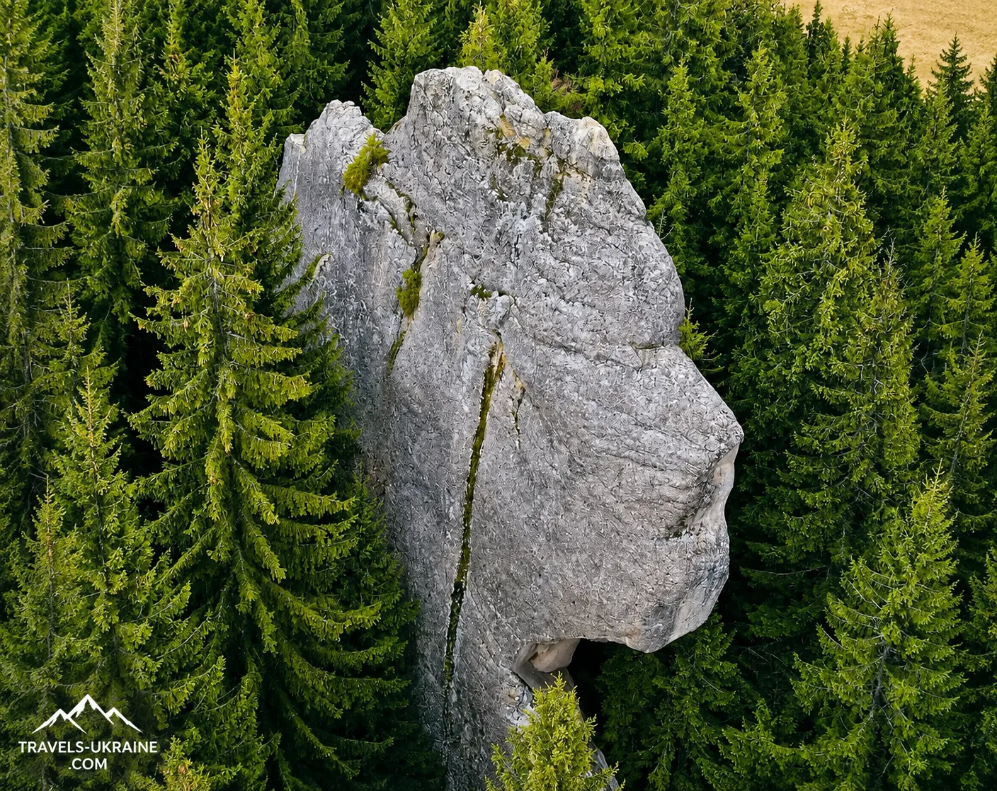
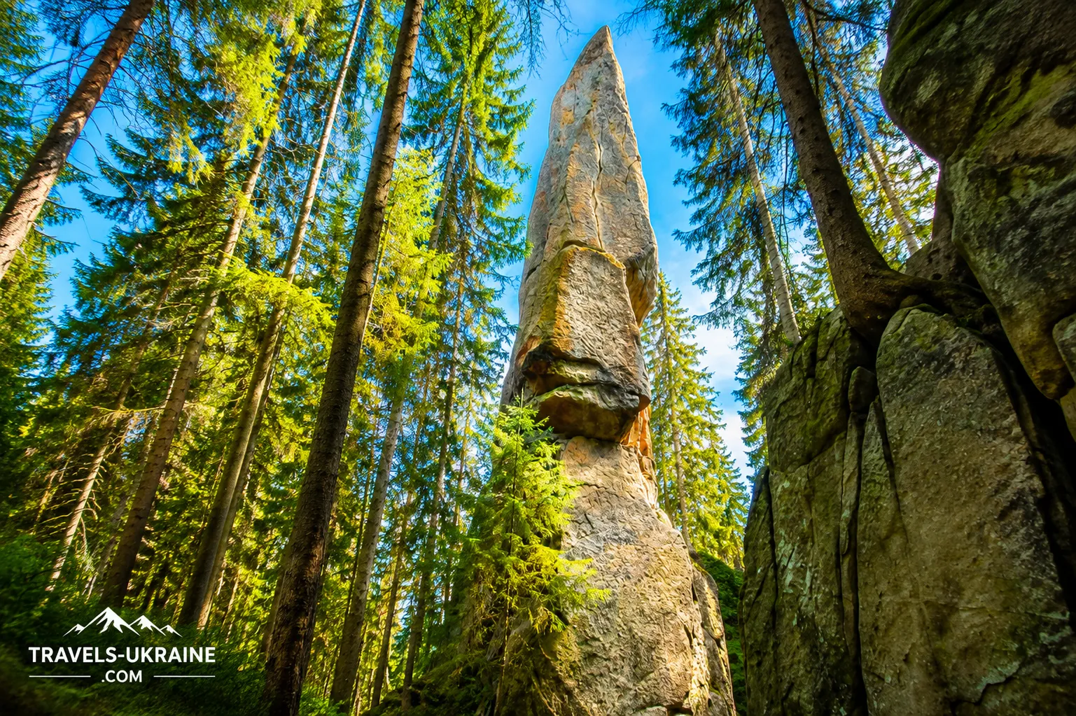
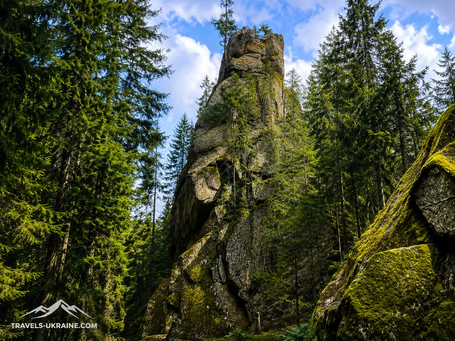
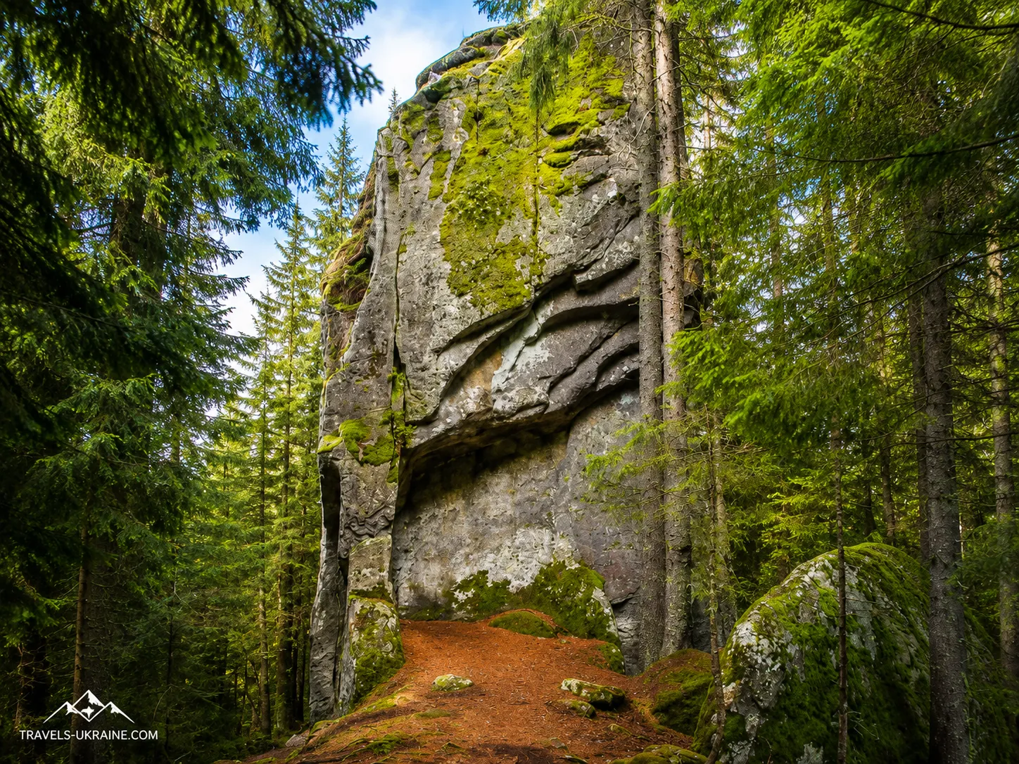
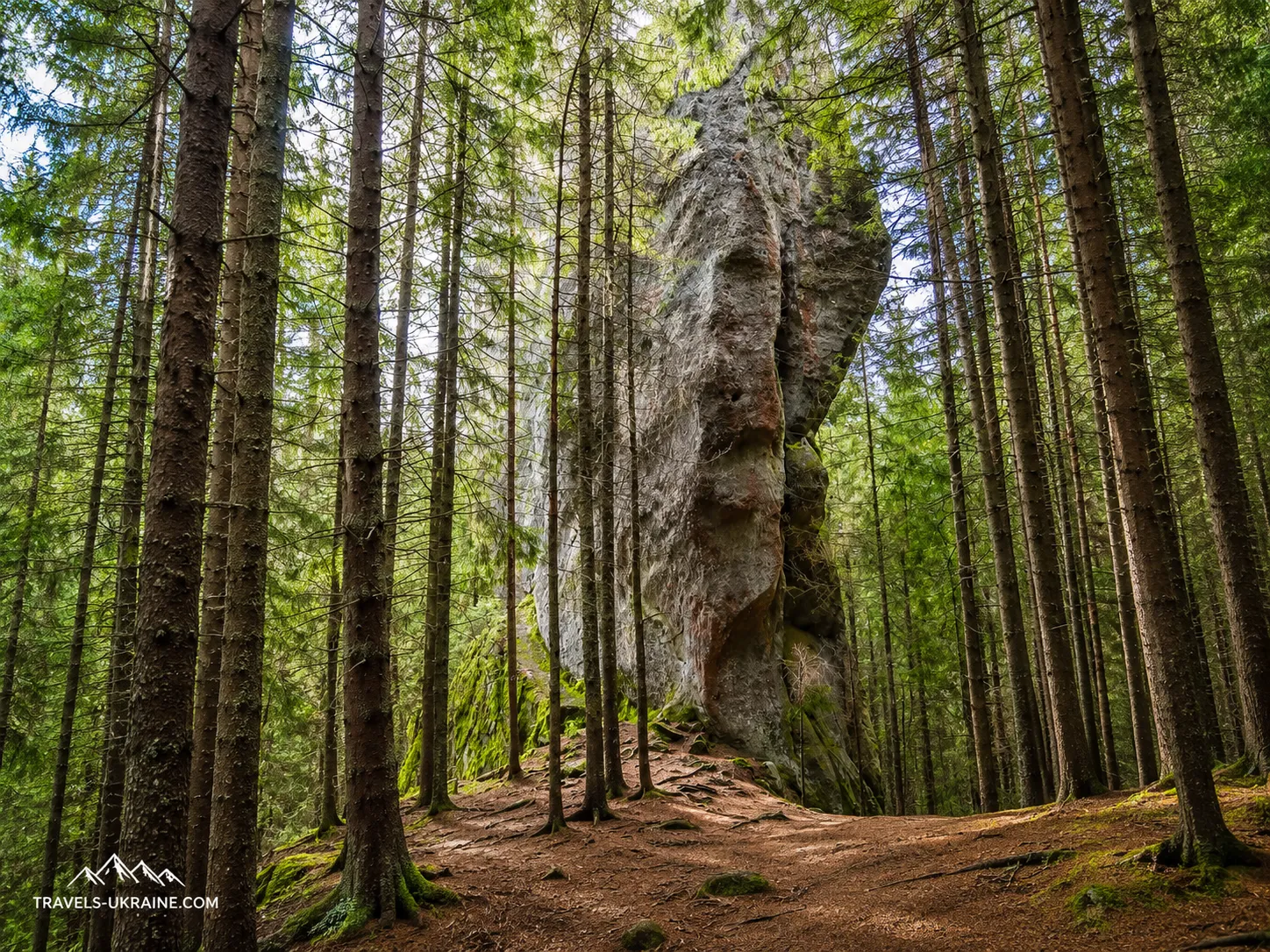
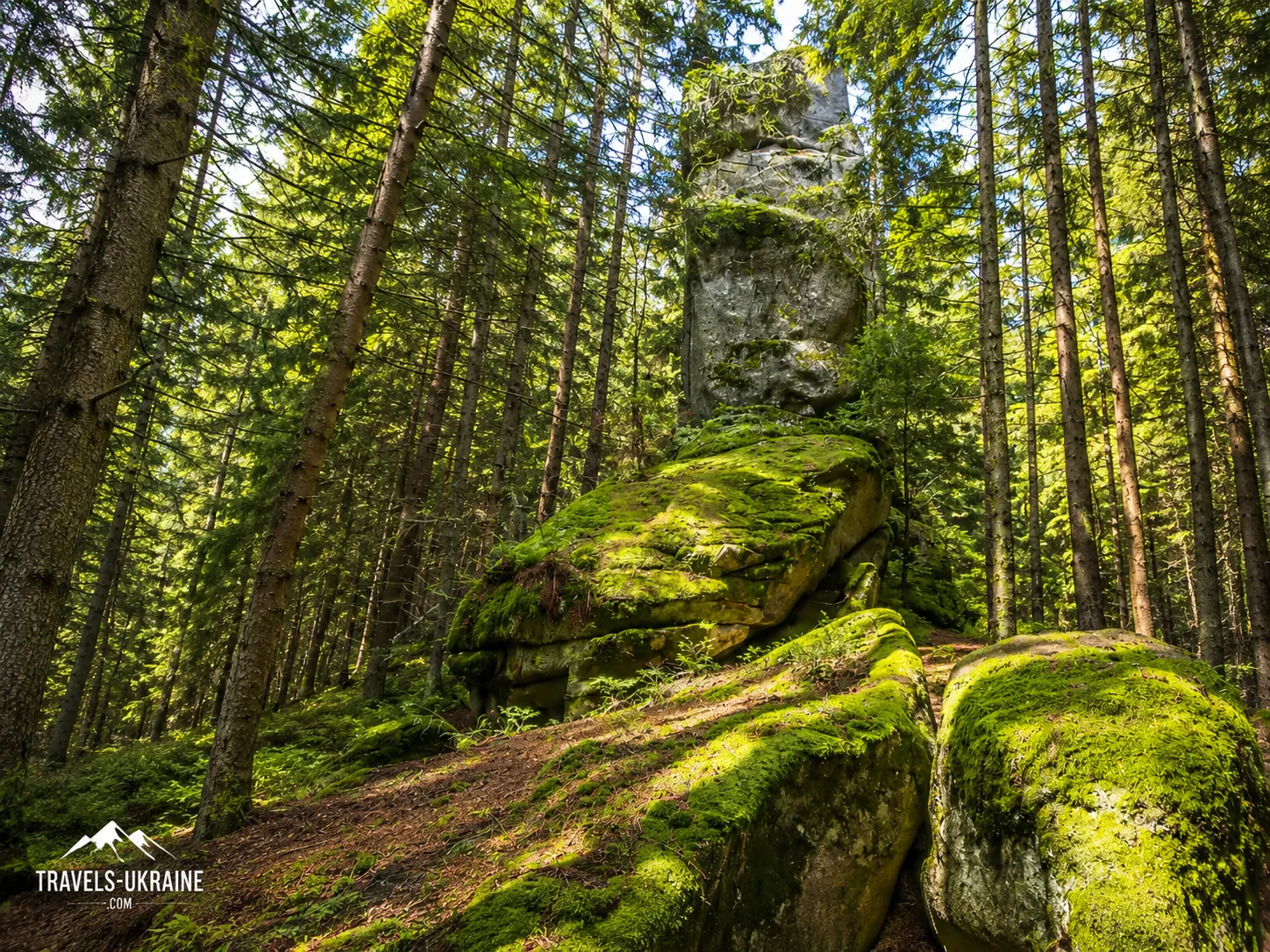
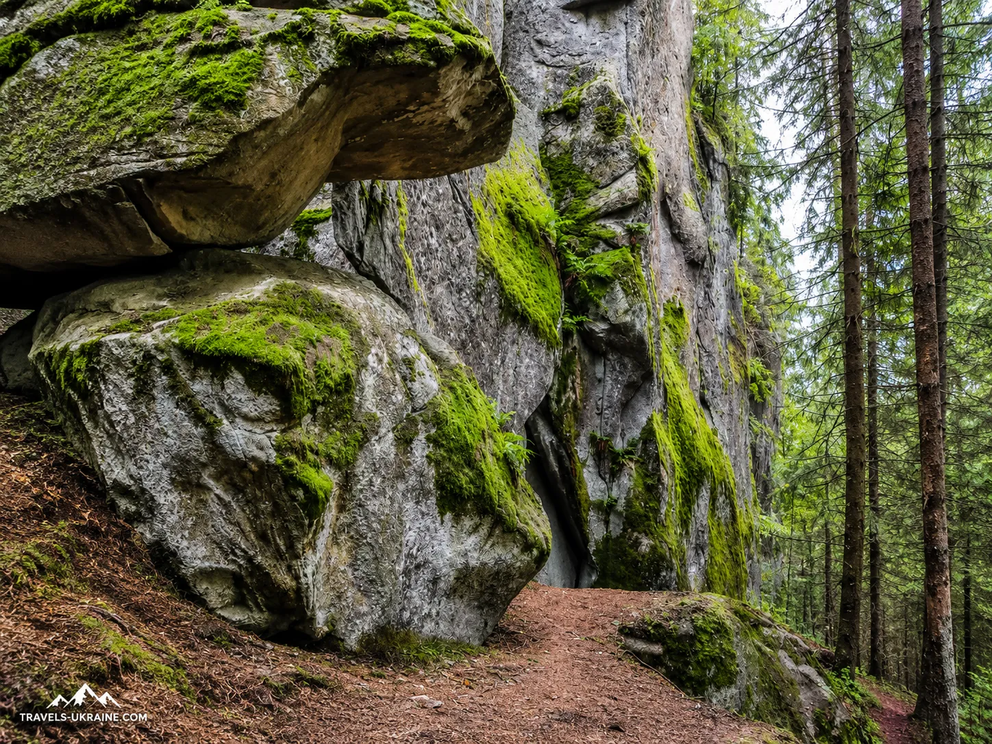
Hungarian Rocks are one of those Carpathian destinations whose true scale cannot be grasped from photographs. Among the dense spruce forest near the village of Zelene, several sheer rock walls suddenly rise, some reaching approximately 20–40 metres in height. From a distance, trees conceal most of the rocks, so it is only at their very foot that their immense scale becomes clear.
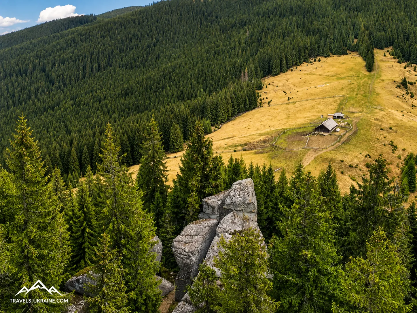
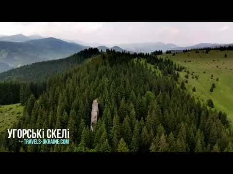
And this is not a single isolated rock. In the Uhorske tract, researchers describe four main rock formations scattered through the coniferous forest on the slopes of the Hryniava Mountains. There is no broad viewpoint or tourist promenade here: the trail winds between trees, rocks and moss, and another stone wall may appear literally around the next bend.
Yet the natural scale is only the beginning of the story. Approximately a kilometre from the main group stands a huge boulder known locally as «The Lord’s Chair». Its shape truly resembles a gigantic stone throne: it is more than five metres high and approximately fifteen metres wide. Researchers have recorded cut marks and geometric signs on its surface, whose origin and purpose leave room for various interpretations.
It was precisely such details that gave rise to one of the most intriguing theories about Uhorsky Kaminnia. Mykola Kuhutiak, a researcher of Hutsul antiquities, regarded some of the rocks and stones in the complex as possible cult objects and linked them to ancient sacred practices. However, calling Hungarian Rocks a proven prehistoric sanctuary would be premature: it is an interesting research hypothesis that must be clearly distinguished from archaeologically established facts.
Hungarian Rocks in the Carpathians are interesting precisely because they combine several different worlds. Here, natural erosion created vertical stone walls amid the forest, human imagination left behind legends about Hungarians, and mysterious shapes and signs on individual stones became the basis for hypotheses about much earlier use of the area.
In this journey, we will explore how Hungarian Rocks were formed, what is known about «The Lord’s Chair» and the possible ancient sanctuary, why the area received its name, where exactly it is located and how to get there from the village of Zelene. We will also find out how difficult the route is, whether it is worth continuing the hike to Mount Skupova, and what else can be seen among the little-known Hryniava Mountains.
How Hungarian Rocks Formed: From Marine Sediments to Stone Giants
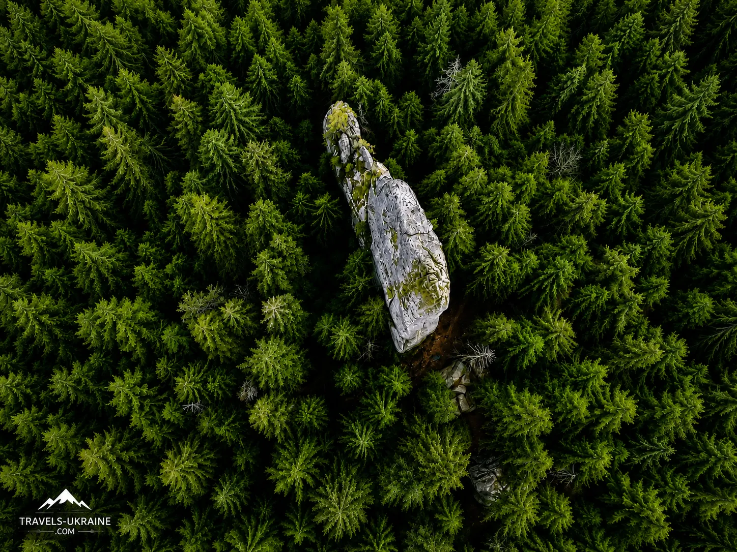
Looking at these rocks, it is easy to imagine that the immense stone walls simply grew along with the Carpathians. In reality, their story began long before the modern mountain relief took shape. The rock formations consist of sandstone—a sedimentary rock formed when huge amounts of sand and fragmented material accumulate in layers, become compacted and gradually turn into solid stone.
Carpathian sandstones formed in an ancient marine basin, where underwater currents carried sand, silt and rock fragments. The material settled in layers on the seabed and later became compacted and cemented under the pressure of new deposits. What now rises among the spruce forest of the Hryniava Mountains was once part of a completely different world: layers of sediment hidden beneath the water.
How Marine Sandstone Ended Up High in the Carpathians
The next stage began during the formation of the Carpathians. Movements of the Earth’s crust compressed, deformed and uplifted immense layers of sedimentary rock. Layers that had originally accumulated almost horizontally were folded, fractured and raised to considerable heights.
These tectonic fractures paved the way for the formation of the stone blocks. They divided the solid sandstone mass into large fragments, while water and atmospheric processes gradually widened its natural weak points. In this way, the future Hungarian Rocks in the Hryniava Mountains began to separate from the surrounding rock.
Why the Surrounding Rock Disappeared While the Rocks Remained
The rocks’ present form is the result not of a single catastrophic event, but of nature’s very long-term work. Rainwater seeped into the cracks, frost widened them in winter, tree roots gradually forced apart weakened sections, and tiny rock particles were washed out and carried down the slope.
At the same time, different parts of the sandstone mass eroded at different rates. Less stable and more heavily fractured rock gradually disappeared, while stronger blocks remained. This is how rock outcrops form—fragments of once much larger masses that survived the destruction of the surrounding surface.
Therefore, the vertical walls of Uhorske Kaminnia were not «carved» by nature according to a finished plan. Their shape was determined by a combination of the sandstone’s structure, the direction of its fractures and millions of cycles of erosion, during which water, frost, gravity and vegetation removed the weaker material.
The sandstone’s surface is still undergoing erosion today. Moisture penetrates between the grains, water expands as it freezes, and mosses, lichens and plant roots gradually affect the stone’s surface. After heavy rainfall, fine grains of sand are washed from the vertical walls, while fragments of rock accumulate at their base.
This means that the rocks in the Hryniava Mountains are not geological scenery frozen forever in one form. They continue to change very slowly: cracks widen, small fragments break away, and individual blocks gradually become less stable. These changes are almost imperceptible to people, but on a geological timescale the rock complex is constantly in motion.
Stone Walls Hidden from Casual View by the Forest
The rocks near the village of Zelene are also distinctive because the modern landscape almost conceals the complex’s geological origins. Spruce trees have grown around the outcrops, moss has covered the stones, and the forest floor has hidden small fragments of rock. As a result, it can seem as though four enormous rocks were simply placed in the forest as separate stone structures.
In reality, travellers are looking at the remains of a much larger natural mass, gradually dismantled by water, frost, erosion and gravity over a long period. Realising this changes how Hungarian Rocks are perceived: they are not merely beautiful stones in the Carpathians, but small fragments of ancient geological history strong enough to survive the destruction of the surrounding mountain slope.
The Lord’s Chair and the Mysterious Stones of the Uhorske Tract
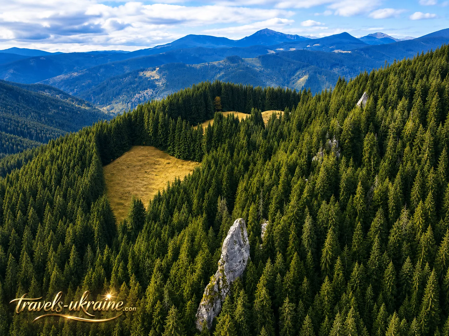
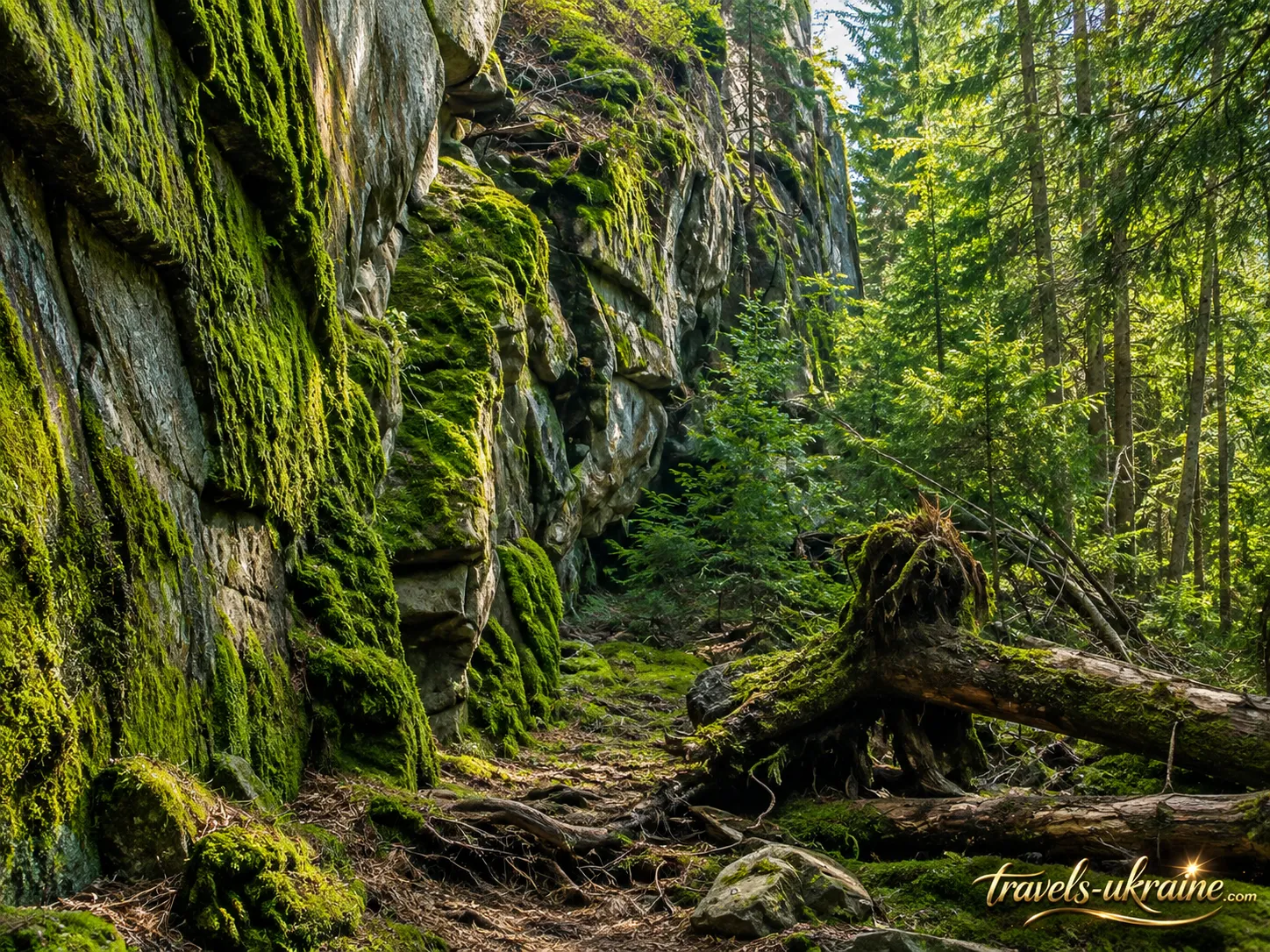
The main Hungarian Rocks of Ivano-Frankivsk Region are not the only unusual rock formations in the Uhorske tract. Approximately a kilometre east of them, on the opposite slope, stands a huge stone that local residents call «Panskyi’s Chair». The name conveys its shape remarkably well: the mass resembles a gigantic chair or stone throne placed in the middle of the Carpathian forest.
The formation’s dimensions only strengthen this impression. According to researcher Mykola Kuhutiak, the stone is more than 5 metres high and approximately 15 metres wide. A person standing beside it looks tiny, while the stone’s natural projections resemble the back and armrests of a huge chair. This unusual shape probably gave the object its popular name.
At first glance, it is easy to assume that someone deliberately tried to give the stone the shape of a throne. However, large sandstone boulders can acquire highly unusual outlines through fracturing, weathering and uneven erosion. Where one part of a mass erodes more quickly, another remains protruding as a wall, ledge, niche or peculiar «seat».
For this reason, the shape of The Lord’s Chair in the Carpathians should not automatically be considered man-made. Much of what resembles a familiar object could have formed entirely naturally. More intriguing are certain details on the stone’s surface, which researchers describe as more than merely the result of weathering.
Signs and Cut Marks on the Surface of The Lord’s Chair
On the western wall of the stone «throne», researchers recorded cut marks, and below them an outlined circle with an X-shaped sign inside. Another elongated vertical cut mark is described beneath the right side of the stone. These traces became one of the reasons for the particular interest in the entire Uhorske tract complex.
However, it is important here to distinguish observation from interpretation. The existence of depressions and signs can be described, but establishing their age, authorship and original purpose without specialised archaeological research is much more difficult. Not every line on an old stone necessarily has ritual significance—some traces may have appeared in different historical periods or had an entirely practical origin.
This uncertainty is precisely what makes The Lord’s Chair near Hungarian Rocks especially interesting. Before the traveller stands a real, enormous stone of unusual form, with real markings on its surface, but there is no definitive answer to who left them or why.
The Zoomorphic Stone beside the Tallest Hungarian Rock
Another unusual object lies directly beside the complex’s tallest, spire-like rock. Research describes a separate stone approximately 2.5 metres high and more than 3 metres wide, whose shape appears zoomorphic—that is, reminiscent of a living creature. Depressions and signs interpreted as symbolic images were recorded on one of its surfaces. Such details formed the basis for the suggestion that some stones may have held greater significance for the ancient inhabitants of the Carpathians than merely serving as natural landmarks.
Here too, however, categorical conclusions should be avoided. The stone’s unusual shape may be the result of natural weathering, while interpreting individual depressions as ancient symbolism remains a research interpretation. That is why it is much more interesting to see these formations with your own eyes and try to understand where nature’s work ends and possible traces of human activity begin.
Why These Stones Are Easy to Miss on a Hike
One of the distinctive features of the Uhorske tract is the absence of a sense that it is one compact «rock museum». The main stone formations lie among dense coniferous forest, while Panskyi’s Chair is located about a kilometre from the main rocks. If you walk only to the best-known vertical wall and immediately turn back, you may simply miss some of the most interesting objects.
Because of the trees, large stones often reveal themselves to hikers only at close range. There is no distant viewpoint from which the entire complex can be seen at once. Instead, the Uhorske tract unfolds gradually: first one stone wall appears among the spruces, then another, followed by individual boulders and, only later, the enormous natural «throne».
This is what makes walking among the mysterious stones of Hungarian Rocks feel less like viewing a single landmark and more like a small exploration of the area. The interest lies not only in reaching a designated point on the map, but also in examining the shapes of the rocks, their cracks, depressions and surface markings.
The Lord’s Chair and the other unusual stones give Hungarian Rocks something that a beautiful mountain landscape alone cannot provide: a question without an obvious answer. Did people use these stones in the distant past, or did nature alone create most of their strange forms? This mystery leads to the next, even more complex subject—the theory of a possible ancient sanctuary among the Hryniava Mountains.
Were Hungarian Rocks an Ancient Sanctuary?
This is where the story of the Uhorські Rocks in Verkhovyna District moves from geology into a far more mysterious realm. The unusual shapes of individual stones, cut marks, geometric signs, and the arrangement of large boulders have led to the suggestion that part of the complex may have been used by people not only as a natural shelter or landmark, but also as a place with special symbolic or ritual significance.
One researcher who consistently developed this interpretation was historian and ethnologist Mykola Kugutуak. As part of the Carpathian Ethnoarchaeological Expedition, he studied dozens of rock complexes in the Hutsul region and other parts of the Carpathians, focusing on their shape, orientation, traces of stone working, and possible symbolic images.
Why researchers focused specifically on the Uhorські Rocks
The interest was caused not only by the size of the rocks themselves. The complex combines several elements that researchers considered unusual: individual large stones with distinctive shapes, traces of cut marks, geometric signs, and a peculiar spatial arrangement of the objects.
Particular attention was drawn to the so-called stone chair and other stones whose surfaces bore X-shaped signs and depressions. In studies of Carpathian cult sites, such symbols are sometimes interpreted as elements of an ancient ritual tradition. However, a sign on a stone alone does not prove the existence of a sanctuary—the context, dating, and connection with other archaeological materials are important.
The hypothesis of the complex’s ritual use
Mykola Kugutуak classified the Uhorські Rocks among possible rock cult sites of the Carpathians and considered them in the broader context of other megalithic and petroglyphic sites in the Hutsul region. In his works, such complexes are interpreted as places that may have held ritual significance for the ancient inhabitants of the mountains.
Under this model, the natural rocks were not necessarily created by humans. Rather, ancient communities may have chosen existing natural formations because of their unusual shape, location, or dominance over the surrounding landscape, and then supplemented them with individual cut marks, symbols, or ritual elements.
This may explain why a natural rock massif and possible traces of human intervention exist side by side. Nature created the foundation, while people may have endowed it with their own meaning.
Can the Uhorські Rocks be reliably dated to the Copper–Bronze Age?
Popular descriptions sometimes claim that the Uhorські Rocks are a sanctuary dating from the Copper–Bronze Age. This wording should be used with great caution. It comes from a research interpretation of the complex, not from a complete archaeological excavation that would provide a reliable set of dated finds directly beside each stone object.
To date an ancient sanctuary with confidence, archaeologists usually need more than the shapes of stones and signs on their surfaces. They also need a cultural layer, pottery, tools, organic remains, or other materials that can be dated independently. There is not enough convincing evidence of this kind for the Uhorський complex in publicly available sources to describe the Copper or Bronze Age as an established fact.
It is therefore more accurate to say that some researchers interpret the Uhorські Rocks as a possible ancient cult complex and associate it with prehistoric Carpathian traditions, although this theory requires further archaeological confirmation.
Where archaeology ends and legend begins
The Uhorські Rocks are interesting precisely because it is easy here to cross the boundary between fact and an attractive interpretation. The rocks themselves, Panske Chair, and the recorded cut marks and signs are real. The research that considered the complex a possible sacred site is also real.
Claims about specific rituals, priests, worship of particular gods, or the exact age of each sign, however, would already be assumptions without additional evidence. That is why it is best to view the Uhorське stones not as a «proven Bronze Age temple,» but as an intriguing archaeological and cultural puzzle, where the natural landscape, possible traces of human activity, and local tales overlap.
And perhaps that is the main value of this mystery for the modern traveler. The Uhorські Rocks do not provide a ready-made answer. They leave you free to look at the stones, signs, and natural forms yourself and ask a question that remains open: were these rocks simply part of the mountain landscape for the ancient inhabitants of the Carpathians—or did they have a much deeper meaning?
Why the rocks are called Uhorські: the history of the name and local legends
The name Uhorські Rocks (Uhorське Stones) sounds as though it must be connected to a specific historical event—a Hungarian military campaign, an ancient border, or a forgotten battle in the Carpathians. That is why many explanations have emerged around it. However, there is currently no reliable document that clearly explains when and because of which particular event the rocks acquired this name.
The safest assumption is that the stone complex is located in the Uhorське tract. The modern names «Uhorські Rocks» and «Uhorське Stones» come from the name of this locality. The more difficult question is why this particular tract was once called «Uhorське.»
The legend of Hungarian warriors in the Hryniava Mountains
The best-known local legend connects the name with Hungarian warriors who supposedly passed through this part of the Carpathians or used the large rocks as natural shelter. The story fits naturally into the borderland history of the mountain region: for centuries, Carpathian passes served as routes between the lands on either side of the mountains.
The enormous stone walls in the dense forest could indeed have been a convenient landmark or a place for a brief stop for people traveling through the mountains. However, there is a major difference between that possibility and a claim about a specific Hungarian military detachment. The available sources contain no names, dates, campaign descriptions, or archaeological finds that would directly confirm this particular story.
The story of the warriors should therefore be understood as a local legend explaining an unusual place name, rather than as an established fact in the history of the Uhorські Rocks.
Could the name be connected with ancient routes across the Carpathians?
Another entirely logical theory does not require a specific battle or military camp. The Hryniava Mountains lie in a region where economic, trade, and seasonal ties between different Carpathian territories existed for a long time. People crossed the ridges, drove livestock, used mountain meadows, and sought shorter routes through the mountains.
In that case, the name may have gradually become attached to the area—for example, as a designation for a direction, road, or territory that popular memory associated with the Hungarian side of the Carpathians. Similar geographical names often outlive the events that gave rise to them, while the original explanation gradually fades from memory.
Yet this version also remains a supposition. Without early written references to the Uhorське tract itself, it is difficult to establish the precise etymology of the name.
Why we should not invent several «historical theories» about the origin of the name
Tourist descriptions sometimes try to explain the name through several attractive stories at once: Hungarian troops, trade caravans, ancient rituals, or the cultural influence of neighboring lands. The problem with such theories is that they easily turn assumptions into supposedly established facts.
For the Uhorські Rocks near Zelene, an honest approach is more interesting: we know the complex’s modern name and the name of the tract, and we know about the widespread tale concerning Hungarians, but we do not have sufficient grounds to connect the place name with one specific historical event.
This uncertainty does not make the story any poorer. On the contrary, it shows how local memory took shape in the Carpathians: the names of mountains, streams, tracts, and rocks could be passed down through generations even after the original reason for their appearance had long been forgotten.
Uhorське Stones—a name that outlived its own history
Today, the names «Uhorські Rocks» and «Uhorське Stones» have themselves become part of the tourist identity of this place. They are memorable, add an air of mystery to the location, and at the same time preserve the old name of the tract, which existed long before modern tourist routes appeared.
Perhaps archival documents or new local-history research will one day clarify the origin of the name. For now, the most accurate approach is to leave room for both levels of the story: the Uhorське tract as a real geographical fact, and the legend of the Hungarian warriors as part of local folklore.
And that suits the atmosphere of the place rather well. Among enormous stone walls, forests, and old mountain trails, not every story has to end with an unambiguous answer. Some names preserve memory longer than documents—and the Uhorські Rocks seem to be one of those places.
How to get to the Uhorські Rocks from the village of Zelene
These Carpathian rocks are located in the Uhorське tract, approximately 4 km southeast of the village of Zelene in Verkhovyna District. The route to the Uhorські Rocks is about 4–5 km to the vicinity of the complex, depending on the exact starting point and chosen trail. This is therefore not a location you can reach by car directly beneath the rock wall: the final part of the route must be covered on foot through the mountain forest.
The most convenient starting point is the village of Zelene. From here, a hiking route toward Skupova passes through the area of the Uhorське Stones. The separate Zelene—Skupova route is marked blue and is approximately 8.2 km long, with the Uhorські Rocks serving as one of its key natural landmarks. After visiting the stone complex, this route allows you to continue climbing into the higher mountain areas.
In this case, however, the Uhorські Rocks become not the final destination but part of a full mountain route. Reaching Skupova requires allowing more time and taking into account the elevation gain, weather, and your own fitness level.
If your main goal is simply to visit the Uhorське Stones and return to Zelene, allow several hours for the route rather than planning it as a short walk. The actual time depends on your pace, the weather, trail conditions, and how long you want to spend exploring individual rocks and looking for Panske Chair.
Traveling may take longer after rain: forest roads become wet, roots and stones slippery, and some sections of the slope require more careful footing. It is therefore best to start the hike in the first half of the day, leaving enough daylight for the return journey.
Zelene—Uhorські Rocks route
From Zelene, the path gradually gains elevation and leads deep into the Hryniava Mountains. At first, the trail follows local and forest roads, then turns into a mountain route through spruce forest. The rocks themselves are well hidden among the trees, so even after approaching them, hikers do not immediately see the entire complex.
This is one of the distinctive features of a mountain hike: there is no moment when the Uhorські Rocks suddenly open up in a vast panorama far ahead. Instead, the stone walls appear gradually, as the trail begins to pass directly between the forest and the rocky outcrops.
For your first hike, it is best to have an offline map or a GPS track downloaded in advance. Forests contain service roads and branch paths that may look more convincing than the trail you need, while mobile coverage in mountainous areas is not always reliable.
What the yellow route of the Uhorські Rocks means
On tourist maps, you can see a separate route called «Uhorske Rocks», marked in yellow and only about 617 meters long. It is important to understand this figure correctly: it does not mean that the walk from the village of Zelene to the rocks is only 600 meters.
This is a short, locally marked section located directly in the area of the rock complex itself. It runs between elevations of approximately 1117–1253 m and involves about 153 m of elevation gain. The main approach from Zelene to the tract is considerably longer.
Because these two routes are sometimes confused in tourist descriptions, it may seem that Uhorske Rocks are almost beside the road. In reality, the short yellow-marked section is only the final part of discovering the complex.
What to consider before setting out from Zelene
The route does not require mountaineering equipment, but ordinary city shoes are not the best choice. It is worth bringing hiking shoes or boots with good tread, a supply of water, a lightweight rain jacket, and a charged phone with an offline map or GPS track downloaded.
You should not expect tourist infrastructure directly near the rocks either. The Uhorsky tract remains a natural mountain area, so it is best to prepare food, water, and other necessities before setting out. The very absence of a road to the foot of the rocks is what makes the route to Uhorske Rocks from Zelene part of the experience itself. The stone giants do not reveal themselves to visitors immediately—you have to climb gradually through the forest, and only then do vertical walls of Uhorsky Kamin begin to appear among the spruces.
Hike to Uhorske Rocks: Difficulty and Preparation
A hike to Uhorske Rocks can be organized in different ways. For some hikers, the main goal will be the rocky outcrops themselves, after which they can return to Zelene. For others, the rocks will be merely the first major stop on the way to Mount Skupova, one of the most distinctive peaks of the Hryniava Mountains. The second option offers considerably more impressive panoramas, but requires more time, stamina, and careful planning.
The main feature of this area is the transition from dense spruce forest to a more open high-mountain landscape. Near Uhorsky Kamin, hikers are almost constantly among the trees, while higher up toward Skupova, the forest gradually recedes, meadows appear, and the views become increasingly broad. That is why continuing the route creates an entirely different impression of the Hryniava Mountains.
How difficult is the hike to Uhorske Rocks?
The route to the rocks is not considered a technically difficult mountain crossing. There are no sections requiring ropes, special mountaineering equipment, or the crossing of exposed rocky ridges. The main challenges are the elevation gain, forest trails, uneven ground, and the overall length of the hike.
In dry weather, the route is quite accessible to hikers with an average level of fitness. After rain, the character of the trail changes: wet roots become slippery, muddy sections develop on clay soils, and the rocks near the cliffs can be extremely slick. That is why good hiking footwear matters much more here than maintaining a fast pace.
Is it worth climbing Skupova after visiting Uhorske Rocks?
If the weather is stable, there is enough daylight, and you still have energy, continuing the route to Skupova is definitely worthwhile. The peak stands at approximately 1580 meters and is the highest point of the Krynta–Skupova ridge. Its lower slopes are forested, while open mountain-meadow sections begin at approximately 1300–1400 meters.
This is where the route changes character dramatically. After the intimate atmosphere of Uhorske Rocks, enclosed among spruces, hikers emerge into open mountain space. Views of neighboring ranges unfold from the summit area and the mountain meadows, and in good visibility it is possible to see a substantial part of the surrounding Carpathians.
However, Skupova should not be treated as a mandatory continuation. If you already feel tired at the rocks, the weather is deteriorating, or little daylight remains, it is wiser to return the same way. The mountain will still be there, and a hurried ascent in fog or late in the day rarely adds to the enjoyment of the trip.
What equipment to take for the Uhorske Rocks–Skupova route
A large expedition backpack is not necessary for a day hike. It is much more important to carry basic items that will let you respond calmly to changing weather or a delay on the route.
- hiking footwear with good tread;
- enough drinking water and food for the entire route;
- a rain jacket or waterproof jacket;
- a warm clothing layer for exposed sections of the ridge;
- a GPS track or offline map and a power bank;
- a small first-aid kit and a flashlight, even if you plan to return before sunset.
Hiking poles are not essential, but they can make a long descent considerably easier, especially after rain. They also help maintain balance on wet roots and uneven forest sections.
When is the best time to visit Uhorske Rocks and Skupova?
The most convenient period for a first hike is from late spring to early autumn, when there is no persistent snow on the trails and the days are long enough. Summer provides the most time for the route, while early autumn is especially attractive for its forest colors and better visibility on cool days. In late autumn and winter, the same route requires an entirely different level of preparation. Snow can conceal the trails and markings, while the short day significantly reduces the time available. A winter hike should therefore not automatically be judged by the route’s summer difficulty.
Uhorske Rocks and Skupova combine well in a single route precisely because they offer two completely different experiences. Around the rocks, it is interesting to walk slowly through the forest, study the sandstone formations, look for individual rock structures, and sense the scale of the vertical walls. Skupova, by contrast, draws visitors with its open space and mountain panorama.
There is therefore no point in rushing through the Uhorsky tract just to add another summit marker as quickly as possible. If you allow enough time for both parts of the route, one day will reveal the Hryniava Mountains from two sides at once—a mysterious rocky world deep in the forest and a broad Carpathian horizon above the spruces.
What to See Near Uhorske Rocks
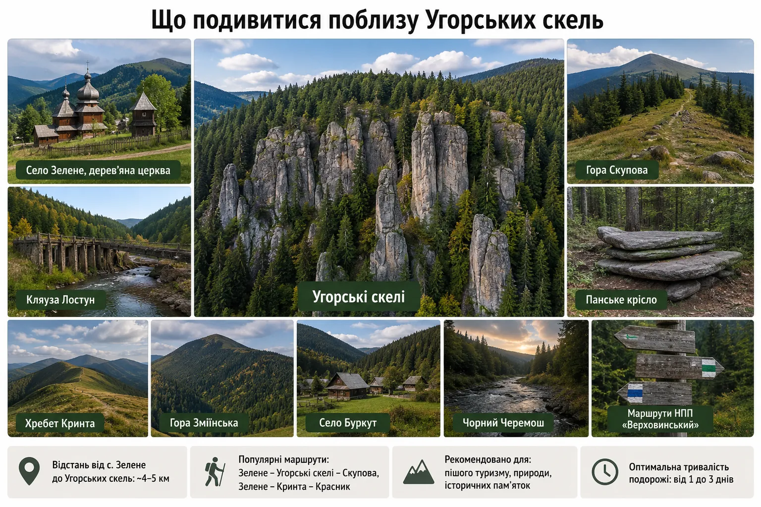
Uhorske Rocks can easily be the main goal of a separate hike, but the area around Zelene and the Hryniava Mountains offers enough reasons to stay longer. The key is not to try to see everything in one day: some attractions lie directly along extensions of the mountain routes, while others are better planned as a separate trip. The best strategy is to treat Zelene as a starting point for several different ways of discovering this part of the Ukrainian Carpathians—through its rocks, mountains, history, and natural heritage.
Krynta Ridge and Mount Zmiinska
If you want to continue hiking after Uhorske Rocks and Skupova, Krynta Ridge is the logical direction. One well-known route runs from Zelene through Uhorske Rocks, Skupova, Mount Zmiinska, and Krynta to the village of Krasnyk.
This is a considerably longer option—about 26 km—so it is best treated as a separate full day in the mountains. In return, it lets you see the Hryniava Mountains from more than one summit, cross part of the ridge, and experience the gradual change in landscape from forest to mountain meadows.
Burkut—Mineral Springs and Traces of Lesya Ukrainka
Burkut deserves a separate day—a remote high-mountain village in the Chyvchyny–Hryniava Mountains, known for its mineral springs. In 1901, Lesya Ukrainka stayed here for several weeks, treating herself with the local mineral water and writing extensively about the surrounding Carpathians in her letters.
Today, Burkut is interesting not only for its literary history. It is another way to see a completely different side of Verkhovyna—remote valleys of the Chornyi Cheremosh, old roads, high-mountain meadows, and places where tourist infrastructure gives way to wild nature.
Lostun Weir—A Trace of the Era of Timber Rafting on the Cheremosh
One of the most interesting technical structures in this area is the Lostun weir—a partially preserved old hydraulic installation on the Chornyi Cheremosh. Weirs of this kind were dams with sluices that stored water and used it to float timber down mountain rivers.
Lostun is considered one of the largest structures of its kind in the Carpathians. During the period of active timber rafting, it was an important part of a complex system for transporting timber from high-mountain areas down the Cheremosh. Today, a separate educational ecological trail of the Verkhovynskyi National Nature Park leads to the weir.
This is an excellent place for those interested not only in nature but also in the history of the Carpathians’ development. After hiking to the natural stone giants of the Uhorsky tract, you can see an entirely different scale—an engineering structure built by people to work with a powerful mountain river.
Verkhovynskyi National Nature Park and the Chyvchyny Mountains
If your trip lasts several days, it is worth considering the routes of the Verkhovynskyi National Nature Park. The park covers part of the Chyvchyny–Hryniava Mountains and has a network of marked educational ecological trails. These include routes to Lostun, Burkut, Chyvchyn, Perkalaba, and other remote areas. These are not short add-ons to a hike at Uhorske Rocks, but separate destinations that can easily fill another day or several days of travel.
The Chyvchyny Mountains are especially interesting—one of the most remote and least urbanized ranges in the Ukrainian Carpathians. There are far fewer popular tourist destinations here, but a much stronger sense of genuine high-mountain wilderness.
What to Choose After Uhorske Rocks
If you have only one day, keep the route simple: Zelene → Uhorske Rocks → Skupova → return. This is enough to gain a complete impression of the Hryniava Mountains.
If you have a second day, you can choose one of two directions. Those who enjoy long hiking routes can continue via Krynta, while travelers more interested in the history and little-known places of Verkhovyna can choose Burkut or the Lostun weir.
This diversity is precisely what makes the area of Uhorske Rocks near Zelene especially interesting. Natural rocky outcrops, mountain meadows, old wooden churches, mineral springs, and hydraulic engineering landmarks from the timber-rafting era all exist side by side here—and each reveals the Carpathians from a completely different perspective.
Frequently Asked Questions About Uhorske Rocks
Where are Uhorske Rocks located?
Uhorske Rocks are located in the Uhorske tract near the village of Zelene in Verkhovyna District, Ivano-Frankivsk Oblast, in the Hryniava Mountains. The complex is hidden in coniferous forest on the slopes around Mount Skupova.
How long does it take to reach Uhorske Rocks from the village of Zelene?
From the village of Zelene to the Uhorske Rocks area, you need to walk approximately 4–5 km, depending on the exact starting point and the trail option chosen. The route follows mountain and forest roads and gradually gains elevation.
How difficult is the route to Uhorske Rocks?
The route does not require mountaineering equipment and, in dry weather, is suitable for hikers with an average level of fitness. The greatest challenges are the elevation gain, uneven forest trail, and slippery sections after rain. Hiking footwear and an offline map are recommended.
What is the Panske Armchair near the Hungarian Rocks?
The Panske Armchair is a large, unusually shaped natural rock located approximately a kilometer from the main rock complex. It is over 5 meters high and about 15 meters wide. Its shape resembles a gigantic stone throne, and researchers have documented cuts and geometric markings on its surface.
Were the Hungarian Rocks really an ancient sanctuary?
This is one research hypothesis, but not an conclusively proven archaeological fact. Mykola Kuhutiak interpreted certain stones, cuts, and markings as possible elements of an ancient cult complex. At the same time, additional archaeological evidence is needed to establish the date with confidence and confirm the sanctuary's function.
Why are the Hungarian Rocks called that?
The rocks are located in the Uhorske tract, from which the modern names «Hungarian Rocks» and «Uhorske Stones» are derived. A popular account links the area to Hungarian warriors, but there is currently no documentary evidence of a specific historical event that gave the tract its name.
Can the Hungarian Rocks be combined with a hike to Skupova?
Yes. One hiking route leads from Zelene through the Hungarian Rocks area and onward to Mount Skupova. This is a good option for travelers with sufficient time and physical fitness. In this case, the rocks become the first major natural stop on the way to the more open high-mountain areas of the Hryniava Mountains.
Is it worth visiting the Hungarian Rocks?
The Hungarian Rocks (stones) are not a Carpathian destination to be judged solely by the number of viewpoints or ease of access. Their main appeal lies elsewhere: enormous sandstone walls are hidden in dense forest, individual rocks have unusual shapes, and enough mysteries remain around the complex itself to turn an ordinary hike into a small investigation.
The contrast between nature and the stories that have grown up around this place makes a particularly strong impression. On one hand, there are entirely understandable geological processes that shaped the vertical rock outcrops over a very long period. On the other, there are the Panske Armchair, cuts and markings on individual stones, a research hypothesis about possible ritual use, and legends associated with the name of the Uhorske tract.
That is why a hike to the Hungarian Rocks will be especially interesting to those who enjoy not only beautiful landscapes but also places with character. There is no ready-made story here in which every question has a definitive answer. Geology explains part of the formations' origins, some traces on the rocks still require investigation, and certain stories remain part of local folklore.
For travelers, it is also a good way to discover the Hryniava Mountains, which feature far less often on popular routes than Chornohora or the Gorgany. The road from Zelene leads through the forest, and after exploring the rocks, the hike can continue to Skupova, where broad Carpathian panoramas open up instead of the enclosed space between the spruce trees.
Do not come here expecting a tourist complex or an easy walk from a parking area. This Carpathian hiking route requires time, proper footwear, basic fitness, and a willingness to spend several hours in the mountains. Yet this remoteness has helped preserve the atmosphere of the place—an atmosphere that quickly disappears where natural sites become crowded attractions.
If you are interested in the lesser-known Carpathians, hiking, natural rock complexes, local legends, and routes where the journey itself is part of the experience, the Hungarian Rocks near the village of Zelene unquestionably deserve your attention. Here, it is easy to feel that the mountains are not only famous summits and popular waterfalls, but also places where enormous stone walls have stood among the forest for centuries, while their full history remains only partly deciphered.


No Comment
You can post first response comment.