
 English
 Українська
 Български
 Hrvatski
 Čeština
 Dansk
Dansk Nederlands
 Eesti
Eesti Suomi
Suomi Français
 Deutsch
 Ελληνικα
 Magyar
 Íslenska
 Italiano
 Latviešu
 Lietuvos
 Polski
 Português
 Română
 Русский
 Српски
 Slovenčina
 Slovenščina
 Español
 Svenska
 Türkçe
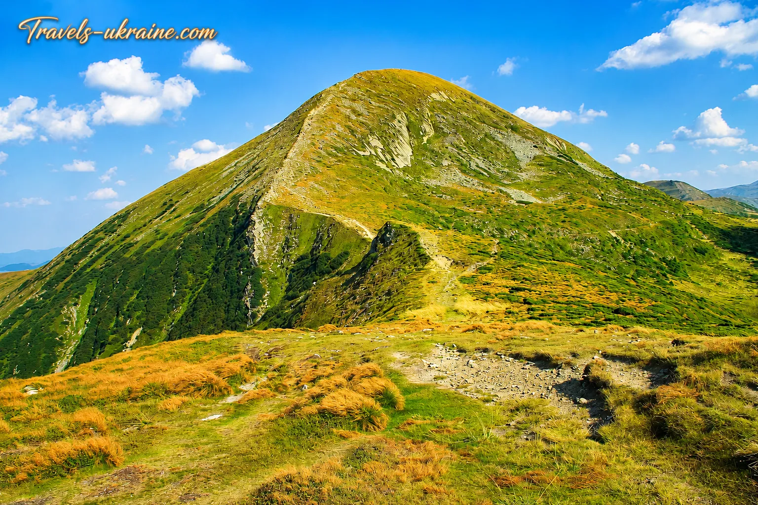
Most travelers climb Hoverla for one simple feeling — to stand higher than anyone else in Ukraine. But the 2,061-meter summit conceals far more than the familiar inscription and panorama of the Chornohora Range. Its slopes preserve traces of ancient glaciers, one of the country’s largest rivers rises at its foot, and the stone markers along the ridge recall a time when a state border ran here.
On Hoverla’s northern side, you can still see glacial cirques and moraines — landforms created long ago by the movement of ice. Where hiking trails now run, glaciers once lay, cutting into the slopes, deepening valleys, and leaving behind rocky ridges. That is why climbing Ukraine’s highest peak is a journey through a landscape shaped as far back as the Ice Age.
In the basin between Hoverla and neighboring Breskul, the Prut begins at several springs. At first, it is merely cold mountain water flowing among the rocks, but later the river travels 967 kilometers through Ukraine, Romania, and Moldova, flows into the Danube, and eventually reaches the Black Sea. It is hard to believe that the course of such a great waterway begins beneath the slopes of a summit climbed by thousands of tourists every year.
Hoverla’s tourism history also spans more than one generation. The first organized route to the summit was established as early as 1880. Since then, states, borders, maps, and equipment have changed, but the desire to rise above Chornohora has remained unchanged. That is why Hoverla is not simply Ukraine’s highest point. It is a mountain whose slopes reveal the history of the Ice Age, bear traces of vanished borders, and stand at the source of a river that crosses several countries. The route to its summit becomes not merely a physical ascent, but an encounter with the Carpathians’ natural and historical memory.
Hoverla Mountain: a summit that should not be underestimated
In photographs, Ukraine’s two-thousand-meter peak often looks calm and accessible: a rounded summit, an open trail, and the long lines of the Carpathian slopes. Yet the high mountains have a character of their own. Weather on Hoverla can change very quickly, while strong winds, fog, rain, wet rocks, or a sudden drop in temperature can complicate even a familiar route. That is why climbing Hoverla means not simply covering a certain distance, but learning to respect the mountains, pace yourself properly, and prepare responsibly for the journey.
This article is a detailed travel guide for those planning a self-guided hike up Hoverla, a guided ascent, a family trip, or a journey through Chornohora. This Carpathian summit does not promise an easy walk and does not try to appeal to everyone. It reveals itself gradually: in the sound of mountain streams, the scent of wet forest, the first serious climb, the cold wind on the ridge, and the moment when the summit finally appears ahead. It is for that moment that thousands of people set out each year toward the main summit of the Ukrainian Carpathians.
The history of Hoverla: from high-mountain trails to a symbol of the Ukrainian Carpathians
The history of Hoverla began long before tourist markings, organized hikes, and popular routes to the summit appeared. For the residents of the surrounding Carpathian settlements, the mountain was not a distant tourist destination but part of their familiar living environment. They grazed livestock here, gathered hay, used forest roads, traveled between valleys, and laid high-mountain trails that later became the foundation of tourist routes.
Mountain crossings were primarily practical. They connected mountain meadows, settlements, and agricultural land, helping local residents reach remote parts of Chornohora and navigate its challenging high-mountain terrain. What a traveler sees today as part of a tourist adventure was, for earlier generations, simply a working road and part of everyday life.
From local trails to a popular tourist route
Throughout the 20th century, Ukraine’s highest mountain became more accessible to travelers. The development of rail connections to Vorokhta and Yasinia made it easier to reach the high mountains, while the emergence of tourist shelters, bases, and marked routes gradually changed the nature of these journeys.
Hoverla ceased to be merely a summit known mainly to local residents, shepherds, and Carpathian researchers. Tourists from different regions began arriving, for whom the ascent became a separate goal of their trip. They were drawn not only by the altitude and panoramic views, but also by the very experience of the journey to the highest point of the Ukrainian Carpathians.
One of the best-known starting points gradually became the Zarosliak sports base. Today, the most popular route up Hoverla begins here. Convenient access, marked trails, and the relatively short distance to the summit have made this route accessible to a broad range of travelers.
However, accessibility should not be confused with ease. Even the most popular route requires endurance, proper footwear, preparation, and respect for mountain weather. Hoverla only seems close when its summit appears above the dwarf pine: the final point still requires overcoming a steep open slope, strong winds, and your own fatigue.
Hoverla: a summit people began not only to conquer, but also to protect
As its popularity among tourists grew, attitudes toward nature gradually changed as well. The summit was increasingly seen not only as the goal of an ascent, but as part of Chornohora’s unique natural complex — with subalpine and alpine meadows, spruce forests, mountain pine thickets, rocky slopes, and cold streams.
High-mountain ecosystems develop slowly and remain extremely vulnerable. Plant cover that adapts over years to low temperatures, strong winds, and a short warm season can be damaged by mass trampling within just a few hours. For this reason, the development of tourism gradually began to be combined with conservation measures.
An important stage in the history of Hoverla’s protection was the creation, on June 3, 1980, of the Carpathian State Nature Park — now the Carpathian National Nature Park. Under Resolution No. 376 of the Council of Ministers of the Ukrainian SSR, 4,941 hectares of land belonging to the Hoverla forestry district were transferred to it, among other areas. Thus, Hoverla’s northeastern slopes and the natural complexes along the route to the summit became part of the newly established protected park.
In 1990, the territory of the Carpathian State Nature Reserve was substantially expanded under Resolution No. 119 of the Council of Ministers of the Ukrainian SSR. The area of the Chornohora massif increased by 2,577 hectares, including a high-mountain section on Hoverla’s southern macroslope and valuable forest areas on the slopes of Petros. This was an important step in preserving Chornohora’s natural complexes. Since then, Hoverla’s natural areas have been protected on both sides of the Chornohora Range: on the Ivano-Frankivsk side, within the Carpathian National Nature Park, and on the Zakarpattia side, within the Carpathian Biosphere Reserve.
Since then, Hoverla’s history has become a story of constantly seeking balance. On the one hand, the summit must remain accessible to travelers. On the other, mass visitation must not destroy the trails, high-mountain vegetation, and landscapes that draw people here.
How Hoverla became a symbol of Ukrainian unity
After Ukraine regained its independence, Hoverla’s significance extended far beyond sport tourism. The country’s principal summit gradually became a symbol of height, endurance, unity, and the determination to move forward. Ascents of Hoverla began to be dedicated to national holidays, commemorative dates, charitable initiatives, and community events. Ukrainian flags were raised at the summit, memorials were installed, and symbolic actions were held. In the public imagination, the mountain became a place where personal achievement is joined with a sense of belonging to the country.
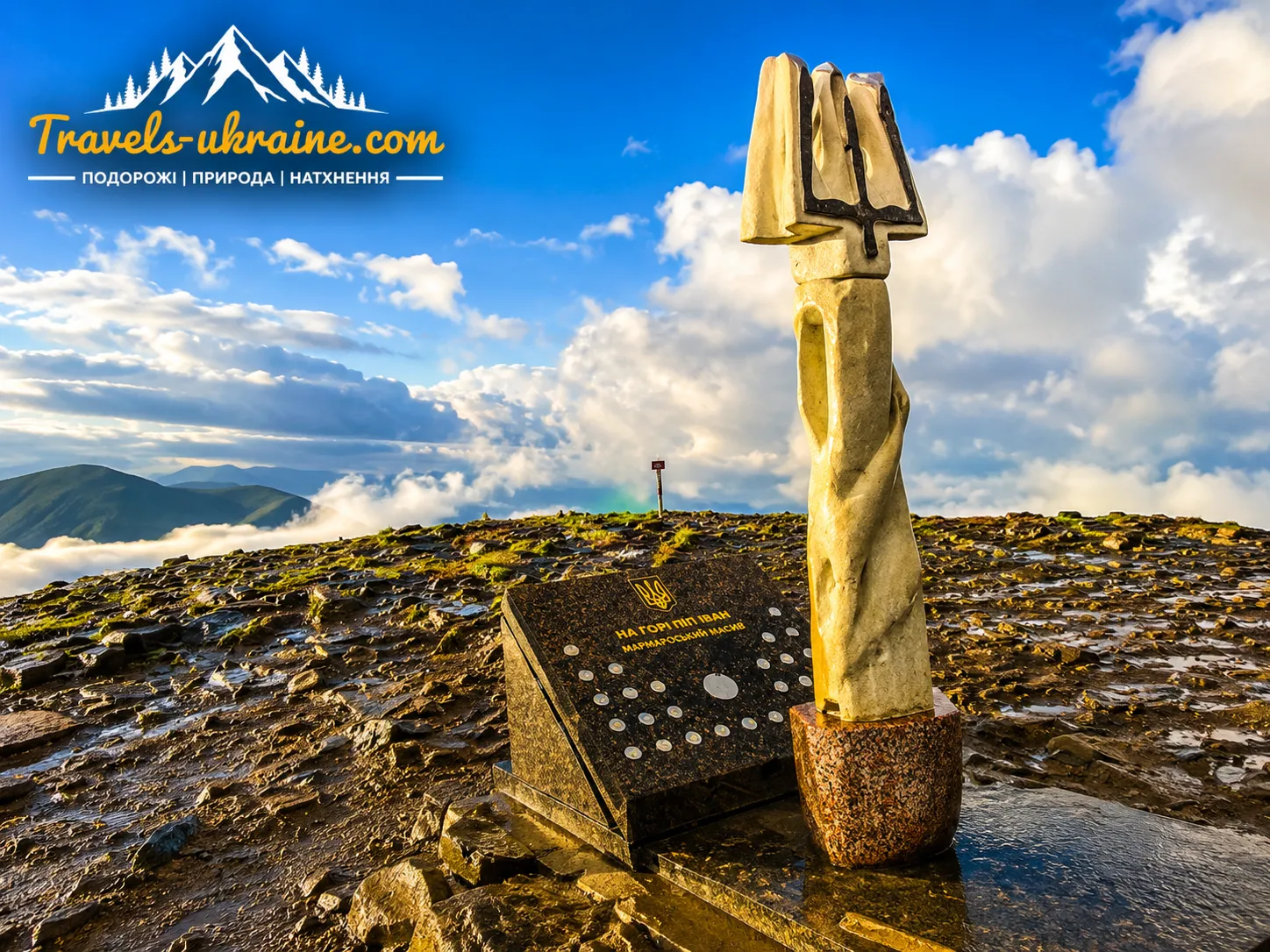
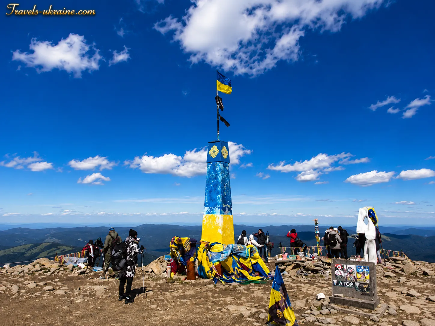
The memorial complex opened at the summit of Hoverla on July 18, 2008, has particular symbolic significance. It consists of a sculptural composition, the «Tryzub», and a marble stele containing capsules filled with soil brought from every region of Ukraine. The composition symbolizes the unity of Ukrainian lands, while Hoverla itself stands not only as the country’s highest geographical point, but also as a place of shared historical memory. Representatives of all the country’s regions took part in the opening ceremony, and the capsules were placed with the participation of President of Ukraine Viktor Yushchenko.
Today, families, tour groups, athletes, schoolchildren, service members, volunteers, and people discovering the Ukrainian Carpathians for the first time climb the summit. For some, it is a test of physical endurance; for others, a long-held dream; and for still others, a chance to experience the scale of their country from its highest point.
At the «2061 m» marker, travelers from different regions, with varying experience and different climbing speeds, meet one another. Some reach the summit confidently, while others mentally reconsider all their life choices during the final meters. Yet the panorama from Hoverla quickly reminds them what the journey was all about.
The history of Hoverla shows how ancient high-mountain trails became the basis for popular tourist routes, while the summit itself became one of Ukraine’s best-known natural symbols. Behind modern photographs, organized tours, and countless accounts of ascents lies a multilayered past: the life of Carpathian communities, the development of travel, the formation of a conservation system, and the emergence of a new symbolic image of the mountain.
Hoverla remains a place where every traveler’s personal story is added to the summit’s larger history. Perhaps that is why the ascent is remembered not only for fatigue and scenery, but for the feeling that, for a few minutes, you stood at a point that is at once a geographical height, a natural landmark, and a symbol of an entire country.
Hoverla in the Carpathians: the natural features of Ukraine’s highest summit
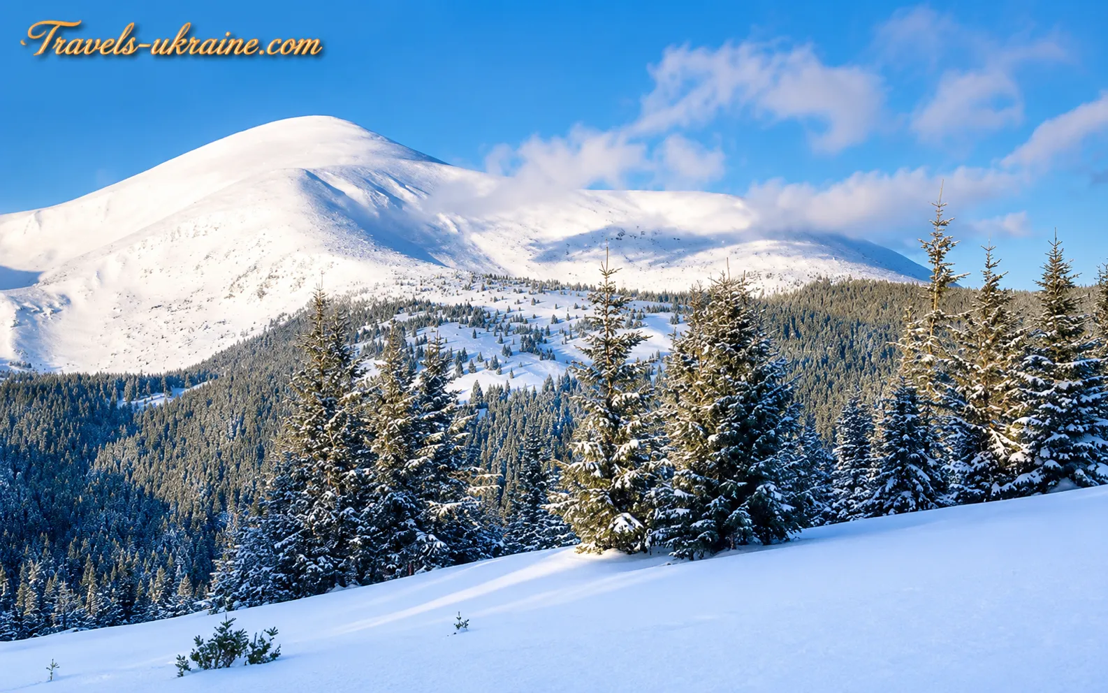
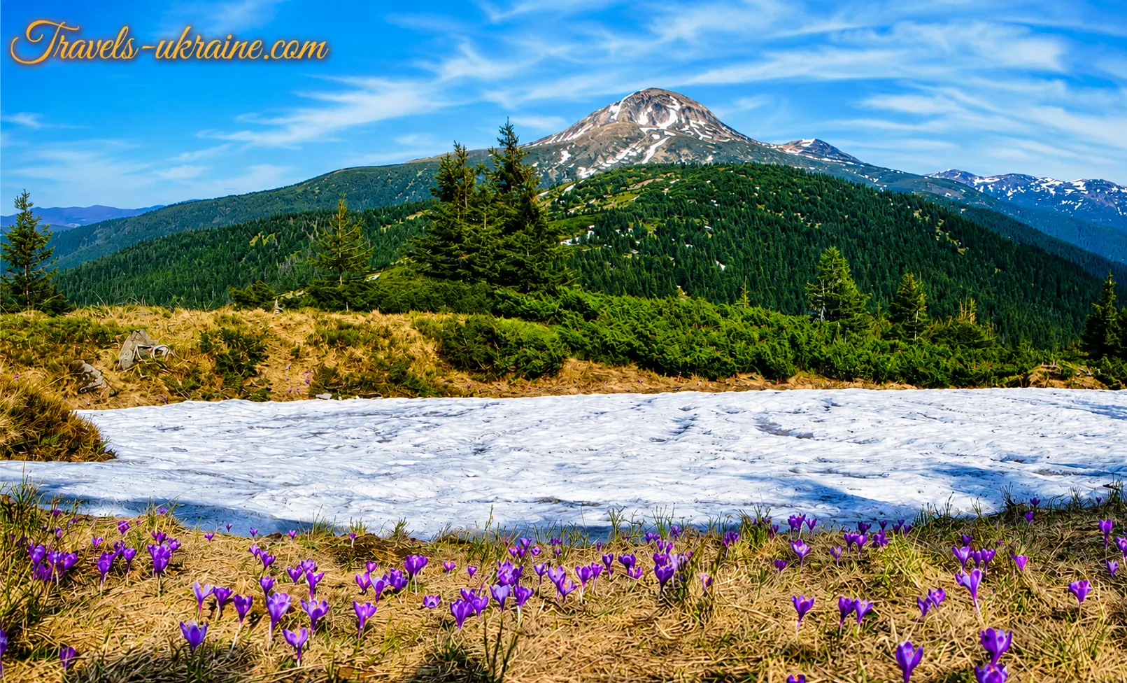
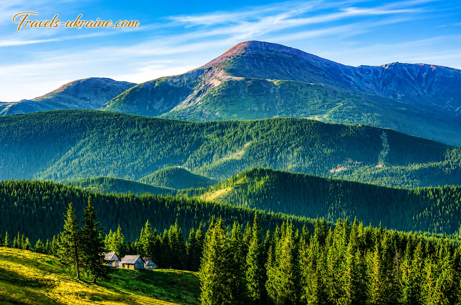
Ukraine’s highest summit is distinguished by more than its elevation. Its natural character is shaped by open high-mountain slopes, traces of ancient glaciation, rocky scree, subalpine shrubs, mountain meadows, and deep valleys through which water descends to the foothills. During the ascent, a traveler gradually passes through several natural zones and can see, within just a few hours, dense Carpathian forest give way to crooked woodland and then to open, austere high mountains.
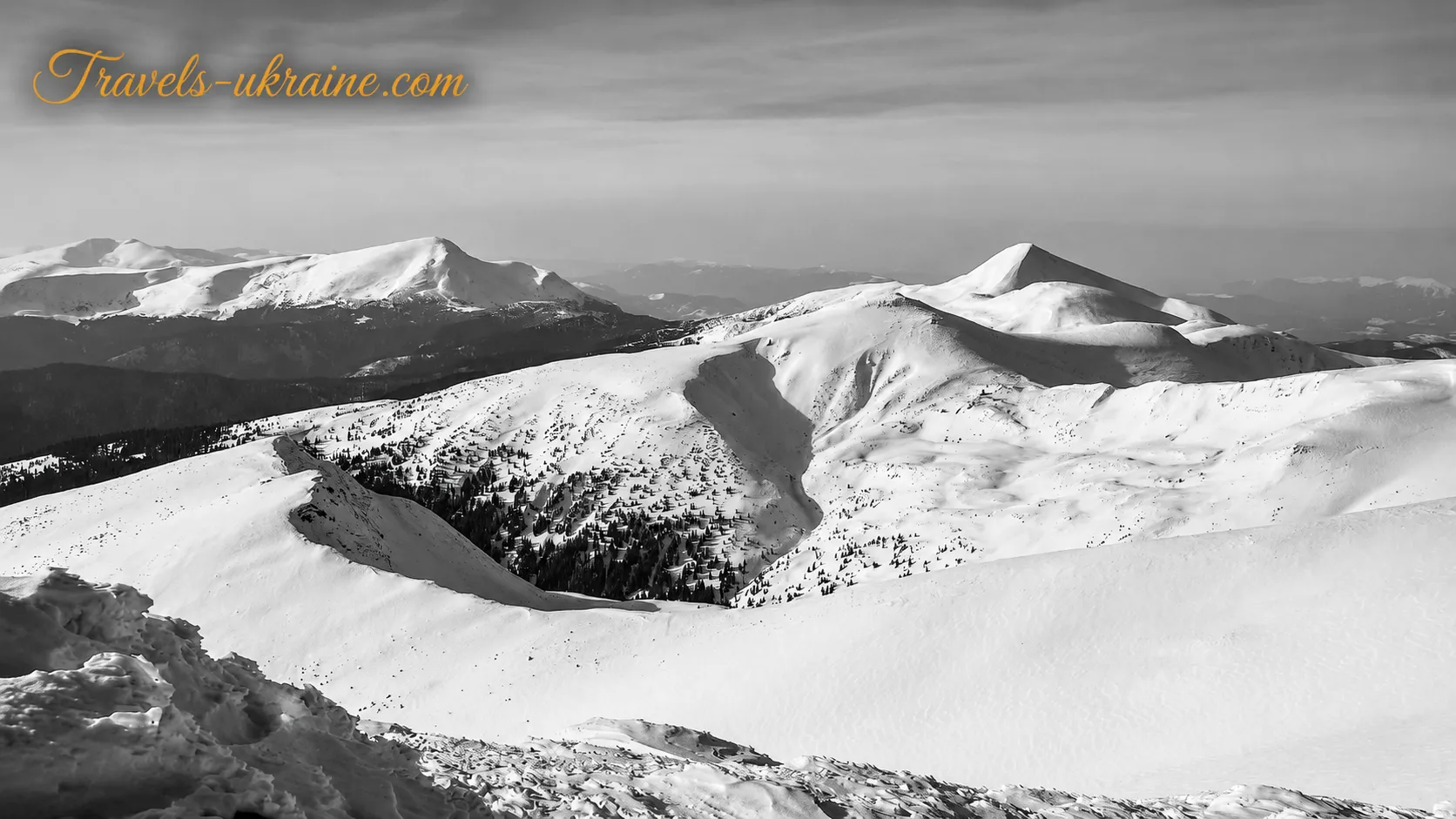
Hoverla belongs to the Chornohora massif of the Ukrainian Carpathians — the country’s highest mountain region. Other Ukrainian two-thousanders are located nearby: Petros, Brebeneskul, Pip Ivan Chornohirskyi, Hutyn Tomnatyk, and Rebra. Together, they form Ukraine’s principal high-mountain chain, clearly visible from the summit in good weather.
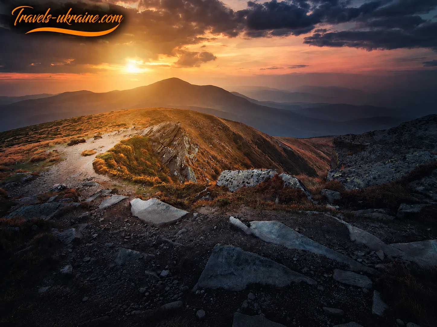
Hoverla’s position among Chornohora’s highest peaks creates a sense of genuine mountain space. As you climb, the trees gradually disappear, neighboring ridges open up, and the horizon grows ever wider. On a sunny day, the view from Hoverla encompasses the highest mountain peaks and the farther line of the Chornohora Range. In fog, however, this same landscape can turn into an almost colorless expanse where even nearby landmarks quickly vanish from view.
Hoverla’s shape and the terrain of the Chornohora massif
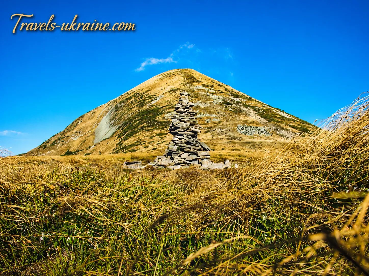
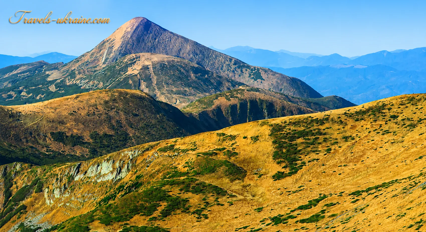
Hoverla’s summit has a distinctive conical shape. Its southern macroslope is steeper, while the northern one is generally gentler. For travelers, however, the perceived difficulty depends not only on the direction of the slope, but also on the specific route, trail conditions, weather, and physical fitness.
From a distance, Hoverla may seem gentle and rounded, but its terrain reveals itself differently during the climb. The upper part of the mountain is covered with rocks, scree, patches of exposed soil, and low alpine vegetation. Popular trails include steep sections, rain-eroded depressions, and slippery rocks. After prolonged rainfall or during snowmelt, navigating such sections requires particular caution.
The terrain of Chornohora preserves traces of Pleistocene glaciation. In the highlands, you can see glacial cirques—bowl-shaped depressions—as well as moraine deposits and broad mountain valleys. The glacial past of the Chornohora Range is most clearly visible near Nesamovyte and Brebeneскul lakes, but Hoverla’s slopes are also part of this ancient natural landscape.
What rocks is Mount Hoverla made of?
Hoverla consists mainly of sandstones and conglomerates of the Chornohora geological formation. These rocks formed over long geological periods, when layers of sand, clay, and fragmented material accumulated on the beds of ancient marine basins. Over time, they were compacted, uplifted, and deformed during the formation of the Carpathians.
The alternating layers of different rocks influence the present-day appearance of the slopes, the direction of streams, and the way the surface breaks down. Water, frost, wind, and temperature fluctuations gradually fragment the rock, forming rocky areas and scree slopes. As a result, the rocks on Hoverla’s upper slopes may be unstable, especially after the spring snowmelt.
Altitudinal zonation: from spruce forest to alpine meadows
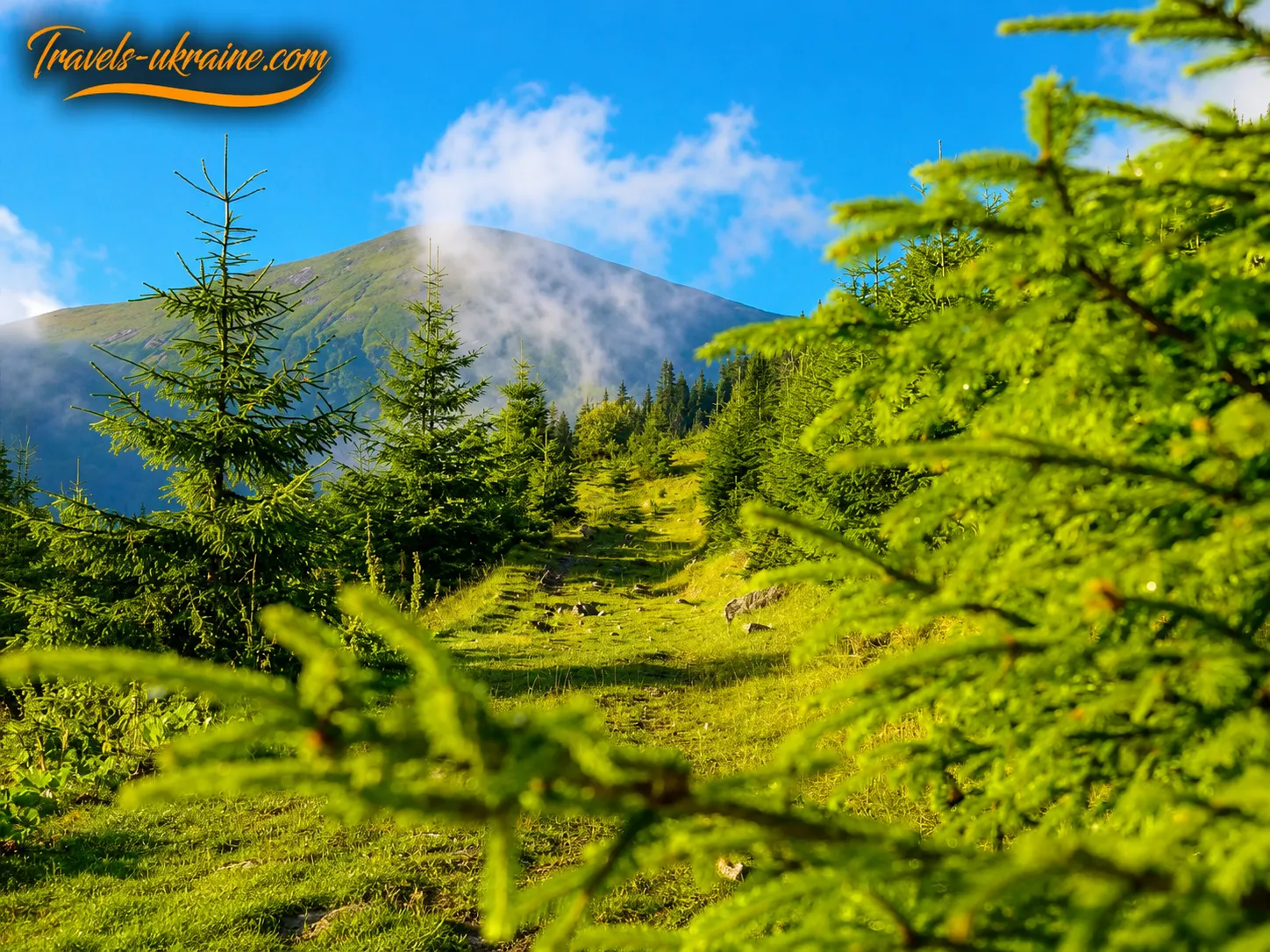
One of the most interesting natural features of the route to Hoverla is the noticeable change in vegetation as you gain altitude. Near Zarosliak, the trail begins among dense coniferous forest. Spruce predominates here, while mosses, ferns, bilberries, and other plants adapted to the cool, humid Carpathian climate grow in shaded areas.
Higher up, the forest gradually becomes sparser. Areas of crooked woodland appear—thickets of mountain pine, juniper, and green alder. The low, flexible form of these plants helps them withstand strong winds, the weight of snow, and the prolonged cold season. For hikers, this zone often marks the boundary beyond which the route emerges fully onto open slopes.
Subalpine and alpine meadows begin higher still. There are no tall trees here, and the vegetation grows close to the ground. During the warm season, the slopes are covered with grasses, bilberry bushes, low shrubs, and flowering alpine plants. Some are rare and protected by law, so it is best not to pick flowers, dig up plants, or leave the trail for the sake of a photograph.
The best-known plant of the Carpathian highlands is considered to be the East Carpathian rhododendron, commonly known as red rue. During its flowering period, its pink blossoms create striking patches of color among the green slopes. However, this is not an ornamental flowerbed but a vulnerable part of the natural ecosystem that recovers very slowly after being trampled.
Weather on Hoverla and the high-altitude microclimate
Weather on Hoverla is significantly harsher and more changeable than in Vorokhta, Lazeshchyna, or Yaremche. As altitude increases, the temperature falls, the wind strengthens, and clouds can quickly cover the summit. Even when it is warm and sunny at the foot of the mountain, the upper part of the route may experience cold rain, dense fog, or sudden gusts of wind.
The exposed summit offers almost no natural protection. On the final section of the climb, there is no forest, substantial shelter, or place where you can safely wait out a storm. In the summer months, thunderstorm fronts are especially dangerous: a person on an exposed ridge is vulnerable to lightning strikes, while wet rocks make the descent from Hoverla considerably more difficult.
Snow can remain in Chornohora until late spring, while the first autumn snowfalls sometimes begin long before the calendar winter. Snowfields, frozen trails, and ice change the route’s level of difficulty. In winter, the slopes pose an avalanche hazard, so a winter ascent of Hoverla must not be treated as an ordinary continuation of a summer hike.
What can be seen from the summit of Hoverla in clear weather?
The panorama from Hoverla depends on cloud cover, air humidity, and atmospheric clarity. On a clear day, neighboring Petros is the most prominent feature, separated from Hoverla by a deep saddle. In the opposite direction stretches the main Chornohora Range, with the summits of Breskul, Pozhyzhevska, Dantsizh, Turkul, Rebra, Hutyn Tomnatyk, Brebeneskul, and Pip Ivan Chornohirskyi.
Below, the valleys of the Prut, the Transcarpathian slopes, mountain meadows, and the undulating lines of distant ranges unfold. The view is often clearest in the morning, while clouds may form above the summits after midday during the warm season. That is why experienced hikers try to begin the climb early: this not only increases the chances of seeing the panorama from Hoverla but also leaves enough time for a safe descent.
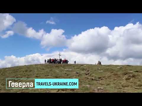
Hiking Hoverla: a brief tourist guide
Hoverla is a high-mountain natural destination intended primarily for hiking. There is no cable car, road access directly to the summit, or developed walking promenade. To see the view from Hoverla, you must follow a mountain trail, gain considerable elevation, and then descend independently to the starting point of the route.
The most popular option remains the route to Hoverla from Zarosliak. Tourists usually reach the sports base via Vorokhta and the checkpoint of the Carpathian National Nature Park. The alternative ascent from the Transcarpathian side begins in Lazeshchyna or the Kozmeshchyk tract, but it is longer and requires more time, endurance, and navigation skills.
Hoverla as a tourist destination in the Ukrainian Carpathians
In terms of recreation, Hoverla belongs to the category of natural mountain attractions and active-tourism routes. It is not a place for a brief roadside stop or an observation deck accessible by car. Even the shortest popular ascent involves several hours of physical exertion, so you should set aside a full day for the trip.
- Type of destination: mountain summit, natural landmark, and hiking route.
- Elevation of Mount Hoverla: 2061 meters above sea level.
- Mountain range: Chornohora, the Ukrainian Carpathians.
- Most popular starting point: Zarosliak sports base.
- Alternative route: Lazeshchyna — Kozmeshchyk — Hoverla.
- Recommended format: a one-day hike or part of a multi-day route through Chornohora.
- Best season for a first ascent: the period without persistent snow cover and with a stable weather forecast.
How long does the ascent of Hoverla from Zarosliak take?
The official educational nature trail of the Carpathian National Nature Park is 10.5 kilometers long, and its estimated duration is approximately 5 hours. However, the actual duration of a hike to Hoverla depends on the exact starting point, the trail selected, the number of stops, the participants’ fitness levels, and weather conditions.
Experienced hikers may ascend faster from Zarosliak sports base, but beginners should not compare themselves with other people’s athletic times. For a relaxed ascent with breaks, time at the summit, and a safe descent, it is better to allow a sufficient amount of daylight. Hurrying in the mountains often leads to exhaustion, falls, and mistakes at trail junctions.
Actual ascent times for different types of hikers
A person in good physical shape may complete the route much faster than a family with children or a group visiting the highlands for the first time. The pace also slows after rain, in fog, during strong winds, or on a snow-covered trail. That is why you should plan the hike not around the minimum possible time but with a reserve of at least enough time for unforeseen delays.
It is best to set out in the morning. An early start gives you a better chance of avoiding afternoon thunderstorms, seeing a clearer panorama, and completing the descent before dark. If the group is moving too slowly or the weather begins to deteriorate, the right decision is to turn back, even when the summit already seems close.
Hoverla with children: when a family hike is safer
Climbing Hoverla with children is possible if a child is accustomed to long walks, has suitable footwear, and understands the rules of mountain safety. Age alone is not the only criterion: one child may easily manage several hours over difficult terrain, while another may quickly tire even on a level road.
Parents must be prepared to turn back early rather than forcing a child to reach the summit at any cost. The hike should be postponed if thunderstorms, strong winds, fog, heat, ice, or prolonged rain are forecast. Small children should not be carried in your arms on steep, slippery sections, as this increases the risk of falling for both of you.
How much does a hike to Hoverla cost, and what makes up the budget?
There is no single fixed price for an ascent of Mount Hoverla. An independent mountain hike will be considerably cheaper than an organized tour with transportation, meals, and a guide. The main expenses depend on the city of departure, the means of transport, the need for overnight accommodation, equipment rental, and the format of the trip.
The least expensive option is to arrive independently in your own vehicle, bring all the necessary equipment, and complete the route without a guide. However, saving on quality footwear, warm clothing, water, a first-aid kit, or navigation equipment is dangerous. A hike to Ukraine’s highest mountain does not require a lavish budget, but it does demand responsible preparation.
Who is a one-day hike to Hoverla suitable for?
The route from Zarosliak is suitable for adults and teenagers in average physical condition who can walk for several hours over uneven terrain. It is a good option for a first introduction to Ukraine’s two-thousand-meter peaks, but only in favorable weather and with the right equipment.
Beginners, families with children, and people who are unsure of their navigation skills should consider joining an organized group or hiring an experienced guide. For a first hike, it is better to choose the warm season, a dry day, and the most popular marked route to Hoverla. A winter ascent, the route via Petros, or a long traverse of the Chornohora Range belongs to a different level of difficulty and requires separate preparation.
Hiking routes to Hoverla: which trail to take to the summit
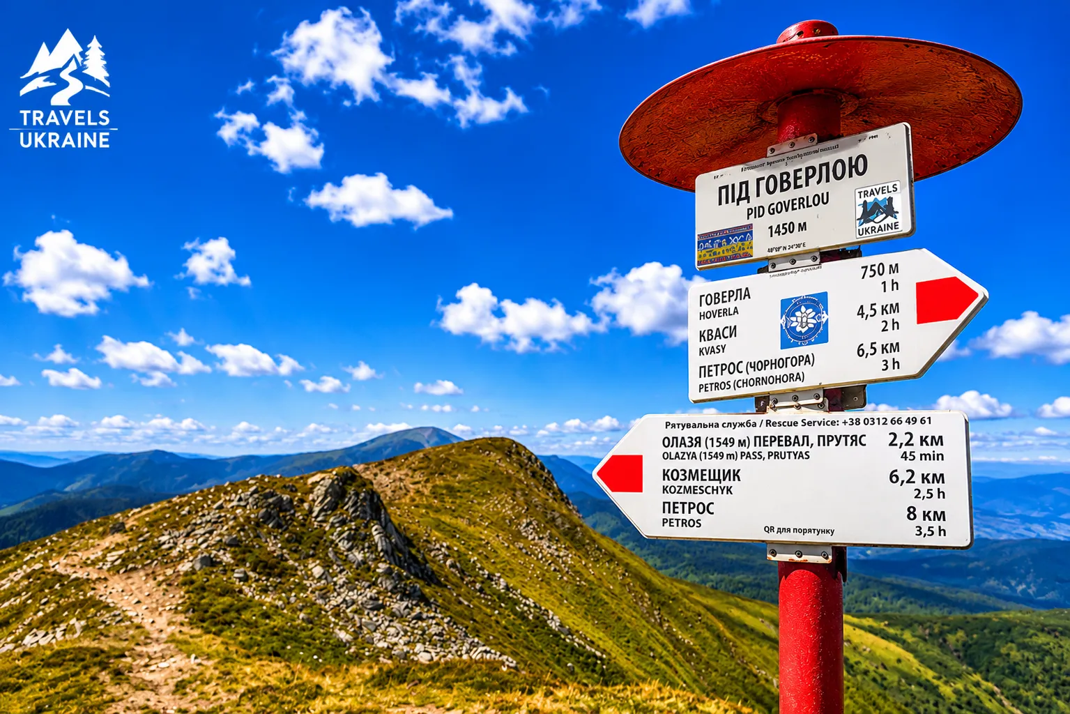
More than one trail leads to the summit of Hoverla; instead, there is an entire network of marked hiking routes. Some begin near the «Zarosliak» sports base and are suitable for a one-day ascent, while others approach from the Transcarpathian side, pass through mountain meadows and neighboring summits, and require considerably more time and endurance.
Choose your route based on more than just its length. Physical fitness, weather, season, trail conditions, and departure time all matter. In the mountains, even a few kilometers can turn out to be longer than they look on the map, especially when the path keeps climbing, the wind decides to test your jacket’s durability, and every successive hill suspiciously resembles the summit.
The time stated below is approximate. It does not include long breaks, taking photographs, picking bilberries, chatting with fellow hikers, or the traditional question: «So, are we almost there?»
The red route from Mount Breskul
The shortest of the listed options leads to Hoverla from the neighboring mountain Breskul, following the red trail markings. This traverse is usually part of a longer journey along the Chornohora Range rather than a separate route from a settlement.
From Breskul, the trail crosses open high-altitude terrain with little protection from strong winds, rain, or fog. In favorable weather, it offers sweeping views of Chornohora, while Hoverla appears very close. Yet in the Carpathians, «very close» can sometimes mean another hour of determined walking.
Estimated time: about 1 hour to the summit and approximately 1 hour back.
The Blue Route from the Zarosliak Base
The blue route from the Zarosliak sports base is one of the best-known paths to Hoverla. The base is usually reached via Vorokhta, after which the hiking section of the journey begins.
The trail gradually passes through the forest zone, climbs toward mountain pine thickets, and then emerges onto an open slope below the summit. At first, the route may seem quite forgiving, but closer to the summit, Hoverla reminds you that it did not earn the title of Ukraine’s highest mountain merely by being pretty.
This option is convenient for a one-day ascent, but it requires proper physical fitness. Special care should be taken on the descent: rocks, tree roots, and wet ground can be slippery even when they seemed perfectly safe during the climb.
Estimated time: about 3 hours for the ascent and approximately 2 hours for the descent.
The Green Route from Zarosliak via Kozmeska Meadow
Another popular path from the Zarosliak base is marked in green. It passes through Kozmeska Meadow and Mala Hoverla, from where the trail continues to the summit.
The route is appealing for its variety of views: the forest gradually gives way to open mountain meadows, and once hikers reach higher ground, a panorama of the mountains unfolds before them. Mala Hoverla may create the pleasant feeling that the main goal is already nearby. Still, in the mountains, the word «nearby» should always be taken with cautious optimism.
Estimated time: about 3 hours for the ascent and approximately 2 hours for the descent.
The Route from Lazeshchyna via Kozmeshchyk, Kozmeska Meadow, and Mala Hoverla
The longer route begins in the village of Lazeshchyna. First, follow the green markings toward the Kozmeshchyk tract. The path then continues along the green route, after which hikers switch to the yellow markings leading to Kozmeska Meadow. From the meadow, the route is marked green again and passes through Mala Hoverla to the summit.
This option lets hikers experience the gradual transition from the Transcarpathian valleys to open high-altitude terrain. The journey is long, so you need to set out early, leaving plenty of time before dark. The route suits travelers who want not merely to climb Hoverla quickly, but to spend a full day among forests, mountain meadows, and mountain views.
Estimated time: about 7 hours for the ascent and approximately 6 hours for the descent.
The Route from Lazeshchyna via Kozmeshchyk and Gropa Meadow
Another route from Lazeshchyna also begins with green markings and leads to the Kozmeshchyk tract. You then need to switch to the yellow route, which passes through Gropa Meadow and heads toward Hoverla. This is a long mountain traverse requiring good endurance, an early start, and confident navigation using the trail markers. Along the route, it is important to keep an eye not only on the views but also on the time: the sun sets over the Carpathians regardless of how many photos the hiker still has not taken.
Estimated time: about 6 hours 45 minutes for the ascent and approximately 5 hours 45 minutes for the descent.
The Red Route from Petros
The traverse from Mount Petros to Hoverla follows the red markings through Holovcheska and Skopeska mountain meadows. An information and tourism center and the Carpathian High Mountains recreational shelter are also located along the way. The route connects the two most famous peaks in the western part of the Chornohora Range and is usually part of a two-day or multi-day trek. Petros is known for its steep slopes, so after crossing it, hikers often begin to view the remaining route to Hoverla with philosophical calm: the important thing is to keep moving forward and not ask the navigator why the finish is once again farther away than it seemed.
Estimated time: about 4 hours each way.
Carpathian High Mountains Information and Tourism Center
The Carpathian High Mountains information and tourism center is located on the route between Petros and Hoverla. It opened on July 7, 2011, within the territory of the Carpathian Biosphere Reserve. The center became the first infrastructure facility of its kind in the high-altitude section of the Chornohora Range.
The center’s exhibition is dedicated to the natural ecosystems of the highlands and traditional land use in Transcarpathian Hutsul communities. Here, travelers can learn more about the nature of Chornohora, the lives of local communities, and the distinctive ways mountain areas are used.
The center also has a recreational shelter with space for 29 people. For tourists undertaking the long route through Petros and Hoverla, such a facility is especially valuable: in the highlands, even the simple chance to rest under a roof can sometimes feel like a five-star luxury.
From Zarosliak to the Summit: A Personal Account of Climbing Hoverla
We planned our ascent of Hoverla for about a month. At first, it was supposed to be a major trip for three families, but during the planning stage it became clear that only our own family would go to the summit: me, my husband, and our two children. We never managed to agree on a convenient time for everyone: one person was unavailable one day, and someone else the next. A familiar story for anyone who has tried to organize a large-group holiday at least once.
Eventually, the day of the trip arrived. We packed our things, brought food, loaded everything we needed into the car, and set off. A few hours later, we were already near the checkpoint on the way to the Zarosliak sports base. I can’t remember the exact fare now, but it was quite symbolic and did not represent a significant part of the trip’s expenses.
We drove to the starting point of the route. We found a vacant clearing not far from the base where we were able to park. There were no rooms left at Zarosliak, but this did not particularly upset us: we had wisely brought a tent for just such an occasion. We spent the first night outdoors, then woke before sunrise, got ready, and began the ascent.
The opening section of the ascent of Hoverla from Zarosliak led through forested terrain. It was cool, quiet, and peaceful, and the trail gave no hint of how many challenges lay ahead. Gradually, the trees grew sparser, and we reached more open mountain-meadow terrain. There were plenty of bilberries along the way, so from time to time we stopped to rest and refresh ourselves with the berries.
At one point, the route split in two: a shorter but much steeper path and a longer, gentler one. Naturally, we chose the short route because at the time we sincerely believed that a shorter distance automatically meant an easier ascent. Hoverla quickly explained that mountain mathematics works quite differently.
The climb turned out to be extraordinarily difficult for me. I no longer remember how many times along the way I seriously considered abandoning my original goal and turning back. Physical exhaustion was compounded by the weather: the sky filled with clouds, rain began to fall, and a steep, grueling slope still lay ahead.
Still, pride, stubbornness, and a reluctance to admit defeat ultimately won out. Step by step, we continued upward. That said, if I had to do this route again, I would choose the longer but gentler path without a second thought. A few extra kilometers no longer seem frightening when you remember how, on a steep climb, you start holding internal negotiations with your own legs.
Eventually, tired and soaked but happy, our whole family reached the summit. Our reward was dense fog, rain, and views that the clouds had almost completely concealed. Hoverla greeted us not with the grand panorama of Chornohora, but with a genuine lesson in the unpredictability of the Carpathians. The only comforting thought was that the hardest part was behind us, while dry clothes, warm things, and delicious food were waiting by the car. Because of the bad weather, we did not stay at the summit for long. We took a few memorable photos, looked around as far as the fog allowed, and began the descent.
You might think the way down would be easier, but our descent took even longer than the ascent. Wet rocks, slippery ground, and tired legs forced us to move slowly and carefully. In the mountains, descending has a special talent for reminding you about muscles whose existence you had never even suspected. The closer we got to the Zarosliak base, the more noticeably the weather improved. The rain finally stopped, the clouds began to break up, and everything around us grew much brighter. At the parking area, we changed clothes and prepared hot food in the designated fire area. After a long ascent, even the simplest hot meal tastes like a restaurant dish, and dry clothes feel like a true luxury.
That day, Hoverla did not give us its famous summit panorama, but it left us with something much more: a shared family adventure, a test of endurance, and a story we still remember. It was a difficult ascent, but these are the journeys that become the most memorable over time—especially once your legs stop hurting and you can smile as you tell how the short route turned out to be anything but a short challenge.
Events on Hoverla: Traditional Ascents
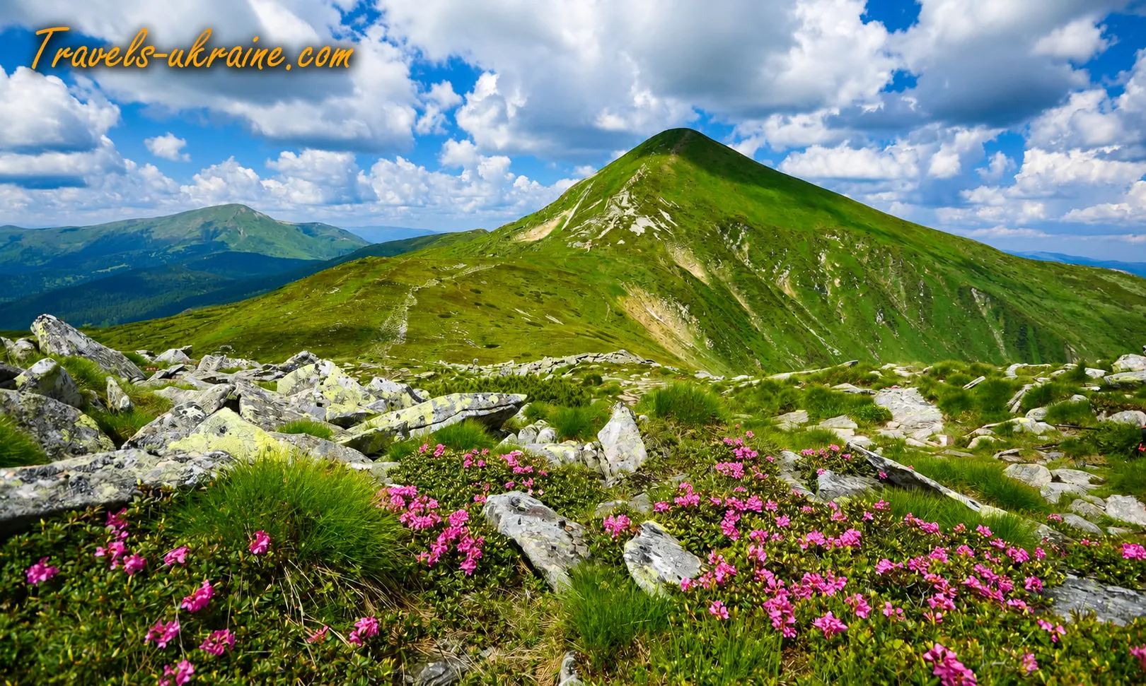
Hoverla has no permanent festival venue, stage, or approved calendar of entertainment events. The main activities here take the form of organized ascents, sporting gatherings, youth hikes, patriotic events, and environmental initiatives. They are united by the summit itself: Ukraine’s best-known Carpathian mountain becomes a place where people test their endurance, mark important dates, and spend time with like-minded people and friends.
At the end of March, beginning in 1964, the Hoverlyana has been held—a traditional mass tourist hiking ascent of Hoverla. The event is dedicated to the opening of the summer sports season in Lviv Oblast and to honoring the memory of climbers and tourists who died in the mountains.
The phrase «opening of the summer season» sounds slightly ironic in this case, in true Carpathian fashion. The calendar promises spring by the end of March, but the mountains apparently do not use calendars. In the highlands, participants are often met by frost, deep snow, strong winds, and poor visibility. So the summer season here begins in winter jackets, with warm gloves, and with a very serious attitude toward equipment.
The traditional route to Mount Hoverla approaches from the side of Vorokhta in Ivano-Frankivsk Oblast. Participants travel along the Prut River valley through the territory of the Carpathian National Nature Park, via the Zarosliak tract, and from there continue the ascent to the summit.
In different years, the hike has been organized by the Department of Physical Culture and Sports of the Lviv Regional State Administration, the Sports Tourism Federation of Ukraine, the Lviv Regional Sports Tourism Federation, and the Skelia Tourist and Mountaineering Center. Before setting out, participants receive a briefing, and during the ascent they must follow the instructions of the guides and rescuers. Mountains love the brave, but they are much more partial to those who are prepared.
The memorial aspect of Hoverlyana carries special significance, as the history of winter crossings in the Hoverla and Petros area also contains tragic chapters. According to information recorded in tourist chronicles, in 1958 an avalanche buried a group of 12 tourists who were attempting to traverse Hoverla’s dome from the northwestern ridge toward the col between Hoverla and Petros. The tragedy occurred in a snow “funnel”—a natural depression in the terrain where large masses of snow accumulate in winter.
An even larger accident, according to the same chronicles, occurred in 1960. During the Hoverla–Petros traverse, an avalanche descended into the same «funnel» and claimed the lives of 20 tourists. The snow cover there was so deep that the victims of both tragedies could be found only in summer.
In this part of the story, any tourist irony falls away. These events remind us that a familiar summer route becomes an entirely different path in winter, requiring experience, special equipment, knowledge of avalanche conditions, and strict discipline. An open map or bright trail markings cannot stop an avalanche, while confidence without proper mountain preparation often becomes more dangerous than the bad weather itself.
Over the decades, Hoverlyana has become more than a sporting event: it is a tradition that brings together travel, remembrance, and responsibility. Participants climb to the summit not only for personal achievement but also as a tribute to people whose lives were connected with the mountains. That is why the main victory of such a hike is not a photograph beside the “2061 m” marker, but the safe return of the entire group to Zarosliak.
What to See Near Hoverla: Interesting Places Nearby
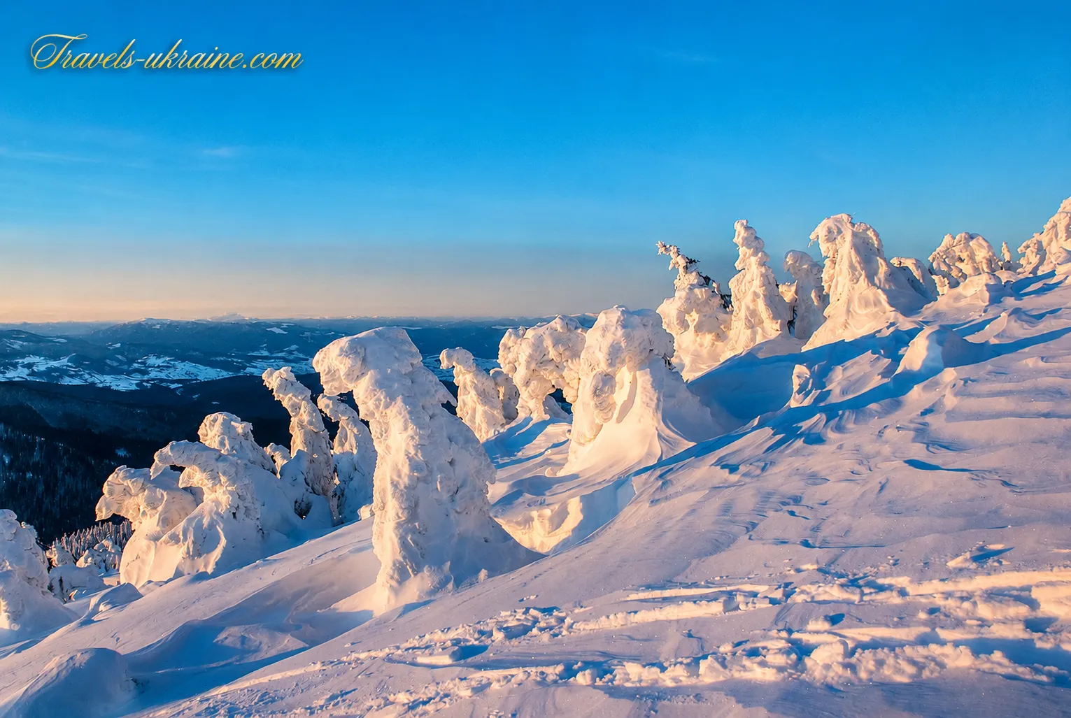
What to see near Hoverla after the ascent is a question best settled before the trip. The Chornohora area is so rich in natural and cultural attractions that one journey can easily become several days of полноценного Carpathian holiday. Nearby are high-mountain waterfalls, glacial lakes, neighboring Ukrainian two-thousanders, mountain pastures, the old viaducts of Vorokhta, and tourist towns.
At the same time, «nearby» in the mountains does not always mean a few minutes’ walk. An object clearly visible from Hoverla’s summit may be separated by a deep col, a steep descent, or several hours of hiking. Therefore, a lake or neighboring mountains should not automatically be added to a standard one-day ascent from Zarosliak. For each location, assess the distance, elevation gain, weather forecast, and time remaining before sunset separately.
Prut Waterfall at the Foot of Hoverla
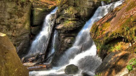
Prut Waterfall, also known as Hoverla Waterfall, is the nearest prominent natural attraction to the popular route from Zarosliak. It is located in the upper reaches of the Prut between Hoverla’s northeastern spurs and Breskul. The water flows down a rocky channel in six main cascades, the largest of which is about 12 meters high, while the total drop reaches approximately 80 meters.
After a snowy winter and prolonged spring rains, the waterfall is especially full. In summer, its character depends on the amount of precipitation: after a dry period, the flow becomes calmer, while after a storm it quickly gains force. The cascades are best viewed from safe sections of the trail, without stepping onto wet rock slabs.
A visit to the waterfall can be combined with an organized ascent of Hoverla only if the chosen hiking route follows the appropriate direction and the group has enough time. It is not advisable to head toward the cascades at random after the descent: darkness falls quickly here, and mobile coverage is unreliable.
Mount Breskul and Pozhyzhevska Peak Near Hoverla
Mount Breskul is the nearest prominent peak on the main Chornohora Ridge on the route from Hoverla toward Pozhyzhevska. It is not one of Ukraine’s two-thousanders, but because it lies almost directly beside the country’s highest summit, it plays an important role in routes through Chornohora.
The crossing from Hoverla to Breskul offers views of treeless high-mountain terrain, broad slopes, and the upper Prut valley. However, even a section that looks short on the map requires a descent followed by another climb. In dense fog or strong winds, continuing along the ridge after Hoverla is inadvisable.
Farther on lies Mount Pozhyzhevska, known for its high-altitude meadows and scientific facilities in the Chornohora Ridge area. Its slopes offer views of Hoverla, Breskul, the Prut valley, and neighboring peaks. Pozhyzhevska can be included in a separate hike from Zarosliak or a multi-day crossing, but for most beginners, this would be too demanding after a standard ascent of Hoverla and a same-day return.
Lake Nesamovyte, Mount Turkul, and the Route from Hoverla
Lake Nesamovyte is one of the best-known high-altitude bodies of water in the Ukrainian Carpathians. It lies in a glacial cirque at an elevation of about 1,750 meters near the slopes of Mount Turkul. The lake is small, but its location among Chornohora’s open slopes creates a striking high-mountain landscape.
The search query «Hoverla — Lake Nesamovyte» may give the impression that the body of water lies directly below the summit. In reality, a substantial section of the Chornohora Ridge lies between them, passing through Breskul, Pozhyzhevska, Dantsizh, and Turkul. This is a full mountain crossing, not a short walk after the ascent.
It is most convenient to plan Nesamovyte as a separate one-day route from the Zarosliak side or as part of a multi-day trek through Chornohora. Do not wash dishes with household chemicals at the lake, leave food behind, build dams, or damage the shoreline. Because of its great popularity, the lake is already experiencing heavy tourist pressure.
Legends of Lake Nesamovyte
Many Hutsul legends are associated with the lake. They described it as a place where storms and hail are born, and a stone thrown into the water was said to be capable of awakening bad weather. Such stories have no scientific basis, but they effectively convey local residents’ respect for the changeable high-mountain climate.
The real explanation for the rapid weather changes is much more prosaic: the lake lies in open high country, where clouds form quickly, winds strengthen, and storm fronts pass through. That is why even in summer you need to bring warm clothing and rain protection.
Lake Brebeneskul and Ukraine’s Second-Highest Mountain
Lake Brebeneskul lies in a glacial cirque between Mount Brebeneskul and Hutyn Tomnatyk. It is one of the best-known high-altitude bodies of water in Chornohora. Rocky slopes covered with subalpine and alpine meadows rise above the lake.
Nearby runs the route to Mount Brebeneskul, Ukraine’s second-highest peak. Its dome-shaped summit rises to 2038 meters above sea level. This section of the Chornohora Ridge is far enough from Hoverla that it should be visited as part of a multi-day trek or a separate route from another starting point.
The query «Hoverla — Brebeneskul distance» should be assessed in more than just kilometers. The route includes several descents and subsequent climbs, wind-exposed sections, and few reliable water sources directly on the ridge. The crossing requires a considerably higher level of preparation than a one-day ascent from Zarosliak.
Petros—A Neighboring Ukrainian Two-Thousander
Petros, 2020 meters high, lies between Sheshul and Hoverla. Its summit offers a panorama of the main Chornohora Ridge, from Hoverla toward Pop Ivan. Petros has steep rocky slopes, rock outcrops, and more challenging terrain than the popular summer route to Hoverla from Zarosliak.
The best-known approaches lead from Lazeshchyna, Yasinia, Kozmeshchyk, and the Kevelev side. The Petros–Hoverla route passes through a deep col, requiring a substantial descent from one summit followed by another ascent to the other. Well-prepared hikers can combine Hoverla and Petros in one day with an early start and stable weather. For most travelers, a more comfortable option is a two-day mountain hike with an overnight stay in an authorized location. This allows you to complete the route without rushing and avoid making the descent in darkness.
Kozmeshchyk Tract and the Mountain Pastures Between Petros and Hoverla
The Kozmeshchyk tract lies on the side of the village of Lazeshchyna and serves as a starting area for routes to Hoverla and Petros. The official route to Hoverla through the Hropa pasture begins near the checkpoint and follows the Kozmeshchyk stream along forest roads and through high-altitude mountain pastures.
This area suits hikers seeking to see the less crowded side of Chornohora. You can plan an overnight stay at a homestead, shelter, or authorized campsite and set out on the route the next morning. The road to the trailhead should be checked in advance, as the condition of unpaved sections depends on the season and precipitation.
Vorokhta and the Old Austrian Viaducts
Vorokhta is the most convenient tourist base for climbing Hoverla from Zarosliak. It has a railway station, accommodation, dining establishments, shops, equipment rentals, and transport providers who arrange transfers to the trailhead. Vorokhta’s best-known historic landmarks are its old stone arch viaducts, built in the late 19th century during the Austro-Hungarian period. Four such bridges of varying lengths have survived around the settlement. Their massive arches over valleys and streams have become some of the Carpathians’ most recognizable architectural symbols.
Viewing the viaducts is convenient to plan for the day of arrival or the morning after the ascent. Do not step onto active railway tracks, go beyond fences, or take photographs where a train may pass. The best views are from safe roads and riverbanks near the bridges.
When planning what to visit after Hoverla, leave some flexibility for the weather. If the ascent takes longer than expected, the group is tired, or rain begins, it is better to postpone the additional attraction. The Carpathians are not going anywhere, while trying to see everything in one day often leaves nothing but rushing and exhaustion instead of pleasant memories.
Hoverla can become the centerpiece of a major journey through the Ukrainian Carpathians. On one side lie Vorokhta, Prut Waterfall, and routes through the Carpathian National Nature Park. On the other are Lazeshchyna, Kozmeshchyk, Yasinia, Petros, and the mountain pastures of the Carpathian Biosphere Reserve. This diversity makes it possible to return to Chornohora many times and discover a different route each time.
Infrastructure Near Hoverla: Accommodation, Food, Transfers, and Trailheads
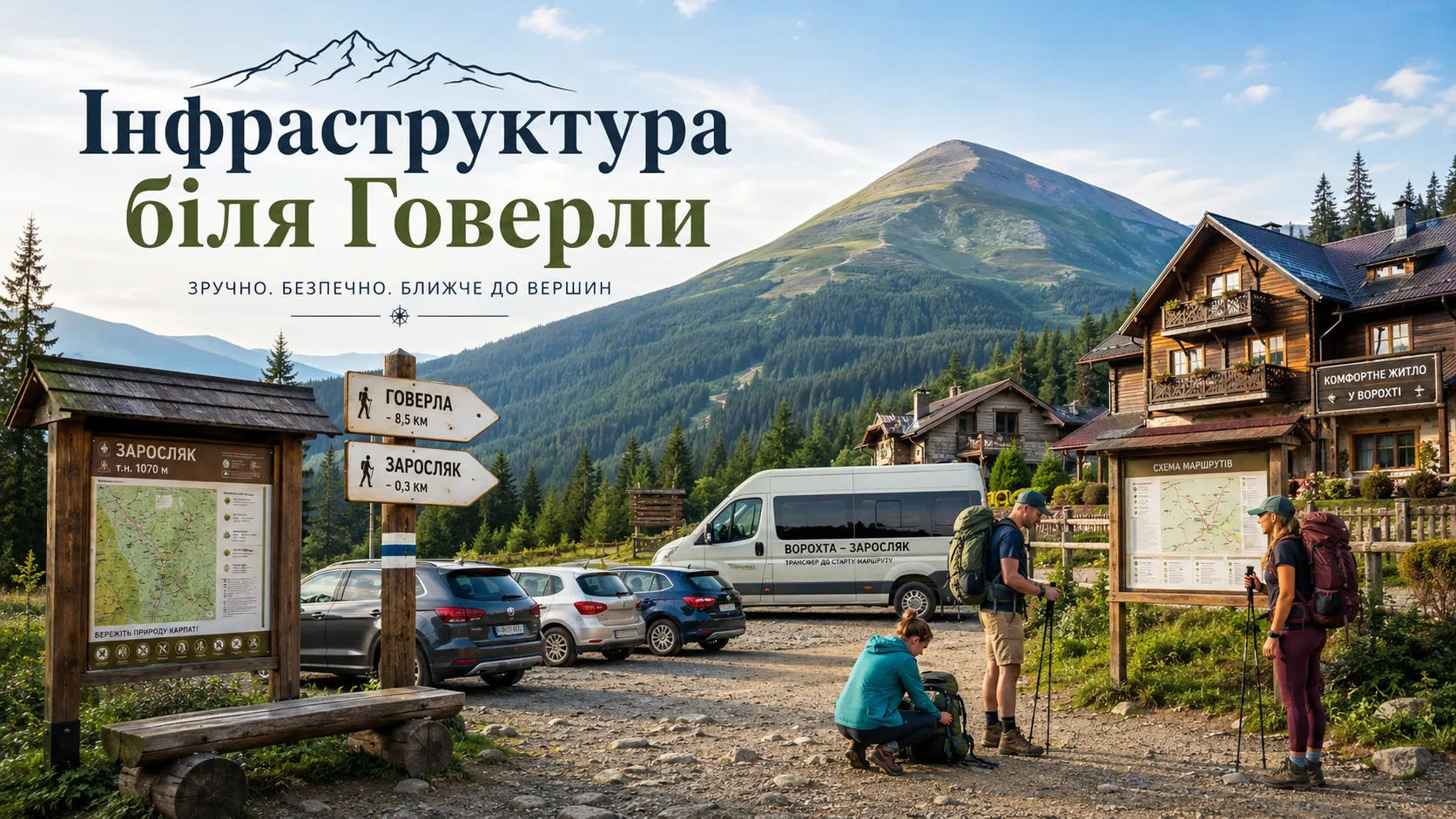
Tourist infrastructure near Hoverla is concentrated not on the summit itself but in the surrounding settlements and near the main trailheads. The widest choice of accommodation, shops, dining establishments, and transport services is available in Vorokhta, Yaremche, Tatariv, Lazeshchyna, Yasinia, and partly Kvasy. Services are much scarcer in the high mountains, so water, food, warm clothing, a first-aid kit, and necessary equipment should be prepared in advance.
For an ascent from the Ivano-Frankivsk region, tourists most often stay in Vorokhta and then travel to the Zarosliak sports base. The Zakarpattia route is more conveniently begun from Lazeshchyna, from where the road leads to the Kozmeshchyk tract. Both options have their advantages, but they require advance planning: the final section of the road passes through mountainous terrain, while public transport to the trailhead runs irregularly or is unavailable altogether.
Zarosliak Sports Base and the Start of the Route to Hoverla
Zarosliak Tourist Base is the best-known starting point near the foot of Hoverla for a one-day ascent. It is located in the high-mountain valley of the Prut River, below the main slopes of the Chornohora Range. Popular hiking trails to Hoverla, Prut Waterfall, Lake Nesamovyte, Breskul, and Pozhyzhevska all begin here.
There is a car park near Zarosliak. During popular summer weekends, holidays, and mass ascents, spaces can fill up quickly, so it is better to arrive early. Leave your car only in the designated area, without blocking access for emergency vehicles or the approaches to tourist attractions.
How to Get to Zarosliak from Vorokhta
The road to Zarosliak begins in Vorokhta and runs toward the Zavoyelia tract and the Prut Valley. Part of the route has a paved surface, while farther on there are gravel, crushed-stone, and uneven sections. After heavy precipitation, road conditions may deteriorate, so travel time depends not only on the distance but also on the vehicle, weather, and traffic volume.
Tourists travel by private car, pre-booked transfer, taxi, off-road vehicle, or an organized group bus. When booking transportation, state clearly that the final destination must be the Zarosliak base, not just central Vorokhta or the turn toward the mountain. When arranging a return transfer, leave extra time. The Zarosliak–Hoverla route depends on the group’s pace, the number of people on the trail, and the weather. An overly early fixed meeting time forces hikers to hurry during the descent, increasing the risk of falling on wet rocks and roots.
Before entering the protected area, tourists pass through the Hoverla–Zarosliak checkpoint, where they must pay an environmental fee and can receive up-to-date information about visiting conditions, current restrictions, and the state of the route. In effect, this is the entrance to the Hoverla trail.
Food Near Zarosliak and Supplies for the Trail
It is best to buy the main provisions for the hike in Vorokhta, Yaremche, Tatariv, Lazeshchyna, or Yasinia. Near the trailhead, the selection may be limited and depend on the season and time of day. Do not assume that a place serving a full menu will necessarily be operating at Zarosliak.
For a one-day ascent, choose light food that does not spoil without refrigeration and does not add unnecessary weight. Options include sandwiches, hard cheese, nuts, dried fruit, energy bars, biscuits, fruit, and a hot drink in a thermos. Excessively fatty or heavy food before a steep climb often causes discomfort.
Each participant should carry part of their own supplies rather than relying on one large backpack carried by the group leader. If the group accidentally becomes separated, each person should have at least water, a snack, a rain jacket, and a basic first-aid kit.
Where to Get Water During a Hike to Hoverla
Streams and springs can be found on the lower sections of the routes, but their availability varies by season. During hot, dry periods, small springs may weaken, while after heavy rain the water becomes cloudy. The presence of a stream on a map does not guarantee that it will be convenient or safe to collect water from.
For the route from Zarosliak, it is best to set out with a sufficient personal supply. Water from natural springs should be passed through a hiking filter or disinfected. Do not collect it downstream from crowded recreation areas, livestock sites, or visibly polluted sections.
There is no guaranteed source of drinking water on the summit of Hoverla itself. Therefore, setting out for the «final climb» with an almost empty bottle is a poor strategy. Distribute your supply so that it lasts for the descent as well, which may take several hours.
Accommodation Near Hoverla and Overnight Stays in Vorokhta
Accommodation near Hoverla is most often sought in Vorokhta. The village has private homesteads, guesthouses, cottages, small hotels, and group accommodation complexes. This option is convenient for those planning an early departure to Zarosliak who do not want to spend several hours traveling from Ivano-Frankivsk or Lviv immediately before the ascent.
Staying overnight before the hike has a practical advantage: tourists can get a good night’s sleep, have breakfast, check their gear, and start the route during the first half of the day. Arriving at night after a long journey, sleeping for only a few hours, and immediately climbing Ukraine’s highest mountain creates unnecessary strain before the trail even begins.
When booking accommodation in Vorokhta, check not only the price and room photos but also the exact location. The village stretches a considerable distance along the valley, so the property may be far from the railway station, shops, or the transfer pickup point.
During the high season, it is best to book accommodation in Vorokhta in advance. Demand is highest on summer weekends, public holidays, during the autumn foliage season, and when organized ascents are taking place. However, check the weather forecast again before your trip: having a paid room is not a reason to climb during a thunderstorm or in storm-force winds.
Route Infrastructure via Lazeshchyna and Kozmeshchyk
Hoverla from Lazeshchyna involves different tourist logistics. From the village, you need to reach the Kozmeshchyk tract, where routes toward Hoverla and Petros begin. Part of the road is unpaved, so whether an ordinary passenger car can make the journey depends on its condition.
The official route through the Hropa mountain meadow has several rest areas, information boards, and signs. An information point operates near the fork, and there is a spring nearby where you can replenish your water supply. A tourist shelter is also located in the Kozmeshchyk area.
The presence of certain infrastructure elements does not make the route short or easy. The Zakarpattia approach is longer than the popular option from Zarosliak, so tourists need to calculate their time especially carefully. Before setting out, clarify overnight options, the condition of the access road, and the current visiting regulations for the reserve.
Overnight Stays in Kozmeshchyk and Camping Near Hoverla
In the Kozmeshchyk tract, you can find accommodation in a tourist shelter, private homesteads, or a campsite. Some tent sites have basic amenities, but their operating status, availability, and list of services should be checked before the trip.
You cannot pitch a tent anywhere convenient on the slopes of Hoverla. Much of the area has protected status, and the rules for staying there depend on the functional zone. Plan overnight stays at official sites, in permitted campsites, or in shelters.
Even an equipped campsite in the Carpathians should not be confused with a city hotel. You may need a sleeping bag, headlamp, spare clothing, personal tableware, hygiene products, and rain protection. On a cold night, temperatures in a mountain valley can drop substantially even in summer.
What Infrastructure Is Not Available on the Summit of Hoverla
Hoverla’s popularity can sometimes create the false impression that a tourist complex operates on the summit. In reality, it is open high mountain terrain without a permanent sheltered building, a guaranteed food outlet, a pharmacy, running water, or a safe place to wait out a thunderstorm.
- there is no cable car to the summit;
- the upper platform cannot be reached by car;
- there is no reliable natural shelter from thunderstorms and wind;
- mobile phone service is not guaranteed;
- there is no permanent source of drinking water;
- do not count on being able to buy food or warm clothing;
- tourists must carry their own rubbish down from the summit.
Plan as though there will be no services anywhere along the entire hiking route. Everything necessary should be in your backpack, and your energy reserves should be calculated not only for the ascent but also for the return. This preparation allows you to use tourist infrastructure as support rather than depend on it at a critical moment.
The infrastructure near Hoverla is sufficient for organizing a comfortable trip if you book accommodation in advance, arrange a transfer, and prepare your gear. Vorokhta is convenient for the route through Zarosliak, while Lazeshchyna and Kozmeshchyk are suitable for the Zakarpattia approach. However, once you leave the trailhead, true high-mountain terrain begins, where the key resources are personal responsibility, proper planning, and respect for the Carpathians.
Hiking Route to Hoverla: Rules, Etiquette, and Safety
Rules of conduct on Hoverla help protect the high-mountain environment, reduce the risk of fires, and make the route safer for tourists. The mountain slopes are part of protected areas, so visitors must follow official trails, comply with park staff instructions, and observe temporary restrictions.
Stay on the marked route, do not cut switchbacks, and do not leave the trail unnecessarily. Heavy foot traffic destroys vegetation, exposes the soil, and causes slope erosion. In fog, leaving the route can also lead to a dangerous rocky slope or a descent into another valley.
Do Not Leave Rubbish or Light Fires in the High Mountains
Take all bottles, packaging, tissues, food scraps, and disposable rain ponchos with you. Do not leave bags near signs or hide waste under rocks. Even organic waste decomposes slowly and attracts animals. It is convenient to carry a separate sealable waste bag. Wet wipes, plasters, and personal hygiene products must also be carried back down.
Campfires are permitted only in specially designated places. An open fire in the forest, crooked forest, or a dry mountain meadow can cause a wildfire. Do not break branches, cut down mountain pine, or create new fire pits. Use a gas burner only where permitted and on a stable, nonflammable surface. Additional restrictions may apply during periods of high fire danger.
Spend the Night Only in Permitted Places
Pitch your tent at official sites, in campsites, or in recommended areas. Do not set up camp on the summit itself, near springs, or among vulnerable vegetation. After spending the night, take away rubbish, ropes, and tent pegs. Do not wash dishes with household chemicals directly in a stream, spring, or high-mountain lake.
A responsible tourist leaves no rubbish, damaged plants, or new trails behind. The best way to thank Hoverla for its views is to keep it clean for future hikers.
Safety During the Ascent of Hoverla
A hike up Mount Hoverla in dry summer weather is accessible to most physically fit tourists, but it remains a full-fledged mountain hike. A basic first-aid kit should therefore contain dressings, antiseptic, blister plasters, an elastic bandage, an emergency blanket, and personal medication. Severe weakness, chest pain, dizziness, impaired coordination, or signs of hypothermia are reasons to stop climbing immediately and begin the descent.
Also remember that the main dangers in the mountains are thunderstorms, fog, strong winds, slippery trails, hypothermia, injuries, and losing the route. Keep the following key rules in mind:
- keep the group together and do not leave participants behind;
- check the trail markers and do not turn onto unknown paths;
- if you get lost, return to the last familiar landmark.
Hoverla in Winter
Winter ascent of Hoverla requires special preparation. Snow conceals trails, wind reduces visibility, and avalanche danger is possible on the slopes. Before a winter hike, check the avalanche forecast, carry appropriate equipment, and travel with an experienced guide. During official warnings, you should abandon the ascent. Also remember the circumstances in which you should stop climbing and turn back:
- a storm is approaching or the wind is strengthening;
- trail markers disappear in the fog;
- a participant is injured or exhausted;
- there is not enough water, warm clothing, or daylight;
- the trail is covered with ice or dangerous snow;
- the group will not reach the descent route before dark.
A safe hike does not end with a photograph at an altitude of 2061 meters, but with all participants returning to the starting point. Being ready to give up the summit because of bad weather or fatigue is a sign of experience, not weakness.
Climbing Mount Hoverla: Practical Tips for Travelers
A hike to Hoverla will be much more enjoyable if you prepare for it as a mountain journey rather than an ordinary walk in the hills. Choosing the right route to the summit of Hoverla, starting early, wearing comfortable footwear, and maintaining a realistic pace will help avoid most common problems.
For a first ascent, hikers most often choose the easiest trail, which starts at Zarosliak. This option is suitable for a one-day hike, is marked, and begins at an already considerable elevation. Tourists planning to climb Hoverla independently without a guide most often choose this route.
The ascent of Hoverla from Lazeshchyna through Kozmeshchyk has a completely different character. This longer route from the Zakarpattia side attracts visitors with scenic mountain meadows, a quieter atmosphere, and fewer tourists, but it requires good physical fitness and careful transport planning.
- For a first ascent: Zarosliak — Hoverla — Zarosliak.
- For experienced hikers: Lazeshchyna — Kozmeshchyk — Hoverla.
- For a multi-day hike: Petros — Hoverla or a traverse of the Chornohora Range.
- In winter: only with appropriate experience, equipment, and a guide.
Dress in Layers and Do Not Test New Footwear
The temperature near Zarosliak and on the summit of Hoverla can differ considerably. Instead of one heavy jacket, it is better to have several layers: a T-shirt, a warm sweater or fleece, a windproof jacket, and a raincoat. Even in summer, pack a hat and lightweight gloves. On the exposed ridge, strong wind quickly chills your hands, and after a stop at the summit, clothing damp with sweat no longer keeps you warm.
The route requires comfortable hiking footwear with a deep-tread sole. It is advisable to break in new boots before the trip. Even high-quality footwear can cause blisters if you wear it for the first time immediately before a several-hour ascent. It is also worth packing spare socks and blister plasters. After rain, the trail becomes wet, so lightweight casual sneakers quickly get soaked and provide poor grip on rocks.
Bring Enough Water and a Simple Snack
Calculate your water supply for both the ascent and the descent. Not every spring marked on the map will be convenient or flowing well on the day of your hike. In hot weather, your need for water increases significantly. Suitable snacks include sandwiches, nuts, dried fruit, cheese, fruit, and energy bars. Do not bring unnecessary dishes, glass bottles, or foods that spoil quickly or create a lot of packaging.
Common Mistakes on a First Ascent of Hoverla
- setting out late and starting the ascent at too fast a pace;
- light casual footwear, no raincoat, and no warm layer;
- an insufficient water supply;
- following an unfamiliar group instead of checking the route;
- trying to combine too many locations in one day;
- continuing the hike as the weather deteriorates;
- not allowing enough time for the descent.
The best advice for your first hike to Hoverla is not to rush to prove anything to yourself or others. A steady pace, attention to the weather, and a willingness to turn back will help you get far more from the journey than an exhausting ascent for the sake of one photograph.
Frequently Asked Questions About Hoverla, Routes, and Ascents
How high is Mount Hoverla?
Hoverla is 2061 meters above sea level. It is the highest mountain in Ukraine, the highest peak of the Ukrainian Carpathians, and the main summit of the Chornohora Massif.
Where is Hoverla located?
Hoverla is located in the Chornohora Massif, on the border of Ivano-Frankivsk and Zakarpattia oblasts. The most popular approach leads from the direction of Vorokhta via the Zarosliak sports base, while the Zakarpattia route runs from Lazeshchyna through Kozmeshchyk.
Which route to Hoverla is best for a beginner?
For a first ascent, hikers most often choose the route to Hoverla from Zarosliak. It is shorter than the approach from Lazeshchyna, has tourist trail markers, and is suitable for a one-day hike in favorable weather.
Which route is easier—the blue or the green one?
The green route is generally considered longer and gentler, while the blue route is shorter but steeper and rockier. Trail conditions may change after rain, snow, or repair work, so check the current map before setting out.
Can you climb Hoverla without a guide?
Yes, you can follow the popular marked route independently. Beginners, families with children, and hikers without navigation experience are safer joining an organized group or using the services of a guide.
Is a hike to Hoverla suitable for children?
Children who are accustomed to long walks and have suitable footwear can make the ascent. Parents should choose a dry day, start the route early, and be ready to turn back if the child becomes tired.
What should you take on a hike to Hoverla?
Your backpack should contain water, a nutritious snack, a raincoat, warm clothing, a first-aid kit, a headlamp, a charged phone, and an offline map. The route requires hiking footwear with a deep-tread sole; trekking poles are also useful.
Do you have to pay to enter the route to Hoverla?
Visiting tourist routes in protected natural areas may involve a recreational fee. Rates, discounts, payment rules, and possible seasonal restrictions change, so check them on the official website of the relevant park or reserve before your trip.
What should you do if the weather on Hoverla deteriorates?
During a storm, strong wind, dense fog, or a sudden drop in temperature, do not continue toward the summit. The group should stay together and return along the marked route. In the event of an injury, losing the trail, or another danger, call 112 or 101.
Hoverla — the Mountain That Leaves the Carpathians in Your Heart
Hoverla is much more than Ukraine’s highest mountain. Its true height cannot be measured in numbers alone. It is made up of morning mist above the spruce trees, the sound of mountain streams, heavy breathing on a steep ascent, and that special feeling that emerges when the trail finally leads onto an open ridge.
On the way to the summit, your thoughts gradually grow quieter. The rush of city life remains somewhere below, beyond the forest and rocky slopes. It no longer matters quite so much how many messages are unanswered or what tasks await after your return. What remains are the mountains, the wind, the road ahead, and the simple desire to take one more step.
Hoverla welcomes people in different ways. For some, it offers an endless panorama; for others, dense fog and only a few meters of visibility. Some climb easily, while others tackle every steep stretch with effort. Yet almost everyone descends with the feeling that they have visited not merely a geographical point, but a place with a character of its own.
Mount Hoverla in the Ukrainian Carpathians does not promise an easy road. It simply opens a trail upward—through forest, rocks, wind, and your own doubts. And at the summit, it quietly reminds you that sometimes, to see the world more broadly, you simply need to dare to climb higher.
One Response Comment
You can post first response comment.