Dovbush Trail in Yaremche is a route where the Carpathian forest gradually transforms into a living backdrop for ancient legends. Rocky climbs, moss-covered boulders, narrow passages between rocks, and the silence beneath towering trees create a special atmosphere even before hikers reach the main viewpoints. It is easy to imagine the times when opryshky hid in the mountain valleys, while the name of Oleksa Dovbush was passed from village to village along with stories of his courage, strength, and hidden treasures.
This Dovbush educational nature trail is located near the central part of Yaremche, within the Carpathian National Nature Park. The basic circular route is about two kilometers long and usually takes approximately two hours, including stops. At the same time, the walk can be extended farther along the mountain slopes toward the Zaprutskyi Horhan Range and Makovytsia Mountain.
Despite its short distance, the Dovbush tourist route never feels monotonous. The trail sometimes rises gently through the forest, sometimes winds between rock formations, and sometimes leads to places offering views of the Prut Valley and the surrounding mountains. Along the way, visitors encounter themed stone compositions, information stops, and natural features associated with legends about the leader of the opryshky.
The forest trail in Yaremche combines several types of recreation at once. It is an easy hiking route in the Carpathians, a nature walk through beech and fir forest, an introduction to the history of the opryshky, and an opportunity to see unusual rocky terrain. Unlike demanding high-mountain hikes, the main loop requires neither special equipment nor extensive hiking experience.
Why a Walk in Oleksa Dovbush’s Footsteps Is So Memorable
The route’s main impression comes not from a single rock or viewpoint, but from the gradual change in atmosphere. The sound of cars remains below, the air becomes cooler, the trees close over the trail, and boulders appear more and more often among the roots and ferns. Even a short stop here makes it possible to feel how close the real Carpathians begin to the city.
For some, the Dovbush Trail route will be an easy walk before visiting Probiy Waterfall. For others, it will be the beginning of a longer mountain hike. Some visitors come specifically for the legends—to see the Dovbush rock massif, find the Storehouse Stone, and discover whether the Carpathian forest truly preserves echoes of the ancient age of the opryshky.
In this article, we will take a detailed look at the route’s history, natural features, legends, length, and difficulty, as well as how to reach the trailhead, safety rules, and ways to extend your time in the mountains. We will also find out what to see along the way, where to go nearby, and how to prepare so that a journey along the Dovbush Trail leaves you with not fatigue, but a desire to return to the Ukrainian Carpathians again and again.
The History of the Dovbush Trail
The History of the Dovbush Trail began long before the appearance of tourist signs, steps, and themed stone compositions. The mountain forests around present-day Yaremche were part of a territory where opryshky—small armed groups of peasants and mountaineers who opposed feudal oppression, excessive duties, and the arbitrary rule of local wealthy landowners—were active in the XVIII century.
Inaccessible slopes, rocky valleys, and dense Carpathian forests provided the opryshky with natural protection. They knew the mountain routes well, could quickly change their location, and enjoyed the support of some of the local population. It was in this environment that the figure of Oleksa Dovbush emerged—a man whose historical activities later became surrounded by legends of extraordinary strength, justice, and elusiveness.
Who Was Oleksa Dovbush, and Why Is His Name Associated with Yaremche?
Oleksa Dovbush was born in 1700 in Pechenizhyn and became the most famous leader of the opryshky movement in the first half of the XVIII century. His bands operated mainly in Hutsulshchyna and Pokuttia, but also carried out raids and incursions across a much wider area of the Carpathian region.
In popular memory, Dovbush remained a defender of the poor and an opponent of injustice. That is why he is often compared to a hero of folk ballads who took wealth from the lords and helped the destitute. The documentary history is far more complex than this romantic image, but one thing is certain: the leader’s name became a symbol of resistance, freedom, and defiance.
The surroundings of Yaremche are connected with the activities of the opryshky in 1738–1745. Mountain passes, the Dribka valley, the rocks above the Prut Valley, and forested slopes may have served as convenient places for travel, observation, and temporary shelter. Against this historical backdrop, the route following in Oleksa Dovbush’s footsteps took shape, combining a nature walk with a story about the Carpathians’ past.
How the Artistic and Memorial Complex «Dovbush Trail» Came into Being
The historic Dovbush route was created as a path intended not only to lead tourists through a picturesque valley, but also to tell the story of the opryshky movement in sequence. The trail itself has more than a century of tourism history, while its modern appearance is enhanced by stone compositions installed in 1990.
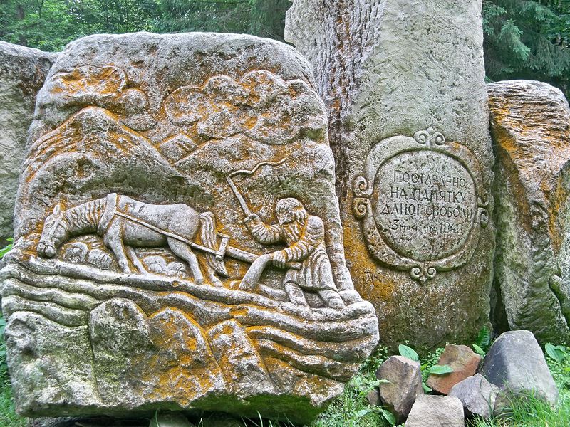
The themed works were created by Lviv sculptor Dariy Hrabar. Natural stones and boulders were used for the compositions, allowing the artistic elements to blend naturally into the forest. They gradually reveal to visitors the social background of the era, a person’s path to an opryshky band, and the pursuit of freedom.
The «Panshchyna» Composition on the Historic Dovbush Route
One of the first themed stops is the «Panshchyna» clearing. Sad human faces, scenes of hard labor, and the image of a lord are carved into the stones. The composition recalls peasant life under feudal obligations and explains the social reasons why some mountaineers left their customary lives and joined the opryshky.
At the center stands a stone cross bearing the date 1848 — the year serfdom was abolished in the western Ukrainian lands within the Austrian Empire. This date falls outside Dovbush’s own lifetime, but it logically concludes the story of the peasants’ prolonged struggle against a system of compulsory obligations.
The «Opryshky» Composition and the Symbolism of Freedom
The next stone composition presents one popular version of how Oleksa Dovbush left his life as a shepherd and joined the opryshky. One stone recalls his escape from the flock, the central one symbolizes freedom through arms raised to the sky, and another depicts the band led by its chieftain.
This artistic interpretation should not be viewed as a literal illustration of a documented biography. It is a figurative narrative built on a combination of history and folk memory. It helps explain why the legendary opryshky trail is perceived not simply as a path to the rocks, but as a coherent story of oppression, choice, struggle, and freedom.
The Dovbush Trail in Yaremche as a Place of Living Historical Memory
Today, the Dovbush nature trail in Yaremche is not a museum in the usual sense. There are no enclosed galleries or exhibits behind glass. The story is told by the landscape itself, the stone compositions, information boards, stop names, and legends accompanying the route through the protected Dribka valley within the Carpathian National Nature Park.
It is important to distinguish three levels of this narrative. The first is the documented facts about Oleksa Dovbush and the opryshky movement. The second is the artistic interpretation of events in the sculptural compositions. The third is the folklore surrounding treasures, caves, enchanted weapons, and the leader’s extraordinary strength. Together, they create a cohesive image, but they should not be confused with one another.
This combination is precisely what makes the historic Dovbush route psychologically captivating. Travelers do not simply read dates; they move through a space where the past gradually reveals itself through stone, forest, and panoramas. Here, it is easy to understand why Dovbush’s figure outlived his era and remains one of the most recognizable legends of the Ukrainian Carpathians.
Natural Features of the Dovbush Trail: Rocks, Forest, and Views
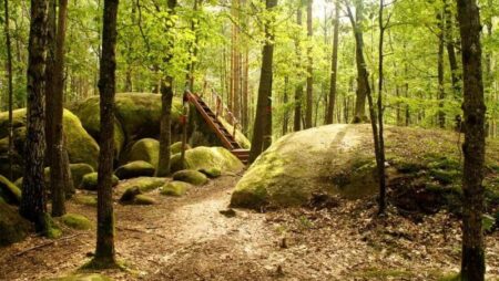
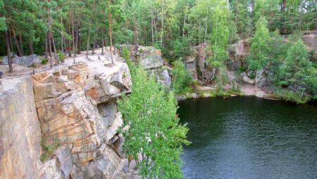
The Dovbush Trail attracts visitors not only with the history of the opryshky. Its main backdrop is nature itself: a rocky slope, sandstone, narrow passages between boulders, trees rooted on almost bare rock, and forest silence occasionally broken by the sound of water below.
The route passes through a protected valley on the right bank of the Prut River. From the noisy automobile road, hikers gradually ascend into a shaded forest, where the urban surroundings quickly disappear from view. This sharp change of environment makes the short hiking route in Yaremche feel like a full-fledged Carpathian journey.
The Dovbush Rock Massif in Yaremche and Yamnа Sandstone
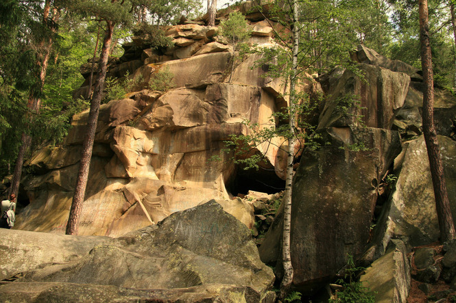
The local rocky terrain is formed primarily by massive outcrops of Yamna sandstone. This sedimentary rock developed from compacted sand in ancient marine basins. In the Carpathians, such sandstones form part of the flysch—a repeated alternation of layers of sandstone, clay, shale, and other sedimentary rocks.
Under the influence of water, frost, temperature fluctuations, and slow weathering, solid layers gradually split into boulders. This created cracks, ledges, hollows, and small cave-like cavities that give the route its distinctive appearance today. According to the Carpathian National Nature Park, the local rocks and caves are approximately 35 million years old.
The route to the Dovbush rocks allows visitors to see these formations up close. Some boulders rise above the trail, others lie among the roots, and some form natural passages. Covered with moss, lichen, and damp dark surfaces, the stones seem like part of the ancient forest rather than separate geological features.
Dovbush’s Storehouse Stone and Natural Cavities in the Rocks
The endpoint of the main route is considered to be the rock known as Dovbush’s Storehouse Stone. Its shape, hollows, and cracks inspired legends about an opryshky hideout and enchanted treasures. The legendary explanation captures the imagination, but the site’s true value lies in its geological structure and natural appearance.
Water enters the sandstone cracks, freezes in winter, and gradually widens them. Plant roots also slowly force apart weakened sections of rock. Over thousands of years, these processes form niches, overhangs, and narrow passages that people have long regarded as natural shelters.
It is not advisable to enter deep crevices or climb to the tops of boulders where no trail has been provided. The surface may be wet, and the rocks may be unstable. It is best to view the rock from the accessible part of the route without damaging the moss or plants.
The Forest Trail in Yaremche Among Beech, Fir, and Spruce
The forest route near Yaremche passes through a mixed environment typical of this part of the Carpathians. Beech, fir, and spruce grow on the slopes, while Scots pine can be found in some rocky areas. The trees provide dense shade, so even in summer the air on the trail often remains cooler than in the city center.
The forest here is far from monotonous. In the lower sections, visitors are surrounded by tall trunks and dense undergrowth; higher up, scree slopes, exposed boulders, and trees with twisted roots appear more frequently. After rain, the scent of damp bark, leaves, and moss becomes especially intense.
Raspberry and blackberry bushes can be seen along the route, while bilberries grow closer to the upper sections. However, the area belongs to a national nature park, so the vegetation should primarily be regarded as part of the natural ecosystem, not as a place for mass picking of berries or plants.
Green mosses are one of the most striking details of the local landscape. They cover rocks, roots, and fallen trunks, retain moisture, and soften the rugged appearance of the cliffs. In shaded areas, the moss cover remains green even when exposed parts of the forest have already dried out after rain.
Together with lichens, mosses slowly contribute to the breakdown of the rock surface and the formation of a thin layer of soil. In time, grasses, ferns, and young trees can take root in it. That is why moss must not be torn off for photographs or decoration: damaged cover recovers very slowly.
Views of the Prut Canyon and the Slopes of Yaremche
Several open sections of the route offer views of the Prut Canyon, the Yaremche valley, and the surrounding slopes. The panorama does not appear immediately: for most of the way, trees conceal the landscape, and then the depth of the river valley suddenly opens up between the branches. These viewpoints are especially striking in autumn, when the slopes take on shades of yellow, copper, and red. In clear weather, it is easy to see how the city stretches along the Prut, while forested areas gradually give way to the higher Carpathian ridges.
For a safe view, there is no need to approach the edge of the cliff or climb over natural obstacles. Rocky ledges can be slippery even in dry weather because of moss, fine sand, and fallen leaves.
Why the Natural Route to Dovbush Rocks Is Worth a Leisurely Walk
The natural features of this trail cannot be appreciated if it is treated merely as the shortest way to the final rock. The most interesting details reveal themselves along the way: roots embracing a boulder, a thin layer of moss, a pine tree above a precipice, and the alternation of dark forest with bright clearings.
This tourist route in the Carpathians shows how geology, water, vegetation, and time work together to shape the landscape. Rock formations provide the foundation, the forest gradually takes root in cracks and on slopes, and people fill natural forms with stories and legends.
That is why the path to the rock formations is best followed without rushing. Dovbush Trail is interesting not only for its final destination, but for the entire space between the beginning of the route and the Chamber Rock—a place where the nature of Yaremche tells its own story in the language of stone, roots, and forest silence.
Dovbush Trail from Personal Experience: Route, Rocks, and the Ascent of Makovytsia
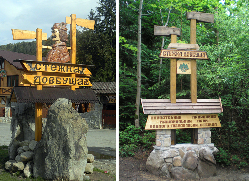
We began our walk along Dovbush Trail at seven in the morning from Svobody Street in Yaremche. Finding the start of the route was easy: a noticeable wooden sign, decorated in the traditional Hutsul style, stands almost beside the road.
From Yaremche railway station to the entrance to the route is approximately 2.5 km. This distance can be covered on foot through the central part of the city or by local transport. We walked, because this way the outing begins before the official start: along the way, you can see old homesteads, mountain slopes, and the unhurried everyday life of Yaremche. From the sign, the road leads to the entrance to the territory of the Carpathian National Nature Park. After passing through the checkpoint, the main route begins.
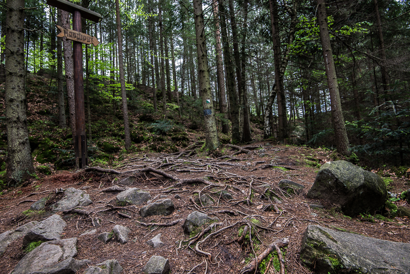
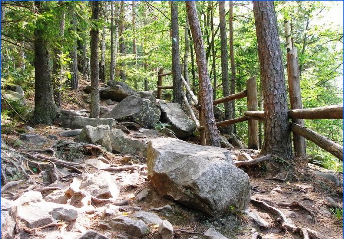
A real forest fairy tale opened before us, one we did not want to leave. Tall beeches, firs, and spruces rose above the trail, their trunks and exposed roots covered in places with thick green moss. Sunlight filtered through the crowns in narrow bands, illuminating ferns, grasses, and small rocky outcrops. The air here feels completely different from the air in the city. It is filled with the scent of damp earth, tree bark, grass, and pine needles. After a few minutes of walking, the rush disappears, breathing settles, and attention gradually shifts from everyday thoughts to what is happening around you.
As we continued, we saw the first stone compositions. They are dedicated to the opryshky movement, the difficult life of Carpathian peasants, and the figure of Oleksa Dovbush. These works fit naturally into their surroundings. They do not look like ordinary monuments placed in the middle of the forest. Stone faces, figures, and symbolic scenes seem to continue the natural forms of the rocks, gradually turning the walk into a historical narrative. Even without detailed knowledge of history, it is possible to understand the creator’s main idea: to show the path from oppression to resistance. That is why this educational ecological route feels like more than a walk to the rocks—it is a coherent story about people who refused to accept injustice.
Information boards are installed along the route, and we stopped by them several times. They contain information about Oleksa Dovbush, the opryshky movement, local legends, flora, and the geological origins of the rocks. These stops help visitors understand the area better. Without the explanations, there would be nothing before them but trees, stones, and forest paths.
Most of the route follows a dirt forest road. At first, the ascent seemed easy and was barely noticeable. Further on, tree roots, uneven stones, natural steps, and several slightly steeper sections appeared more frequently. Wooden steps and handrails have been installed in several places. They are genuinely helpful, especially on the descent.
After the forest ascent, large sandstone boulders gradually appeared—the same Dovbush Rocks. They do not suddenly emerge as one solid wall. At first, individual stones appear among the trees; then they become more numerous, and eventually the trail leads to a whole cluster of rock formations.
Rest areas for short breaks have been arranged near the rocks and in open sections of the route. From here, views open between the trees toward Yaremche, the Prut valley, and the forested mountain slopes. We stopped for a few minutes to rest and simply look at the mountains. The panorama does not unfold as one broad, unbroken wall as it does from a high summit. It appears in fragments between the treetops, creating the feeling of peering at the Carpathians through a natural window.
The main Dovbush Trail follows a loop. After viewing the rocks, you can continue along the signs and gradually return to the starting point near the entrance. It took us about two hours to complete the basic route, although we often stopped at the information boards, photographed the forest, and spent a long time examining the rocks. At a faster pace, the loop can be completed sooner, but there is no reason to hurry here.
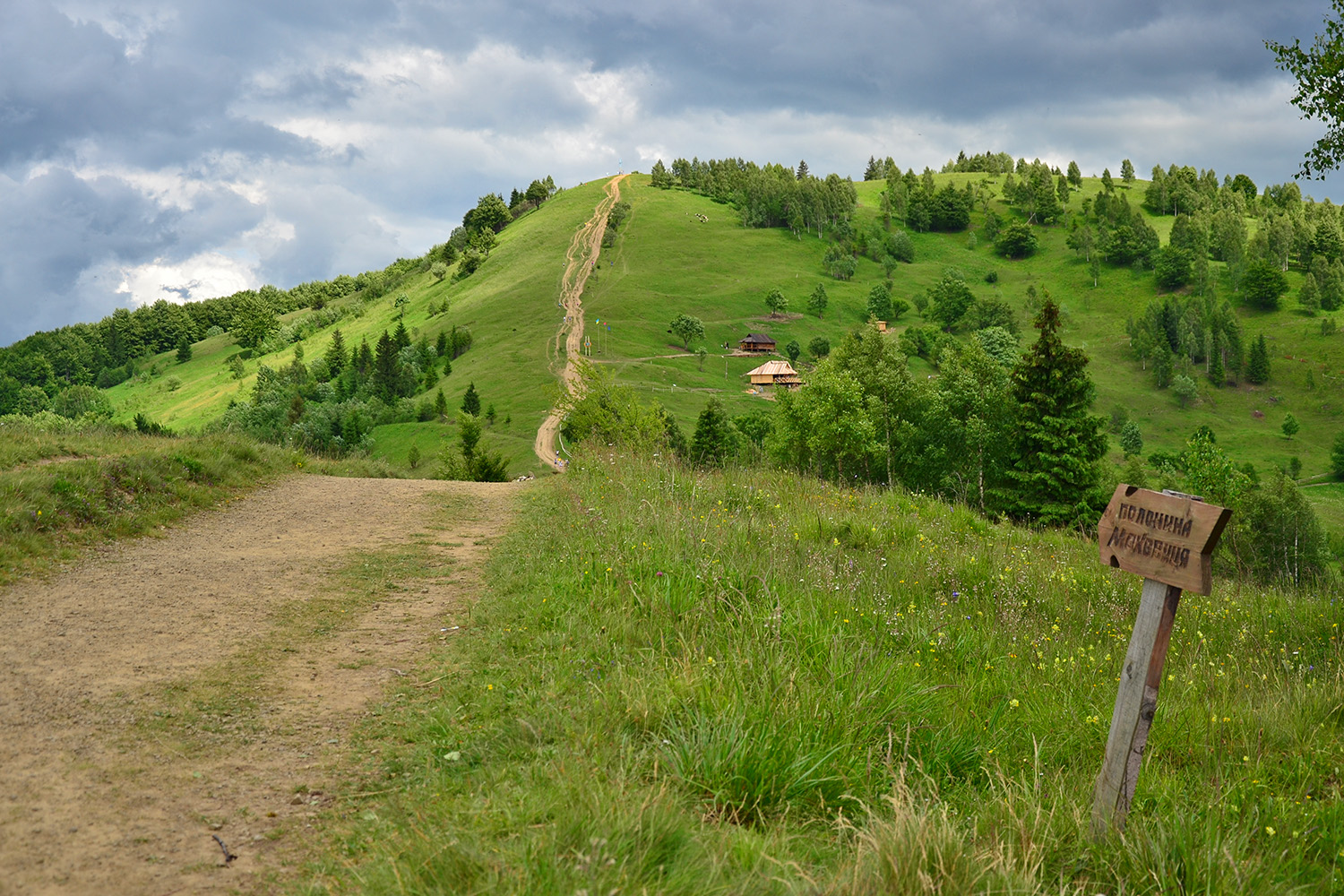
At one of the junctions, you can finish the loop walk or continue hiking to Mount Makovytsia. We decided to go on because we wanted to see Yaremche from a greater height. Beyond the turnoff, the route becomes longer and noticeably more challenging. The path continues uphill through mixed forest, rocky sections, and small open clearings. There are fewer tourists here, and the distance between information points is much greater.
Near the summit, the dense forest gradually recedes, revealing a much broader panorama. In clear weather, you can see the surrounding ridges and peaks, including Yavirnyk, Khomiak, Syniak, and Dovbushanka, and in the distance, the high mountain ranges of Chornohora. It was at the summit that we understood how different two versions of the same trip can be. The basic Dovbush Trail is a short forest walk with history and rocks. Continuing to Makovytsia is already a full-fledged mountain hike requiring time, stamina, and better preparation.
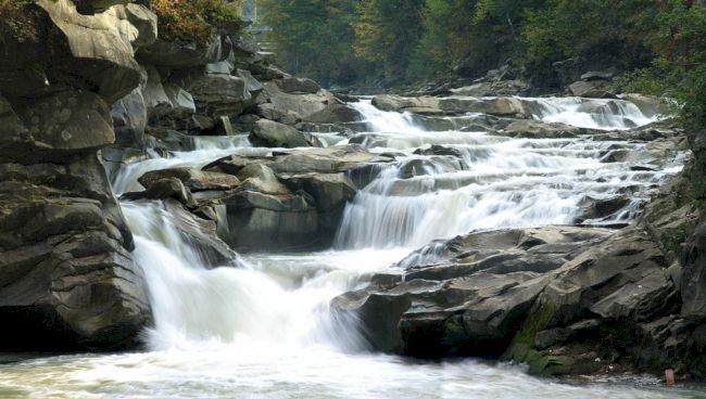
After the summit, you can return by the same road or choose another marked direction and descend to Yaremche. We chose the descent toward the city center so that we could finish the route near Probiy Waterfall. After the long forest descent, the sound of the Prut gradually grew louder. Soon we reached the area around Probiy Waterfall, the Hutsulshchyna restaurant, and the souvenir market. After several hours in the forest, returning to tourist-filled Yaremche felt especially stark.
Events and Festivals in Yaremche: How to Complement a Walk along Dovbush Trail
Dovbush Trail in Yaremche remains above all a natural and historical site. There is no permanent festival venue along the route itself, as the trail runs through a national nature park, where silence, forests, and the preservation of the natural environment are the main values. However, a trip to the rocks can easily be combined with cultural events in the Yaremche region. Hutsul celebrations, Christmas festivities, fairs, concerts, and festivals are held in the town and surrounding villages. During such events, visitors can not only see the Carpathians but also become better acquainted with the local music, clothing, cuisine, and customs.
The events calendar changes every year. Some festivals are held intermittently, moved to another settlement, or combined with city celebrations. Therefore, before your trip, check Yaremche’s current event listings and the organizers’ official announcements.
International Hutsul Festival in Yaremche
One of the region’s best-known cultural events is the International Hutsul Festival. Its program traditionally introduces guests to Hutsul culture through music, dance, crafts, traditional clothing, and ceremonial performances. Festival events may include performances by folk groups, arkan dance competitions, exhibitions of local artisans’ work, art plein airs, and reenactments of a Hutsul wedding. A separate part of the program is often devoted to traditional dishes, highland customs, and sporting challenges.
For tourists, this is a great opportunity to complement the route to the rocks with a firsthand encounter with the region’s culture. In the forest, the history of the opryshky is revealed through rocks and legends; at the festival, it comes alive through songs, dances, traditional dress, and the memory of local communities.
Hutsul Carnival and Yaremche City Day Celebrations
The Hutsul Carnival stands out for its colorful procession, traditional costumes, music, and themed floats. The program may include horseback riders, folk groups, tastings of Carpathian dishes, and performances by local artisans. Some cultural events take place as part of Yaremche City Day, traditionally held at the end of July. Concerts, exhibitions, fairs, and entertainment programs are organized in the city center.
On the day of major events, Yaremche usually attracts more visitors, so it is best to start the eco-trail in Yaremche early in the morning. This allows you to complete the main loop before large tour groups arrive and then join the city program after returning.
Ivan Kupala Celebrations in the Carpathians
In summer, the area around Yaremche hosts Ivan Kupala celebrations with a Carpathian flair. The program may include folk songs, wreath weaving, symbolic bonfires, themed performances, and stories about ancient customs. One of the well-known venues for Kupala festivities is the tourist site «Polonyna Pertsі.» However, the exact date, program details, and entry conditions are determined by the organizers separately for each season.
The Kupala theme resonates strongly with the legends of Dovbush Trail. According to one tale, on Ivan Kupala night, a secret entrance to a cave containing the opryshky’s treasures may reveal itself. Of course, this is only folklore, but the story adds a special atmosphere to a summer trip.
«Tatariv Vatra» Near Yaremche
In Tatariv, located near Yaremche, the cultural and entertainment celebration «Tatariv Vatra» is held. Its program may include performances by folk groups, master classes, Hutsul food tastings, a fire show, and the lighting of a symbolic vatra. The event is convenient to combine with a trip around the Yaremche region, especially when tourists are staying here for several days. In the first half of the day, you can follow a tourist route in Yaremche, and in the evening, head to Tatariv for the festive program.
Hutsul Feira Festival in Yablunytsia
Another colorful event in the region is the Hutsul Fira Festival in Yablunytsia. A fira is a traditional horse-drawn cart that remained an important means of transport in mountain villages for many years, used to carry people, hay, timber, and farm cargo. During the festival, competitions may be held to test the speed and skill of driving horse-drawn carts, along with contests for the best-decorated fira, strength challenges, and performances by folk groups.
This celebration presents Hutsulshchyna from a different perspective. After stories about opryshky, cliffs, and mountain hideouts, visitors see the everyday culture of the Carpathian residents—their transport, household skills, crafts, and traditional ways of interacting with the mountain environment.
Festivals are not an essential part of visiting the Dovbush Trail, but they help visitors better understand the cultural setting in which Carpathian legends were born. After walking among the rocks, it is especially interesting to hear a trembita, watch an arkan dance, taste traditional dishes, and talk with people who still preserve the customs of Hutsulshchyna today.
What to Visit Near the Dovbush Trail in Yaremche
The Oleksa Dovbush Trail is so conveniently located that it is easy to combine with other natural and cultural attractions in the city. After the short loop route, you can continue exploring Yaremche near Probiy Waterfall, stroll through the souvenir market, where vendors sell wood products, ceramics, woolen goods, lizhnyky blankets, embroidered shirts, jewelry, Carpathian teas, honey, and various gifts featuring local symbols.
Mount Makovytsia — Continuing the Dovbush Trail Route
The most logical continuation of the hike is Mount Makovytsia, as one of the marked routes is connected to the Dovbush Trail. The summit rises above Yaremche and offers a broad panorama of the city and the surrounding mountain ranges. The official route to Makovytsia is of moderate difficulty and is approximately four kilometers one way. The ascent leads through forest, across rocky sections, and over an open mountain meadow. Near the summit, you can see other mountains: Yavirnyk, Khomiak, Syniak, Dovbushanka, and, in clear weather, the distant peaks of Chornohora.
The hike to Makovytsia via the Dovbush Trail is no longer a short walk but a full ascent taking a substantial part of the day. Continue only in stable weather, with sufficient water and enough time for a safe descent.
Enclosure Facility of the Carpathian National Nature Park
For a family outing, the enclosure facility in Yaremche is a good choice. It is located in the Zhonka tract and introduces visitors to representatives of the Carpathians’ wildlife. In the spacious enclosures, you can see red deer, wild boar, pheasants, and other birds. Swans, ducks, and other waterfowl live near the lake.
This location is convenient to visit with children, as the walk is short and does not require a difficult climb. At the same time, explain to children that animals must not be teased, frightened, fed with personal food, or touched by putting hands through the fence.
Carpathians in Miniature Museum Park
Not far from the enclosure facility is the «Carpathians in Miniature» museum park. Its exhibition introduces visitors to the history, geography, and architectural heritage of the Yaremche area. It features scaled-down replicas of famous Carpathian sites: Probiy Waterfall with its bridge, the «Hutsulshchyna» restaurant, the Tatariv railway station, the Vorokhta viaducts, wooden churches, monasteries, mountain ranges, and high-altitude lakes.
The park is especially interesting for travelers who are just beginning to explore the region. By looking at the models, you can decide which places to add to the next days of your Carpathian journey.
Divchi Slozy Waterfall and a Forest Walk Along the Zhonka
A forest road to Divchi Slozy Waterfall begins at the enclosure facility. It stretches for approximately two kilometers along the Zhonka River and passes through spruce and beech forest. The waterfall itself is small and much calmer than Probiy. Its main appeal lies in its peaceful natural surroundings, cool air, and freedom from urban noise. A shallow pool has formed beneath the water flow, and there is a place nearby for a brief rest.
After completing the Dovbush Trail, the hike to Divchi Slozy may prove to be an unnecessary burden, especially for children. It is better to set aside a separate half-day for the Zhonka tract and combine the waterfall with the enclosure facility and the miniature park.
Yaremche’s attractions are relatively close to one another, but the mountain terrain and tourist traffic can lengthen the travel time between them. When planning what to see near the Dovbush Trail, it is best to allow extra time and avoid turning your Carpathian getaway into a rushed contest to visit as many places as possible.
The best trip around Yaremche is not made up of the longest list of attractions, but of a well-balanced combination of a forest walk, mountain views, local culture, and relaxed stops. That is when the Dovbush Trail becomes not just a single point on the map, but the beginning of a full introduction to the Carpathians.
Dovbush Trail Infrastructure: Facilities for Visitors
The Dovbush Trail’s tourist infrastructure is fairly simple and suits the character of a natural route. There is no urban promenade with cafés every hundred meters or a large visitor center in the middle of the forest. Instead, you will find what is genuinely needed during a hike: an official entrance, a checkpoint, signposts, a route map, information boards, equipped crossings, and viewpoints.
This format seems entirely appropriate. Once you enter the forest, civilization gradually fades into the background, while visitors do not feel as though they have simply been sent into the mountains along an unknown trail. The main directions are marked, information is provided near important sites, and at junctions it is possible to work out where to go next.
National Nature Park Checkpoint
Before setting out on the main part of the route, visitors pass through the checkpoint of the Carpathian National Nature Park. This is where the organized section of the nature trail begins. An official entrance is important not only because of the recreational fee. Park staff monitor the condition of the area, maintain the tourist infrastructure, update informational materials, and oversee compliance with nature protection regulations.
Before your hike, check the current opening hours and admission fee on the official Carpathian NNP resource, as prices and organizational arrangements may change.
Route Map, Trail Signs, and Information Boards
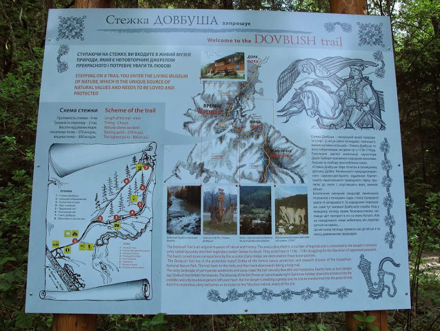
One of the most useful features along the route is the Dovbush Trail map. Information boards help you understand where you are, which sites you will see next, and which direction to take. Signposts are especially important at junctions. One direction returns visitors to the Dovbush Trail loop, another allows them to continue the hike to Mount Makovytsia, while separate branches lead to other tourist attractions.
That is why you should not rely solely on well-trodden ground. In popular areas, secondary paths can sometimes look just as convincing as the main hiking route in the Carpathians. At a fork, it is better to stop, find an official signpost, and only then continue.
Themed boards along the Dovbush educational nature trail describe the opryshky movement, Oleksa Dovbush, the area’s natural features, Yamna sandstones, and Carpathian vegetation. The information is placed directly beside the relevant sites. When you read about a relict pine and then see its roots gripping a vertical cliff, the text no longer feels like a dry reference note. The same applies to the «Panshchyna» and «Opryshky» compositions—the explanations help visitors understand their concept.
For independent exploration of the route, the Carpathian National Nature Park created an audio guide to the Dovbush Trail. Signs with numbers and QR codes are installed near the themed points; after scanning them, visitors can listen to the corresponding recording on a smartphone. The audio route consists of eleven stops in total. The recordings cover the area’s history, Dovbush’s life and legacy, legends, and individual natural sites.
Handrails, Steps, and Equipped Sections of the Route
Most of the forest route remains a natural dirt trail. Where the terrain becomes steeper or rockier, you will encounter constructed steps and handrails. These features make the route considerably easier, but they do not make it fully accessible. Roots, uneven rocks, changes in elevation, and narrow sections are still present. After rain, wooden elements and stone steps may also become slippery.
There are several viewpoints along the route, offering views of the Prut Canyon, the Yamna neighborhood, and the surrounding mountain slopes. These are convenient places to stop, catch your breath, drink some water, and take a few photographs. After a long ascent, such a brief pause is much more pleasant than trying to rest in the middle of a narrow trail and obstructing other visitors.
Rules of Conduct on the Dovbush Trail and Hiking Etiquette
The path to the rock formations passes through a nature park, so it is important not only to look after your own safety but also to protect the environment. The basic principle is simple: after your walk, the forest, rocks, and trail should remain exactly as you found them.
During your walk, stay on the marked trail and follow the official signposts. Cutting through the forest damages vegetation and soil and may also lead to steep or dangerous sections.
Protect the Dovbush Rocks and Vegetation and Animals, and Respect Other Visitors
Do not carve inscriptions into the rocks, chip off pieces of stone, or damage artistic compositions, trees, or moss. In the park, you should also not pick flowers or gather medicinal plants. The best souvenir from the Dovbush Trail is a photograph and your own memories—not a stone, flower, or branch taken from the forest.
Do not approach wild animals, feed them, or try to photograph them from close range. In the forest, it is also better to avoid loud music—silence is part of the atmosphere of a Carpathian walk. On narrow sections, let other hikers pass, do not block the trail for photographs, and do not pressure those who are moving more slowly.
Responsible tourism does not require complicated rules. It is enough to complete the route carefully, enjoy your experience, and leave nothing unnecessary behind. That is how one of Yaremche’s best-known trails will remain clean and beautiful for future generations of travelers.
Dovbush Trail in Yaremche: Frequently Asked Questions About the Route
Where is the Dovbush Trail in Yaremche?
The Dovbush Trail is located in the Dribka protected tract of the Carpathian National Nature Park, near the Yamna neighborhood. From Yaremche railway station to the start of the route is approximately 2.5 km. A convenient landmark is Svobody Street and the «Penky» bus stop, from which you need to walk to the park checkpoint.
How long is the Dovbush Trail, and how much time does the route take?
The official pages of Carpathian National Nature Park give different route details: the loop walk is described as approximately 2 km long and taking about 2 hours, while a separate route listing states 4 km and about 3 hours. Therefore, for a leisurely walk along the Dovbush Trail, it is best to allow at least 2–3 hours, especially if you plan to take photos, listen to the audio guide, and make stops.
How difficult is the Dovbush hiking route?
Carpathian National Nature Park classifies the Dovbush Trail route as easy. However, it is a mountain forest trail with climbs, roots, rocks, and uneven sections. After rain, the route becomes more challenging because the rocks and soil can be slippery.
Is the Dovbush Trail a loop route, or do you have to return the same way?
The main Dovbush Trail route is a loop and brings hikers back to the area where the walk began. At the junctions, however, you can choose a different direction and continue the hike, including toward Mount Makovytsia. At trail intersections, follow the installed signs and current trail markers.
Do you have to pay to enter the Dovbush Trail?
Yes. The trail passes through the territory of Carpathian National Nature Park, where a recreational fee is charged for visiting tourist routes. Fees may change, so it is best to check the current cost before your trip or directly at the checkpoint.
Is the Dovbush Trail suitable for hiking with children?
Yes, hiking the Dovbush Trail with children is entirely possible, especially if the child is accustomed to active walks. Constant adult supervision is required on rocky sections, steps, and near cliffs. The route is not suitable for a stroller because of the natural surface, roots, and changes in elevation.
What footwear is needed for the Dovbush Trail?
It is best to choose hiking boots or comfortable sneakers with a textured, non-slip sole. Even in dry weather, the forest route in Yaremche includes rocks, roots, and uneven ground, while after rain, moss and sandstone become particularly slippery.
Can you climb Mount Makovytsia from the Dovbush Trail?
Yes. At the junction, you can continue along the Dovbush Trail–Makovytsia route. The official route to Makovytsia is of medium difficulty and approximately 4 km one way, so this extension should be planned as a separate, longer hike with sufficient time, water, and energy.
Are the Dovbush Rocks in Yaremche and the Dovbush Rocks near Bubnyshche the same place?
No. The Dovbush Rocks on the route in Yaremche and the large rock-and-cave complex near the village of Bubnyshche are different tourist destinations. Because they share the same name, they are often confused when people search for the route, so be sure to check the location on the map before your trip.
When is the best time to hike the Dovbush Trail in Yaremche?
The most comfortable time to hike the Dovbush Trail in Yaremche is in dry weather, setting out during the first half of the day. In spring, the route is enhanced by fresh greenery; in summer, the forest provides plenty of shade; and in autumn, the surrounding slopes become especially beautiful. An early start also helps you avoid the largest crowds and leaves enough time to climb Makovytsia or visit other places in Yaremche.
The Dovbush Trail — more than a walk through the Carpathians
A day trip along the Dovbush Trail in Yaremche left me with exactly the feeling that makes you want to return to the Carpathians. It is easy to forget about time here, slow down, and simply keep walking—among ancient rocks, moss-covered trees, morning silence, and legends that, in this forest, somehow stop seeming like mere tales.
It is neither the most difficult nor the longest route in the Carpathians, but it has a special magic of its own. After a walk like this, what stays with you is not the kilometers covered, the elevation, the green trail markers, or the route map, but the coolness of the forest, the scent of damp earth, the silence between the trees, and the feeling that, for a few hours, you truly left the bustle of everyday life far behind.
It is precisely these beginner-friendly routes in the Carpathians that remind us that travel is not always about conquering the highest peak or covering as many kilometers as possible. Sometimes a few hours among Carpathian forests, ancient rocks, and mountain views are enough to return a little tired but clear-headed, in good spirits, and eager to set out again along forest trails, through mountains and mountain meadows.
Travel, discover new horizons, and do not be afraid to set out in search of new experiences. May the Dovbush Trail become one of those routes that mark the beginning of a genuine love for mountains and hiking. Let the Carpathians distract you, if only for a few hours, from the bustle, stress, and worries of everyday life, and give you silence, fresh mountain air, and a sense of inner freedom. Perhaps this small journey will become the beginning of your great introduction to the mountains, new routes, and incredible tourist destinations across Ukraine.


No Comment
You can post first response comment.