
 English
 Українська
 Български
 Hrvatski
 Čeština
 Dansk
Dansk Nederlands
 Eesti
Eesti Suomi
Suomi Français
 Deutsch
 Ελληνικα
 Magyar
 Íslenska
 Italiano
 Latviešu
 Lietuvos
 Polski
 Português
 Română
 Русский
 Српски
 Slovenčina
 Slovenščina
 Español
 Svenska
 Türkçe
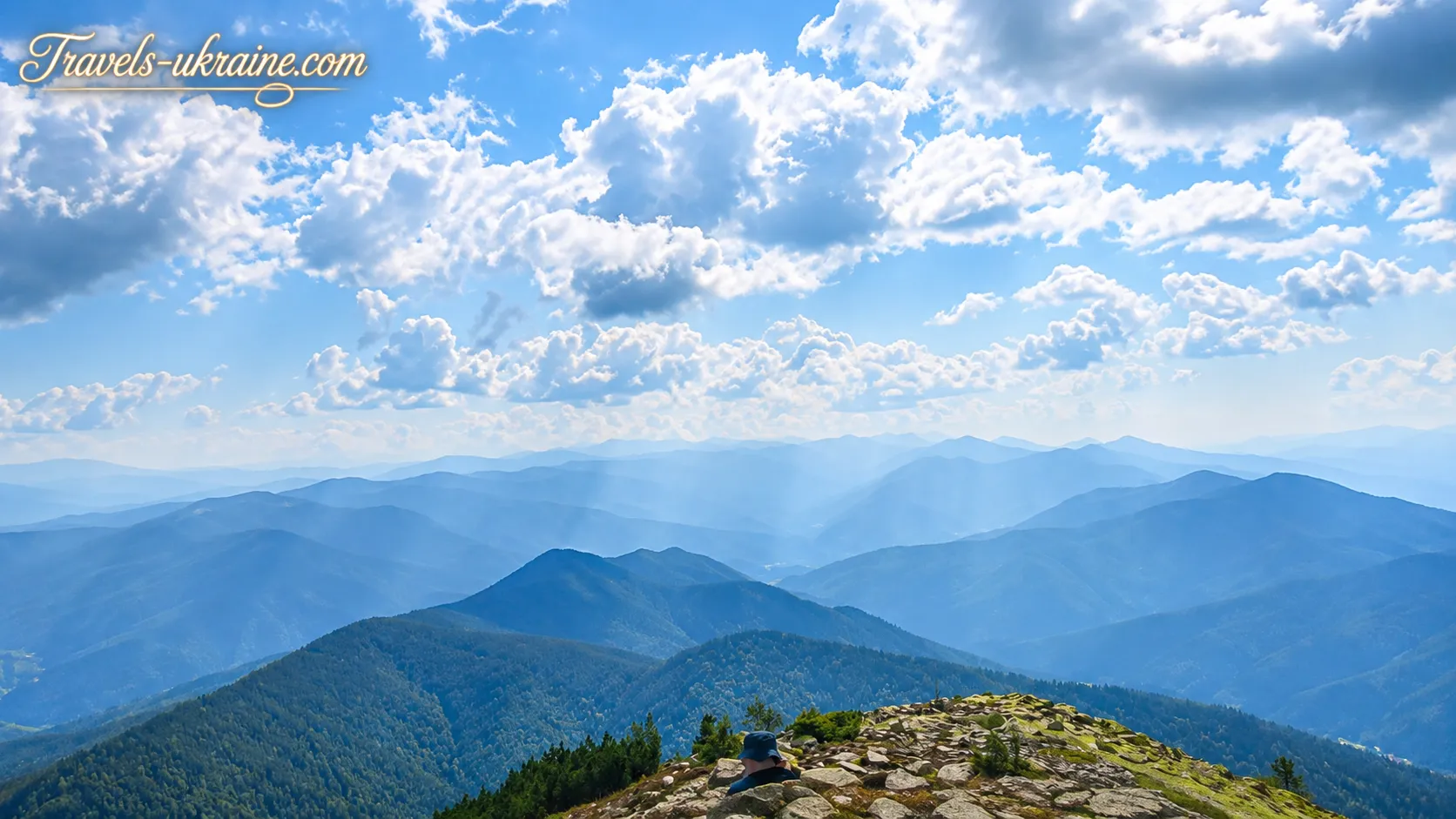
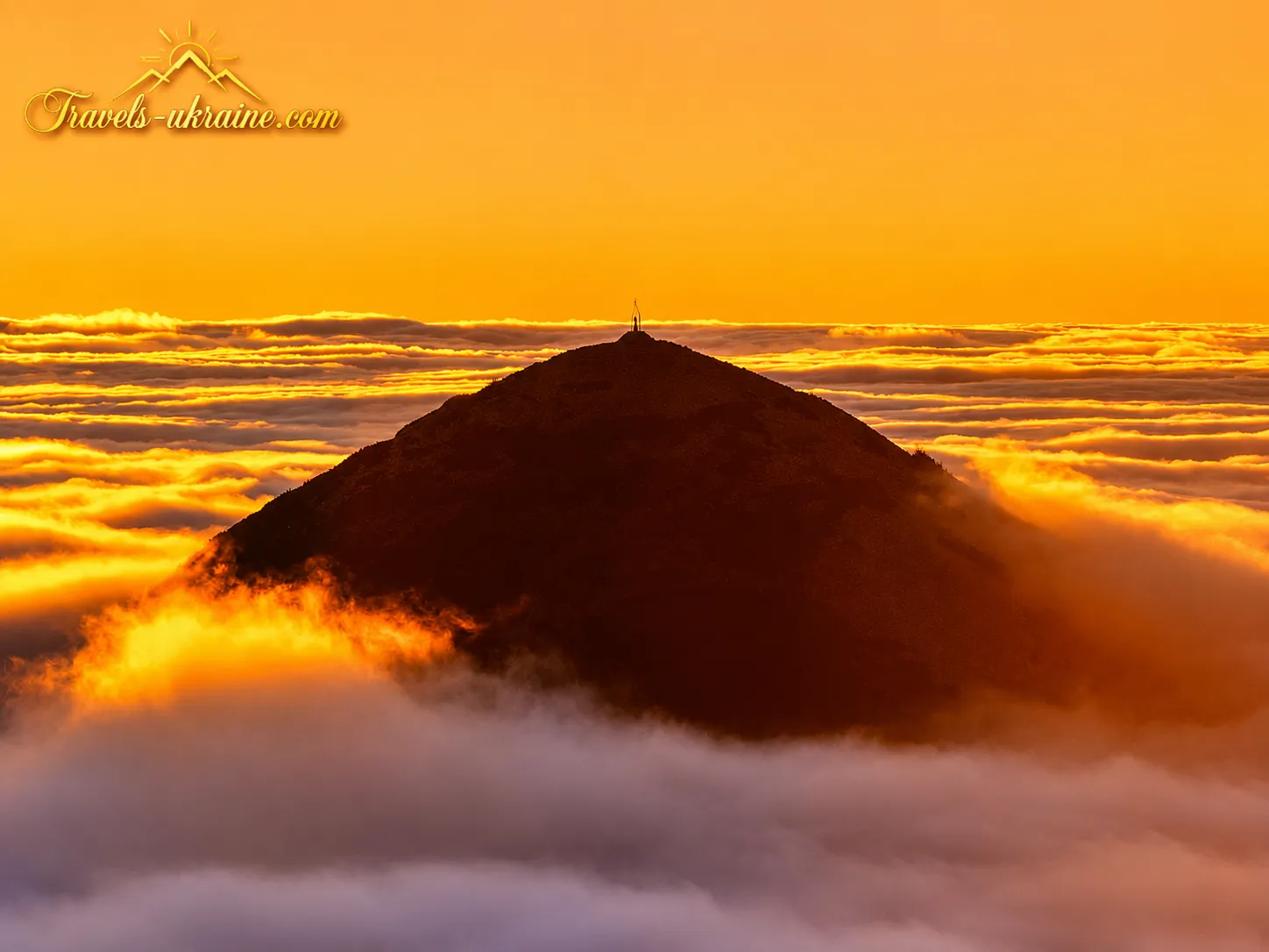
Mount Khomyak is precisely the kind of Carpathian peak where, for many people, a true love of the mountains begins. It does not try to impress with record-breaking altitude or an excessively difficult ascent. Its strength lies in the harmonious combination of coniferous forest, open mountain meadow, rocky slopes, and a broad panorama that gradually unfolds before the hiker.
The Carpathian peak rises to approximately 1542 meters above sea level in the southeastern part of the Gorgany mountain range, in Ivano-Frankivsk Oblast. This mountain is located near Tatariv, Polianytsia, and Bukovel, making it relatively easy to reach the trailhead. Its convenient location has made it one of the region’s most popular hiking mountains and an excellent destination for those planning an active holiday near Bukovel.
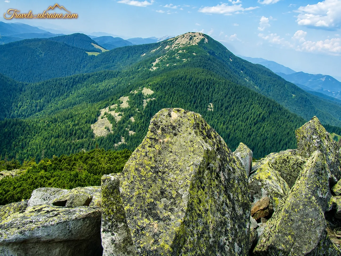
A hike up Mount Khomyak is fascinating because the scenery is constantly changing. At first, the trail passes beneath spruce canopies, where you can hear streams, the rustle of needles, and the muffled sounds of the forest. Higher up, the path emerges onto Khomiakiv Meadow, while the final part of the ascent runs between large grey boulders—the characteristic stone fields of the Gorgany. Here, the walk turns into a small mountain adventure, and every step reveals an increasingly expansive panorama.
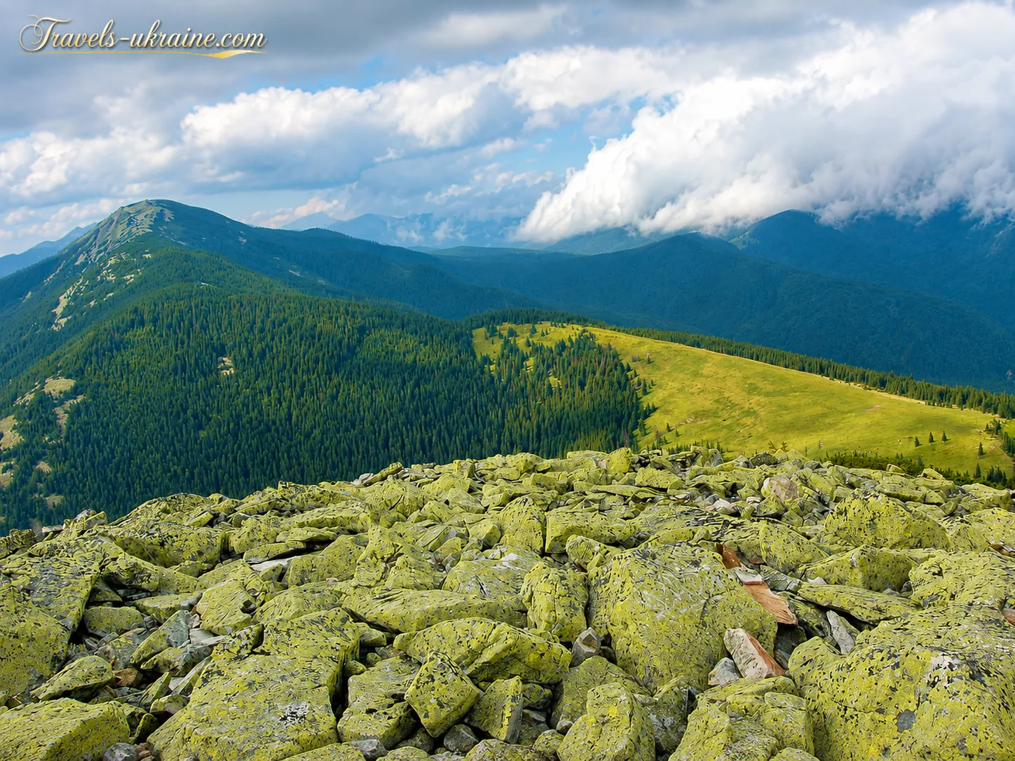
In clear weather, from the summit you can see neighbouring Mount Syniak, the Dovbushanka massif, the Yavirnyk ridge, and the distant outlines of Chornohora. The mountains seem to roll in waves all the way to the horizon, while familiar roads, villages, and tourist resorts become almost invisible. It is for this moment—when nothing remains around you but wind, stone, and the boundless Carpathians—that you want to return here again and again.
Why an ascent of Mount Khomyak belongs on your Carpathian itinerary
The route to Mount Khomyak is well suited to a day trip. Depending on the chosen starting point, the ascent can begin from Tatariv, Polianytsia, the road to Bukovel, or the Zhenets area. Some hikers combine the climb with a visit to Khomiakiv Meadow, while more experienced travellers continue along the hiking route towards Mount Syniak.
Despite its reputation as one of the most accessible Carpathian peaks, Khomyak should not be treated as an ordinary park walk. The elevation gain, slippery roots, changeable weather, and rocky section before the summit require suitable footwear, plenty of water, and care. With proper preparation, however, the ascent offers exactly the balance of exertion and exhilaration that draws people into the mountains.
Khomyak in the Carpathians is more than just a point on a hiking map. It is sunrise over the meadow, the scent of pine needles warmed by the sun, the coolness of mountain streams, and a summit where fatigue unexpectedly gives way to a feeling of freedom. One ascent is often enough to realise that this Carpathian adventure is truly one you will want to experience again.
Mount Khomyak: from the ancient trails of the Gorgany to a popular hiking peak
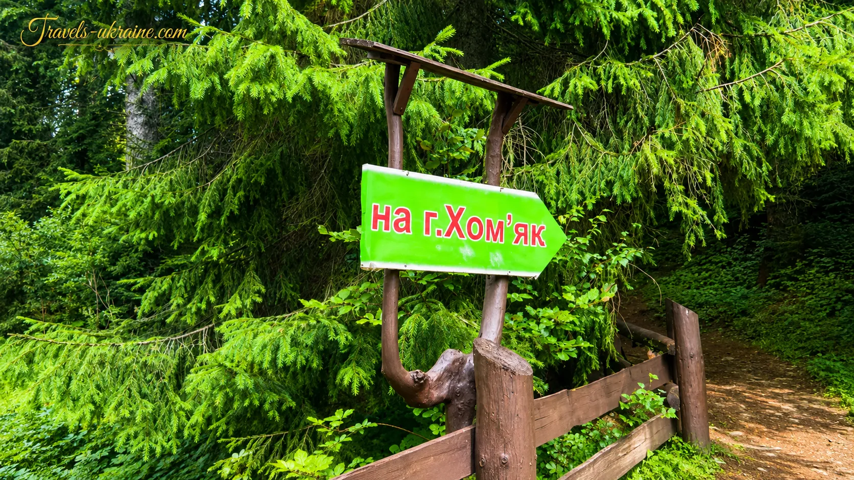
The history of Mount Khomyak is not associated with fortresses, ancient temples, or famous battles. Its past has survived in a different form—in forest passages, mountain-meadow roads, local place names, and trails used by residents of nearby settlements long before modern hiking markers appeared.
For centuries, life in this Carpathian region was closely connected with the forest, livestock grazing, haymaking, seasonal stays on mountain meadows, and travel between mountain areas. As a result, the first paths on the mountain slopes emerged not as recreational routes but as practical roads to pastures, springs, forest plots, and neighbouring valleys.
It is impossible to establish the exact date when people first climbed Mount Khomyak. Nor is there sufficient evidence to name a specific year when the first trail appeared. Most likely, some sections of today’s routes developed from old working paths used by local residents. Over time, hikers began choosing these trails, and later they became part of the Gorgany hiking network.
Mount Khomyak and Tatariv: the historical context of the Carpathian region
The nearest well-known tourist hub at the foot of the mountain is Tatariv. The settlement was first mentioned in writing in 1651. At different times, it was known as Prutets and Belzets, while the name Tatariv has been recorded since the 17th century. In 1946, the village was renamed Kremintsi, but after Ukraine regained independence, its historic name was restored.
Its location in the Prut Valley gradually made Tatariv an important stop on the way to the high-mountain areas of the Carpathians. As rail and road connections developed, not only local residents and traders but also holidaymakers began arriving, attracted by the clean air, coniferous forests, and opportunities for mountain walks.
Tatariv’s proximity to Khomyak significantly contributed to the peak’s popularity. Hikers did not need to organise a long expedition into a remote part of the mountains: the ascent could begin directly from the valley or from the road connecting the surrounding settlements. As a result, Mount Khomyak in the Carpathians gradually became a convenient destination for day hikes.
How tourism developed in the Gorgany and routes to Mount Khomyak
Organized mountain tourism in the Ukrainian Carpathians began to develop actively in the late 19th century. Tourist societies built shelters, installed signposts, described routes, and marked trails on maps. In 1880, one of the first organized tourist trails in the mountains was equipped and marked, while colored stripes began to be used to mark routes in the early 20th century.
The network of hiking trails developed particularly rapidly between the First and Second World Wars. During this period, trips through Chornohora and the Gorgany became increasingly popular, and hiking organisations maintained hundreds of kilometres of routes. Vorokhta, Yaremche, Tatariv, and other settlements in the Prut Valley became important starting points.
These historical processes do not mean that the modern tourist route to Khomiak Mountain already existed in its present form at that time. Its directions, junctions, and markings changed along with the development of roads, tourist infrastructure, and the growing popularity of nearby resorts. However, it was in the late 19th and first half of the 20th century that a culture of organized mountain travel took shape, gradually making the accessible peaks near the Prut Valley known to a wide range of tourists.
Khomiak Mountain in the Second Half of the 20th Century
In the second half of the 20th century, the Carpathians became one of the main regions for hiking tourism in Ukraine. Hikes were organized by tourist sections, sports clubs, educational institutions, and independent groups. The mountain peak was often included in routes together with Khomiakiv Polonyna, Syniak Mountain, and Malyi Gorgan.
For experienced hikers, the summit was part of longer crossings through the Gorgany, while for beginners it was a stand-alone goal for a day hike. This dual role remains today: Khomyak can be climbed by a relatively short route, yet more challenging hiking trails leading towards Syniak, Malyi Gorgan, and Dovbushanka also pass through it.
How Mount Khomyak became a popular peak near Bukovel
A new phase in Khomyak’s popularity began with the development of tourist infrastructure in Tatariv, Polianytsia, and Bukovel. Improved road connections and the emergence of guesthouses, hotels, tourist centres, and equipment rentals made the ascent more accessible to people who had never taken part in multi-day hikes.
Today, routes to the summit lead from Tatariv, Polianytsia, the road to Bukovel, and the Zhenets area. Khomyak can also be included in a longer trek via Mount Syniak. Officially described hiking routes vary in length and difficulty, making this popular Carpathian peak suitable both for a first serious ascent and for an intensive mountain adventure.
It was precisely this accessibility that kept Khomyak from remaining an obscure Gorgany peak. The mountain gradually became one of the best-known destinations for those planning a day hike in the Carpathians, a holiday near Bukovel, or an introduction to the rocky peaks of this mountain range.
Yet its modern popularity can easily obscure the most important point: the route to Khomyak and beyond passes through a landscape that shaped the lives of local communities for many generations. Forest roads, mountain meadows, shepherds’ huts, and crossings between valleys remind us that long before hiking signs appeared, the mountain was part of everyday Carpathian life—harsh, practical, and extraordinarily beautiful at the same time.
The natural features of Mount Khomyak: a rocky summit and Gorgany scenery
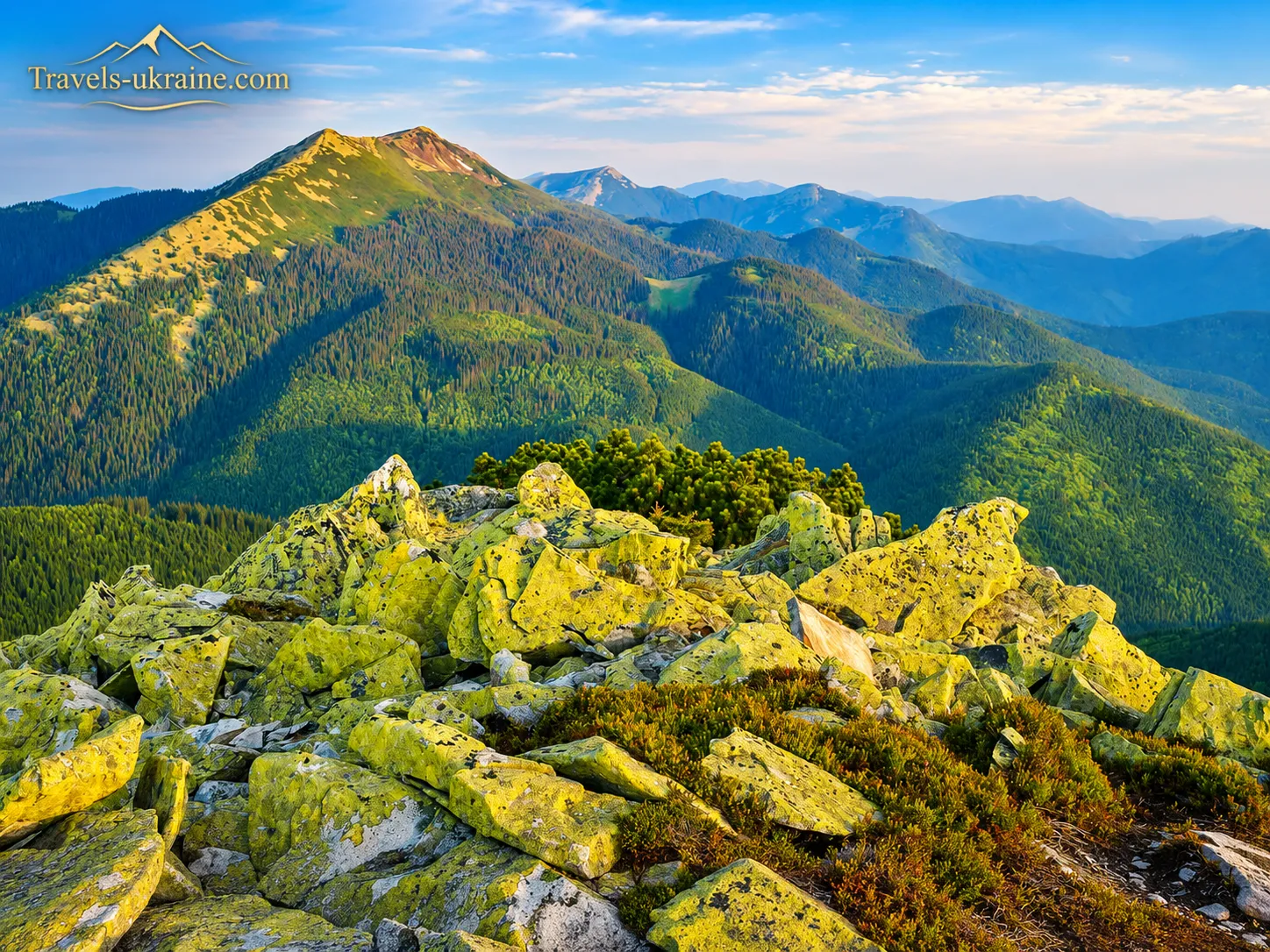
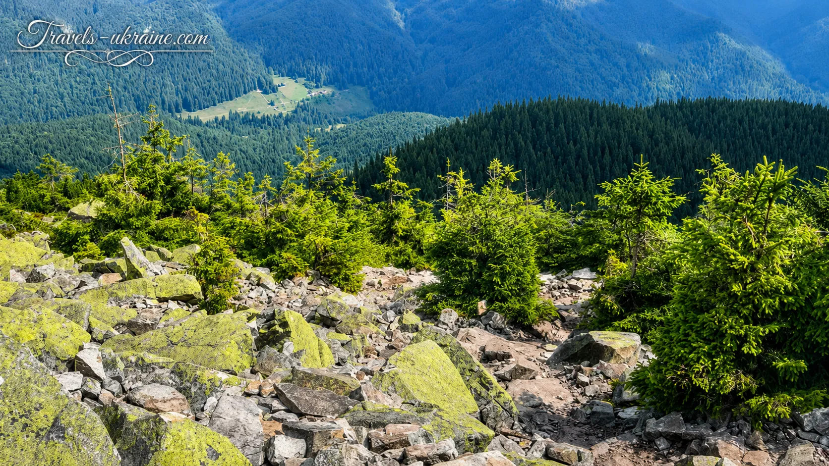
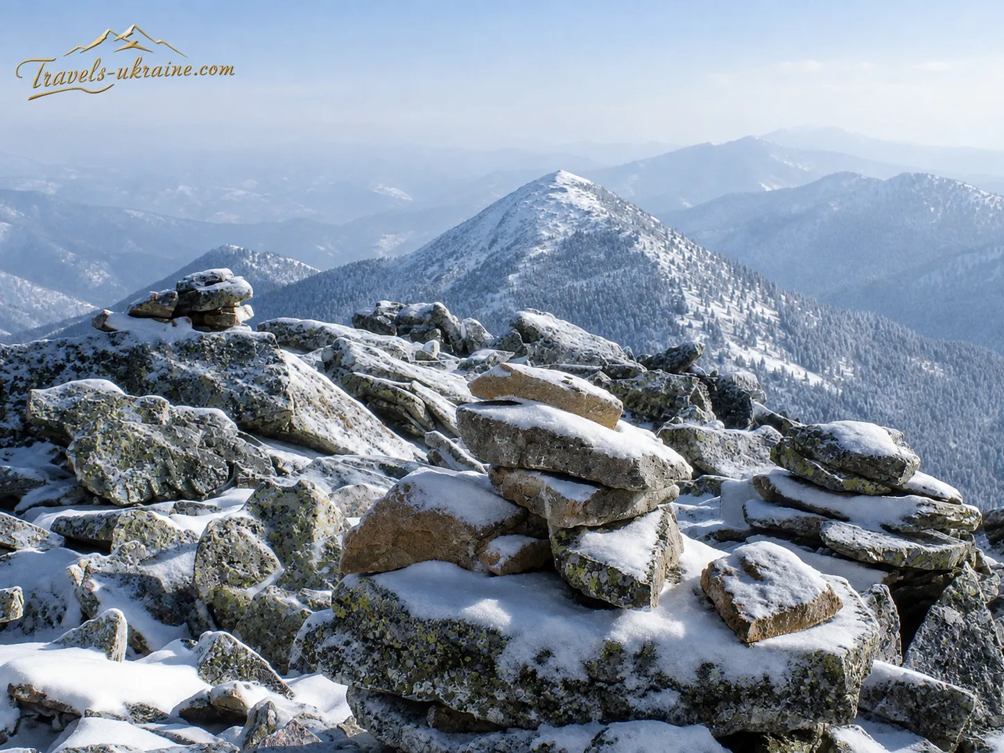
The mountain’s most distinctive natural feature is the rocky terrain near the summit. In the Gorgany, these formations are called gregon, tsekoty, or gorgany. The name of the entire mountain range comes from these rocky areas. They consist primarily of hard sandstone. Under the effects of frost, water, sharp temperature fluctuations, and prolonged weathering, the rock fractured into large boulders and slowly shifted down the slopes, forming the characteristic stone fields that can be seen today on Khomyak and other peaks in the range.
Unlike walking on a level trail, moving across the gregon requires care. The stones lie unevenly, deep gaps appear between the boulders, and some slabs may shift underfoot. Hiking footwear with a sturdy sole is far more important here than speed. Particular caution is needed after rain, during frosts, or when snow is present.
Why the stones on Khomyak should not be moved
Moss and lichen communities gradually develop on the surface of the boulders. They grow very slowly and are adapted to harsh conditions—wind, temperature fluctuations, prolonged snow cover, and a lack of soil. Moving stones, carving inscriptions, or building new stone structures can damage this fragile natural covering.
The stone fields are also part of the slopes’ natural drainage system. Water flows between the boulders, nourishes the lower forest areas, and feeds small mountain streams. The gregon should therefore be seen not as a disorderly pile of stones but as a complex natural system that has formed over a long period.
Forests, crooked woodland, and Khomiakiv Meadow
The lower and middle sections of Khomyak’s slopes are covered with mixed and coniferous forests. Spruce predominates along the route, while at lower elevations it may be joined by beech, fir, and other trees characteristic of the Carpathians. The forest provides shade, retains moisture, and protects the soil from rapid erosion.
After rain, the scent of pine needles, wet bark, and forest soil is especially noticeable here. At the same time, roots on the trail become slippery, and muddy patches form in waterlogged areas. That is why, even in warm weather, it is advisable to choose closed footwear with a pronounced tread for the hike.
Closer to the upper forest line, tall trees gradually give way to low-growing vegetation. Here you encounter mountain pine, known in the Carpathians as zherep. Its flexible branches withstand strong winds and the pressure of snow, while its dense roots help stabilise the slopes.
Making your way straight through the zherep is difficult and dangerous. The branches may conceal rocks, holes, and uneven ground, while trampling new passages damages the vegetation. Therefore, even when the summit seems very close, it is best to stay on the visible hiking trail.
To the northwest of the summit lies Khomiakiv Meadow, a large open area between mountain slopes. It has become one of the main landmarks on routes from Polianytsia, Tatariv, and the Zhenets area. The meadow creates a sharp contrast with the dark spruce forest: the space opens up, distant views appear, and Mount Khomyak itself rises above the rocky slope.
Panoramic Views from the Summit of Mount Khomyak
The summit of Mount Khomyak is a natural viewpoint in the Carpathians. In clear weather, it offers panoramic views of the surrounding ridges, mountain valleys, and settlements. Syinyak and the Dovbushanka massif are clearly visible to the northwest, the Yavirnyk Ridge lies to the north, and the outlines of Chornohora can be seen to the southeast.
The mountain with a panorama of the Chornohora range usually attracts the most attention. In clear enough conditions, Hoverla and Petros stand out on the horizon. In the valleys, you can make out Tatariv, Mykulychyn, Polianytsia, individual roads, and the buildings of the Bukovel resort complex.
The view depends heavily on the weather. After a cold front passes, the air often becomes clearer, making distant ridges more distinct. On hot days, haze may appear over the valleys, while rapidly forming clouds can envelop the summit in fog within minutes.
The panorama is best appreciated not while moving, but during a quiet stop. It is worth finding a safe place among the rocks, sheltering from the wind, and taking a closer look at the terrain. You can then see how forested valleys transition into ridges, how one summit obscures another, and how varied the Gorgany Mountains are.
How Mount Khomyak Changes Throughout the Seasons
Khomyak’s natural appearance is constantly changing. In spring, the lower slopes may already be green, while snow still remains in shaded areas and among rocky screes. Melting snow saturates the trails, and sharp temperature fluctuations create icy patches in the upper part of the route.
In summer, the mountain is covered in rich greenery, and the long daylight hours make it possible to complete longer routes. At the same time, Khomyak receives the most visitors during the warm season. Thunderstorms are possible after midday, so it is better to begin the ascent in the morning rather than postpone the start until the afternoon.
In autumn, Khomyak takes on contrasting colors. The lower deciduous forests turn golden and coppery, the spruce stands remain dark green, and the gray rocky fields emphasize the summit’s rugged character. However, the days grow short quickly, morning frosts make the rocks slippery, and the weather can change much faster than in the valley.
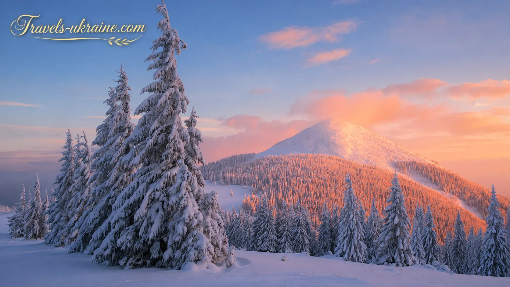
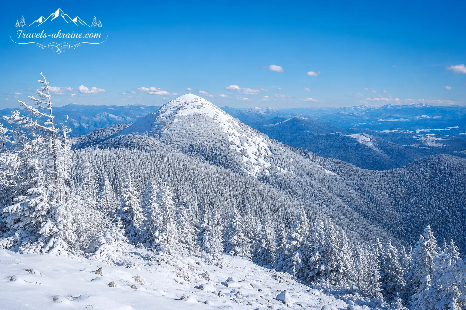
In winter, the summit becomes a challenging mountain environment. Snow conceals the trail, gaps between the rocks, and patches of dwarf pine. Dangerous snow accumulations may form on the slopes, so a winter ascent requires experience, appropriate equipment, checking avalanche conditions, and the ability to navigate in limited visibility.
Mount Khomyak: A Brief Guide to the Route and Hiking Difficulty
Khomyak is often described as an accessible summit for beginners, but this should not be taken literally. The forested section of the route mostly follows trails and dirt roads, but the final ascent leads over uneven boulders. After rain, in fog, or when snow is present, the route becomes noticeably more difficult. Therefore, for a first ascent, it is best to allow for a full day of daylight. An early start leaves extra time for unexpected weather changes, a slower pace, or returning by the same route. Starting the ascent after lunch is risky, especially in autumn, when darkness falls earlier, or in summer, when storm clouds may form over the mountains in the afternoon.
Key Features of an Ascent of Mount Khomyak
- Type of location: mountain summit, natural viewpoint, hiking route.
- Mountain range: Gorgany Mountains, Ukrainian Carpathians.
- Trip format: a one-day hike without an overnight stay in the mountains.
- Approximate distance: about 10–14 kilometers on popular loop routes.
- Elevation gain: approximately 700–880 meters, depending on the starting point.
- Hiking duration: an average of 5–8 hours, including stops and rest at the summit.
- Difficulty level: moderate in warm, dry weather; more challenging in winter, after precipitation, and in poor visibility.
- Trail marking: marked trails and information signs are available on the main routes.
Who Is a Hike up Mount Khomyak Suitable For?
The hiking route to Khomyak can be recommended for physically active beginners, travelers with basic mountain-hiking experience, couples, and families with older children who are accustomed to extended walking. The route is also of interest to photographers, nature enthusiasts seeking panoramic views, and travelers staying in Tatariv, Yaremche, Mykulychyn, Polianytsia, or Bukovel.
For young children and people with significant joint, balance, or cardiovascular problems, the final rocky section may be too difficult. In that case, a walk to the Khomiakiv mountain meadow without reaching the summit is a practical alternative. Even this shorter route offers views of coniferous forest, open mountain spaces, and the surrounding ridges.
Estimated Budget for a One-Day Hike to Khomyak
An independent hike is one of the relatively affordable ways to enjoy the Carpathians. The main expenses include transportation to the trailhead, food, drinking water, travel insurance, and, if necessary, parking. If a traveler arrives from another region, the budget should also include accommodation in Tatariv, Polianytsia, Mykulychyn, Yaremche, or another nearby settlement.
Some routes pass through the territory of the Carpathian National Nature Park, where a fee may apply for visiting environmental education trails. Rates may change, so it is worth checking the latest information on the park’s official website immediately before the trip.
When Is the Best Time to Plan an Ascent of Mount Khomyak?
The most convenient period for a first ascent is the warm season, when the route is not covered in snow and the length of daylight allows you to travel without rushing. Conditions should not be assessed by the calendar alone: in May, snowy sections may still remain on the upper slopes, while in late autumn the rocks are often covered with ice.
Winter Khomyak should not be considered an ordinary continuation of the summer route. Snow conceals gaps between the boulders, makes navigation more difficult, and creates hazards on steep slopes. Without winter experience, specialized equipment, and an assessment of weather conditions, it is better not to plan such an ascent.
In brief: an ascent of Mount Khomyak is a full-day hike of moderate difficulty. It is accessible to a prepared beginner in warm, dry weather, but requires an early start, comfortable footwear, sufficient water, and a responsible attitude toward the mountains.
Interesting Facts and Legends about Mount Khomyak in the Carpathians
Mount Khomyak is memorable not only for its views and rocky summit. A whole body of stories has developed around it concerning the origin of its name, ancient travelers, mysterious outlines, and spiritual symbolism. Some of these stories are supported by official tourism sources, while others belong to local legends or modern tourist folklore.
It is important to distinguish facts from legends, because the Carpathians have always inspired people to invent stories where few written records have survived. Fog, dense forests, lonely mountain meadows, and rocky screes create an atmosphere in which even an ordinary natural silhouette can easily become the image of a giant, an animal, or an enchanted traveler.
Why Was the Mountain Named Khomyak?
There is no definitive scientific explanation for the summit’s name. The most widespread theory links it to the mountain’s shape. When viewed from the valley or from certain sections of the road between Tatariv and Polianytsia, the rounded profile of the summit may resemble the curved back of a small animal.
Another explanation connects the name with marmots, which supposedly once lived in this area. This version is cited by the Carpathian National Nature Park. However, publicly available sources contain insufficient documentary or zoological evidence that the name originated specifically because of a substantial marmot population on Khomyak’s slopes.
Therefore, the most accurate approach is to speak of several possible interpretations. The name may have originated from the summit’s outline, an old local name for an animal, a nickname, a surname, or a word whose original meaning was lost over time. For travelers, this uncertainty only adds character to the mountain: everyone can decide for themselves whether its silhouette really resembles a hamster.
The Statue of the Mother of God on Mount Khomyak
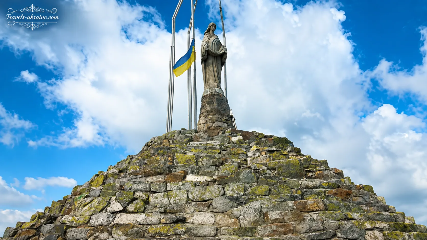
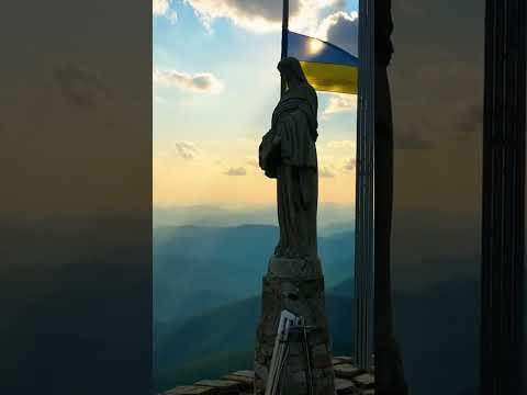
The main man-made feature on the mountain summit is the statue of the Mother of God, installed on a high stone pedestal. It has become one of Khomyak’s best-known symbols and a prominent landmark among the gray Gorgany boulders.
For some tourists, the sculpture is primarily a religious symbol; for others, it is a memorable feature of the summit and a place for a brief stop after the ascent. People often rest beside it, take photographs, quietly look out over the surrounding ridges, or remain there for a few minutes in silence.
The combination of the light-colored figure, rough stone pedestal, and open mountain landscape creates a striking image. However, visitors should remember that this is not a prop for dangerous photographs. Do not climb onto the structure, leave inscriptions on it, or damage objects that hold spiritual significance for others.
The Old Serpentine Road on the Mountain’s Slopes
One of the most interesting historical facts is the presence of remnants of an old serpentine road in the Carpathians. Its gentle turns are visible in places along the route and differ from the modern shortcuts that tourists often create by walking straight across the terrain. The official description by the Carpathian Nature Park connects this road with the Austrian period. A serpentine road in the mountains made it possible to gain elevation gradually while avoiding overly steep sections. Similar routes may have been used for traveling through the forest, хозяйственные needs, hunting, or crossing between local areas.
There is a theory that the Austro-Hungarian emperor himself hunted in the surrounding forests. However, the park presents this information as an assumption rather than an established historical fact. The story of imperial hunting should therefore be regarded as an interesting theory requiring additional archival evidence.
Khomyak Was a Tourist Summit Even Before Modern Bukovel
The mountain’s popularity did not begin with the development of the modern resort. According to the Carpathian National Nature Park, ascents of Khomyak were already becoming popular among Ukrainian and Polish tourists in the early 1930s.
This fact changes the usual perception of the summit. Modern travelers often think of it primarily as a mountain near Bukovel, although Khomyak’s tourism history began much earlier. Before large hotels, car parks, and digital maps appeared, groups of students, members of hiking societies, and mountain trekking enthusiasts were already coming here.
The old trails did not have the same informational infrastructure as they do today. Travelers relied on paper maps, route descriptions, compasses, and advice from local residents. Thus, even a relatively accessible ascent required greater self-reliance and the ability to navigate mountainous terrain.
The Legend of Yavir, Syiniak, and Khomyak
Modern tourist legends include a story about three young men—Yavir, Syiniak, and Khomyak. According to one version, they set out in search of the magical red ruta flower, which was supposed to bring happiness or help fulfill their deepest wish.
On the way, the young men encountered an evil sorcerer. He prevented them from completing their search and turned the travelers into mountains. Thus, according to the legend, Yavirnyk, Syiniak, and Khomyak came into being—summits that stand close to one another and form a recognizable part of the local mountain landscape.
This story should be understood as a figurative travel legend, not as a verified ancient Hutsul tale. No reliable ethnographic publications establishing its origin, date of appearance, or original text are available in open sources. The legend likely emerged as an attempt to weave the names of neighboring mountains into a single narrative.
What the red rue symbolizes in Carpathian legends
The image of the red rue has long been present in Ukrainian culture. In folk beliefs, it is a rare magical flower associated with love, happiness, and the fulfillment of wishes. In nature, rue does not turn bright red overnight, so the legendary image belongs specifically to the poetic tradition.
In the story of the three young men, the red rue symbolizes the goal for which a person is willing to set out into the unknown. The mountains, meanwhile, become a symbol of time standing still: the heroes never returned home but remained forever in the Carpathian landscape.
Are there opryshky treasures and mysterious places on Mount Khomyak?
As around many Carpathian peaks, stories can be heard around Khomyak about hidden treasures, opryshky, molfars, and mountain spirits. Such narratives are characteristic of the tourist folklore of the entire Carpathian region. They were passed down orally, changed from storyteller to storyteller, and were often transferred from one locality to another.
There is no convincing historical evidence that treasures are buried specifically on Khomyak. Unauthorized searches, digging up the soil, or moving stones are not only fruitless but also harmful to the natural environment. In addition, the area belongs to a protected zone where established rules must be observed.
The true treasures of the peak are not legendary coins but the panoramic views, old trails, Gorgan stone screes, and sense of space. These are precisely the things one can find without a shovel or metal detector and without damaging the natural landscape.
Legends add emotion to a hike, but Khomyak’s true appeal needs no invented wonders. The rocky summit, ancient serpentine road, statue among the boulders, and panorama of the surrounding ridges already create a story that every traveler experiences in their own way.
Events and festivals near Mount Khomyak
One of the most accessible Carpathian peaks remains primarily a natural tourist destination, so regular festivals or mass entertainment events are not held directly on the summit of Khomyak. There is no stage, fairground, or official holiday calendar here. For a traveler, the main event is the ascent itself: setting out from the valley in the morning, crossing the forest and mountain meadow, tackling the rocky slope, and encountering the panorama of the Gorgans.
At the same time, the peak’s location near Tatariv, Polianytsia, and Bukovel makes it possible to combine a hike to Mount Khomyak with local cultural celebrations, sporting competitions, fairs, and seasonal entertainment. This format is especially convenient for tourists visiting the Carpathians for several days who want to add variety to their active mountain holiday.
Events near Mount Khomyak offer a chance to experience the Carpathians from different perspectives. In the mountains, travelers encounter silence, stone screes, and open panoramas, while the valleys offer music, crafts, sporting competitions, and the living traditions of local communities. Together, they create a rich journey in which relaxation naturally combines with discovering the region’s culture.
«Tatariv Bonfire» — a traditional celebration near Mount Khomyak
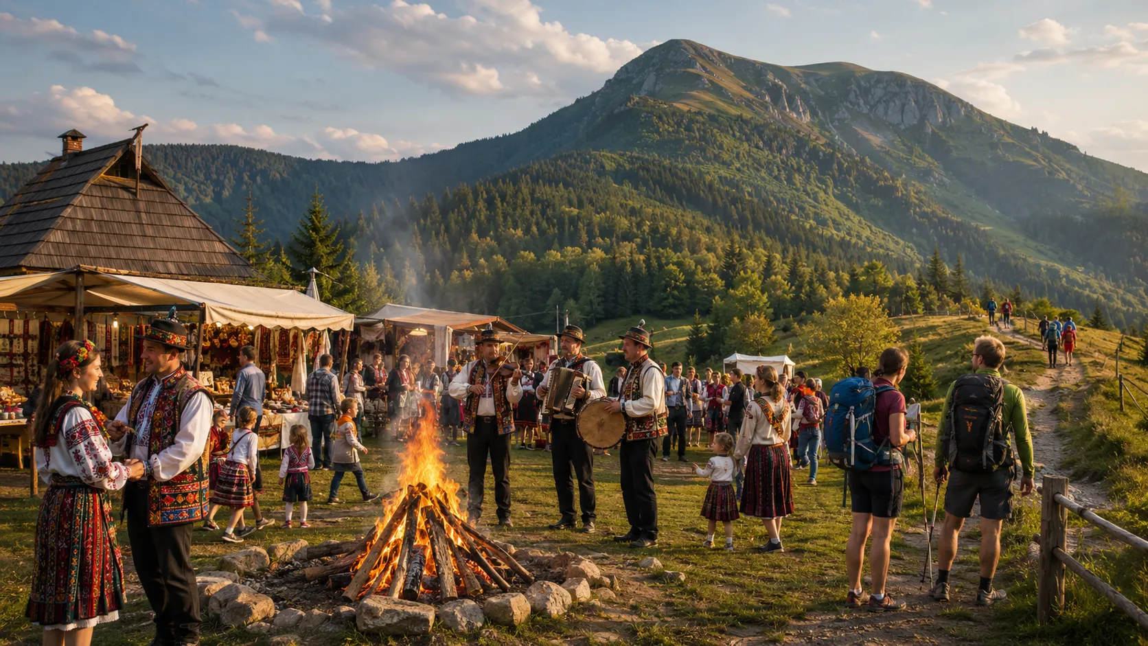
One of the best-known cultural events in the surrounding area is the «Tatariv Bonfire». The festival is associated with the old local tradition of lighting a fire on the eve of the Feast of Saint George the Dragon Slayer. In Carpathian culture, the bonfire has not only a practical but also a symbolic meaning: it represents warmth, community unity, the beginning of a new farming season, and protection from all that is evil.
The modern celebration combines folk music, performances by local groups, workshops, competitions, traditional dishes, and the communal lighting of a large bonfire. For tourists, it is an opportunity to see the Carpathians not merely as a beautiful mountain landscape but as a living cultural space with its own customs, music, and family traditions.
Tatariv is located near popular starting points for Khomyak, so the festival can be combined with a one-day hike. However, attempting a route and attending the evening program on the same day is advisable only with an early start and sufficient energy reserves. After several hours of climbing, it is better to allow time for rest, changing clothes, and a proper meal.
The date and program of the «Tatariv Bonfire» may change. Before traveling, be sure to check announcements from the Vorokhta settlement council, the local cultural center, or the community’s official tourism pages.
Sporting events and active recreation near Bukovel
Mount Khomyak near Bukovel is especially appealing to travelers who want to combine a hiking route with a packed sports program. At the resort, running, cycling, functional fitness, and other outdoor events are held in different seasons.
The format and scale of events change every year. The calendar may include mountain runs, obstacle courses, team challenges, sports festivals, open training sessions, and amateur races. Some events are intended for experienced athletes, while others offer separate distances or activities for beginners and families.
When planning active recreation near Bukovel, it is important to assess the exertion properly. Taking part in a race or sporting challenge before the ascent can lead to exhaustion. Likewise, you should not head for the summit immediately after a strenuous event if your muscles have not had time to recover.
Fairs and seasonal entertainment in Bukovel
After a hike, tourists can visit Bukovel’s fairgrounds, where souvenirs, handicrafts, Carpathian treats, and local products are sold. The selection and opening hours depend on the season, the number of visitors, and the resort’s program.
The fair allows visitors to complement their mountain journey with an introduction to the region’s crafts. Here, you can see wooden goods, textiles with traditional patterns, ceramics, jewelry, and other items inspired by Hutsul culture. When choosing a souvenir, it is worth giving preference to products made by local artisans rather than generic factory goods with no connection to the Carpathians.
Tourist centers are especially crowded on holidays and weekends. If the main purpose of the trip is climbing the Carpathian peak of Khomyak, it is better to leave the entertainment for the evening after returning or for the following day. This way, you will not have to rush along the route to make it to the start of a concert or fair program.
Hutsul celebrations and cultural events in surrounding communities
Tatariv, Vorokhta, Mykulychyn, Yaremche, and neighboring Carpathian villages occasionally hold community days, charity fairs, craft exhibitions, concerts, sports tournaments, and themed gatherings. Such events help visitors better understand the region’s contemporary life, which extends beyond tourist guesthouses and popular natural attractions.
During cultural events, you can hear the trembita, listen to Hutsul melodies, see traditional clothing, sample local cuisine, and talk with artisans. However, not all celebrations have a fixed annual date. Some programs are announced only a few weeks in advance, while individual events may be postponed because of weather conditions or the security situation.
Therefore, when planning a trip, it is worth checking current announcements from organizers rather than random old posters. A publication from the previous year may remain in search results even though the date listed in it no longer matches the new calendar.
Organized hikes and tourist gatherings on Khomyak
Tourist clubs, guides, and local organizers may arrange group hikes to the summit of Khomyak. Most often, these are one-day ascents for beginners, morning departures, photo hikes, or combined routes through Khomyakiv mountain meadows and neighboring peaks.
The advantage of an organized hike lies not only in having an escort. Participants receive advance information about the necessary equipment, approximate pace, route length, and rules of conduct in the mountains. This is especially useful for people visiting the Gorgans for the first time or lacking experience walking across stone screes.
At the same time, the term «mass ascent» should not mean an uncontrolled crowd. Large numbers of people place additional pressure on the trails, mountain meadows, and vegetation near the summit. Responsible organizers lead groups along marked paths, leave no litter, and do not hold loud entertainment events in the protected zone.
What to see on Mount Khomyak and what to do during the hike

The hiking route to Mount Khomyak is about more than reaching the 1542-meter elevation above sea level. Over the course of a single day, tourists pass through several different natural zones and see old forest roads, open mountain meadows, stone screes, and panoramas of the Gorgans. That is why the journey should not be turned into a race to the summit: the most memorable experiences often await not at the final point but along the way.
The main tourist routes begin from the Tatariv side, the Veredivskyi tract, Polianytsia, and the Zhenets River valley. They differ in length, elevation gain, and route structure, but most share Khomyak’s characteristic locations: coniferous forest, a mountain meadow, dwarf pine thickets, a rocky ascent, and natural viewpoints.
Route to Mount Khomyak from Tatariv
Mount Khomyak from Tatariv is one of the most popular options for a one-day hike. The village has rail and road connections, as well as guesthouses, hotels, dining establishments, and shops, making Tatariv a convenient base for the trip.
Depending on the trail selected, the route may begin not in the village center but closer to the Veredivskyi tract or the Tatariv–Polianytsia road. The exact starting point should be determined in advance, since tourists often use the name «route from Tatariv» for several different directions.
The first sections run along forest roads and trails. The ascent is fairly long in places, but the shade of the trees makes walking easier on a hot day. Along the way, you can see mixed and coniferous forest, small streams, moss-covered rocks, and sections of an old serpentine road.
The official environmental education trail from the Veredivskyi tract leads through the forest to the open Barania mountain meadow, where a route sign has been installed. From there, the tourist trail continues toward Mount Khomyak. After gentler forest sections, a steeper ascent begins, and the earthen trail gradually becomes rocky.
This option is well suited to travelers staying in Tatariv or arriving by public transport. However, before setting out, check the current trail markers and download a map for offline use.
Route to Khomyak from Polianytsia and Bukovel
Mount Khomyak from Polianytsia is a convenient option for tourists staying in Bukovel. The popular circular route begins in the Polianytsia area, leads through forested slopes and a mountain meadow to the summit, and then returns to the valley.
The route described by the resort has a moderate difficulty level, a significant elevation gain, and takes up most of the day. It is intended for people in normal physical condition who can walk uphill for several hours and then safely descend along uneven terrain.
The route to Khomyak from Bukovel is often chosen for its convenient logistics. In Polianytsia, it is easy to find a transfer, buy supplies, rent some equipment, or arrange a guide. However, the resort’s proximity does not turn the mountain into a park stroll: beyond the built-up area, an ordinary Carpathian route begins, with mud, roots, boulders, and changeable weather.
During the high season, this route can be crowded. To see the forest and mountain meadow without large tourist flows, it is best to set out early in the morning and avoid the most popular hours on weekends.
Climbing Khomyak via Khomiakiv Mountain Meadow
The Khomyak–Khomiakiv Mountain Meadow route is considered one of the most scenic options. After a long stretch among the trees, the trail emerges into open space, offering a clear view of the upper part of the mountain. The contrast between the dark spruce forest, green meadow, and gray rock fields creates one of the most striking landscapes of the entire hike.
The meadow is a good place to take a break, have a snack, and check the weather before the final ascent. If dense clouds have already covered the summit, a storm is approaching, or the group has fallen significantly behind schedule, this is the right place to calmly assess whether to continue.
During the warm season, livestock may graze on the mountain meadows, where traditional farming is practiced. Tourists should not enter farm buildings without permission, frighten animals, or leave gates open. Dogs near flocks may be guarding the area, so pass them calmly, do not run, and avoid sudden movements.
What to do at Khomiakiv Mountain Meadow
The meadow is well suited to a short rest and observing the surrounding slopes. You can take panoramic photos, study the route of the upcoming ascent, listen to the sounds of mountain farming, or simply relax after the forest section of the trail.
Do not light fires, leave food waste, or organize noisy entertainment. Open terrain may seem spacious, but traces of large numbers of visitors accumulate very quickly.
Photographing the Gorgany Panorama and Observing Nature
Khomyak is interesting for landscape photography throughout the entire route. In the forest, you can photograph moss-covered rocks, roots, streams, and rays of light between the spruces. On the meadow, the main subjects are the open space, the summit’s silhouette, and traditional farm buildings. From the summit, the most striking views open toward Syniak, Dovbushanka, Yavirnyk, and Chornohora. You do not need to stand on the edge of a boulder to take photographs. A panoramic view can often be captured from a safer position by changing the camera height or shooting direction.
Drones are not permitted everywhere. The route passes through a protected area, so before flying, check the park administration’s rules, airspace restrictions, and safety requirements. The device must not disturb wild animals, livestock, or other tourists.
Birds and forest animals are easier to spot early in the morning, when the route is still quiet. Do not try to approach, feed, or chase them for the sake of a photograph. Seeing a wild animal from a safe distance is a far more valuable experience than making it run away from a person.
Plants are also best left where they grow. Some mountain species are rare or protected by law, while even ordinary flowers play an important role in the natural ecosystem.
A hike up Khomyak offers far more than a single panoramic photograph. It is an opportunity to pass through a Carpathian forest, experience the openness of a mountain meadow, see the rugged rocks of the Gorgany, and observe firsthand how the mountain landscape changes as you gain elevation. If you take your time and pay close attention to your surroundings, the route becomes a complete journey through nature rather than simply a physical ascent to a summit.
What to See Near Khomyak Mountain: Tourist Attractions
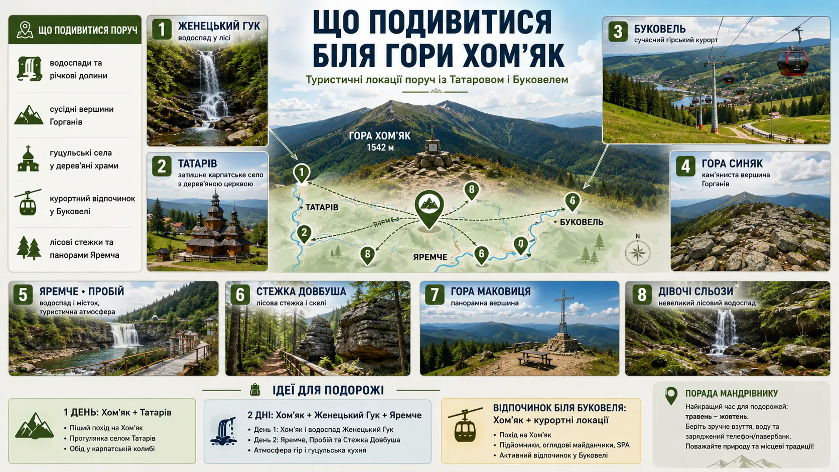
The scenic summit is located in one of the most tourism-rich areas of Ivano-Frankivsk Oblast. Nearby are waterfalls, mountain trails, Hutsul architectural landmarks, nature paths, and recreational sites. This makes it easy to turn the climb into a complete Carpathian journey lasting two or three days.
There is no need to try to visit all the interesting places immediately after the hike. Even the relatively accessible route to Khomyak requires several hours of walking and considerable physical effort. On the day of the ascent, it is better to choose one nearby location and leave Yaremche, Bukovel, or neighboring summits for the following day.
Huk Waterfall — a Waterfall Near Khomyak Mountain
Jenetskyi Huk is one of the nearest and best-known natural attractions. The waterfall is located in the Jenets tract between the Yavirnyk and Khomyak–Syniak ranges. The stream drops from a rocky ledge about 15 meters high, creating the characteristic roar from which the name «Huk» is derived.
An approximately 4.75-kilometer ecological educational trail leads to the waterfall one way. Much of the route follows the valley of the Jenets River, making the walk considerably easier than the ascent to the summit. Along the way, there are streams, a small cascade, wooden crossings, and places for short breaks.
A visit to Huk can be planned separately or added to a longer route after descending from Khomyak toward the Jenets tract. The second option is suitable only for tourists who have downloaded the track in advance, calculated the time required, and know where the route will end.
After heavy rainfall, the stream looks especially powerful, but the rocks and wooden walkways may be slippery. Approaching the water too closely, climbing over barriers, or standing on wet boulders for a photograph is dangerous.
Bukovel — Relaxing After Climbing Khomyak Mountain
Bukovel is located near Polianytsia and is a convenient place to relax after a hike. The resort operates not only in winter: during the warmer months, it offers walking areas, scenic chairlifts, cycling routes, bodies of water, pools, and a variety of activities for adults and children.
After the ascent, it is better to choose a relaxed form of recreation—a walk by the lake, dinner, restorative treatments, or an unhurried ride to a viewpoint. Strenuous sports activities should not be added on the same day: tired muscles and reduced concentration increase the risk of injury.
The operating hours of lifts, seasonal sites, and water areas change throughout the year. Before traveling, check the current information on the resort’s official website, especially during the off-season.
Syniak Mountain — Continuing the Route Through the Gorgany
Syniak Mountain is located next to Khomyak and is clearly visible from its summit. It is approximately 1665 meters high, and its upper slopes are covered with the rock fields characteristic of the Gorgany. Because of lichens and the unusual lighting, the boulders can appear bluish from a distance, which is associated with the mountain’s name.
The Khomyak–Syniak traverse is suitable for experienced hikers who are prepared for prolonged travel across uneven, rocky terrain. The route requires an early start, stable weather, an adequate supply of water, and a carefully planned endpoint. Beginners should not combine the two summits in one day. Syniak can be saved for a separate hike from the Polianytsia or Bukovel side. This makes the journey safer and leaves more time to enjoy the views.
Malyi Gorgan — a Rocky Summit for Prepared Hikers
Malyi Gorgan rises near Syniak. Its upper section is almost entirely covered with rock fields, and some slopes are steep and difficult to cross. Together with Syniak, the mountain forms a small ridge about six kilometers long.
Malyi Gorgan should not be considered an easy addition to a first hike up Khomyak. It is a separate goal for people who already have experience moving across rocky terrain, know how to navigate, and can properly assess the group’s pace. The best way to get to know this area is to gradually increase the difficulty of your routes. First climb Khomyak, then hike Syniak, and only after that plan longer traverses toward Malyi Gorgan.
Yaremche and Probiy Waterfall
Yaremche is convenient to visit the day after the ascent. The city’s best-known natural attraction is Probiy Waterfall on the Prut River. The water flows between massive blocks of Yamnian sandstone and drops from a height of approximately eight meters. Nearby are a pedestrian bridge, a souvenir market, and the famous Hutsulshchyna restaurant building. The wooden restaurant was built in 1965 to a design by Ivan Bondarchuk. The building is distinguished by its log construction, carved details, and traditional Hutsul architectural motifs.
The area around Probiy is usually among the busiest places in Yaremche. For a peaceful walk, it is better to come in the morning or on a weekday. After heavy rain, the Prut becomes especially turbulent, so descending to the slippery rocks along the shore is dangerous.
Dovbush Trail in Yaremche
Dovbush Trail runs through the protected Dribka tract, near the Yamna neighborhood. The route leads through forest, rocky outcrops, and formations of Yamnian sandstone. Its central point is a rock known as Dovbush’s Storeroom Stone. The site combines natural scenery with legends about Oleksa Dovbush and the Carpathian opryshky. Along the route, you can see stone formations, a relic pine, stairs, and viewpoints.
This route is suitable for a day when you want to remain active after the ascent without undertaking another long mountain hike. At the same time, the trail has rocky and slippery sections, so comfortable footwear is necessary even for a short walk.
Maiden’s Tears Waterfall and the Enclosure Facility
For a more peaceful break in Yaremche, you can choose a walk to Maiden’s Tears Waterfall. The small cascade formed on the Zhonka River and is about 1.7–1.8 meters high. There is a place to rest nearby, and the route passes through woodland. The walk can be combined with a visit to the enclosure facility of the Carpathian National Nature Park. This is a convenient option for families with children and tourists who are not ready for another substantial elevation gain after a mountain ascent.
Animals in the enclosures should not be fed food brought from outside. Even ordinary bread or sweets can harm their health. Follow the information signs and the park staff’s rules.
The surroundings of Khomyak offer a chance to see the Carpathians in many different forms: rugged rocky ridges, thundering waterfalls, wooden architecture, resort centers, and quiet forest trails. This combination makes the area around Tatariv, Polianytsia, and Yaremche a good destination not only for a single ascent but also for a complete tourist journey.
Frequently Asked Questions About Khomyak Mountain and the Ascent Route
Where is Khomyak Mountain located, and how high is it?
Khomyak Mountain is located in the Gorgany mountain range in Ivano-Frankivsk Oblast, near Tatariv, Polianytsia, and Bukovel. The summit is approximately 1542 meters above sea level. Thanks to its isolated position, it offers views of Syniak, Yavirnyk, the surrounding Gorgany, and, in clear weather, Hoverla and Petros.
Which route to Khomyak Mountain is best for a first ascent?
For a first hike, it is best to choose a popular marked trail from the Veredivskyi tract, Tatariv, or Polianytsia, returning to the planned starting point. The official «Veredivskyi Tract — Mount Khomiak» eco-trail has a moderate difficulty level and passes through mixed and coniferous forest, the Barania mountain meadow, krummholz, and a rocky section near the summit. Combining Khomiak with Syniak or Zhenetskyi Huk is better left for a future hike.
How long does it take to climb Mount Khomiak?
The duration depends on the starting point, fitness level, weather, and number of stops. The official route from Veredivskyi is approximately 5.6 kilometers one way, and the estimated ascent time is about three hours. For the full hike, including the return and time to rest in the mountain meadow and at the summit, it is best to allow 5–8 hours and keep some daylight in reserve.
Can you climb Mount Khomiak with children?
The hike is suitable for older children who are used to walking for long periods, can follow adults’ instructions, and move confidently along uneven trails. The most challenging section is the final stretch among large boulders. For younger children or a first family hike, the mountain meadow can serve as the endpoint without requiring an ascent to the summit.
Is a guide needed to climb Mount Khomiak?
In dry, warm weather, experienced hikers can follow the marked trail independently with an offline map, suitable equipment, and a clear return plan. A guide is useful for beginners, families with children, large groups, hikers without navigation experience, and winter hikes. A guide also helps assess the weather correctly and change the route in good time if necessary.
Is there an entrance fee for the Mount Khomiak trail?
Some routes to Khomiak pass through the territory of the Carpathian National Nature Park, where a fee is charged for visiting environmental education trails. Parking near the starting point may be charged separately. Rates change, so check the current cost on the park’s official website shortly before your trip.
Is there water along the Khomiak trail?
Streams and natural springs can be found in the forested sections, but their availability depends on the season and weather. During hot periods, small waterways may become shallow, and clear-looking water is not necessarily safe to drink. Bring your main supply of drinking water, and purify water from natural springs with a hiking filter or another reliable method if needed.
When is the best time to hike Mount Khomiak?
For a first ascent, the most convenient period is when there is no persistent snow cover—from late spring to early autumn in stable, dry weather. In May, snow may still remain among the rocks; summer can bring afternoon thunderstorms, while autumn may bring morning frost and ice. Start the trail in the morning after checking the forecast, wind speed, and sunset time again.
What should you take on a day hike to Mount Khomiak?
You will need hiking boots or shoes with a lugged sole, a rain jacket, a warm layer of clothing, enough water and food, a personal first-aid kit, a charged phone with an offline map, a power bank, and a headlamp. In sunny weather, also bring a hat, sunglasses, and sunscreen. City shoes with smooth soles are not suitable for the rocky summit.
What should you do if the weather worsens or the group gets lost?
During a thunderstorm, leave the summit and exposed areas, and keep away from sharp rocks, isolated tall trees, mountain streams, and metal structures. If the group loses the trail, stop, stay together, identify the last known location, and check the offline map. In the event of an injury, complete loss of orientation, or another danger, call 112 or 101 and provide the coordinates, group details, and a description of the situation. Before setting out, it is advisable to register the route with the mountain rescuers.
Environmental note: how to preserve Mount Khomiak and the Gorgany nature
Mount Khomiak welcomes thousands of hikers every year, and its popularity is gradually becoming one of the greatest challenges for its natural environment. An individual visitor may barely notice the impact of a single step, a picked flower, or a small wrapper. But when such actions are repeated hundreds of times, they alter trails, mountain meadows, springs, and rocky slopes.
The route passes through an area with vulnerable mountain ecosystems. Plant cover regenerates slowly here, lichens on the rocks grow for years, and a trampled slope can quickly turn into a washed-out rut under the force of rain. Responsible hiking therefore means not only taking your own rubbish with you, but also leaving the natural landscape without visible changes.
On switchbacks and long bends, there may be a temptation to cut straight across. This path seems shorter, but it destroys the grass cover and exposes the soil to water erosion. After heavy rain, water begins to flow along the newly trampled line, washing away soil, exposing roots, and widening the damaged area.
A few minutes saved by taking a shortcut are not worth years of damage to the slope. Staying on the marked trail helps concentrate visitor impact in a single corridor and preserve the surrounding vegetation.
Leave Khomiak’s rocky scree unchanged
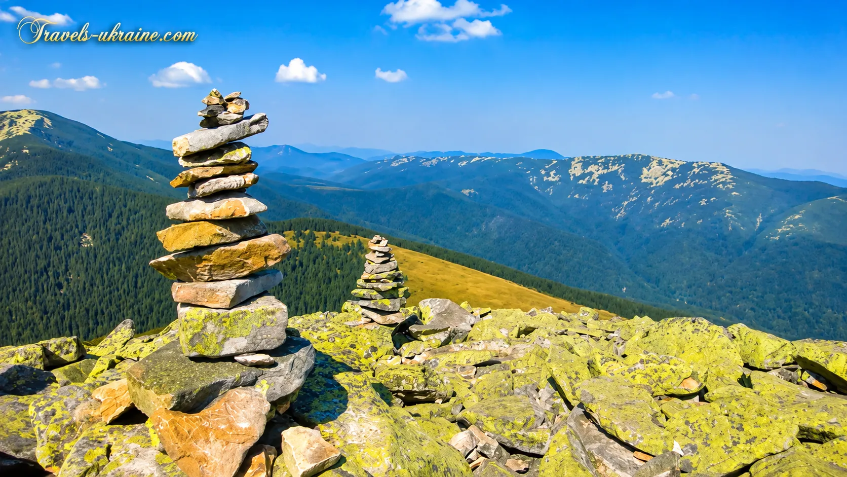
The summit scree may seem solid and almost lifeless, yet moss and lichen communities gradually develop on the surface of the boulders. They are adapted to strong winds, frost, and a lack of soil, but tolerate mechanical damage poorly. Do not move rocks, build new cairns, carve names, or push boulders down the slope. Such actions damage the natural cover, alter the appearance of the summit, and may endanger people moving below.
Do not pick mountain plants or break krummholz
Mountain-meadow flowers, mosses, berries, and mountain pine are part of a single natural system. Even a plant that seems ordinary may play an important role for insects, birds, and soil protection. Krummholz is especially vulnerable. Its dense branches stabilize slopes, retain snow, and provide shelter for animals. Creating new passages through the thickets breaks branches and gradually expands the damaged area.
The best souvenir from the Carpathians is a photograph—not a bouquet, a dug-up plant, or a branch of mountain pine.
Take everything you bring up the mountain back with you
There are no waste containers at the summit of Khomiak, in the mountain meadow, or along most of the route. All packaging, bottles, tissues, cigarette butts, and food scraps should be placed in a separate bag and carried to a settlement or an official waste collection point.
Organic waste should not be left in the mountains either. Fruit peels, bread, and leftover snacks can attract animals, change their behavior, and remain visible for a long time in the cool mountain environment.
An eco-friendly hike on Mount Khomiak does not require complicated actions. Simply stay on the trail, take your rubbish with you, avoid damaging natural features, and leave animals and plants undisturbed. The Carpathians should not become cleaner because a visitor arrived—they should remain just as clean as they were before. Then the next hiker will also see a green mountain meadow, living krummholz, clear streams, and a rocky summit free from traces of someone else’s carelessness.
Mount Khomiak — a Carpathian adventure you will want to experience again
Mount Khomiak captivates not with record-breaking elevation, but with a journey that gradually carries you away from everyday life. First, the trail leads through a cool spruce forest; then it emerges onto a broad mountain meadow, and before the summit, it requires careful progress over large boulders. When you finally reach the top, the fatigue does not disappear—it simply stops mattering.
At the summit, you feel like being silent. You watch the Carpathian ridges stretch to the horizon, dark forests descend into the valleys, and distant peaks touch the sky. In moments like these, everyday worries seem wonderfully small, leaving only the wind, the open space, and the quiet joy of having completed the journey.
A hike to Mount Khomiak gives you the special feeling of a victory honestly earned. No vehicle brings you to this view—you must gain it with your own steps, overcoming the ascent, wet roots, fatigue, and rocky slope. That is why the panorama from the summit stays with you more powerfully than any developed viewing platform.
After returning to the valley, the fatigue will gradually fade, but the scent of pine, the expanse of the mountain meadow, the cold wind, and the moment when the boundless Carpathians opened up before your eyes will remain in your memory. And very soon, instead of thinking about the strenuous ascent, another thought will arise: when can I walk this trail again? Khomyak is a mountain you climb on foot but return from with your heart. The adventure ends on the map, but lives on in your memories for a long time—and one day, it will surely call you back to the Carpathians.

No Comment
You can post first response comment.