
 English
 Українська
 Русский

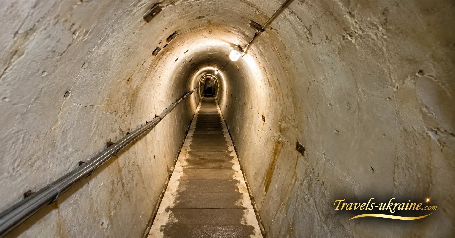
At first glance, Verkhnia Hrabivnytsia in Zakarpattia is an ordinary Carpathian village nestled among forest-covered mountains. Yet inside one of the slopes lies an entirely different world: concrete corridors, underground chambers, and military passageways built during World War II. Today, visitors can enter this underground complex and see part of the defensive system known as the Árpád Line with their own eyes.
This system was constructed by the Hungarian military in the Carpathians before and during World War II to block strategic roads, valleys, and mountain passes. Importantly, the Árpád Line was not a continuous concrete wall. Its strength lay in a network of separate fortified positions that used the Carpathian Mountains themselves as part of the defenses — steep slopes, narrow valleys, and terrain difficult for military vehicles to navigate.
One of the largest early fortification complexes along this Carpathian defensive route has survived in Verkhnia Hrabivnytsia. Behind an inconspicuous entrance lies an underground complex designed to accommodate military personnel, store supplies, maintain communications, and support the defense of a strategically important route through the Latorytsia River valley. The opportunity to literally step inside a former military defensive installation makes this bunker a very different tourist attraction from a conventional World War II museum.
However, many questions still surround the Árpád Line bunker. Why are some of its underground passages inaccessible today? How extensive was the system originally? Are there sealed-off chambers for which no documentation survives? And where did the stories of hidden military treasures buried deep beneath the Carpathian Mountains come from?
To understand where legends end and documented history begins, it is worth first exploring why the Árpád Line was constructed, how this unusual defensive system operated, and what role the underground complex in Verkhnia Hrabivnytsia played within it.
The Árpád Line: Why Hungary Built Defenses in the Carpathian Mountains
The Árpád Line was not conceived as a single gigantic fortress or a continuous concrete wall stretching across the Carpathian Mountains. Instead, it was designed as a system of defensive strongpoints that would take advantage of the region's greatest natural asset — the mountains themselves. Following the territorial changes of the late 1930s, the Hungarian military command faced the challenge of defending a substantial section of the border in the Eastern and Northeastern Carpathians, where the main routes available to large military formations passed through narrow valleys, mountain passes, roads, and railway lines.
Preparations for the Carpathian fortifications began as early as 1939, although the concept of the Árpád Line in its characteristic form emerged around 1940. In the mountain pass areas, engineers restored old positions dating from World War I, constructed concrete fortifications, and prepared defensive strongpoints in the valleys. Initially, this was intended as a long-term military construction program. However, in 1944, as the front rapidly approached the Carpathians, construction had to be accelerated dramatically.
The Carpathian Mountains as Part of the Defensive System
The basic concept was highly practical: rather than attempting to block hundreds of kilometers of mountainous terrain with continuous fortifications, military engineers concentrated their defenses at natural bottlenecks through which enemy forces would have to advance. Tanks, artillery, trucks, and large military units could not move freely across steep, forested slopes. Consequently, the main avenues of attack remained river valleys, mountain passes, roads, and railway lines.
These locations were protected by so-called valley defense strongpoints. Engineers constructed concrete and timber-and-earth shelters, trenches, anti-tank obstacles, minefields, and roadblocks. Some structures were buried underground and carefully camouflaged to make them harder to detect from the air or destroy with direct artillery fire. In this way, the mountain was not merely a location for building a fortress — the mountain itself became part of the fortress. Steep slopes restricted maneuverability, narrow valleys directed advancing troops toward prepared defensive positions, and defenders could concentrate their forces precisely where they were most needed.
Why the Árpád Line Was Not a "Hungarian Maginot Line"
The Árpád Line is often compared to France's Maginot Line, but modern military-historical research considers this comparison inaccurate. The French system relied on large permanent fortresses equipped with powerful weapons and extensive underground complexes. In the Carpathians, Hungarian engineers ultimately adopted a different approach.
Researcher István Rácz describes the fortifications of the Árpád Line as small, deeply embedded, widely dispersed, and carefully camouflaged structures. Many of the concrete installations were intended not for direct combat but for protecting personnel, command posts, supplies, and technical facilities. Firing positions were often established separately in the surrounding terrain, making them more difficult to detect and allowing defenders to adapt their positions after shelling.
This also means that the familiar image of hundreds of concrete embrasures forming an uninterrupted defensive wall does not reflect reality. The Árpád Line consisted of separate fortified areas positioned according to the terrain and transportation routes, while vast stretches of mountains between them could have no permanent fortifications at all.
Three Defensive Lines in the Carpathians
By 1944, the defense of the Carpathians effectively consisted of several successive defensive lines. In the foothills, the Hunyadi Position was established to delay the initial enemy advance. Closer to the main Carpathian ridge, the Saint Ladislaus Position was partially developed, while farther behind it lay the principal permanent defensive line — the Árpád Line.
Intermediate obstacles and field fortifications were also constructed between individual positions. The purpose of this system was not simply to stop the enemy physically. Each successive defensive line was intended to force advancing troops to redeploy their formations, bring forward artillery, clear mines from roads, and spend additional time overcoming new obstacles.
In practice, this was a form of defense in depth: if a forward position had to be abandoned, troops could withdraw to the next prepared defensive line without immediately losing the entire defensive system.
What Happened to the Árpád Line in 1944?
By August 1944, Soviet forces had approached the Carpathians, and the fortifications faced their first major test in actual combat. In some sectors, the mountain defenses significantly slowed the Soviet advance: attacking through narrow valleys required considerable time, manpower, and continuous engineering support. However, the decisive developments did not take place solely in front of the bunkers. On August 23, 1944, Romania broke with the Axis powers, and its territory soon became a route for the advance of Soviet forces. This created a far more serious problem for the Carpathian defenses: fortified areas designed primarily to resist an attack from the east through mountain passes were now threatened with being outflanked from the south.
Therefore, the popular claim that the Árpád Line was "absolutely impregnable" and could never be breached oversimplifies the historical reality. In some sectors, defenses were overcome after difficult and prolonged fighting. Elsewhere, Hungarian and German units abandoned their positions because of changes in the overall military situation and the danger of encirclement. Modern military studies describe the overcoming of the Carpathian defensive system as the result of extended offensive operations rather than a single rapid assault.
A large underground complex already existed at Verkhnia Hrabivnytsia along this same Carpathian defensive route, which later became associated with the Árpád Line. To understand its significance, simply examining the concrete corridors is not enough: it is important to understand how they were connected to the defense of the valley, the surface positions, and the broader defensive strategy of the Árpád Line. And this raises a particularly intriguing question — what was actually hidden inside the Carpathian mountain?
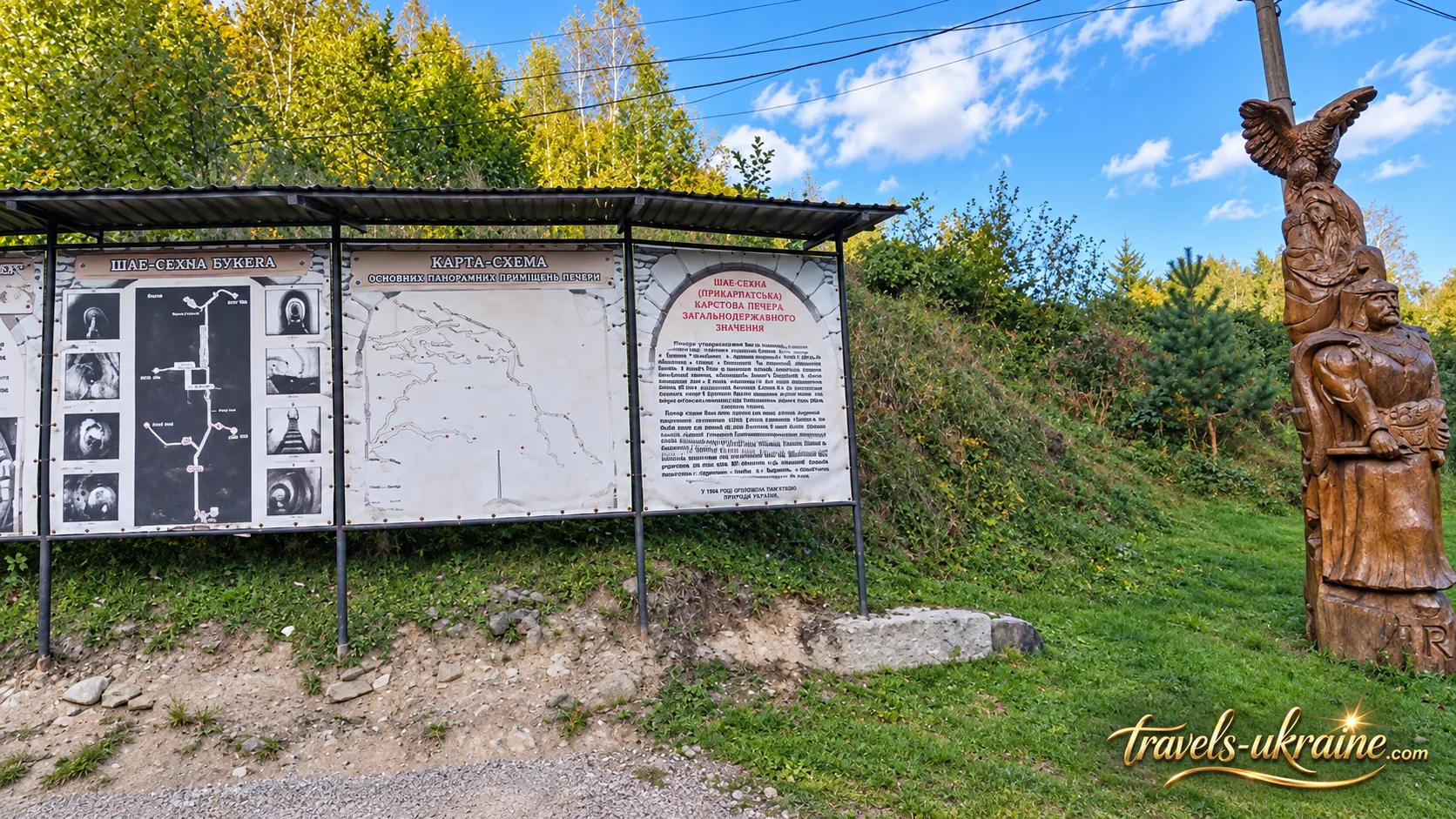
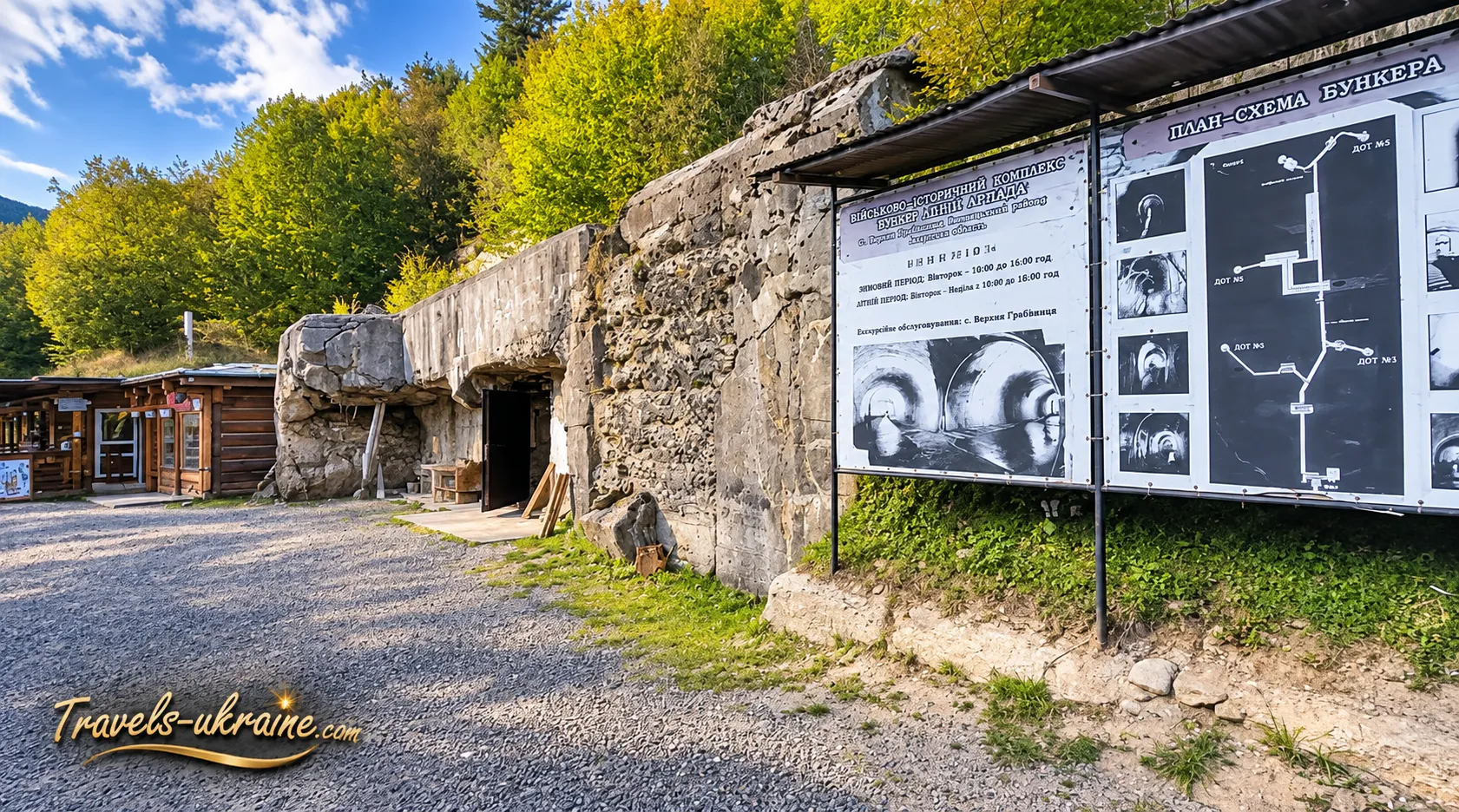
The Bunker in Verkhnia Hrabivnytsia: Inside the Underground Fortress
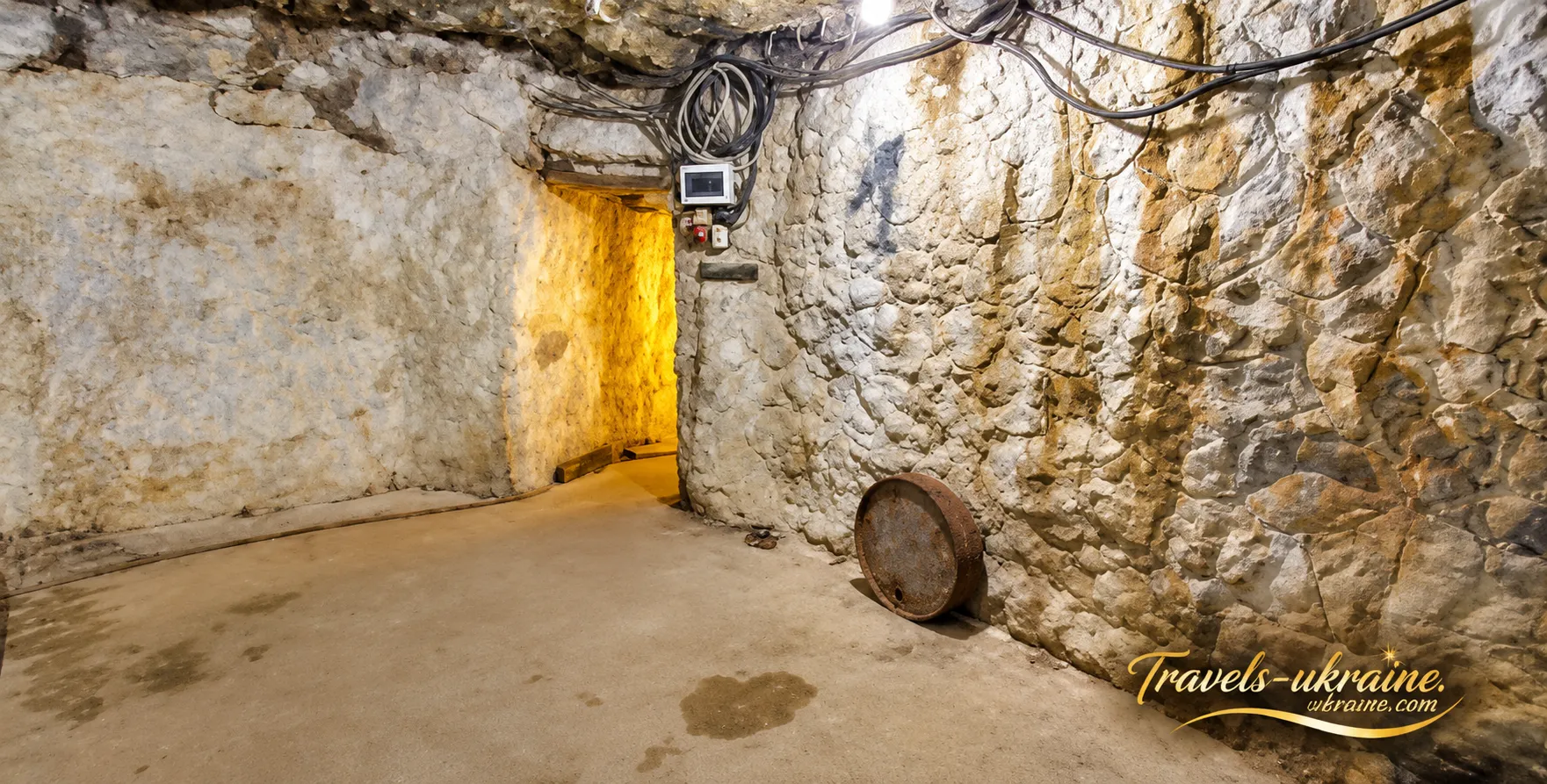
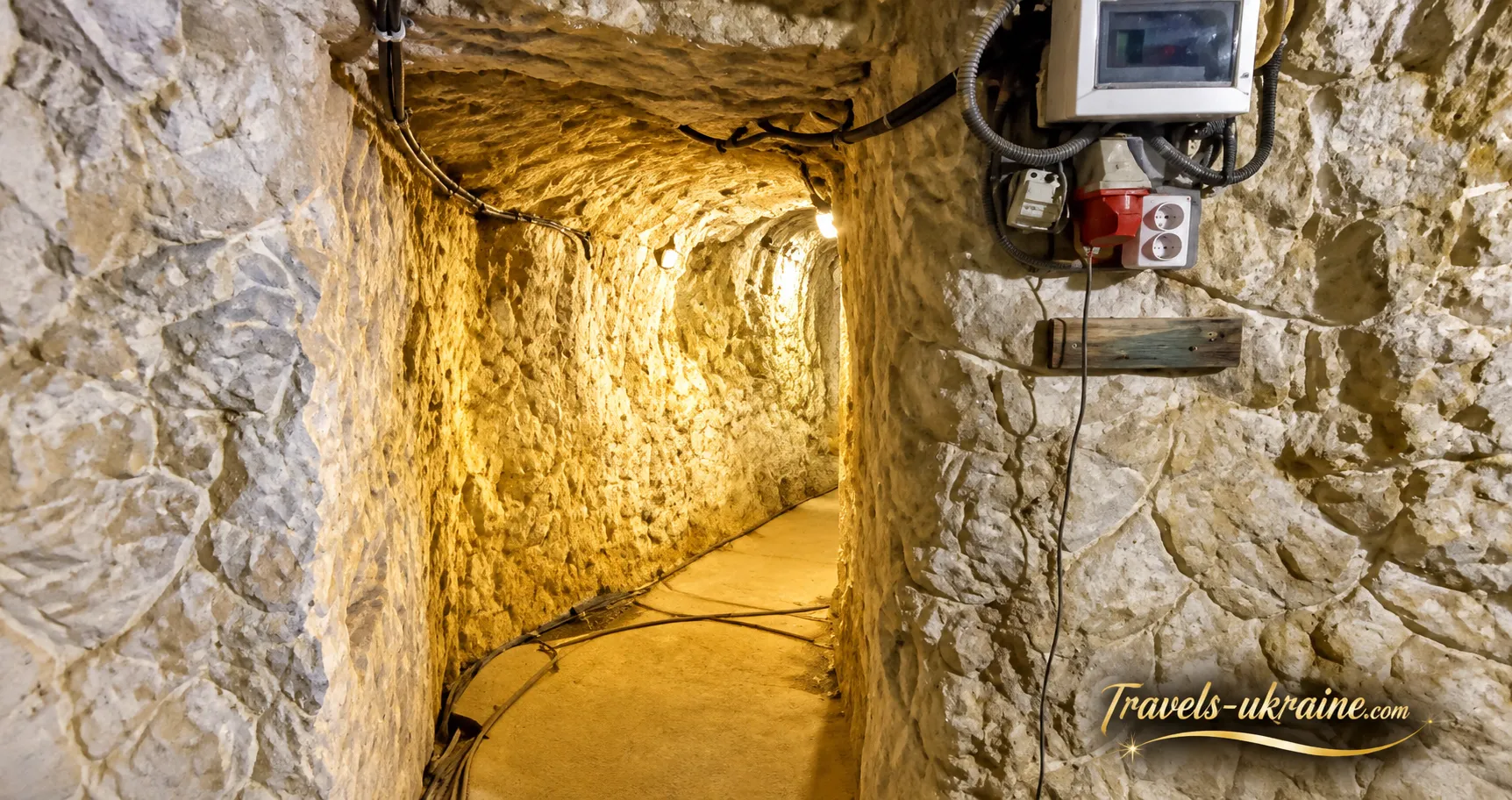
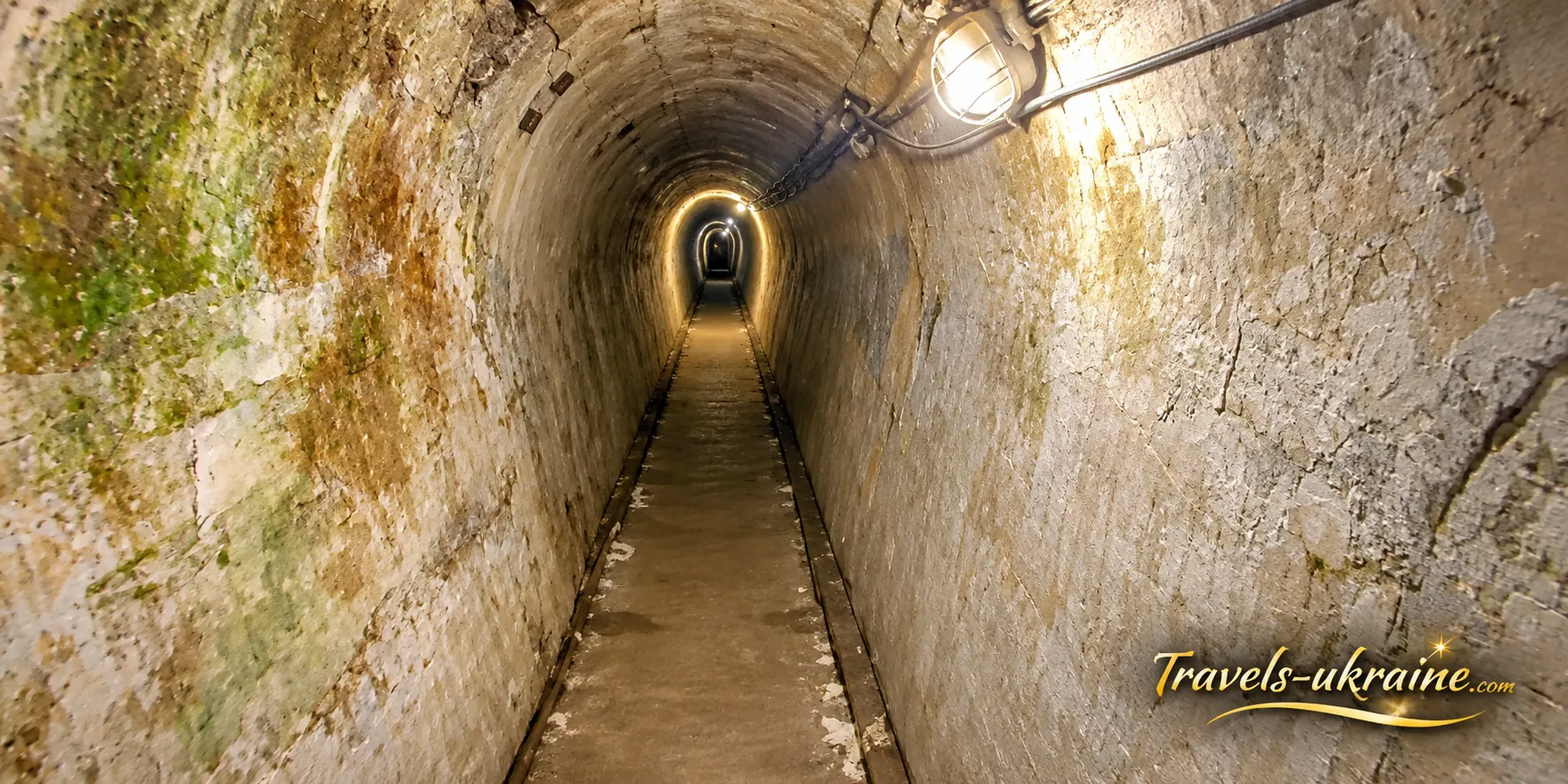
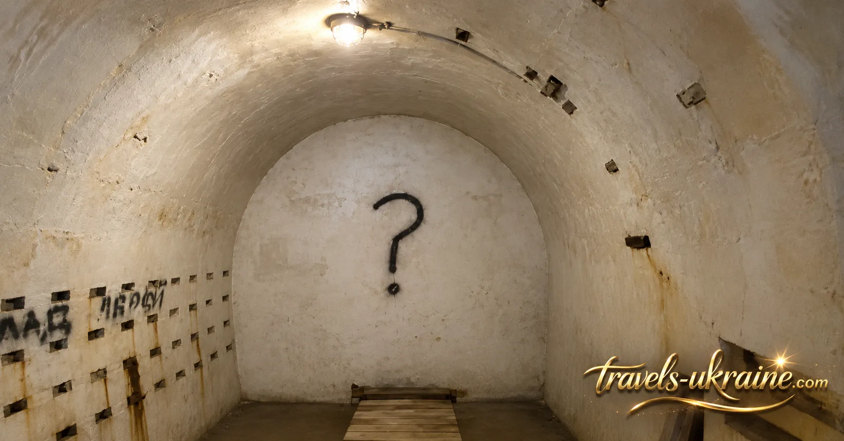
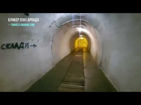
While the surface fortifications of the Árpád Line were designed to stop enemy forces in the narrow Carpathian valleys, the bunker in Verkhnia Hrabivnytsia served a different purpose. Deep inside the mountain, an extensive network of tunnels and service rooms was constructed to shelter military personnel from artillery fire, store ammunition and food supplies, maintain communications, and support the defensive positions on the surface.
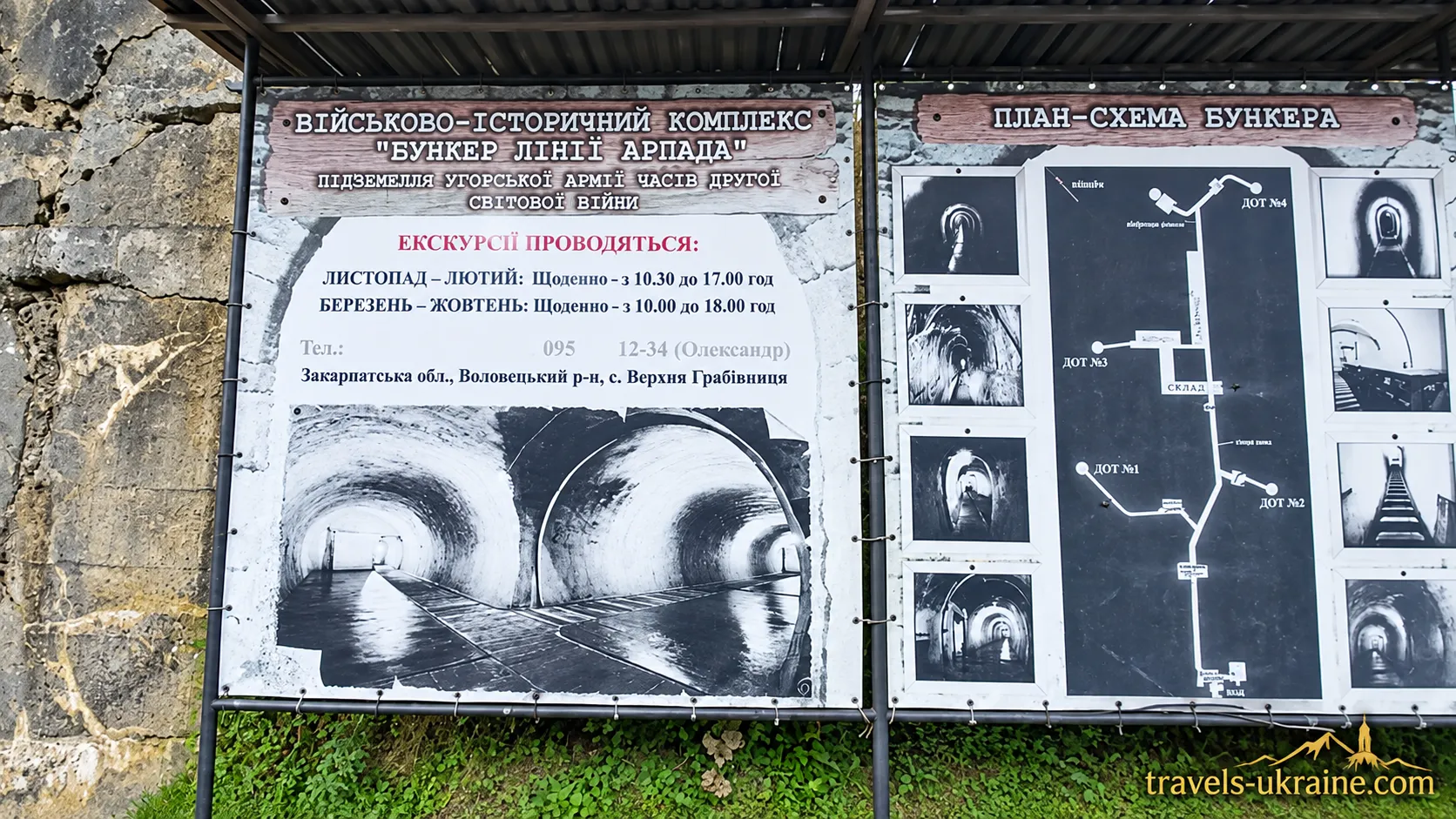
According to local historical sources, the original length of the underground passages may have reached approximately 1.5 km, although only part of the system — around 800 meters — is accessible to visitors today. The deepest sections of the complex lie more than 50 meters below the surface. Its scale and depth distinguish this installation from the much smaller field shelters that were more common along the Árpád Line.
Five Entrances and a Network of Underground Passageways
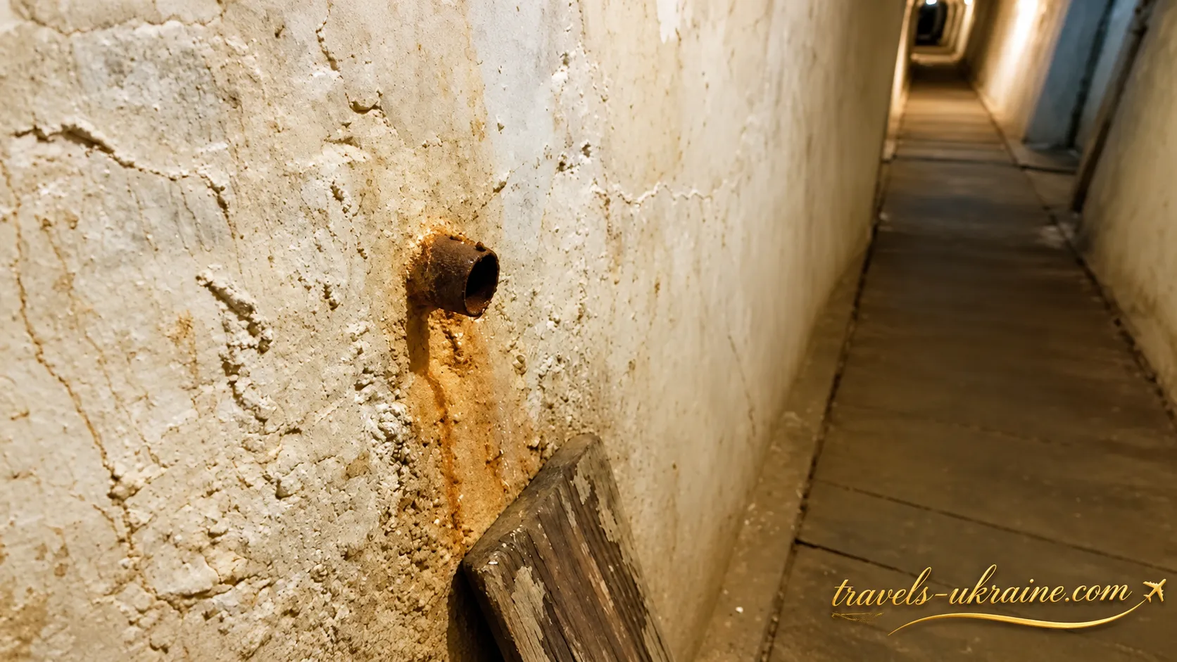
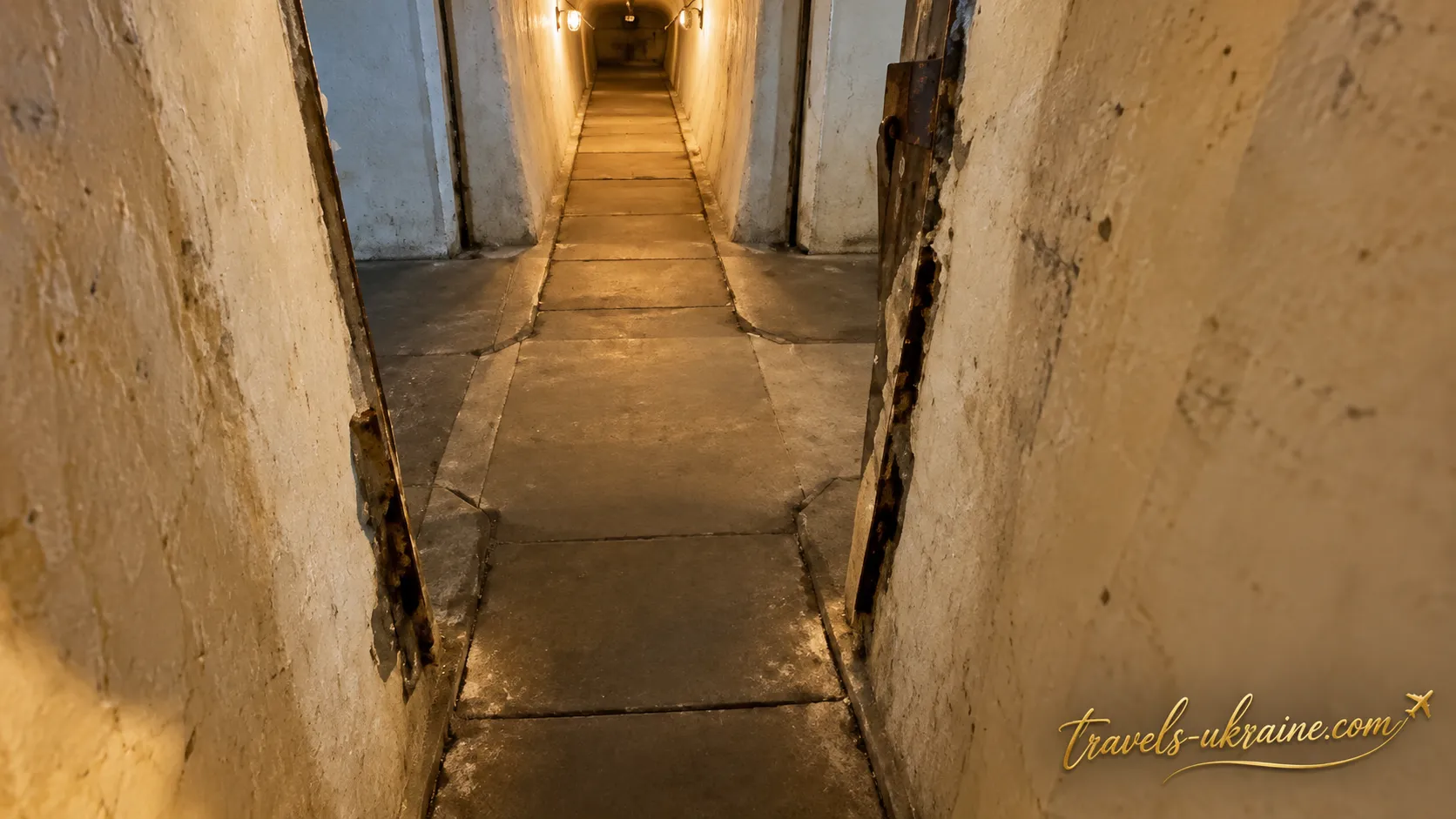
The complex had five entrances, four of which were connected to permanent defensive positions. These exits allowed the garrison not only to move underground but also to reach positions from which the road and valley could be controlled. Individual rooms were connected by long underground passageways known as posterns. In the sections accessible today, these corridors reach approximately two meters in height, allowing visitors to walk almost upright. The passages were constructed on different levels and include numerous branches, making even the section open to tourists feel like part of a much larger underground labyrinth.
However, the figure of 1.5 km should be understood as a historical estimate rather than the length of the present-day tourist route. Some passages are inaccessible today, while others were modified or sealed after the war.
Barracks, Communications, Armory, and Military Storage Rooms
The bunker was far more than a passageway through the mountain. Various levels contained an entire network of rooms necessary for the operation of the garrison. These reportedly included barracks, an engineering room, a communications center, an armory, ammunition and food storage facilities, as well as larger chambers near the exits leading to defensive positions.
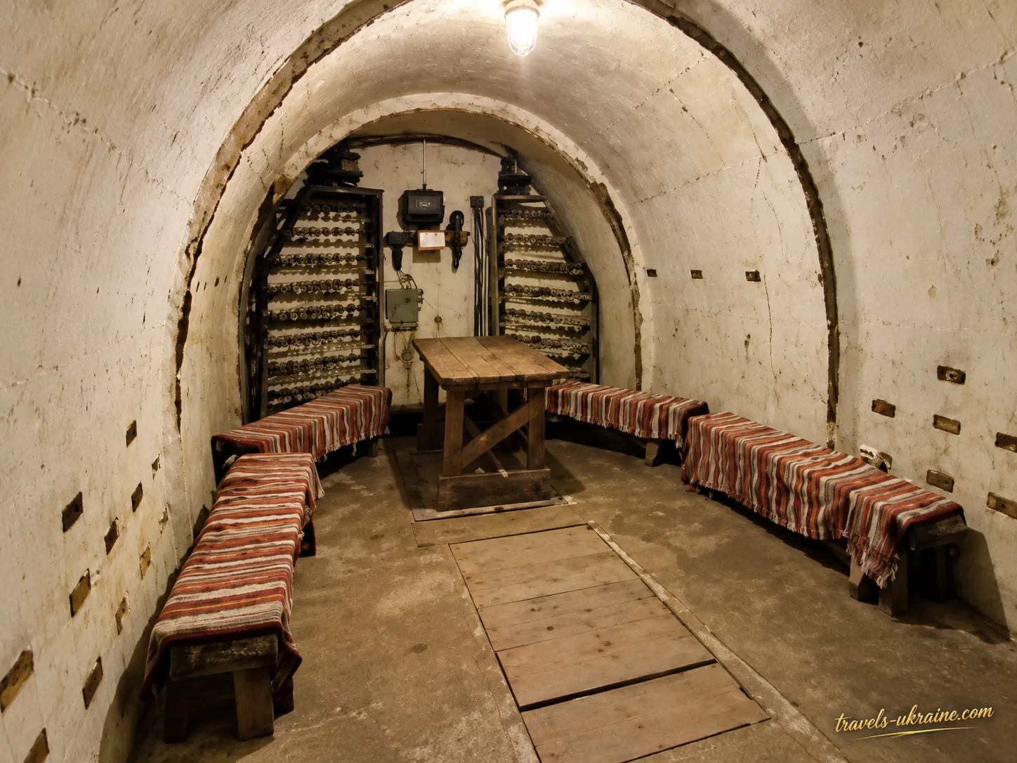
The communications center was particularly important. The defensive complex could not operate in isolation: orders had to be transmitted, information received from surface positions, and military units coordinated along the valley. For this reason, a protected underground room housing radio and telephone equipment was just as important as the weapons storage facilities.
Ammunition and food supplies were also stored underground, where they were better protected from artillery bombardment and air attacks. During prolonged fighting, this arrangement would allow the garrison to maintain its positions for some time, even if regular supplies from the rear became difficult or dangerous to deliver.
Hospital, Kitchen, and Everyday Life Underground
The scale of the complex is reflected in the fact that it included not only military facilities but also rooms intended for everyday needs. Descriptions of the bunker mention a hospital, a kitchen, and sanitary facilities. In other words, the underground system was designed not merely to provide temporary shelter during shelling but to support the prolonged presence of personnel under combat conditions.
A medical facility was particularly important for an isolated defensive strongpoint. Wounded soldiers could receive first aid without having to be transported immediately along exposed roads under enemy fire. The kitchen and food storage rooms supplied the garrison with meals, while sanitary facilities made extended periods underground more manageable.
Its Own Water Supply and Ventilation: How the Bunker Could Remain Self-Sufficient
One of the most fascinating features of the complex is a natural freshwater spring that can still be seen in one of the corridors today. For a defensive installation, this was a tremendous advantage: the water supply did not depend entirely on deliveries from outside and could support the garrison even if access roads were blocked.
Ventilation was equally important. Dozens of people, a kitchen, medical facilities, lighting, and military equipment inside an enclosed underground complex required a constant exchange of air. Local historical descriptions mention ventilation shafts that provided air circulation between the underground rooms and the surface.
It is precisely this combination of protected tunnels, water, ventilation, supplies, communications, and living facilities that makes Verkhnia Hrabivnytsia much more than an ordinary concrete pillbox. It was a fully developed underground military complex.
Why the Bunker Was Hidden Deep Inside the Mountain
The surrounding rock itself provided an additional layer of protection. Rather than constructing the entire installation from massive layers of concrete above ground, military engineers made use of the mountain's natural structure. Dozens of meters of soil and rock above the tunnels significantly reduced the danger posed by shrapnel, artillery shells, and aerial bombardment.
At the same time, most of the underground complex remained concealed from observation. From outside, enemy forces could see individual entrances, defensive positions, and fortifications, while the barracks, supplies, and communications facilities were hidden deep within the mountain. This is where the evolution of Hungarian fortification strategy becomes particularly evident. Verkhnia Hrabivnytsia reflected the early Maginot-style concept of a large underground fortress, whereas after 1940, engineers increasingly favored smaller, dispersed, and carefully camouflaged shelters characteristic of the mature Árpád Line.
For this reason, walking through the tunnels of Verkhnia Hrabivnytsia provides a far deeper understanding of the Árpád Line than simply examining an isolated concrete pillbox. Here, visitors can discover not only the positions from which soldiers were expected to fight but also the hidden infrastructure designed to support the defense from within. And part of this system remains outside the tourist route to this day, naturally raising questions about sealed passages and chambers that are no longer accessible.
From Military Installation to Museum: What Visitors Can See Today
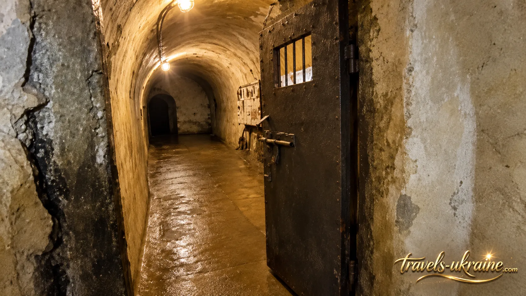
Today, the Árpád Line bunker in Verkhnia Hrabivnytsia no longer serves a military purpose, but its underground corridors remain the main attraction of the tourist route. This is not a museum housed in a recreated historical setting: visitors enter the original defensive complex, walk through its old underground passageways, and explore rooms once used by military personnel.
The bunker's history did not end with World War II. During the Soviet period, the complex was used as a civil defense facility and a storage site for so-called emergency reserves. Some of its underground passages were modified or sealed during this time. After 1991, the site remained largely neglected for approximately two decades and suffered from vandalism. Eventually, efforts began to gradually restore and adapt the complex for tourist visits.
Exploring Authentic Underground Tunnels
The most memorable part of the visit is the experience of walking underground. The route leads through concrete corridors and former service rooms, where the original structure of the military complex has been preserved. There is no natural daylight, while the thick walls and surrounding rock quickly change one's sense of space. Just a few dozen meters from the entrance, it becomes difficult to believe that an ordinary Carpathian forest lies directly overhead.
During a guided tour of the bunker, visitors can explore sections of the former barracks, storage rooms, communications center, technical facilities, and other parts of the underground system. A natural freshwater spring still flows through one of the corridors, serving as a reminder of how important self-sufficiency was for such a military installation during combat operations.
Museum Exhibition and World War II Artifacts
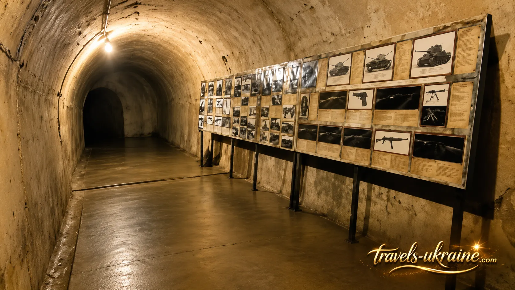
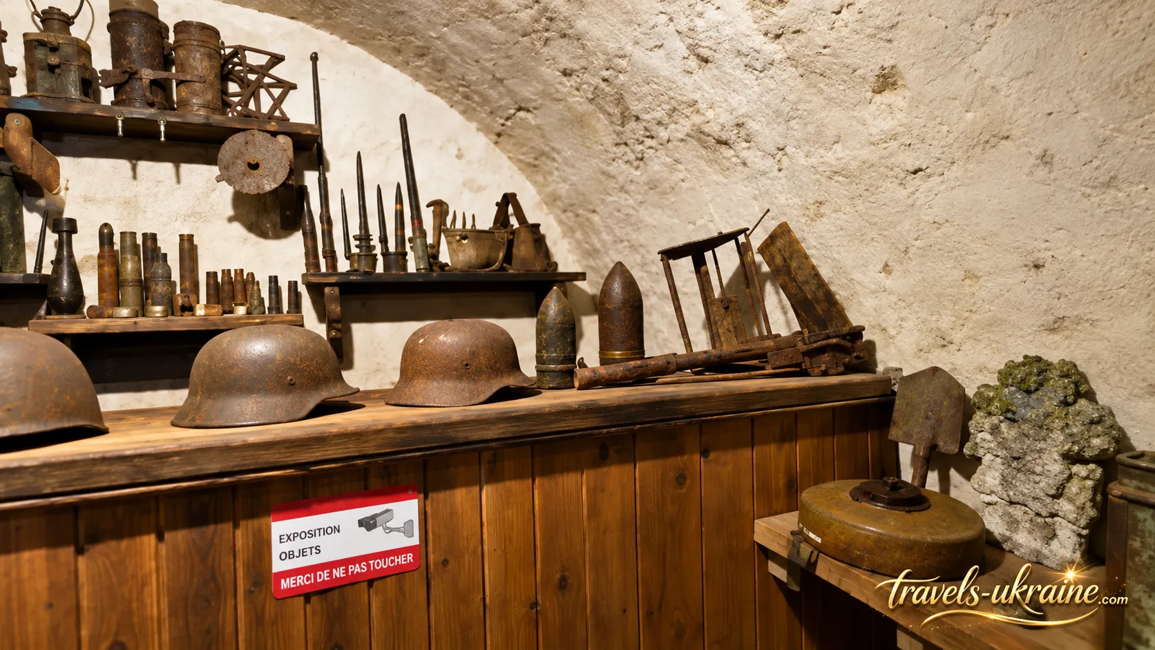
A small museum exhibition has been established in one of the former radio communications rooms. It contains approximately one hundred items, most of which are associated with World War II and the Hungarian Army. The exhibits include various types of cartridges and shell casings, entrenching tools, machine-gun components, mines, flashlights, helmets, household items, and other military artifacts. There are also objects from earlier periods, including equipment dating back to World War I. Some of these items were discovered in the immediate vicinity of the fortifications.
The exhibition itself is relatively small, so the bunker remains the most impressive "museum exhibit." Its old corridors, traces of modifications, concrete walls, and branching tunnels provide a far more vivid understanding of the site's military history than a display case filled with individual artifacts.
Why Exploring the Bunker with a Guide Is Recommended
Exploring the underground complex independently may provide a sense of its scale, but without explanations, many of the rooms would appear to be little more than empty concrete chambers. A guided tour makes it much easier to understand where the communications center was located, where ammunition was stored, how the defensive system operated, and why the various tunnels were constructed in their particular arrangement.
A guided visit is especially valuable because not all underground passages are currently open to tourists. Some sections are inaccessible or remain in a condition that makes safe entry impossible. Attempting to enter closed-off branches without authorization is therefore not only inappropriate but also dangerous.
Mysteries of the Árpád Line Bunker: Sealed Tunnels and Hidden Gold
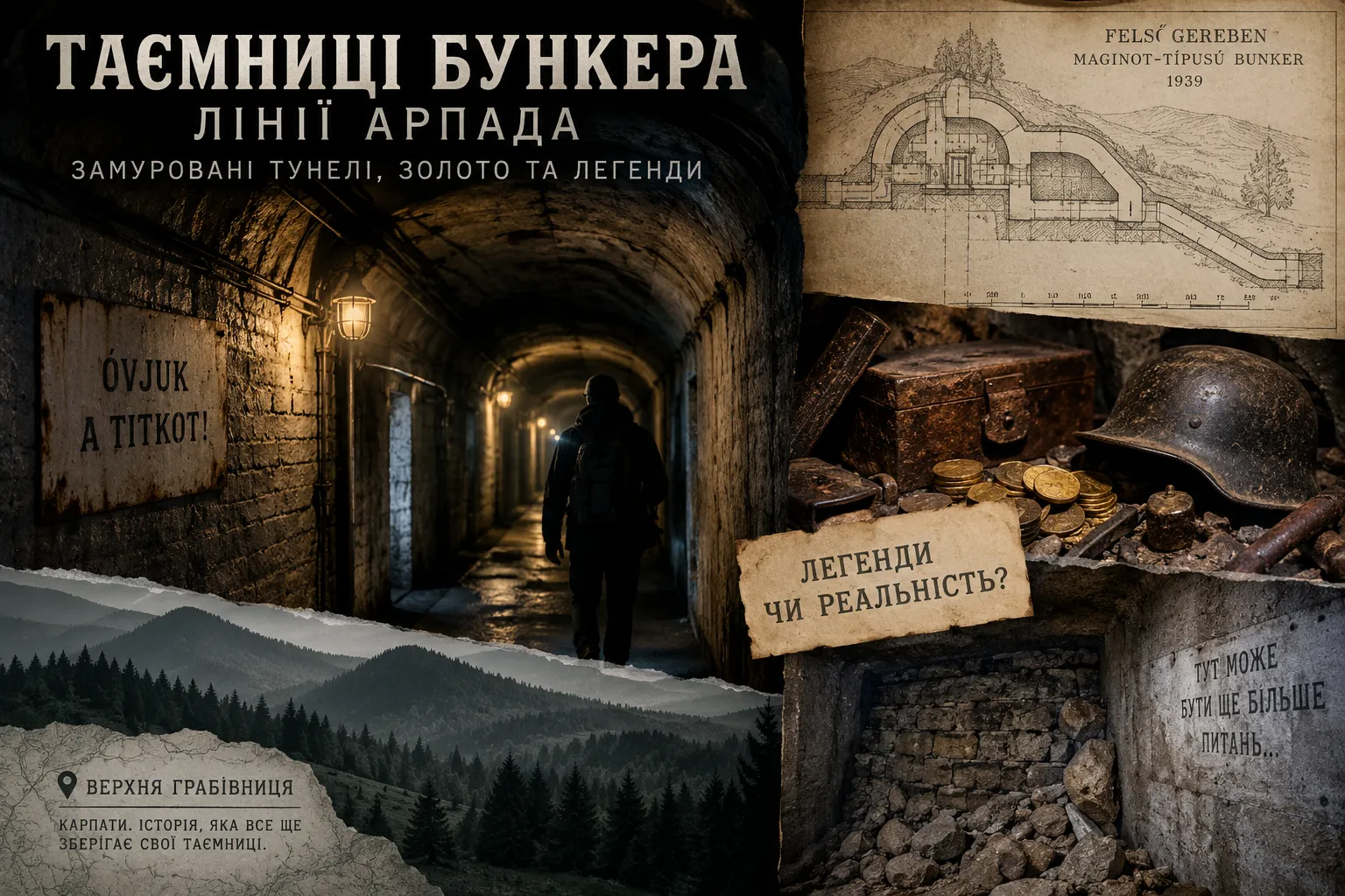
The underground complex in Verkhnia Hrabivnytsia is surrounded by mysteries that extend far beyond its dark corridors and sealed passageways. The deeper researchers delve into the history of the Carpathian fortifications, the more questions arise: Was this installation truly part of the Árpád Line as it developed after 1940? How extensive was the original tunnel network? Why did some of its documentation disappear? And is there any historical evidence behind the legends of military treasures hidden beneath the mountains?
Was the Bunker in Verkhnia Hrabivnytsia Really Part of the Árpád Line?
The answer is more complicated than the name displayed on tourist signs might suggest. In István Rakaczki's research, "Structures of the Árpád Line", the complex at what was then Felsőgereben — present-day Verkhnia Hrabivnytsia — is identified as a Maginot-style bunker. Construction began in the autumn of 1939 near the Veretsky Pass and the Latorytsia River valley, when Hungarian military engineers were still following the French model of large underground fortifications with extensive tunnels and spacious shelters.
Following the fall of the French Maginot Line in 1940, a Hungarian military commission examined the captured fortifications and substantially revised its own defensive strategy. During the autumn and winter of 1940, a new approach emerged: instead of large underground fortresses, engineers favored smaller, dispersed, carefully camouflaged shelters and open firing positions. It was around this time that the name "Árpád Line" began appearing in military documents.
Historically, therefore, it is more accurate to describe the complex in Verkhnia Hrabivnytsia as belonging to the early development of the Carpathian defensive system, reflecting the earlier Maginot-style concept. Although the name "Árpád Line Bunker" has become firmly established in modern tourism, strictly speaking, this installation is not a typical example of the Árpád Line as it was ultimately developed after 1940.
Why Have So Few Documents About the Complex Survived?
One reason for the numerous historical debates is the incomplete documentary record. A specialized Fortification Command, headquartered in Budapest, was responsible for overseeing the construction of Hungarian defensive installations. During the war, its headquarters building was struck by a bomb, resulting in the loss of a substantial portion of its records.
For a long time, even Hungarian historians believed that the plans, reports, and much of the Árpád Line's archival documentation had been almost entirely destroyed. Later, military historian Balázs Mihály discovered copies of certain letters, diagrams, orders, and technical documents among the General Staff records. The documents had not disappeared completely, but the surviving collection remains incomplete.
This fragmented historical record explains why different sources continue to offer varying estimates of the tunnel network's length, the original purposes of individual rooms, and the role of Verkhnia Hrabivnytsia within the wider Carpathian defensive system.
Could Gold Confiscated in Zakarpattia Have Ended Up on the "Gold Train"?
At this point, local legend unexpectedly intersects with documented history. Records held by the Hungarian National Archives confirm that in the spring of 1944, during the ghettoization and deportation of the Jewish population of Zakarpattia, people were deprived of their cash, precious stones, and precious metals. The confiscated valuables were not kept locally; they were systematically transported to Budapest. This is an important detail because, by the autumn of 1944, the Hungarian capital had become a collection point for property seized from Jewish communities across different regions of the country. Gold, jewelry, watches, silver, paintings, carpets, and other valuables accumulated in regional and metropolitan bank vaults were transferred by September to the Royal Hungarian Postal Savings Bank warehouse on Lónyay Street.
As the Red Army approached Budapest, the authorities decided to evacuate these valuables westward. By October 16, 1944, the first large shipments had already reached the Óbánya area near Zirc. The property was subsequently transported to Brennbergbánya near Sopron, where it was sorted, packed, and placed in crates. In March 1945, the shipment continued toward the territory of the Third Reich. This transport became known in history as the Hungarian "Gold Train." American forces seized it in Austria in May 1945. Its railway cars contained gold, jewelry, works of art, silver, carpets, and other possessions, much of which had been confiscated from Hungarian Jews.
Since archival documents separately confirm that valuables seized in Zakarpattia were sent to Budapest, and confiscated property from the regions was subsequently centralized there, it is entirely possible that some items taken from Jewish families in Zakarpattia were among the cargo of the "Gold Train." However, establishing the precise origin of an individual gold object or piece of jewelry is now extremely difficult: during the sorting process, the items lost their connection to their original owners and the places where they had been confiscated.
It Is Important to Distinguish Between Two Different "Gold Trains"
Confusion can easily arise because, toward the end of the war, Hungary evacuated two separate major shipments westward, both of which are frequently referred to as "gold trains" in later historical literature. The first carried the state reserves of the Hungarian National Bank. These included approximately 30 tonnes of gold bars and coins, foreign currency reserves, banknotes, documents, and state-owned cultural treasures. The shipment traveled through Veszprém and Fertőboz to Spital am Pyhrn in Austria, where it came under American control at the end of the war. The gold reserves were subsequently returned to Hungary.
The second "Gold Train" had an entirely different origin. It primarily transported property confiscated from Hungarian Jews. Its railway cars contained jewelry, gold, paintings, carpets, silverware, and countless personal belongings. The American Army seized this train near Werfen in Austria. Distinguishing between these two shipments is essential: the history of Hungary's national gold reserves is not the same as that of a "Nazi treasure," while the second train was directly connected to the systematic plundering of the Jewish population.
Could the "Gold Train" Have Passed Through Verkhnia Hrabivnytsia?
This is where the theory of treasure hidden inside the bunker begins to lose its documentary foundation. The known routes of both "gold trains" ran westward from central Hungary toward Austria. The documented route of the train carrying confiscated Jewish property followed Budapest — Zirc — Brennbergbánya — Austria. The Hungarian National Bank's gold reserves were likewise evacuated through western Hungary to Spital am Pyhrn.
Verkhnia Hrabivnytsia lay in a completely different direction — in the Carpathian Mountains, east of the principal Hungarian evacuation routes to Austria. Therefore, transporting valuables that had already reached Budapest from Zakarpattia back into the Carpathian Mountains would have made little apparent logistical sense. A search of the Hungarian National Archives, American documentation concerning the Hungarian Gold Train, and studies of postwar restitution revealed no references to Verkhnia Hrabivnytsia as a storage or transit location for gold. Nor was any document found linking the underground complex to the transportation of state reserves, confiscated Jewish valuables, or Reichsbank assets. Thus, the documentary record confirms the westward movement of valuables seized in Zakarpattia, but the known direction of their journey led away from Verkhnia Hrabivnytsia rather than through it.
Where Might the Legend of Treasure Hidden in the Bunker Have Originated?
Here, another and considerably more plausible explanation emerges. After Hungarian troops withdrew, a substantial amount of property was indeed left behind inside the underground complex. Recorded recollections of local residents mention military uniforms, equipment, footwear, ammunition, weapons, food, alcohol, and medical supplies.
One elderly resident recalled that after the fighting ended, uniforms and equipment remained in the barracks, while the storage rooms contained crates of hardtack, ring-shaped bread, canned food, and bottles of schnapps, rum, and cognac. Small bottles of medical alcohol were found in the medical section, while ammunition and other military supplies remained near the armory.
Researcher Oleksii Savchyn, in his work "The Árpád Line: Known and Unknown", also recounts local memories of residents discovering what they regarded as a kind of "treasure" within the surviving fortifications after the war. However, the term did not refer to gold bars. It described containers filled with valuable Hungarian military supplies, some of which were subsequently removed by Soviet troops.
This provides a plausible explanation for how the legend developed. After the war, local residents genuinely discovered crates containing valuable military supplies inside a secret underground complex. Some corridors were soon sealed or demolished. Documentation was scarce, and access to the interior remained restricted for decades. With each passing generation, the story of abandoned military warehouses could easily evolve into a tale of "hidden treasure" and eventually into a legend about gold.
Could Gold Still Be Hidden Behind the Sealed Walls?
In theory, unexplored sections beyond sealed partitions could contain unknown chambers or objects dating from the war. Geophysical surveys have reportedly identified certain underground cavities and possible extensions of the tunnel network. However, there is an enormous difference in evidence between "an unknown chamber" and "a hidden gold vault."
To date, no known archival source confirms that the bunker in Verkhnia Hrabivnytsia was used to store gold belonging to the Third Reich, Hungary's national gold reserves, or valuables confiscated from Jewish families. The known evacuation routes of these assets did not pass through the complex either.
- Confirmed: In 1944, gold, jewelry, precious stones, and other valuables were confiscated in Zakarpattia.
- Confirmed: These valuables were systematically transported to Budapest.
- Confirmed: Property from regional bank vaults subsequently became part of the centralized system of confiscated assets evacuated westward.
- Highly probable: Some items confiscated in Zakarpattia may have been among the possessions transported aboard the Hungarian "Gold Train."
- Supported by local testimonies: After the fighting, substantial stocks of military equipment, food, supplies, and ammunition remained inside the bunker.
- Not confirmed: That either of the known "gold trains" passed through Verkhnia Hrabivnytsia.
- Not confirmed: That gold or large quantities of valuables were stored inside the bunker.
- Legend: A hidden treasury belonging to the Third Reich remains concealed behind the sealed tunnels.
Therefore, the story of gold hidden in Verkhnia Hrabivnytsia remains a legend with an intriguing historical background but no documentary confirmation. Paradoxically, the real history is no less fascinating: valuables seized in Zakarpattia did enter a vast system of confiscation and evacuation toward the end of the war. The documented route of that history, however, leads through Budapest to Austria — not into the sealed corridors of a Carpathian bunker.
What to See Near the Árpád Line Bunker
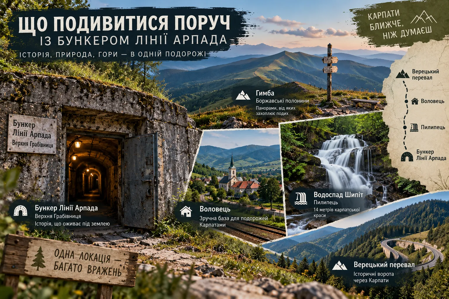
A visit to the Árpád Line bunker in Verkhnia Hrabivnytsia does not have to be the only highlight of your trip. Nearby lies one of the most fascinating mountainous areas of Zakarpattia — the Volovets region and the Borzhava mountain range. After exploring the underground tunnels, you can easily change the atmosphere and continue your day among panoramic mountain passes, waterfalls, and Carpathian alpine meadows.
Volovets makes a convenient next stop or overnight base. Popular hiking routes to Temnatyk and Plai begin here, while the settlement itself offers good transport connections and tourist facilities. If you would prefer a mountain walk to another museum after visiting the bunker, Volovets provides several excellent options for continuing your journey.
Pylypets, Shypit Waterfall, Hymba Mountain, and the Borzhava Alpine Meadows
One of the best-known natural attractions nearby is Shypit Waterfall near the village of Pylypets. The stream cascades down from a height of approximately 14 meters, becoming particularly impressive in spring and after prolonged rainfall. An easy walking trail leads from the tourist area to the waterfall, making Shypit an excellent choice even for visitors who are not planning a demanding mountain hike. Pylypets itself is worth exploring beyond the waterfall. The village has established tourist facilities, while the surrounding slopes provide access to the Borzhava alpine meadows — one of the most spectacular mountain landscapes in this part of the Carpathians.
If you want to see the Carpathians from above after exploring the underground passages, Hymba Mountain and the Borzhava range offer a natural continuation of the trip. A ski lift from Pylypets can cover part of the ascent, after which you can continue on foot. From the open alpine meadows, long mountain ridges, valleys, and villages stretch into the distance — the complete opposite of the enclosed environment of the military bunker.
Veretsky Pass — A Historic Gateway Through the Carpathians
Another destination for those whose interest in Carpathian military and transportation history has been sparked by the Árpád Line is Veretsky Pass. For centuries, this part of the mountains served as one of the natural routes across the Carpathians. The strategic importance of such passes helps explain why twentieth-century defensive systems were concentrated along roads and valleys leading through the mountain range.
Ultimately, the best way to plan a visit to the bunker in Verkhnia Hrabivnytsia is to embrace the contrast: begin with several hours exploring underground military history, then continue to Volovets, Shypit Waterfall, or the Borzhava alpine meadows. In this way, a single attraction becomes part of a full day in the Carpathians, where history and nature complement rather than compete with each other.
Frequently Asked Questions About the Árpád Line Bunker
What is the Árpád Line?
The Árpád Line was a system of Hungarian defensive fortifications built in the Carpathian Mountains during World War II. It was not a continuous concrete wall. Instead, its defenses were organized around strategically important valleys, mountain passes, roads, and railway routes, using the natural terrain of the Carpathians as an integral part of the fortification system.
How long are the bunker tunnels in Verkhnia Hrabivnytsia?
The original underground system is generally estimated to have extended approximately 1.5 km. Today, only part of the complex — around 800 meters of passageways — is accessible to visitors. Other sections have been sealed, modified, or remain unsafe for public access.
Can visitors enter the bunker?
Yes. Part of the underground complex is open to visitors. The tour route passes through historic corridors, former barracks, technical rooms, and a museum exhibition. Visitors must not enter closed or sealed passageways independently.
How long does a tour of the Árpád Line bunker take?
Allow approximately 1–2 hours to explore the underground complex properly. The duration depends on the type of tour, the number of visitors, and whether the itinerary includes the remains of the surface fortifications.
Is the bunker suitable for visiting with children?
Yes, but parents should consider the nature of the attraction: dark underground corridors, cool temperatures, damp conditions, and extended walking distances. Younger children may find the tour tiring or frightening, so the decision should take their age and individual temperament into account.
Have all the bunker tunnels been explored?
According to reports of certain geophysical surveys, additional underground cavities or extensions of the passageways may exist beyond sealed sections. However, not all such areas have been confirmed through archaeological investigation or independent scientific research.
Is it true that gold is hidden inside the bunker?
There is no reliable evidence to support this claim. Stories about hidden gold, military valuables, and secret treasures are part of local folklore. Available military-historical studies and known archival records provide no confirmation that gold belonging to the Third Reich or any other major treasure was stored in Verkhnia Hrabivnytsia.
Árpád Line Bunker: Where History Lies Hidden Beneath the Carpathians
The bunker in Verkhnia Hrabivnytsia is one of those tourist attractions where history does not have to be imagined solely through photographs or museum displays. Here, visitors can literally step inside a mountain, walk through old military corridors, and explore a complex built to support the actual defense of the Carpathians during World War II.
What makes the complex remarkable is not merely the length of its tunnels or the depth of its underground chambers. Far more fascinating is the opportunity to understand the logic behind its fortifications: how natural terrain replaced the need for a continuous concrete wall, how barracks, communications facilities, supplies, and technical rooms were arranged underground, and why valleys and mountain passes were strategically important to the defense.
At the same time, the Árpád Line bunker remains a place surrounded by unanswered questions. Some tunnels are inaccessible, the historical documentation is incomplete, and legends of unknown passageways and hidden treasures have developed around the sealed chambers. This makes the site interesting not only as a monument to military history but also as a place whose past researchers continue to investigate and clarify.
A visit to the underground complex is best combined with a journey through the Volovets region — a walk across the Borzhava alpine meadows, a visit to Shypit Waterfall, or a scenic drive through the Carpathian mountain passes. After exploring the dark, cool tunnels, the open mountain landscapes feel entirely different.
And perhaps this is the greatest significance of Verkhnia Hrabivnytsia: beneath an ordinary Carpathian mountainside lies an entire chapter of European military history, one that continues to raise intriguing questions. How much do we really know about this complex, and how many of its secrets still remain behind the sealed walls?

No Comment
You can post first response comment.