Carpathian route: Urych Cliffs (Tustan) → Kamyanka Waterfall →
Dead (Zhuravlyne) Lake → Mount Kliuch → Mount Parashka.
In two days you’ll combine a rock fortress, a waterfall and a bog lake with ascents to panoramic peaks of
the Skole Beskids — without extra kilometres and with a clear timetable.
eco-trails & boardwalks museum-reserve top viewpoints from the rocks
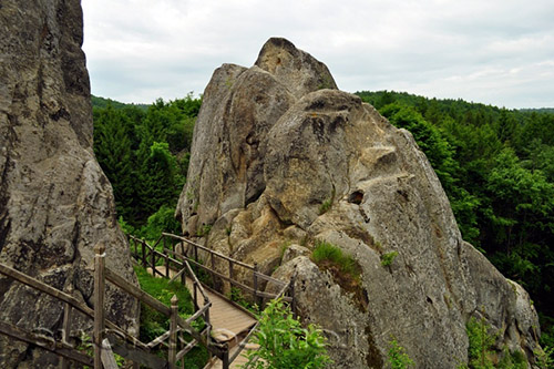
A legendary rock fortress in the heart of the Carpathians. Wooden walkways and viewing platforms lead
through narrow “streets” between the boulders, revealing panoramas of the village of Urych and the surrounding forests.
Exhibitions, reconstructions of fortifications and special event days run on site — check the schedule in advance.
Skole Beskids National Park short trail footbridge & cascades
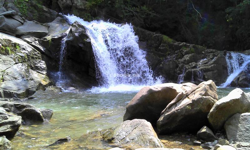
One of the region’s most popular waterfalls, tucked among spruce forests between the villages of Kamyanka and Dubyna.
A well-laid path leads to the cascades and viewing bridges — perfect for photos and family strolls.
acidic water, no fish eco-route from Kamyanka bird habitats
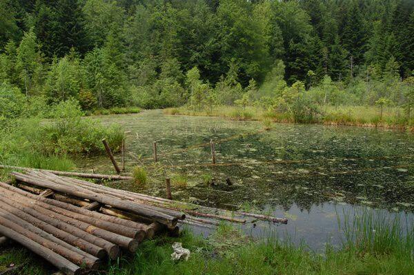
An atmospheric highland pond with floating “carpets” of sphagnum and roots. Encircled by coniferous forest,
silence and misty legends. The path begins at the waterfall and climbs gently.
moderate ascent viewpoint clearings quirky rock outcrops
An accessible viewpoint summit on the Skole Beskids ridge. Trails are waymarked; along the way you’ll pass
small rock outcrops and forest glades — ideal for photo stops and breaks.
~25–40 mins by car from Kamyanka (trailheads on the outskirts)
full-day hike classic start from Skole 360° panoramas
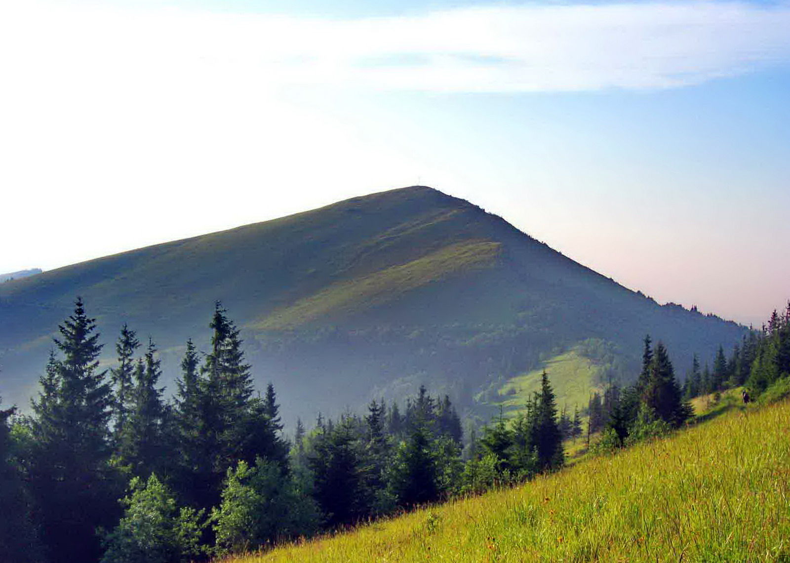
The jewel of Skole Beskids National Park. The classic route from Skole leads through forest and meadows to a broad
summit with sweeping views across the Beskids ridges. The path is waymarked, but in fog basic navigation is essential.
Ascent of Parashka from Skole. A lighter alternative for the day — Kliuch summit (half-day).
Practical
Cash for tickets/parking, trekking shoes, rain jacket, flask/water 1.5–2 L per person, power bank.
Tip:
check the forecast and trail conditions, stay on marked routes within the protected area, and have an offline map.
Frequently asked questions
How much time do you need for the whole route?
Ideally 2 days: Day 1 — Tustan, Kamyanka, Zhuravlyne; Day 2 — hike to Parashka (6–8 hrs). Kliuch summit is an easier alternative or a bonus in the warmer season.
Is it convenient to travel by car and what about parking?
Yes. There are organised car parks at Tustan and Kamyanka (often cash only). From there it’s short approaches on foot. For mountain routes, leave the car in Skole/at the trailhead.
Is the route suitable for children?
Day 1 — yes (easy paths, viewing bridges). Parashka — for teenagers and adults with average fitness; allow enough time and bring warm layers.
Can you shoot photos/videos and fly a drone?
Photography is fine in open areas; the national park has restrictions for drones — coordinate with the NP administration. On the trails — safety first.
Tickets and payments
Admission fees may apply at Tustan and in the national park. Carry cash for ticket offices and car parks; card payments aren’t always available.

No Comment
You can post first response comment.